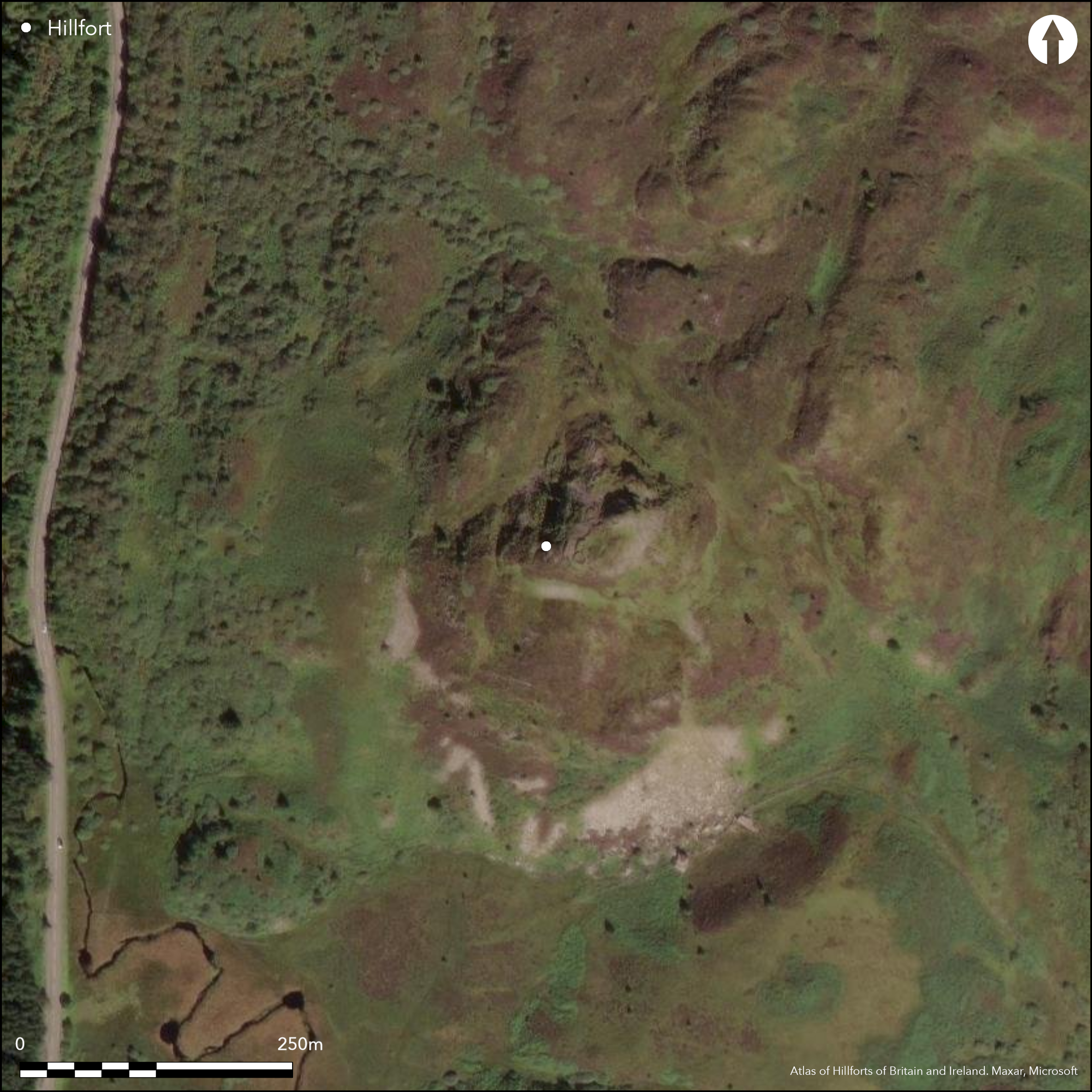
Satellite Imagery
Satellite Imagery
HER: The West of Scotland Archaeology Service 962 (None)
NMR: NM 80 SE 15 (22772)
SM: 5473
NGR: NM 8544 0365
X: 185440 Y: 703650 (OSGB36)
Occupying a rocky hilltop, the defences of this fort comprise two elements: a single wall extending around the irregular summit area; and outworks blocking access on the SE, W and probably N flanks. The summit enclosure measures about 37m from ENE to WSW by 16m transversely (0.05ha) within a wall up to 4.5m in thickness, and before an act of vandalism the outer face adjacent to the entrance on the E stood 2m high in nineteen courses; numerous runs of outer face can be seen elsewhere and there are also traces of an intramural feature on the NE. The entrance passage cuts obliquely across the line of the wall on the E, its axis lying almost N and S. Much of the interior is taken up by a spine of rock outcrops surmounted by a marker cairn, but on the N side there are the footings of a rectangular building and an arc belonging to another structure, while at the SW end the replica of a stone-walled round-house was built for a film-set in 1983. A survey carried out by RCAHMS investigators in that year discovered an early medieval stone gaming board lying on the wall core on the NW. A rotary quern had been found in the rubble from the wall previously (Campbell and Sandeman 1962, 48-9). The RCAHMS investigators suggested that the scree of rubble below the NE end of the fort may hide the remains of an outer wall, and there are certainly walls on the E and W blocking access from these quarters to broad terraces below the inner enclosure on the SW and SE, though they do not appear to have been enclosed as such. Two lines can be distinguished on the W at the top and bottom respectively of a sloping terrace; there are gaps in both and this may well have been the original route up to the summit enclosure. At least two small rectangular buildings can be seen on a terrace on the SE flank, while outside the outer wall here there is also a rectangular animal pen.
Citizen Science: ✗
Reliability of Data: Confirmed
Reliability of Interpretation: Confirmed
X: -607626 Y: 7593749 (EPSG: 3857)
Longitude: -5.45839815893871 Latitude: 56.177081438095506 (EPSG:4326)
Country: Scotland
Current County or Unitary Authority: Argyll & Bute
Historic County: Argyll
Current Parish/Community/Council/Townland: Kilmartin
None
| Extant | ✓ |
| Cropmark | ✗ |
| Likely Destroyed | ✗ |
None
| Woodland | ✗ |
| Commercial Forestry Plantation | ✗ |
| Parkland | ✗ |
| Pasture (Grazing) | ✓ |
| Arable | ✗ |
| Scrub/Bracken | ✗ |
| Bare Outcrop | ✗ |
| Heather/Moorland | ✓ |
| Heath | ✗ |
| Built-up | ✗ |
| Coastal Grassland | ✗ |
| Other | ✗ |
None
| Contour Fort | ✓ |
| Partial Contour Fort | ✗ |
| Promontory Fort | ✗ |
| Hillslope Fort | ✗ |
| Level Terrain Fort | ✗ |
| Marsh Fort | ✗ |
| Multiple Enclosure Fort | ✗ |
| Hilltop | ✓ |
| Coastal Promontory | ✗ |
| Inland Promontory | ✗ |
| Valley Bottom | ✗ |
| Knoll/Hillock/Outcrop | ✗ |
| Ridge | ✗ |
| Cliff/Plateau-edge/Scarp | ✗ |
| Hillslope | ✗ |
| Lowland | ✗ |
| Spur | ✗ |
Dominant Topographic Feature: None
| North | ✗ |
| Northeast | ✗ |
| East | ✗ |
| Southeast | ✗ |
| South | ✗ |
| Southwest | ✗ |
| West | ✗ |
| Northwest | ✗ |
| Level | ✓ |
Altitude: 259.0m
N/A
A rotary quern and an early medieval gaming board have been found here
Reliability: D - None
| Pre 1200BC | ✗ |
| 1200BC - 800BC | ✗ |
| 800BC - 400BC | ✗ |
| 400BC - AD50 | ✗ |
| AD50 - AD400 | ✗ |
| AD400 - AD 800 | ✗ |
| Post AD800 | ✗ |
| Unknown | ✓ |
| Pre Hillfort: | None |
| Post Hillfort: | Round-house and S-shaped structure built for film set in 1983 |
| Artefactual: | None |
None
| 1st Identified Map Depiction (1872): | Annotated Fort on the 1st edition OS 6-inch map (Argyll and Bute 1875, sheet 188) |
| Earthwork Survey (1888): | Sketch-plan and description (Christison 1889, 416-7, fig 40) |
| Other (1955): | Rock-cut footholds noted below the entrance (Cregeen 1955) |
| Other (1963): | Description and rotary quern noted (Campbell and Sandeman 1962, 48-9) |
| Other (1970): | Surveyed at 1:10,000 by the OS |
| Earthwork Survey (1983): | Plan and description (RCAHMS 1988, 160-1, no.250; RCAHMS DC13292-3) |
| Earthwork Survey (1984): | Detailed plan of summit area (RCAHMS DC13294) |
| Other (1992): | Scheduled |
Rectangular building in addition to traces of another structure and a replica stone round-house
None
| None | ✓ |
| Spring | ✗ |
| Stream | ✗ |
| Pool | ✗ |
| Flush | ✗ |
| Well | ✗ |
| Other | ✗ |
Replica stone round-house
| No Known Features | ✗ |
| Round Stone Structures | ✗ |
| Rectangular Stone Structures | ✓ |
| Curvilinear Platforms | ✗ |
| Other Roundhouse Evidence | ✗ |
| Pits | ✗ |
| Quarry Hollows | ✗ |
| Other | ✓ |
None
| No Known Excavation | ✓ |
| Pits | ✗ |
| Postholes | ✗ |
| Roundhouses | ✗ |
| Rectangular Structures | ✗ |
| Roads/Tracks | ✗ |
| Quarry Hollows | ✗ |
| Other | ✗ |
| Nothing Found | ✗ |
None
| No Known Geophysics | ✓ |
| Pits | ✗ |
| Roundhouses | ✗ |
| Rectangular Structures | ✗ |
| Roads/Tracks | ✗ |
| Quarry Hollows | ✗ |
| Other | ✗ |
| Nothing Found | ✗ |
None
| No Known Finds | ✓ |
| Pottery | ✗ |
| Metal | ✗ |
| Metalworking | ✗ |
| Human Bones | ✗ |
| Animal Bones | ✗ |
| Lithics | ✗ |
| Environmental | ✗ |
| Other | ✗ |
NO APPARENT FEATURES
| APs Not Checked | ✓ |
| None | ✗ |
| Roundhouses | ✗ |
| Rectangular Structures | ✗ |
| Pits | ✗ |
| Postholes | ✗ |
| Roads/Tracks | ✗ |
| Other | ✗ |
See main summary
| 3: | None |
| 2: | The two entrance may belong to enclosures of different periods |
Guard Chambers: ✗
Chevaux de Frise: ✗
| 1. Simple Gap (East): | The entrance passage cuts obliquely across the thickness of the wall of the inner enclosure |
| 2. Simple Gap (West): | Gaps in both the inner and outer walls |
| 2. Simple Gap (West): | Oblique approach up natural ramp of outcrop |
Single wall round the summit, with outlying walls blocking access to terraces on the S flank and possibly forming elements of a larger outer enclosure
| Area 1: | 0.05ha. |
| Area 2: | 1.0ha. |
| Total: | 1.0ha. |
Total Footprint Area: 1.0ha.
None
| ✗ | None |
| ✓ | The outlying walls are not disposed in a way that they can be included in this analysis |
| NE Quadrant: | 1 |
| SE Quadrant: | 1 |
| SW Quadrant: | 1 |
| NW Quadrant: | 1 |
| Total: | 1 |
| Partial Univallate | ✗ |
| Univallate | ✓ |
| Partial Bivallate | ✗ |
| Bivallate | ✗ |
| Partial Multivallate | ✗ |
| Multivallate | ✗ |
| Unknown | ✗ |
| Partial Univallate | ✗ |
| Univallate | ✗ |
| Partial Bivallate | ✗ |
| Bivallate | ✗ |
| Partial Multivallate | ✗ |
| Multivallate | ✗ |
None
| None | ✗ |
| Earthen Bank | ✗ |
| Stone Wall | ✓ |
| Rubble | ✗ |
| Wall-walk | ✗ |
| Evidence of Timber | ✗ |
| Vitrification | ✗ |
| Other Burning | ✗ |
| Palisade | ✗ |
| Counter Scarp Bank | ✗ |
| Berm | ✗ |
| Unfinished | ✗ |
| Other | ✗ |
None
| None | ✗ |
| Earthen Bank | ✗ |
| Stone Wall | ✗ |
| Murus Duplex | ✗ |
| Timber-framed | ✗ |
| Timber-laced | ✗ |
| Vitrification | ✗ |
| Other Burning | ✗ |
| Palisade | ✗ |
| Counter Scarp Bank | ✗ |
| Berm | ✗ |
| Unfinished | ✗ |
| No Known Excavation | ✓ |
| Other | ✗ |
| ✗ | None |
| ✗ | None |
Number of Ditches: None
| ✗ | None |
Campbell and Sandeman, M and M (1962) 'Mid Argyll: an archaeological survey', Proc Soc Antiq Scot 95 (1961-2), 1-125
Christison, D (1889) The duns and forts of Lorne, Nether Lochaber, and the neighbourhood'. Proc Soc Antiq Scot 23 (1888-9), 368-432
RCAHMS (1988) The Royal Commission on the Ancient and Historical Monuments of Scotland. Argyll: an inventory of the monuments volume 6: Mid-Argyll and Cowal, prehistoric and early historic monuments. HMSO: Edinburgh
Ritchie, J N G (1983) 'Dun Chonallaich (Kilmartin p), fort, gaming-board'. Disc Exc Scot 1983, 24
Atlas of Hillforts:
Wikidata:
This work is licensed under CC BY-SA 4.0

 and should be cited as:
Lock, Gary and Ralston, Ian. 2024. Atlas of Hillforts of Britain and Ireland. Available at: https://hillforts.arch.ox.ac.uk
Document Version 1.1