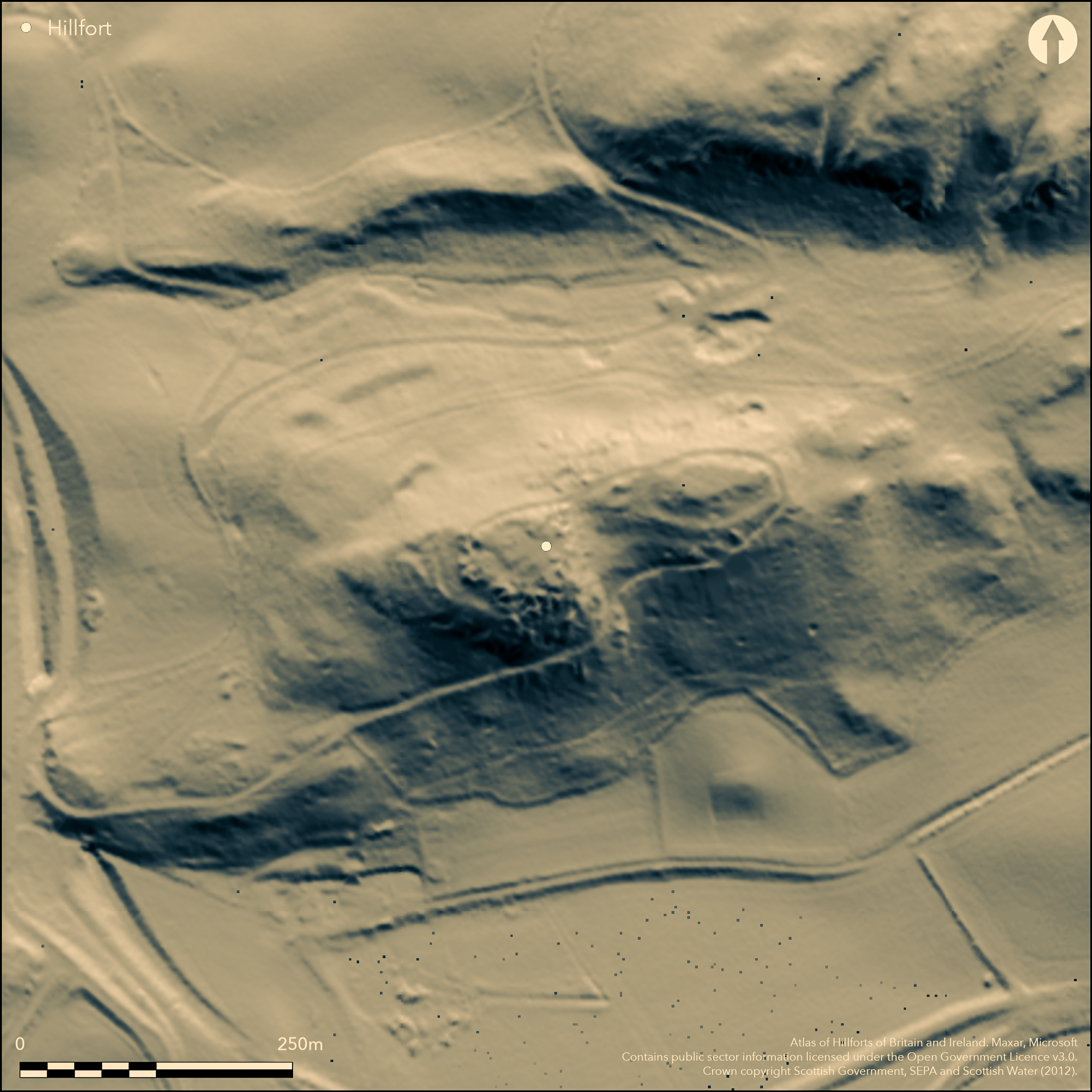
LiDAR 1m DTM Hillshade
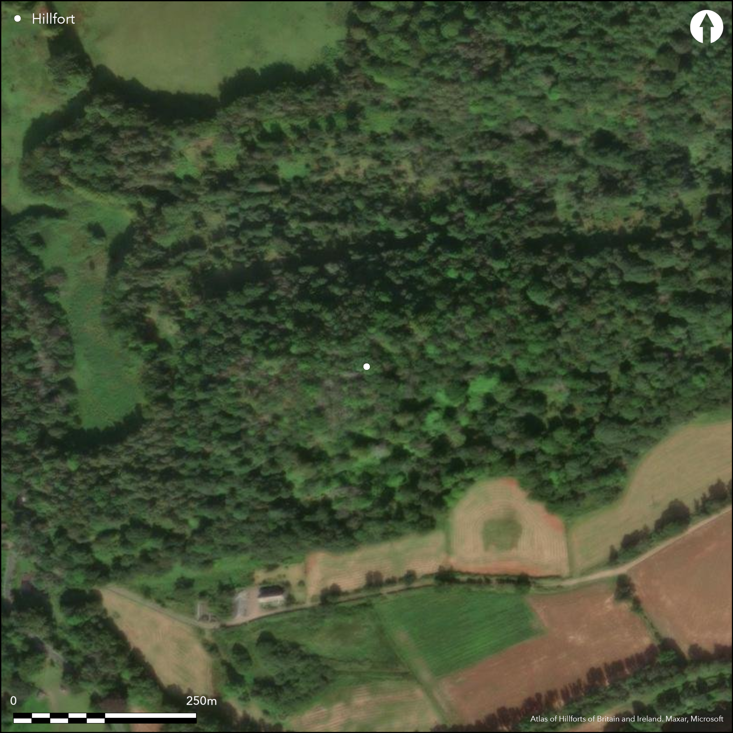
Satellite Imagery
LiDAR 1m DTM Hillshade
Satellite Imagery
Scroll left/right to view further images.
HER: Perth and Kinross Heritage Trust MPK920 (None)
NMR: NN 82 SW 3 (25524)
SM: None
NGR: NN 8247 2170
X: 282476 Y: 721700 (OSGB36)
The remains of a fort are situated on Tom a' Chaisteil, a low hill at the end SW of a ridge of hard rock that has diverted the course of the river into a relatively narrow channel some 4km W of Crieff. First noted at the end of the 18th century, when it was recorded that most of the stones had been robbed in the 1740s to build field walls (Stat Acct viii, 1793, 575), it was traditionally held to be the site of a castle of the Earls of Strathearn and was further demolished in 1831 to make way for the monument to General Sir David Baird. If there was once a medieval stronghold here, no clear evidence can be seen of it, though the summit knoll is partly obscured by dense rhododendrons. Nevertheless, an extensive series of fortifications can be seen both enclosing the summit knoll and also taking in a lower spur on the ENE, which not only provides the easiest line of approach to the summit, but is also the route taken by a carriageway leading up to the monument on the summit. Variously cut into the rock and founded on a built terrace of large boulders and rubble, the construction of this carriageway has been immensely disruptive, curling round the E end of the spur and climbing up to the summit knoll along the N flank to sweep round its W margin before approaching the W face of the monument, where the major inscription is to be found. Whether there are two walls enclosing the summit, as suggested by the OS in 1967, is currently difficult to determine, and even the course of the carriageway becomes lost in the rhododendrons on the WSW. Nevertheless, there is no doubt that at least one major wall enclosed the summit, rising in a scarp of moss-grown boulders above the built revetment along the inner edge of the carriageway on the N, and elsewhere forming a scree of stones extending below the carriageway on the W and along the S flank of the summit. In a narrow gap in the rhododendrons at the top of this slope on the S, a low stony scarp can also be seen set back from the margin of the summit, but in the present circumstances its character is uncertain and it is probably no more than the continuation of the carriageway or a pathway around the S and E, as shown on the 1st edition of the OS 25-inch map (Perth and Clackmannan 1866, sheet 95.13). The interior, which is rough and uneven and in some places strewn with stones, measures at least 40m from E to W by 33m transversely (0.01ha). This inner enclosure, however, is no more than the core of a more extensive system of defences, which are most clearly seen on the W, where some 15m beyond the line of the carriageway there are two outer ramparts built of material taken from internal quarry ditches; the outer comprises two short segments set to either side of a well-formed entrance way that penetrates the outer defences at this point, but the line of the inner can be traced round onto the S flank, where it forms a well-defined scarp extending along the lip of a natural terrace. There is no evidence of these outer defences on the rather steeper N flank, but crossing the crest of the ENE spur, some 40m out from the foot of the summit knoll, a band of moss-covered rubble extends in an arc along the leading edge of a natural terrace, while a second band of rubble can be traced lower down the slope along the S flank of the spur. On the E the latter is cut by the carriageway, which may have adopted its line on the N, though there is no reason to believe that the large boulders and rubble visible in the make-up of the road terrace there are the remains of the rampart in situ. The relationship of this latter work to the fort on the summit knoll is uncertain, particularly as an oval area on the highest part of the spur is also enclosed by a band of rubble; the oval interior of this enclosure measures 33m in length by a maximum of 12m transversely at its broader WSW end. In all, an area about 100m in length by a maximum of 50m in breadth may have been enclosed on this spur (0.4ha), perhaps forming annexes, and possibly indicating that this is a nuclear fort.
Citizen Science: ✗
Reliability of Data: Confirmed
Reliability of Interpretation: Confirmed
X: -434640 Y: 7633031 (EPSG: 3857)
Longitude: -3.904437873392279 Latitude: 56.37300337504449 (EPSG:4326)
Country: Scotland
Current County or Unitary Authority: Perth & Kinross
Historic County: Perthshire
Current Parish/Community/Council/Townland: Monzievaird And Strowan
None
| Extant | ✓ |
| Cropmark | ✗ |
| Likely Destroyed | ✗ |
None
| Woodland | ✓ |
| Commercial Forestry Plantation | ✗ |
| Parkland | ✗ |
| Pasture (Grazing) | ✗ |
| Arable | ✗ |
| Scrub/Bracken | ✓ |
| Bare Outcrop | ✗ |
| Heather/Moorland | ✗ |
| Heath | ✗ |
| Built-up | ✗ |
| Coastal Grassland | ✗ |
| Other | ✗ |
None
| Contour Fort | ✓ |
| Partial Contour Fort | ✗ |
| Promontory Fort | ✗ |
| Hillslope Fort | ✗ |
| Level Terrain Fort | ✗ |
| Marsh Fort | ✗ |
| Multiple Enclosure Fort | ✓ |
| Hilltop | ✓ |
| Coastal Promontory | ✗ |
| Inland Promontory | ✗ |
| Valley Bottom | ✗ |
| Knoll/Hillock/Outcrop | ✗ |
| Ridge | ✗ |
| Cliff/Plateau-edge/Scarp | ✗ |
| Hillslope | ✗ |
| Lowland | ✗ |
| Spur | ✗ |
Dominant Topographic Feature: None
| North | ✗ |
| Northeast | ✗ |
| East | ✗ |
| Southeast | ✗ |
| South | ✗ |
| Southwest | ✗ |
| West | ✗ |
| Northwest | ✗ |
| Level | ✓ |
Altitude: 132.0m
N/A
In the absence of modern excavation, there are neither stratified artefacts nor radiocarbon dates to provide a chronology for the defences.
Reliability: D - None
| Pre 1200BC | ✗ |
| 1200BC - 800BC | ✗ |
| 800BC - 400BC | ✗ |
| 400BC - AD50 | ✗ |
| AD50 - AD400 | ✗ |
| AD400 - AD 800 | ✗ |
| Post AD800 | ✗ |
| Unknown | ✓ |
| Pre Hillfort: | None |
| Post Hillfort: | Erection of a monument |
Excavation about 1800 in what was supposed to be a dungeon revealed 'fragments of jars and pieces of metal' (NSA 10, Perthshire, 735), while in 1831 the workmen 'discovered the remains of an extensive edifice intermixed with a blackish mould, in which human bones frequently occurred, with stirrups, buckles, and other decayed fragments of ancient armour. In the old dungeon-keep were found a quantity of black earth, apparently the debris of animal matter, a bracelet, a considerable portion of charcoal, and some human bones' (NSA 10, Perthshire, 735).
| 1st Identified Written Reference (1793): | Noted (Stat Acct viii, 1793, 575) |
| Excavation (1800): | Reported in 1842 (NSA 10, Perthshire, 734-5) |
| Other (1831): | Discoveries during the constructionof the baird monument (NSA 10, Perthshire, 734-5) |
| 1st Identified Map Depiction (1863): | Annotated Site of Castle on the 1st edition OS 25-inch map (Perth and Clackmannan 1866, sheet 95.13) |
| Other (1967): | Surveyed at 1:2500 |
| Other (2015): | Description by SH |
Featureless
None
| None | ✓ |
| Spring | ✗ |
| Stream | ✗ |
| Pool | ✗ |
| Flush | ✗ |
| Well | ✗ |
| Other | ✗ |
None
| No Known Features | ✓ |
| Round Stone Structures | ✗ |
| Rectangular Stone Structures | ✗ |
| Curvilinear Platforms | ✗ |
| Other Roundhouse Evidence | ✗ |
| Pits | ✗ |
| Quarry Hollows | ✗ |
| Other | ✗ |
None
| No Known Excavation | ✓ |
| Pits | ✗ |
| Postholes | ✗ |
| Roundhouses | ✗ |
| Rectangular Structures | ✗ |
| Roads/Tracks | ✗ |
| Quarry Hollows | ✗ |
| Other | ✗ |
| Nothing Found | ✗ |
None
| No Known Geophysics | ✓ |
| Pits | ✗ |
| Roundhouses | ✗ |
| Rectangular Structures | ✗ |
| Roads/Tracks | ✗ |
| Quarry Hollows | ✗ |
| Other | ✗ |
| Nothing Found | ✗ |
None
| No Known Finds | ✓ |
| Pottery | ✗ |
| Metal | ✗ |
| Metalworking | ✗ |
| Human Bones | ✗ |
| Animal Bones | ✗ |
| Lithics | ✗ |
| Environmental | ✗ |
| Other | ✗ |
Obscured by trees
| APs Not Checked | ✗ |
| None | ✓ |
| Roundhouses | ✗ |
| Rectangular Structures | ✗ |
| Pits | ✗ |
| Postholes | ✗ |
| Roads/Tracks | ✗ |
| Other | ✗ |
See main summary
| 2: | The carriageway is cut through the outer enclosures and evidently penetrates the inner wall |
| 2: | None |
Guard Chambers: ✗
Chevaux de Frise: ✗
| 1. Passage-way/Corridor (West): | Penetrates outer defences on the W, but relationship to inner wall is obscured by the construction of the later carriageway |
Inner wall with outer defences on the W and enclosing the spur on the ENE
| Area 1: | 0.01ha. |
| Total: | 0.01ha. |
Total Footprint Area: 0.95ha.
None
| ✗ | Area unknown |
| ✗ | Does not include the outer lines on the ENE, which may be construed as annexes. |
| NE Quadrant: | 0 |
| SE Quadrant: | 2 |
| SW Quadrant: | 3 |
| NW Quadrant: | 1 |
| Total: | 3 |
| Partial Univallate | ✓ |
| Univallate | ✗ |
| Partial Bivallate | ✓ |
| Bivallate | ✗ |
| Partial Multivallate | ✓ |
| Multivallate | ✗ |
| Unknown | ✗ |
| Partial Univallate | ✗ |
| Univallate | ✗ |
| Partial Bivallate | ✗ |
| Bivallate | ✗ |
| Partial Multivallate | ✗ |
| Multivallate | ✗ |
None
| None | ✗ |
| Earthen Bank | ✗ |
| Stone Wall | ✗ |
| Rubble | ✓ |
| Wall-walk | ✗ |
| Evidence of Timber | ✗ |
| Vitrification | ✗ |
| Other Burning | ✗ |
| Palisade | ✗ |
| Counter Scarp Bank | ✗ |
| Berm | ✗ |
| Unfinished | ✗ |
| Other | ✗ |
None
| None | ✗ |
| Earthen Bank | ✗ |
| Stone Wall | ✗ |
| Murus Duplex | ✗ |
| Timber-framed | ✗ |
| Timber-laced | ✗ |
| Vitrification | ✗ |
| Other Burning | ✗ |
| Palisade | ✗ |
| Counter Scarp Bank | ✗ |
| Berm | ✗ |
| Unfinished | ✗ |
| No Known Excavation | ✓ |
| Other | ✗ |
| ✗ | None |
| ✗ | None |
Number of Ditches: None
| ✓ | The defences that take in the spur on the ENE possibly include elements of up to two annexes enclosing an area of up to 0.4ha in extent. The status of the enclosure on the highest part of the spur is uncertain. |
Carment, S (1882) Scenes and legends of Comrie and Upper Strathearn. Dundee (p 101)
Hunter and Jamieson, J and H M (eds) (1896) Chronicles of Strathearn. Crieff (p 5, 253-254, 374)
Mayall, C (2003) The Story of Strathearn. (p 27, 104)
Miles, H (1930) Fair Perthshire. London (p 81-82)
NSA (1834-1845) The new statistical account of Scotland by the ministers of the respective parishes under the superintendence of a committee of the society for the benefit of the sons and daughters of the clergy, 15v Edinburgh
Stat Acct (date) Statistical Account of Scotland: Drawn up from the Communications of the Ministers of the Different Parishes (Sinclair, J ed), 1791-99
Oram and Stell, R and G (eds) (2005) Lordship and architecture in medieval and renaissance Scotland. Edinburgh (p 30)
Atlas of Hillforts:
Wikidata:
This work is licensed under CC BY-SA 4.0

 and should be cited as:
Lock, Gary and Ralston, Ian. 2024. Atlas of Hillforts of Britain and Ireland. Available at: https://hillforts.arch.ox.ac.uk
Document Version 1.1