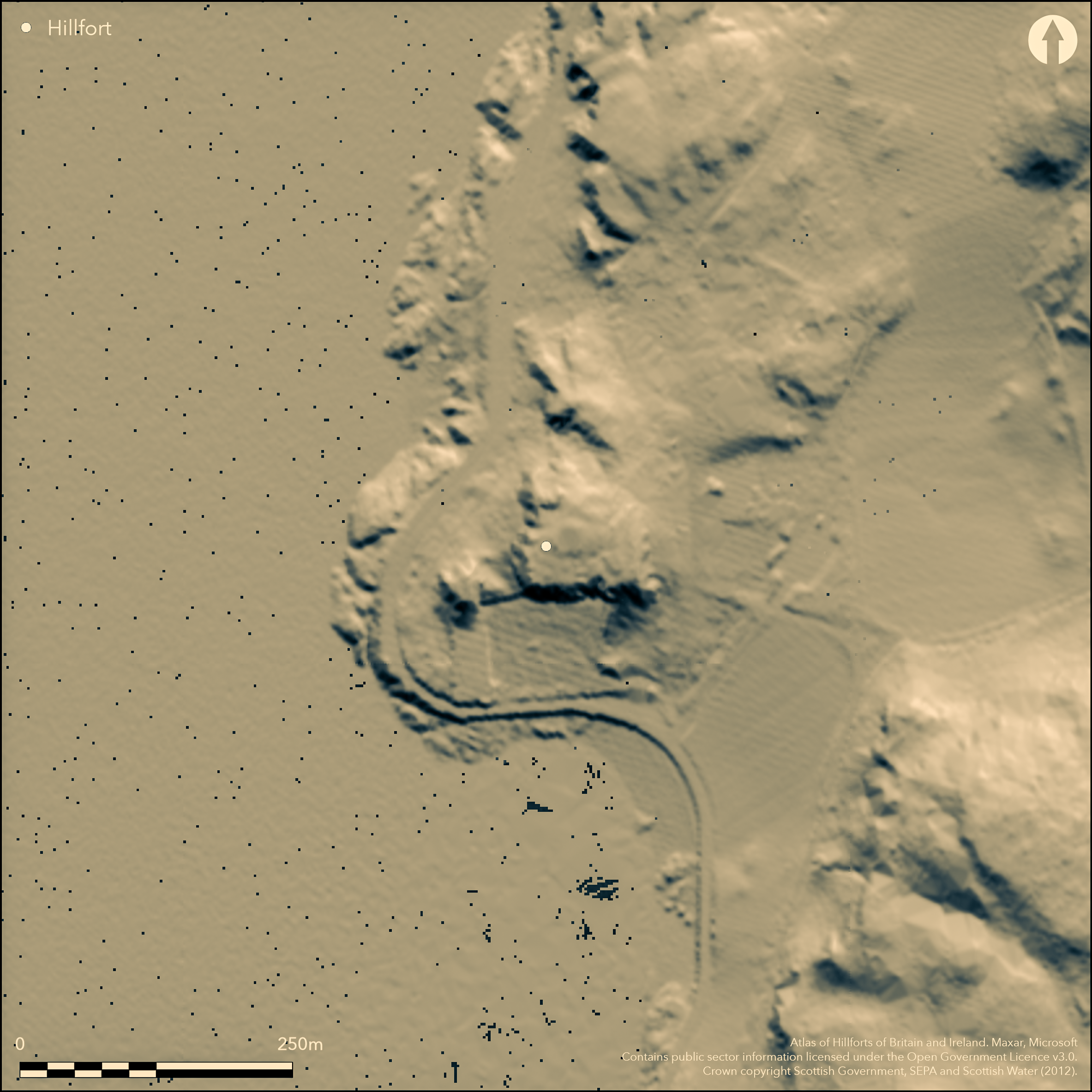
LiDAR 1m DTM Hillshade
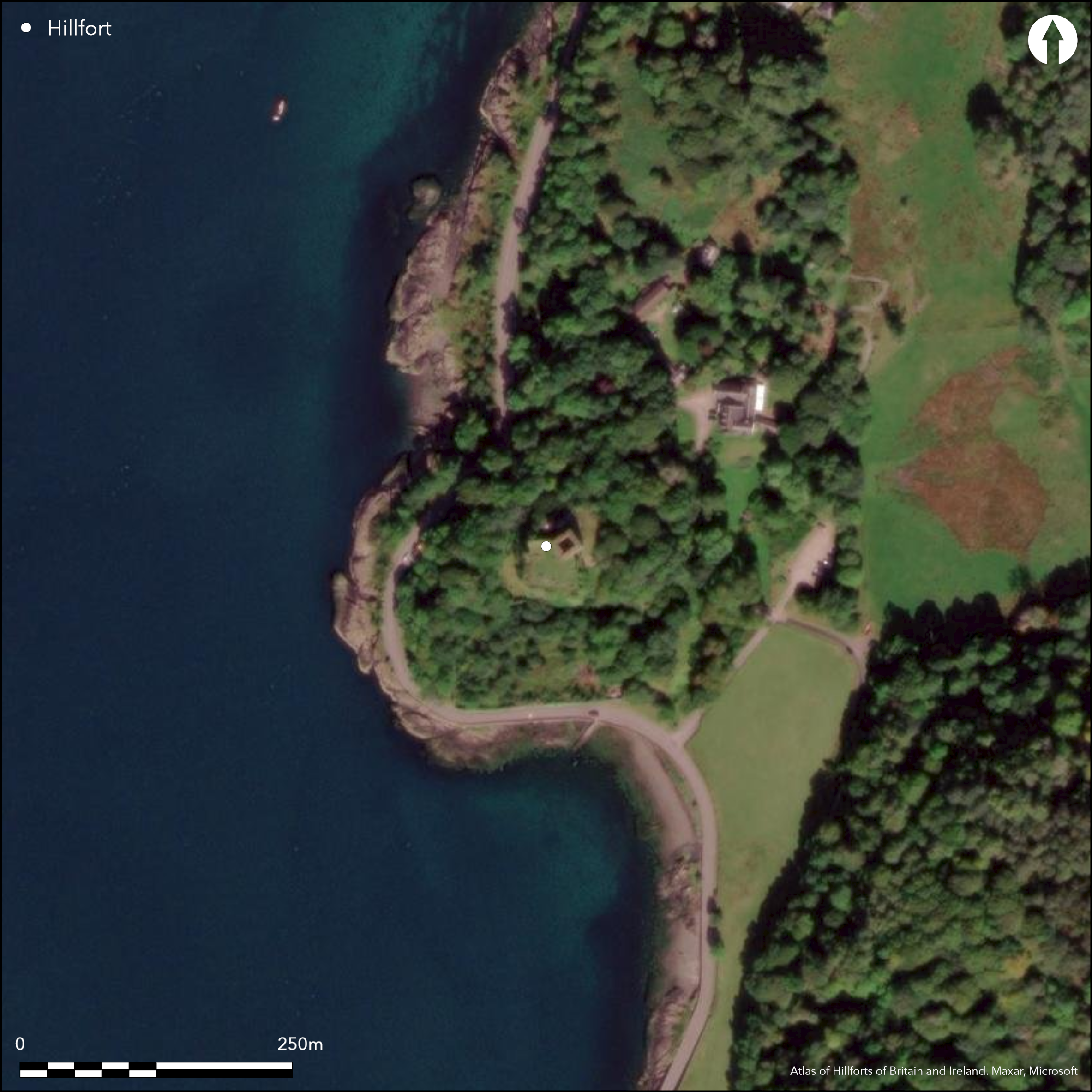
Satellite Imagery
LiDAR 1m DTM Hillshade
Satellite Imagery
Scroll left/right to view further images.
HER: The West of Scotland Archaeology Service 1217 (None)
NMR: NM 83 SE 11 (23027)
SM: 293
NGR: NM 8521 3148
X: 185215 Y: 731484 (OSGB36)
Dunollie crowns a precipitous stack overlooking the N exit of the Sound of Kerrera and the passage into the sheltered waters of Oban Bay. Crowned by a ruined tower-house and its courtyard, the references by annalists for the years AD 686, 698, 701, 714 and 734 also indicate this was the site of an early medieval fortification, the existence of which was confirmed by excavations directed by Leslie Alcock on earthworks first shown but not annotated on the 1st edition of the OS 25-inch map (Argyllshire 1874, sheet 98.3). In his interpretation, the stone castle masks a citadel, while a bank on the leading edge of a terrace some 15m to the N incorporates a massive stone rampart up to 5m thick enclosing an upper court; overlying a metalworkers hearth associated with artefacts and radiocarbon dates spanning from the late 5th to the late 9th centuries AD, its collapsed ruin was overlain by deposits dated between the mid 9th and mid 11th centuries AD. Sometime later, another rampart was built on this line, though this may well belong to the 13th century or later. A similar undated sequence of construction was recovered from a terrace lower down on the E flank of the stack. While the presence of an early medieval fortification here is not in doubt, its form and extent are unknown. The medieval castle occupies an area of about 0.08ha on the presumed site of the citadel on the summit of the stack, while the position of the rampart to the N might increase this to 0.17ha, and the lower rampart on the E to perhaps as much as 0.24ha overall.
Citizen Science: ✗
Reliability of Data: Confirmed
Reliability of Interpretation: Confirmed
X: -610553 Y: 7643811 (EPSG: 3857)
Longitude: -5.484687460831362 Latitude: 56.42659282495825 (EPSG:4326)
Country: Scotland
Current County or Unitary Authority: Argyll & Bute
Historic County: Argyll
Current Parish/Community/Council/Townland: Kilmore And Kilbride
None
| Extant | ✓ |
| Cropmark | ✗ |
| Likely Destroyed | ✓ |
None
| Woodland | ✗ |
| Commercial Forestry Plantation | ✗ |
| Parkland | ✓ |
| Pasture (Grazing) | ✗ |
| Arable | ✗ |
| Scrub/Bracken | ✗ |
| Bare Outcrop | ✗ |
| Heather/Moorland | ✗ |
| Heath | ✗ |
| Built-up | ✗ |
| Coastal Grassland | ✗ |
| Other | ✗ |
None
| Contour Fort | ✓ |
| Partial Contour Fort | ✗ |
| Promontory Fort | ✗ |
| Hillslope Fort | ✗ |
| Level Terrain Fort | ✗ |
| Marsh Fort | ✗ |
| Multiple Enclosure Fort | ✗ |
| Hilltop | ✗ |
| Coastal Promontory | ✗ |
| Inland Promontory | ✗ |
| Valley Bottom | ✗ |
| Knoll/Hillock/Outcrop | ✓ |
| Ridge | ✗ |
| Cliff/Plateau-edge/Scarp | ✗ |
| Hillslope | ✗ |
| Lowland | ✗ |
| Spur | ✗ |
Dominant Topographic Feature: None
| North | ✗ |
| Northeast | ✗ |
| East | ✗ |
| Southeast | ✗ |
| South | ✗ |
| Southwest | ✗ |
| West | ✗ |
| Northwest | ✗ |
| Level | ✓ |
Altitude: 30.0m
N/A
Documentary references to Dunollie appear in Annals compiled at Iona and date to AD 686, 698, 701, 714 and 734, mentioning it in the terminology of a fortified centre. Radiocarbon dates and the artefact assemblage from evaluation trenches also demonstrate that this site was fortified in the early medieval period.
Reliability: D - None
| Pre 1200BC | ✗ |
| 1200BC - 800BC | ✗ |
| 800BC - 400BC | ✗ |
| 400BC - AD50 | ✗ |
| AD50 - AD400 | ✗ |
| AD400 - AD 800 | ✓ |
| Post AD800 | ✗ |
| Unknown | ✗ |
| Pre Hillfort: | None |
| Post Hillfort: | None |
| Artefactual: | Assemblage fro excavation |
| C14: | Five radiocarbon dates |
| Other: | Documentary |
The RCAHMS collection has extensive archives of the medieval castle which are not detailed here. They also hold the excavation archive.
| 1st Identified Map Depiction (1870): | Earthworks reported and depicted, but not annotated, on the 1st edition of the OS 25-inch map (Argyllshire 1874, sheet 98.3; Name Book, Argyll) |
| Other (1931): | Castle Scheduled |
| Excavation (1978): | Directed by Leslie Alcock (1987) |
| Earthwork Survey (1979): | Plan prepared for Alcock (see also RCAHMS 1975, 194-8, no.286; RCAHMS ) |
| Other (2002): | Re-Scheduled |
Largely occupied by the medieval castle
None
| None | ✓ |
| Spring | ✗ |
| Stream | ✗ |
| Pool | ✗ |
| Flush | ✗ |
| Well | ✗ |
| Other | ✗ |
None
| No Known Features | ✓ |
| Round Stone Structures | ✗ |
| Rectangular Stone Structures | ✗ |
| Curvilinear Platforms | ✗ |
| Other Roundhouse Evidence | ✗ |
| Pits | ✗ |
| Quarry Hollows | ✗ |
| Other | ✗ |
Metalworkers site beneath rampart
| No Known Excavation | ✗ |
| Pits | ✗ |
| Postholes | ✗ |
| Roundhouses | ✗ |
| Rectangular Structures | ✗ |
| Roads/Tracks | ✗ |
| Quarry Hollows | ✗ |
| Other | ✓ |
| Nothing Found | ✗ |
None
| No Known Geophysics | ✓ |
| Pits | ✗ |
| Roundhouses | ✗ |
| Rectangular Structures | ✗ |
| Roads/Tracks | ✗ |
| Quarry Hollows | ✗ |
| Other | ✗ |
| Nothing Found | ✗ |
Prior to the rampart identified in excavation, there was a metalworker's hearth with mould fragments for the production of stick pins. An iron spearhead and five socketed arrows were also found, three tanged knives, an axe, a hammer and an awl, and a sherds of imported E ware representing four vessels, a gold wire hoop, a glass bead and bone and antler pins and a composite comb.
| No Known Finds | ✗ |
| Pottery | ✓ |
| Metal | ✓ |
| Metalworking | ✓ |
| Human Bones | ✗ |
| Animal Bones | ✓ |
| Lithics | ✓ |
| Environmental | ✗ |
| Other | ✓ |
Obscured by the castle and trees
| APs Not Checked | ✗ |
| None | ✓ |
| Roundhouses | ✗ |
| Rectangular Structures | ✗ |
| Pits | ✗ |
| Postholes | ✗ |
| Roads/Tracks | ✗ |
| Other | ✗ |
None known
| 0: | None |
| 2: | Not known |
Guard Chambers: ✗
Chevaux de Frise: ✗
At least two ramparts enclosing terraces on the stack; extent of interior unknown
| Area 1: | Noneha. |
| Total: | Noneha. |
Total Footprint Area: 0.24ha.
None
| ✗ | True extents of any of the enclosures are unknown |
| ✗ | Unknown plan |
| NE Quadrant: | 1 |
| SE Quadrant: | 1 |
| SW Quadrant: | 0 |
| NW Quadrant: | 0 |
| Total: | 1 |
| Partial Univallate | ✓ |
| Univallate | ✗ |
| Partial Bivallate | ✗ |
| Bivallate | ✗ |
| Partial Multivallate | ✗ |
| Multivallate | ✗ |
| Unknown | ✗ |
| Partial Univallate | ✗ |
| Univallate | ✗ |
| Partial Bivallate | ✗ |
| Bivallate | ✗ |
| Partial Multivallate | ✗ |
| Multivallate | ✗ |
None
| None | ✗ |
| Earthen Bank | ✗ |
| Stone Wall | ✓ |
| Rubble | ✗ |
| Wall-walk | ✗ |
| Evidence of Timber | ✗ |
| Vitrification | ✗ |
| Other Burning | ✗ |
| Palisade | ✗ |
| Counter Scarp Bank | ✗ |
| Berm | ✗ |
| Unfinished | ✗ |
| Other | ✗ |
None
| None | ✗ |
| Earthen Bank | ✗ |
| Stone Wall | ✓ |
| Murus Duplex | ✗ |
| Timber-framed | ✗ |
| Timber-laced | ✗ |
| Vitrification | ✗ |
| Other Burning | ✗ |
| Palisade | ✗ |
| Counter Scarp Bank | ✗ |
| Berm | ✗ |
| Unfinished | ✗ |
| No Known Excavation | ✗ |
| Other | ✗ |
| ✗ | None |
| ✗ | None |
Number of Ditches: None
| ✓ | The rampart recorded in excavation on the N and E are likely to be enclosing subsidiary courts in a more complex pattern of defences. |
Alcock and Alcock, L and E A (1988) 'Reconnaissance excavations on Early Historic fortifications and other royal sites in Scotland, 1974-84: 2, Excavations at Dunollie Castle, Oban, Argyll, 1978'. Proc Soc Antiq Scot 117 (1987), 119-47
RCAHMS (1975) The Royal Commission on the Ancient and Historical Monuments of Scotland. Argyll: an inventory of the ancient monuments: volume 2: Lorn. HMSO: Edinburgh
Atlas of Hillforts:
Wikidata:
This work is licensed under CC BY-SA 4.0

 and should be cited as:
Lock, Gary and Ralston, Ian. 2024. Atlas of Hillforts of Britain and Ireland. Available at: https://hillforts.arch.ox.ac.uk
Document Version 1.1