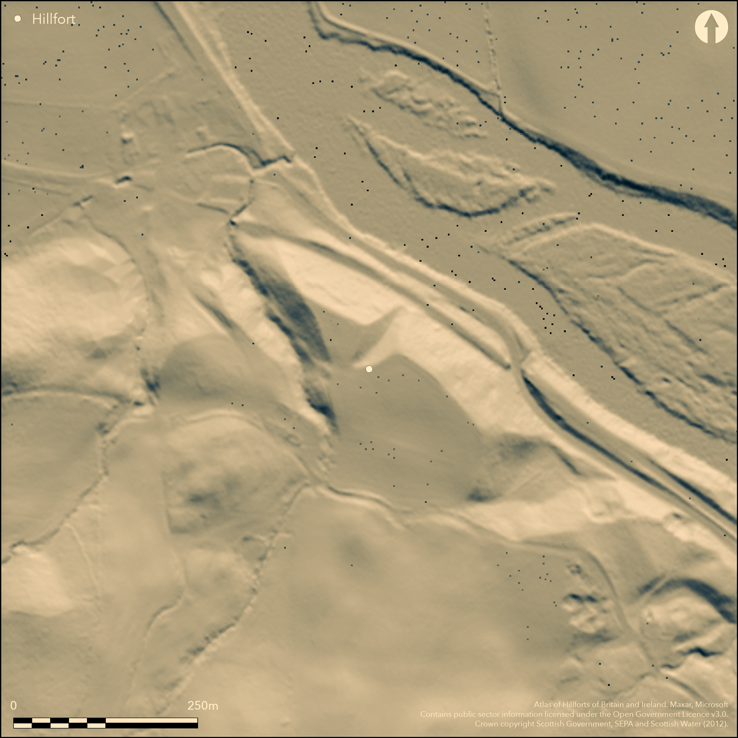
LiDAR 1m DTM Hillshade
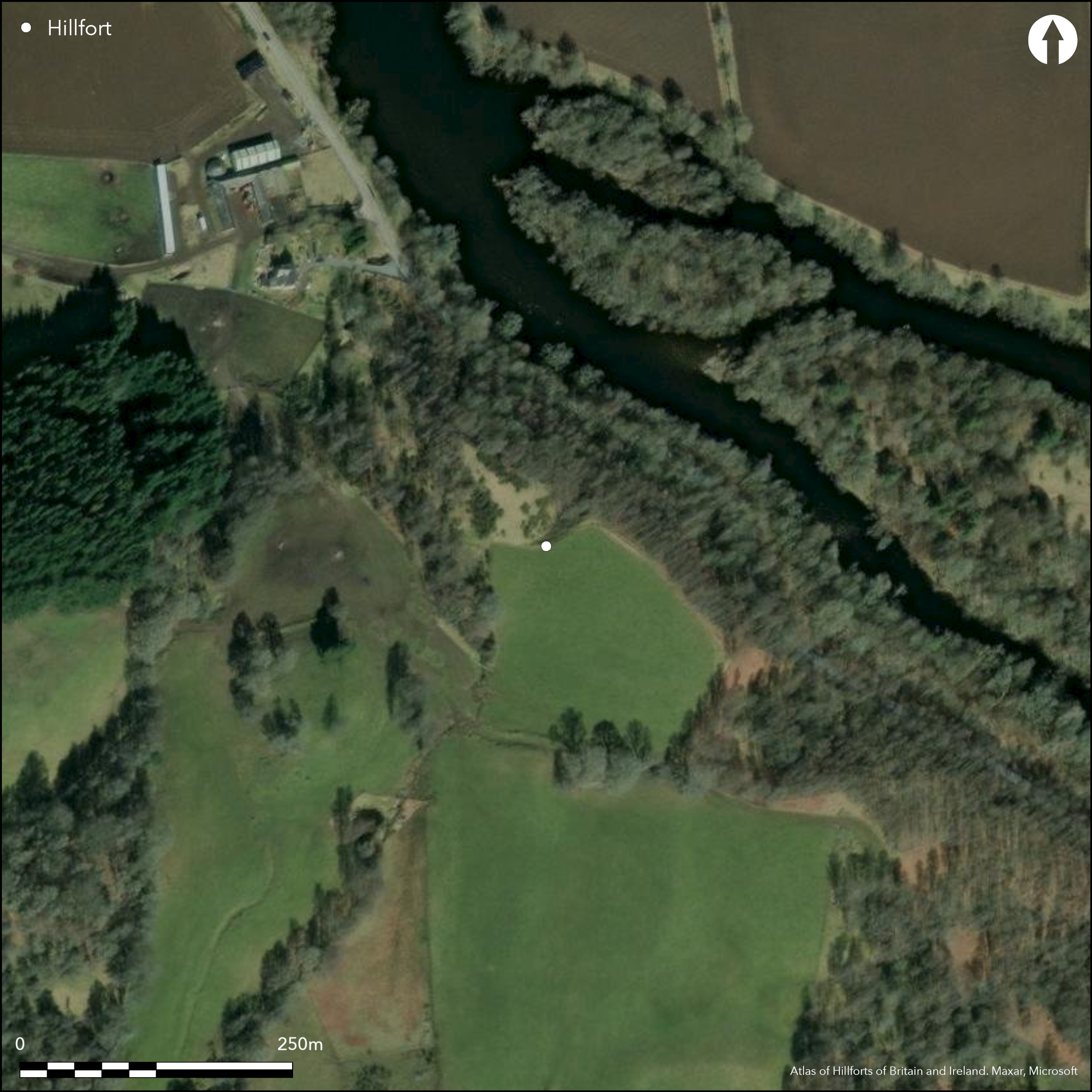
Satellite Imagery
LiDAR 1m DTM Hillshade
Satellite Imagery
Scroll left/right to view further images.
HER: Perth and Kinross Heritage Trust MPK9941 (None)
NMR: NN 95 SW 66 (148956)
SM: 9533
NGR: NN 9265 5291
X: 292650 Y: 752910 (OSGB36)
A large and complex fortification is revealed by parchmarks on a promontory formed where a stream gully cuts down through the escarpment known as Haughbrae of Grandtully, which falls away steeply on the NE down to the W bank of the River Tay some 25m below. The defences almost certainly represent several phases of construction, comprising an inner series of ditches cutting off the tip of the promontory, which was already partly isolated by a natural hollow that bites into the escarpment on the NE flank, and an outer pair of ditches with two concentric internal palisade trenches. The two innermost ditches, which are both about 4m in breadth, are set roughly parallel behind the natural hollow, cutting off a triangular area measuring about 50m in length from NW to SE by a maximum of 35m transversely (0.09ha); although the parchmark of the outer peters out, the inner terminates abruptly a short distance from the SW margin of the promontory and almost certainly indicates the position of an entrance leading out towards the SE. Further complexities in the arrangement of the ditches at the entrance are probably masked by the natural hollow, which can be seen in the parchmarks extending in an arc across the entrance and into the stream gully on the SW; it may well hide another ditch, and outside its line there is another dark mark lying parallel to it on the edge of the stream gully, though if this is yet another ditch it does not seem to extend any further across the neck of the promontory. The outer defences lie some 30m beyond the natural hollow and cut off a much larger area measuring in the order of 100m in length from NW to SE by a maximum of 75m transversely (0.41ha). The two ditches lie roughly parallel 5m apart, though neither can be traced all the way to the edge of the escarpment on the NE. There is a clearly defined entrance towards this side, and while a short segment of the inner can be seen between the entrance and the lip of the escarpment, the outer apparently terminates on the SW side of the entrance, turning inwards slightly on this side of the causeway. Immediately within the line of the inner ditch, there are traces of two concentric palisade trenches set about 4m apart, both of which are also broken at the entrance causeway and turn inwards slightly to either side of the gap. While these outer elements are all concentric, it is unclear whether they all relate to a single scheme of defence, or whether the palisades indicate an earlier timber phase.
Citizen Science: ✗
Reliability of Data: Confirmed
Reliability of Interpretation: Confirmed
X: -417747 Y: 7690067 (EPSG: 3857)
Longitude: -3.7526889094002303 Latitude: 56.65568726215258 (EPSG:4326)
Country: Scotland
Current County or Unitary Authority: Perth & Kinross
Historic County: Perthshire
Current Parish/Community/Council/Townland: Little Dunkeld
None
| Extant | ✗ |
| Cropmark | ✓ |
| Likely Destroyed | ✗ |
None
| Woodland | ✓ |
| Commercial Forestry Plantation | ✗ |
| Parkland | ✗ |
| Pasture (Grazing) | ✓ |
| Arable | ✓ |
| Scrub/Bracken | ✗ |
| Bare Outcrop | ✗ |
| Heather/Moorland | ✗ |
| Heath | ✗ |
| Built-up | ✗ |
| Coastal Grassland | ✗ |
| Other | ✗ |
None
| Contour Fort | ✗ |
| Partial Contour Fort | ✗ |
| Promontory Fort | ✓ |
| Hillslope Fort | ✗ |
| Level Terrain Fort | ✗ |
| Marsh Fort | ✗ |
| Multiple Enclosure Fort | ✗ |
| Hilltop | ✗ |
| Coastal Promontory | ✗ |
| Inland Promontory | ✓ |
| Valley Bottom | ✗ |
| Knoll/Hillock/Outcrop | ✗ |
| Ridge | ✗ |
| Cliff/Plateau-edge/Scarp | ✓ |
| Hillslope | ✗ |
| Lowland | ✗ |
| Spur | ✗ |
Dominant Topographic Feature: None
| North | ✗ |
| Northeast | ✗ |
| East | ✗ |
| Southeast | ✗ |
| South | ✗ |
| Southwest | ✗ |
| West | ✗ |
| Northwest | ✗ |
| Level | ✓ |
Altitude: 90.0m
N/A
In the absence of excavation, there are neither stratified artefacts nor radiocarbon dates to provide a chronology for the defences.
Reliability: D - None
| Pre 1200BC | ✗ |
| 1200BC - 800BC | ✗ |
| 800BC - 400BC | ✗ |
| 400BC - AD50 | ✗ |
| AD50 - AD400 | ✗ |
| AD400 - AD 800 | ✗ |
| Post AD800 | ✗ |
| Unknown | ✓ |
| Pre Hillfort: | None |
| Post Hillfort: | None |
None
| 1st Identified Written Reference (1995): | Discovered by RCAHMS Aerial Survey Programme |
| Other (2001): | Scheduled |
Featureless apart from palisades
None
| None | ✓ |
| Spring | ✗ |
| Stream | ✗ |
| Pool | ✗ |
| Flush | ✗ |
| Well | ✗ |
| Other | ✗ |
None
| No Known Features | ✓ |
| Round Stone Structures | ✗ |
| Rectangular Stone Structures | ✗ |
| Curvilinear Platforms | ✗ |
| Other Roundhouse Evidence | ✗ |
| Pits | ✗ |
| Quarry Hollows | ✗ |
| Other | ✗ |
None
| No Known Excavation | ✓ |
| Pits | ✗ |
| Postholes | ✗ |
| Roundhouses | ✗ |
| Rectangular Structures | ✗ |
| Roads/Tracks | ✗ |
| Quarry Hollows | ✗ |
| Other | ✗ |
| Nothing Found | ✗ |
None
| No Known Geophysics | ✓ |
| Pits | ✗ |
| Roundhouses | ✗ |
| Rectangular Structures | ✗ |
| Roads/Tracks | ✗ |
| Quarry Hollows | ✗ |
| Other | ✗ |
| Nothing Found | ✗ |
None
| No Known Finds | ✓ |
| Pottery | ✗ |
| Metal | ✗ |
| Metalworking | ✗ |
| Human Bones | ✗ |
| Animal Bones | ✗ |
| Lithics | ✗ |
| Environmental | ✗ |
| Other | ✗ |
Palisade trenches
| APs Not Checked | ✗ |
| None | ✗ |
| Roundhouses | ✗ |
| Rectangular Structures | ✗ |
| Pits | ✗ |
| Postholes | ✗ |
| Roads/Tracks | ✗ |
| Other | ✓ |
See main summary
| 2: | Ploughed flat |
| 2: | single entrance in both the inner and outer defences, probably representing separate periods |
Guard Chambers: ✗
Chevaux de Frise: ✗
| 1. Simple Gap (South east): | Through inner defences |
| 1. Simple Gap (South east): | Breaks in both the outer ditches and the internal palisades |
Multivallate earthwork and timber defences cutting off a promontory
| Area 1: | 0.09ha. |
| Area 2: | 0.41ha. |
| Total: | 0.41ha. |
Total Footprint Area: 0.53ha.
None
| ✗ | None |
| ✗ | None |
| NE Quadrant: | 0 |
| SE Quadrant: | 4 |
| SW Quadrant: | 0 |
| NW Quadrant: | 0 |
| Total: | 4 |
| Partial Univallate | ✗ |
| Univallate | ✗ |
| Partial Bivallate | ✗ |
| Bivallate | ✗ |
| Partial Multivallate | ✓ |
| Multivallate | ✗ |
| Unknown | ✗ |
| Partial Univallate | ✗ |
| Univallate | ✗ |
| Partial Bivallate | ✗ |
| Bivallate | ✗ |
| Partial Multivallate | ✗ |
| Multivallate | ✗ |
Not visible on the surface; palisade trenches revealed by cropmarks
| None | ✗ |
| Earthen Bank | ✗ |
| Stone Wall | ✗ |
| Rubble | ✗ |
| Wall-walk | ✗ |
| Evidence of Timber | ✗ |
| Vitrification | ✗ |
| Other Burning | ✗ |
| Palisade | ✓ |
| Counter Scarp Bank | ✗ |
| Berm | ✗ |
| Unfinished | ✗ |
| Other | ✗ |
None
| None | ✗ |
| Earthen Bank | ✗ |
| Stone Wall | ✗ |
| Murus Duplex | ✗ |
| Timber-framed | ✗ |
| Timber-laced | ✗ |
| Vitrification | ✗ |
| Other Burning | ✗ |
| Palisade | ✗ |
| Counter Scarp Bank | ✗ |
| Berm | ✗ |
| Unfinished | ✗ |
| No Known Excavation | ✓ |
| Other | ✗ |
| ✗ | None |
| ✓ | At least four, probably representing a minimum of two phases of construction. |
Number of Ditches: 4
| ✗ | None |
No related records
Atlas of Hillforts:
Wikidata:
This work is licensed under CC BY-SA 4.0

 and should be cited as:
Lock, Gary and Ralston, Ian. 2024. Atlas of Hillforts of Britain and Ireland. Available at: https://hillforts.arch.ox.ac.uk
Document Version 1.1