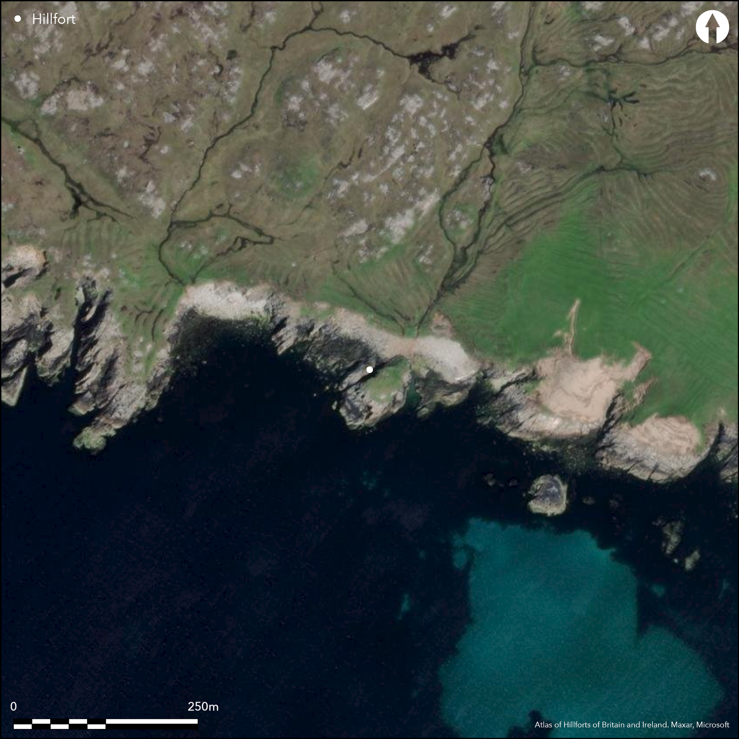
Satellite Imagery
Satellite Imagery
HER: Comhairle nan Eilean Siar - Western Isles Sites and Monuments Record MWE109407 (None)
NMR: NB 03 SW 21 (109407)
SM: None
NGR: NB 0315 3398
X: 103150 Y: 933980 (OSGB36)
This low rocky promontory juts out from the shore on the N coast of Camus Uig. Now separated from the shore by a storm beach, a single wall some 17m in length, with an entrance midway along its length, spans the landward side on the NE. On the surface the remains of this wall are up to 0.8m high and spread between 1.4m and 1.6m thick, but excavation has shown that it is 4m thick at the entrance (Nesbitt et al 2011). The interior measures about 34m from NE to SW by 21m transversely (0.07ha). Within the interior traces of set stones and a T-shaped excavation trench serve to identify the position of two rectangular buildings noted within the interior. The excavations revealed a complex history of occupation, which was resolved by the excavators into four main phases of activity by the excavators and mainly date to the period 800-400 BC, though the contexts of the radiocarbon dates are not provided in the report and their relationship to the wall unclear (Nesbitt et al 2011).
Citizen Science: ✗
Reliability of Data: Confirmed
Reliability of Interpretation: Confirmed
X: -785248 Y: 8008278 (EPSG: 3857)
Longitude: -7.0539983376158855 Latitude: 58.194455264962954 (EPSG:4326)
Country: Scotland
Current County or Unitary Authority: Western Isles
Historic County: Ross-shire
Current Parish/Community/Council/Townland: Uig
None
| Extant | ✓ |
| Cropmark | ✗ |
| Likely Destroyed | ✗ |
None
| Woodland | ✗ |
| Commercial Forestry Plantation | ✗ |
| Parkland | ✗ |
| Pasture (Grazing) | ✓ |
| Arable | ✗ |
| Scrub/Bracken | ✗ |
| Bare Outcrop | ✗ |
| Heather/Moorland | ✗ |
| Heath | ✗ |
| Built-up | ✗ |
| Coastal Grassland | ✓ |
| Other | ✗ |
None
| Contour Fort | ✗ |
| Partial Contour Fort | ✗ |
| Promontory Fort | ✓ |
| Hillslope Fort | ✗ |
| Level Terrain Fort | ✗ |
| Marsh Fort | ✗ |
| Multiple Enclosure Fort | ✗ |
| Hilltop | ✗ |
| Coastal Promontory | ✓ |
| Inland Promontory | ✗ |
| Valley Bottom | ✗ |
| Knoll/Hillock/Outcrop | ✗ |
| Ridge | ✗ |
| Cliff/Plateau-edge/Scarp | ✗ |
| Hillslope | ✗ |
| Lowland | ✗ |
| Spur | ✗ |
Dominant Topographic Feature: None
| North | ✗ |
| Northeast | ✗ |
| East | ✗ |
| Southeast | ✗ |
| South | ✗ |
| Southwest | ✗ |
| West | ✗ |
| Northwest | ✗ |
| Level | ✓ |
Altitude: 5.0m
N/A
Excavation revealed at least four phases of activity; interpretation was based on eight radiocarbon dates from single entity barley seed samples in pairs from four key stratigraphic contexts. One date from early dug features is Late Bronze Age, six are Early Iron Age, and one falls a little later Apart from the LBA dates, the contexts are not elaborated in the report and it is unclear what these key contexts were, and what their relationship to the construction of the wall may have been.
Reliability: B - Medium
| Pre 1200BC | ✗ |
| 1200BC - 800BC | ✗ |
| 800BC - 400BC | ✓ |
| 400BC - AD50 | ✗ |
| AD50 - AD400 | ✗ |
| AD400 - AD 800 | ✗ |
| Post AD800 | ✗ |
| Unknown | ✗ |
| Pre Hillfort: | None |
| Post Hillfort: | None |
| Artefactual: | Ceramics |
| C14: | Eight radiocarbon dates from seeds |
Photographed by RCAHMS Aerial Survey Programme in 2004
| 1st Identified Written Reference (1995): | Discovery (Burgess and Church 1995) |
| Excavation (1996): | Burgess et al 1996; Nesbitt et al 2011 |
| Excavation (1998): | Church et al 1998; Nesbitt et al 2011 |
| Other (2009): | Description by RCAHMS |
Rectangular buildings
None
| None | ✓ |
| Spring | ✗ |
| Stream | ✗ |
| Pool | ✗ |
| Flush | ✗ |
| Well | ✗ |
| Other | ✗ |
None
| No Known Features | ✗ |
| Round Stone Structures | ✗ |
| Rectangular Stone Structures | ✓ |
| Curvilinear Platforms | ✗ |
| Other Roundhouse Evidence | ✗ |
| Pits | ✗ |
| Quarry Hollows | ✗ |
| Other | ✗ |
Cobbling, paving and ash spreads. Four phases of occupation revealed in shallow stratigraphy
| No Known Excavation | ✗ |
| Pits | ✓ |
| Postholes | ✗ |
| Roundhouses | ✗ |
| Rectangular Structures | ✓ |
| Roads/Tracks | ✗ |
| Quarry Hollows | ✗ |
| Other | ✓ |
| Nothing Found | ✗ |
None
| No Known Geophysics | ✓ |
| Pits | ✗ |
| Roundhouses | ✗ |
| Rectangular Structures | ✗ |
| Roads/Tracks | ✗ |
| Quarry Hollows | ✗ |
| Other | ✗ |
| Nothing Found | ✗ |
Norse pottery
| No Known Finds | ✗ |
| Pottery | ✓ |
| Metal | ✗ |
| Metalworking | ✗ |
| Human Bones | ✗ |
| Animal Bones | ✗ |
| Lithics | ✗ |
| Environmental | ✗ |
| Other | ✗ |
NO APPARENT FEATURES
| APs Not Checked | ✗ |
| None | ✗ |
| Roundhouses | ✗ |
| Rectangular Structures | ✓ |
| Pits | ✗ |
| Postholes | ✗ |
| Roads/Tracks | ✗ |
| Other | ✗ |
See main summary
| 1: | Incomplete circuit |
| 2: | None |
Guard Chambers: ✗
Chevaux de Frise: ✗
| 1. Simple Gap (North east): | None |
Single wall across a promontory, thought to have been carried up in turf
| Area 1: | 0.07ha. |
| Total: | 0.07ha. |
Total Footprint Area: Noneha.
None
| ✗ | None |
| ✗ | None |
| NE Quadrant: | 1 |
| SE Quadrant: | 0 |
| SW Quadrant: | 0 |
| NW Quadrant: | 0 |
| Total: | 1 |
| Partial Univallate | ✓ |
| Univallate | ✗ |
| Partial Bivallate | ✗ |
| Bivallate | ✗ |
| Partial Multivallate | ✗ |
| Multivallate | ✗ |
| Unknown | ✗ |
| Partial Univallate | ✗ |
| Univallate | ✗ |
| Partial Bivallate | ✗ |
| Bivallate | ✗ |
| Partial Multivallate | ✗ |
| Multivallate | ✗ |
None
| None | ✗ |
| Earthen Bank | ✗ |
| Stone Wall | ✓ |
| Rubble | ✗ |
| Wall-walk | ✗ |
| Evidence of Timber | ✗ |
| Vitrification | ✗ |
| Other Burning | ✗ |
| Palisade | ✗ |
| Counter Scarp Bank | ✗ |
| Berm | ✗ |
| Unfinished | ✗ |
| Other | ✗ |
Interpreted as a stone footing that was carried up in turf.
| None | ✗ |
| Earthen Bank | ✗ |
| Stone Wall | ✓ |
| Murus Duplex | ✗ |
| Timber-framed | ✗ |
| Timber-laced | ✗ |
| Vitrification | ✗ |
| Other Burning | ✗ |
| Palisade | ✗ |
| Counter Scarp Bank | ✗ |
| Berm | ✗ |
| Unfinished | ✗ |
| No Known Excavation | ✗ |
| Other | ✗ |
| ✗ | None |
| ✗ | None |
Number of Ditches: None
| ✗ | None |
Burgess and Church, C and M (1995) 'Uig Sands to Aird Uig, Isle of Lewis (Uig parish), survey'. Disc Exc Scot (1995), 112
Burgess, C, Dempsey, J, Gilmour, S and Jackson, A (1996) 'Gob Eirer (Uig parish), promontory fort'. Disc Exc Scot (1996), 111
Church, Gilmour and Flitcroft, M, S and C (1998) 'Gob Eirer (UIg parish), promontory fort'. Disc Exc Scot (1998), 106
Nesbitt, C, Church, M J, and Gilmour, S M D (2011) 'Domestic, industrial, (en)closed? Survey and excavation of a Late Bronze Age/Early Iron Age promontory enclosure at Gob Eirer, Lewis, Western Isles'. Proc Soc Antiq Scot 141 (2011), 31-74
Atlas of Hillforts:
Wikidata:
This work is licensed under CC BY-SA 4.0

 and should be cited as:
Lock, Gary and Ralston, Ian. 2024. Atlas of Hillforts of Britain and Ireland. Available at: https://hillforts.arch.ox.ac.uk
Document Version 1.1