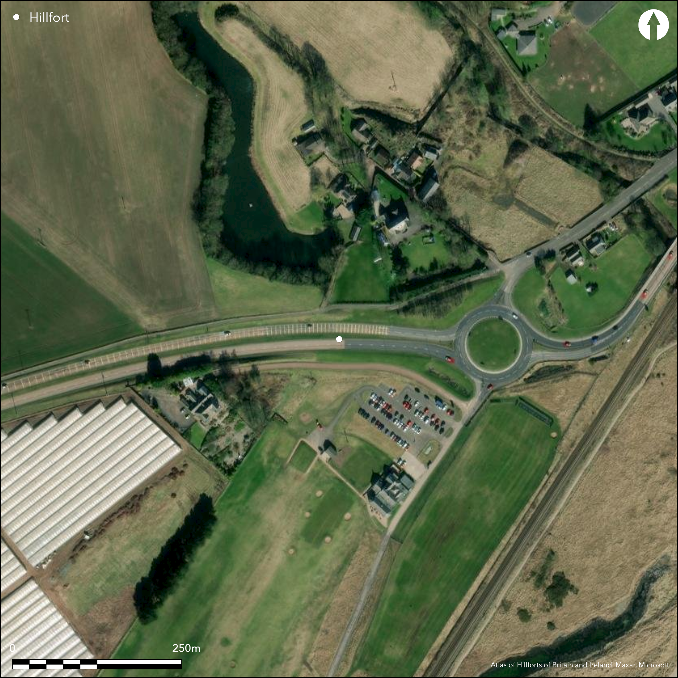
Satellite Imagery
Satellite Imagery
HER: Angus SMR per Aberdeenshire Council NO63NW0007 (None)
NMR: NO 63 NW 7 (35382)
SM: None
NGR: NO 6175 3933
X: 361750 Y: 739332 (OSGB36)
Excavations along the line of the A90 dual carriageway S of Wormiehills revealed what may be a promontory enclosure utilising a spur of the raised beach on the SE side of the mouth of Kelly Den, its surviving portion lying between the road and the escarpment that forms the S bank of the old mill pond at Wormiehills. A single ditch some 3m in breadth was exposed on the SW, drawn in two straight segments with a butt end forming its eastern terminal; stones from an internal rampart had been demolished into the ditch. The excavators estimated that the area cut off on the promontory measured about 80m in length and tapered from about 70m in breadth at the W end to 35m on the E, where the ground also falls away sharply, but the position of the ditch and the projection of its line on satellite imagery suggests that its transverse measurements are rather shorter. Indeed, on plan it is as likely to have been D-shaped, backing onto the escarpment above the mill pond and measuring about 80m from ESE to WNW along the chord by no more than 45m transversely (2.8); allowing for the presence of the internal rampart, the interior might have extended to 0.23ha. As a result of heavy plough truncation, few internal features survived, but they included two long cist burials dating from about AD 530-710, what may have been another burial in a pit accompanied by a copper alloy ring and an iron bracelet, and what was either an area of paving or the foundation of a wall. Other finds included a fragment of cannel coal pendant, though this may have come from another grave, and a scatter of flint and quartz.
Citizen Science: ✗
Reliability of Data: Confirmed
Reliability of Interpretation: Confirmed
X: -292065 Y: 7667577 (EPSG: 3857)
Longitude: -2.6236609404042266 Latitude: 56.54447386399921 (EPSG:4326)
Country: Scotland
Current County or Unitary Authority: Angus
Historic County: Angus
Current Parish/Community/Council/Townland: Arbirlot
None
| Extant | ✗ |
| Cropmark | ✓ |
| Likely Destroyed | ✓ |
None
| Woodland | ✗ |
| Commercial Forestry Plantation | ✗ |
| Parkland | ✓ |
| Pasture (Grazing) | ✗ |
| Arable | ✗ |
| Scrub/Bracken | ✗ |
| Bare Outcrop | ✗ |
| Heather/Moorland | ✗ |
| Heath | ✗ |
| Built-up | ✓ |
| Coastal Grassland | ✗ |
| Other | ✗ |
While the promontory is currently inland, at only 8m OD it is conceivable that this was once a coastal promontory.
| Contour Fort | ✗ |
| Partial Contour Fort | ✗ |
| Promontory Fort | ✓ |
| Hillslope Fort | ✗ |
| Level Terrain Fort | ✗ |
| Marsh Fort | ✗ |
| Multiple Enclosure Fort | ✗ |
| Hilltop | ✗ |
| Coastal Promontory | ✗ |
| Inland Promontory | ✓ |
| Valley Bottom | ✗ |
| Knoll/Hillock/Outcrop | ✗ |
| Ridge | ✗ |
| Cliff/Plateau-edge/Scarp | ✓ |
| Hillslope | ✗ |
| Lowland | ✗ |
| Spur | ✗ |
Dominant Topographic Feature: None
| North | ✗ |
| Northeast | ✗ |
| East | ✗ |
| Southeast | ✗ |
| South | ✗ |
| Southwest | ✗ |
| West | ✗ |
| Northwest | ✗ |
| Level | ✓ |
Altitude: 8.0m
N/A
There are neither stratified artefacts nor radiocarbon dates to provide a chronology for the defences.
Reliability: D - None
| Pre 1200BC | ✗ |
| 1200BC - 800BC | ✗ |
| 800BC - 400BC | ✗ |
| 400BC - AD50 | ✗ |
| AD50 - AD400 | ✗ |
| AD400 - AD 800 | ✗ |
| Post AD800 | ✗ |
| Unknown | ✓ |
| Pre Hillfort: | None |
| Post Hillfort: | Used for a long cist cemetery and subsequently demolished and ploughed over, and now partly under the dual carriageway |
None
| 1st Identified Written Reference (1982): | Identified by RCAHMS Aerial Survey Programme |
| Excavation (1998): | Evaluation (Rees and Cameron 1998; Cameron et al 2007) |
| Excavation (2000): | By CFA Ltd (Rees and Cameron 2000; Cameron et al 2007; RCAHMS MS5728) |
Area of paving and several pits
None
| None | ✓ |
| Spring | ✗ |
| Stream | ✗ |
| Pool | ✗ |
| Flush | ✗ |
| Well | ✗ |
| Other | ✗ |
None
| No Known Features | ✓ |
| Round Stone Structures | ✗ |
| Rectangular Stone Structures | ✗ |
| Curvilinear Platforms | ✗ |
| Other Roundhouse Evidence | ✗ |
| Pits | ✗ |
| Quarry Hollows | ✗ |
| Other | ✗ |
Paving or wall foundation and long cist cemetery
| No Known Excavation | ✗ |
| Pits | ✓ |
| Postholes | ✗ |
| Roundhouses | ✗ |
| Rectangular Structures | ✗ |
| Roads/Tracks | ✗ |
| Quarry Hollows | ✗ |
| Other | ✓ |
| Nothing Found | ✗ |
None
| No Known Geophysics | ✓ |
| Pits | ✗ |
| Roundhouses | ✗ |
| Rectangular Structures | ✗ |
| Roads/Tracks | ✗ |
| Quarry Hollows | ✗ |
| Other | ✗ |
| Nothing Found | ✗ |
Long cists and other burials are assumed to post-date the occupation and account for the main finds of a copper alloy ring, an iron bracelet and a cannel coal pendant. Other finds include a small assemblage of flint and quartz, an iron peg, two nails and a spoon handle, although these latter are probably all post-medieval. A few poorly preserved animal bones were recovered and macro fossils from floated samples.
| No Known Finds | ✗ |
| Pottery | ✗ |
| Metal | ✓ |
| Metalworking | ✗ |
| Human Bones | ✗ |
| Animal Bones | ✓ |
| Lithics | ✓ |
| Environmental | ✓ |
| Other | ✓ |
NO APPARENT FEATURES
| APs Not Checked | ✗ |
| None | ✓ |
| Roundhouses | ✗ |
| Rectangular Structures | ✗ |
| Pits | ✗ |
| Postholes | ✗ |
| Roads/Tracks | ✗ |
| Other | ✗ |
See main summary
| 1: | None |
| 2: | The eastern terminal of the ditch was a butt end |
Guard Chambers: ✗
Chevaux de Frise: ✗
| 1. Simple Gap (South): | None |
Single ditch with an internal rampart cutting off a promontory or forming a D-shaped enclosure backing onto an escarpment
| Area 1: | 0.23ha. |
| Total: | 0.23ha. |
Total Footprint Area: Noneha.
None
| ✗ | None |
| ✗ | None |
| NE Quadrant: | 0 |
| SE Quadrant: | 0 |
| SW Quadrant: | 1 |
| NW Quadrant: | 0 |
| Total: | 1 |
| Partial Univallate | ✓ |
| Univallate | ✗ |
| Partial Bivallate | ✗ |
| Bivallate | ✗ |
| Partial Multivallate | ✗ |
| Multivallate | ✗ |
| Unknown | ✗ |
| Partial Univallate | ✗ |
| Univallate | ✗ |
| Partial Bivallate | ✗ |
| Bivallate | ✗ |
| Partial Multivallate | ✗ |
| Multivallate | ✗ |
None
| None | ✓ |
| Earthen Bank | ✗ |
| Stone Wall | ✗ |
| Rubble | ✗ |
| Wall-walk | ✗ |
| Evidence of Timber | ✗ |
| Vitrification | ✗ |
| Other Burning | ✗ |
| Palisade | ✗ |
| Counter Scarp Bank | ✗ |
| Berm | ✗ |
| Unfinished | ✗ |
| Other | ✗ |
Ditch found with evidence of a demolished internal rampart in its upper fills
| None | ✓ |
| Earthen Bank | ✗ |
| Stone Wall | ✗ |
| Murus Duplex | ✗ |
| Timber-framed | ✗ |
| Timber-laced | ✗ |
| Vitrification | ✗ |
| Other Burning | ✗ |
| Palisade | ✗ |
| Counter Scarp Bank | ✗ |
| Berm | ✗ |
| Unfinished | ✗ |
| No Known Excavation | ✗ |
| Other | ✓ |
| ✗ | None |
| ✓ | None |
Number of Ditches: 1
| ✗ | None |
Cameron, Rees, Dunwell and Anderson, K, A, A and S (2007) 'Prehistoric pits, Bronze Age roundhouses, and Iron Age promontory enclosure, Early Historic cist burials and medieval enclosures along the route of the A92, Dundee to Arbroath'. Tayside Fife Archaeol J 14 (2007), 39-74
Rees and Cameron, A R and K (1998) 'A92 road improvement: Dundee to Arbroath (Arbirlot; Barry; Carnoustie; Dundee; Monifieth; Monikie; Panbride parishes), evaluation and excavation'. Disc Exc Scot (1998), 12
Rees and Cameron, A R and K (2000) 'A92 road improvement: Dundee to Arbroath (Arbirlot; Panbride; Barry parishes), excavations'. Disc Exc Scot, New Ser, 1 (2000), 11-12
Atlas of Hillforts:
Wikidata:
This work is licensed under CC BY-SA 4.0

 and should be cited as:
Lock, Gary and Ralston, Ian. 2024. Atlas of Hillforts of Britain and Ireland. Available at: https://hillforts.arch.ox.ac.uk
Document Version 1.1