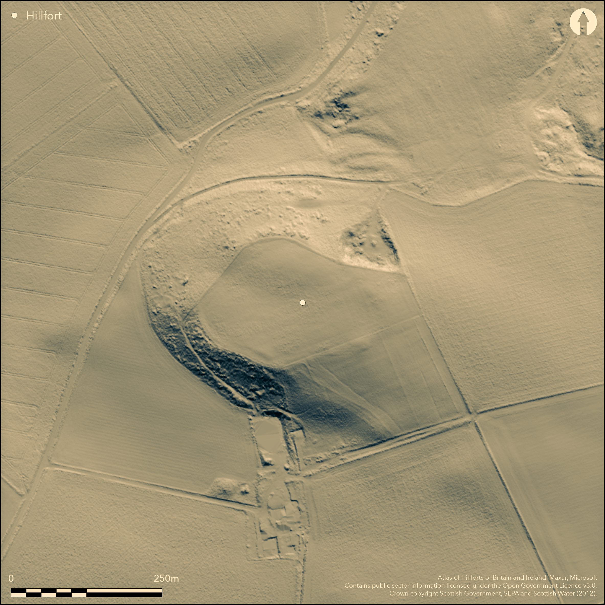
LiDAR 1m DTM Hillshade
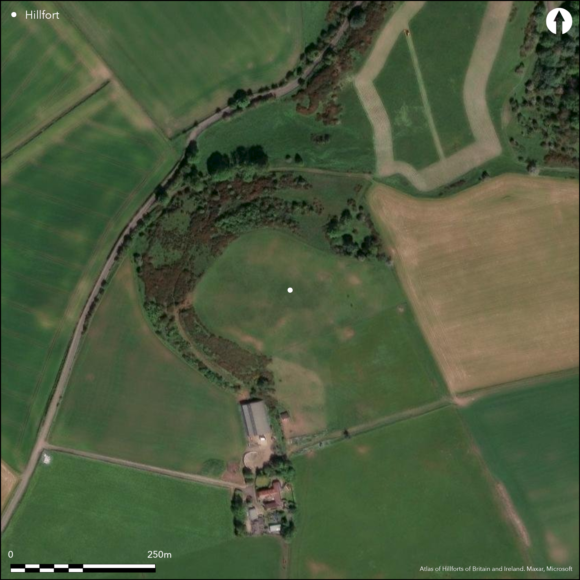
Satellite Imagery
LiDAR 1m DTM Hillshade
Satellite Imagery
Scroll left/right to view further images.
HER: Fife Council None (None)
NMR: NO 30 NW 7 (31283)
SM: None
NGR: NO 3323 0775
X: 333230 Y: 707750 (OSGB36)
This possible fort is situated on Bowden Hill, where in 1791 the minister reported in the Statistical Account that there were 'some remains of a circumvallation and rampart....nearly 200 yards in diameter' (i, 1791, 381). This is shown on the 1st edition OS 6-inch map (Fife 1856, sheet 17) with long hachures falling away from an area 110m in diameter (0.95ha) taking in the summit and the sloping ground to the W, and an outer scarp swinging round the S side and extending NW down the slope, though whether this was intended to depict a line of enclosure or merely the natural slope is unclear. The subsequent depiction on the 25-inch map prepared in 1893 is subtly different, particularly in respect to this outer scarp, which is shown returning up the N flank on the line of what was previously a plantation boundary, leaving only a relatively short sector on the E open (Fifeshire 1894, sheet 20.2); with the revision of 1912 most of this detail was removed and the present field shape had come into existence, extending down the flank of the hill to the NW. A subsequent visit in 1925 during the preparation of the County Inventory for the County of Fife could find no trace of defences on the summit, but described this outer scarp as a terrace which the investigators followed round the hill for 'between two and three hundred yards' (RCAHMS 1933, 161-2, no.302). The OS surveyor who followed them in 1962 attributed the traces of the scarp he observed round the edges of the field to ploughing, and another terrace also shown on the maps to a trackway. Nevertheless, Getmapping satellite imagery (Copyrighted 2015) reveals faint traces of a ditch some 3m in breadth following the line on E and S of the inner enclosure shown on the OS map in 1854, and though the character of the outer scarp cannot be determined from this source it would be unwise to dismiss the possibility that it is also a work of some antiquity, perhaps taking an area of as much as 1.8ha.
Citizen Science: ✗
Reliability of Data: Unconfirmed
Reliability of Interpretation: Unconfirmed
X: -342792 Y: 7609867 (EPSG: 3857)
Longitude: -3.079357251432123 Latitude: 56.25759120293185 (EPSG:4326)
Country: Scotland
Current County or Unitary Authority: Fife
Historic County: Fife
Current Parish/Community/Council/Townland: Kettle
None
| Extant | ✗ |
| Cropmark | ✓ |
| Likely Destroyed | ✗ |
None
| Woodland | ✗ |
| Commercial Forestry Plantation | ✗ |
| Parkland | ✗ |
| Pasture (Grazing) | ✓ |
| Arable | ✓ |
| Scrub/Bracken | ✗ |
| Bare Outcrop | ✗ |
| Heather/Moorland | ✗ |
| Heath | ✗ |
| Built-up | ✗ |
| Coastal Grassland | ✗ |
| Other | ✗ |
None
| Contour Fort | ✓ |
| Partial Contour Fort | ✗ |
| Promontory Fort | ✗ |
| Hillslope Fort | ✗ |
| Level Terrain Fort | ✗ |
| Marsh Fort | ✗ |
| Multiple Enclosure Fort | ✗ |
| Hilltop | ✓ |
| Coastal Promontory | ✗ |
| Inland Promontory | ✗ |
| Valley Bottom | ✗ |
| Knoll/Hillock/Outcrop | ✗ |
| Ridge | ✗ |
| Cliff/Plateau-edge/Scarp | ✗ |
| Hillslope | ✗ |
| Lowland | ✗ |
| Spur | ✗ |
Dominant Topographic Feature: None
| North | ✗ |
| Northeast | ✗ |
| East | ✗ |
| Southeast | ✗ |
| South | ✗ |
| Southwest | ✗ |
| West | ✗ |
| Northwest | ✗ |
| Level | ✓ |
Altitude: 180.0m
N/A
In the absence of excavation, there are neither stratified artefacts nor radiocarbon dates to provide a chronology for the defences.
Reliability: D - None
| Pre 1200BC | ✗ |
| 1200BC - 800BC | ✗ |
| 800BC - 400BC | ✗ |
| 400BC - AD50 | ✗ |
| AD50 - AD400 | ✗ |
| AD400 - AD 800 | ✗ |
| Post AD800 | ✗ |
| Unknown | ✓ |
| Pre Hillfort: | None |
| Post Hillfort: | Ploughed flat |
None
| 1st Identified Written Reference (1791): | Description (Stat Acct, i, 1791, 381) |
| 1st Identified Map Depiction (1854): | Annotated Fort on the 1st edition OS 6-inch map (Fife 1856, sheet 17) |
| Other (1893): | Depiction on the 25-inch map (Fifeshire 1894, sheet 20.2) |
| Other (1925): | Description (RCAHMS 1933, 161-2, no.302) |
| Other (1962): | Visited by the OS |
Featureless
None
| None | ✓ |
| Spring | ✗ |
| Stream | ✗ |
| Pool | ✗ |
| Flush | ✗ |
| Well | ✗ |
| Other | ✗ |
None
| No Known Features | ✓ |
| Round Stone Structures | ✗ |
| Rectangular Stone Structures | ✗ |
| Curvilinear Platforms | ✗ |
| Other Roundhouse Evidence | ✗ |
| Pits | ✗ |
| Quarry Hollows | ✗ |
| Other | ✗ |
None
| No Known Excavation | ✓ |
| Pits | ✗ |
| Postholes | ✗ |
| Roundhouses | ✗ |
| Rectangular Structures | ✗ |
| Roads/Tracks | ✗ |
| Quarry Hollows | ✗ |
| Other | ✗ |
| Nothing Found | ✗ |
None
| No Known Geophysics | ✓ |
| Pits | ✗ |
| Roundhouses | ✗ |
| Rectangular Structures | ✗ |
| Roads/Tracks | ✗ |
| Quarry Hollows | ✗ |
| Other | ✗ |
| Nothing Found | ✗ |
None
| No Known Finds | ✓ |
| Pottery | ✗ |
| Metal | ✗ |
| Metalworking | ✗ |
| Human Bones | ✗ |
| Animal Bones | ✗ |
| Lithics | ✗ |
| Environmental | ✗ |
| Other | ✗ |
NO APPARENT FEATURES
| APs Not Checked | ✗ |
| None | ✓ |
| Roundhouses | ✗ |
| Rectangular Structures | ✗ |
| Pits | ✗ |
| Postholes | ✗ |
| Roads/Tracks | ✗ |
| Other | ✗ |
None known
| 0: | None |
| 2: | None known |
Guard Chambers: ✗
Chevaux de Frise: ✗
Considerable uncertainties about the character and extent of these works
| Area 1: | 0.9ha. |
| Area 2: | 1.8ha. |
| Total: | 1.8ha. |
Total Footprint Area: Noneha.
None
| ✗ | None |
| ✓ | There are so many uncertainties with the regard to the outer scarp that it is omitted here |
| NE Quadrant: | 1 |
| SE Quadrant: | 1 |
| SW Quadrant: | 1 |
| NW Quadrant: | 1 |
| Total: | 1 |
| Partial Univallate | ✗ |
| Univallate | ✓ |
| Partial Bivallate | ✗ |
| Bivallate | ✗ |
| Partial Multivallate | ✗ |
| Multivallate | ✗ |
| Unknown | ✗ |
| Partial Univallate | ✗ |
| Univallate | ✗ |
| Partial Bivallate | ✗ |
| Bivallate | ✗ |
| Partial Multivallate | ✗ |
| Multivallate | ✗ |
None
| None | ✓ |
| Earthen Bank | ✗ |
| Stone Wall | ✗ |
| Rubble | ✗ |
| Wall-walk | ✗ |
| Evidence of Timber | ✗ |
| Vitrification | ✗ |
| Other Burning | ✗ |
| Palisade | ✗ |
| Counter Scarp Bank | ✗ |
| Berm | ✗ |
| Unfinished | ✗ |
| Other | ✗ |
None
| None | ✗ |
| Earthen Bank | ✗ |
| Stone Wall | ✗ |
| Murus Duplex | ✗ |
| Timber-framed | ✗ |
| Timber-laced | ✗ |
| Vitrification | ✗ |
| Other Burning | ✗ |
| Palisade | ✗ |
| Counter Scarp Bank | ✗ |
| Berm | ✗ |
| Unfinished | ✗ |
| No Known Excavation | ✓ |
| Other | ✗ |
| ✗ | None |
| ✓ | None |
Number of Ditches: 1
| ✗ | None |
RCAHMS (1933) The Royal Commission on the Ancient and Historical Monuments and Constructions of Scotland. Eleventh report with inventory of monuments and constructions in the counties of Fife, Kinross, and Clackmannan. HMSO: Edinburgh
Stat Acct (date) Statistical Account of Scotland: Drawn up from the Communications of the Ministers of the Different Parishes (Sinclair, J ed), 1791-99
Atlas of Hillforts:
Wikidata:
This work is licensed under CC BY-SA 4.0

 and should be cited as:
Lock, Gary and Ralston, Ian. 2024. Atlas of Hillforts of Britain and Ireland. Available at: https://hillforts.arch.ox.ac.uk
Document Version 1.1