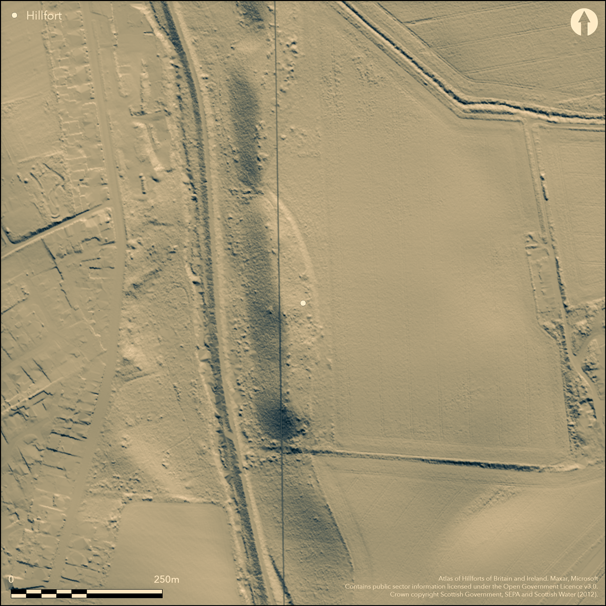
LiDAR 1m DTM Hillshade
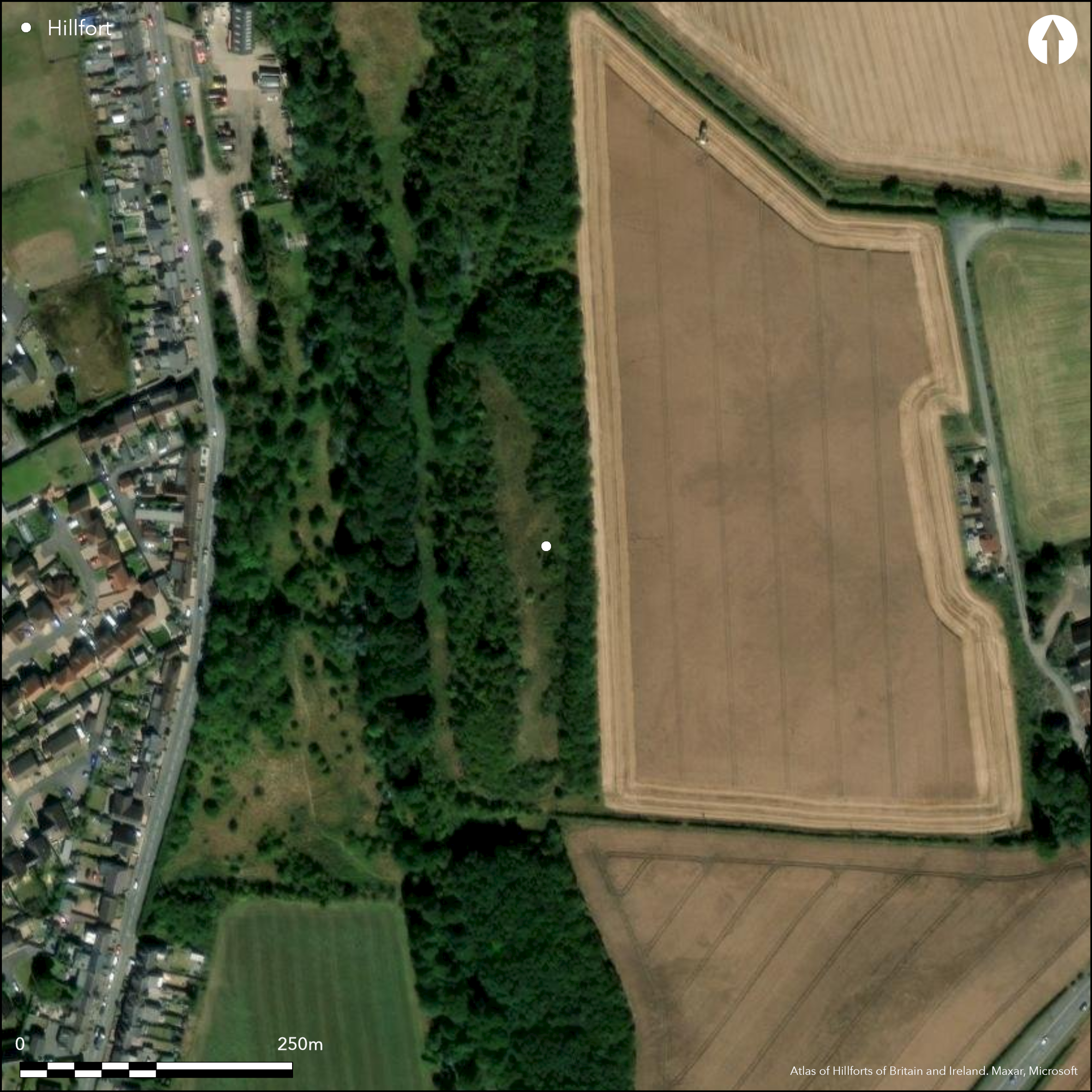
Satellite Imagery
LiDAR 1m DTM Hillshade
Satellite Imagery
Scroll left/right to view further images.
HER: Fife Council None (None)
NMR: NO 30 SE 112 (132446)
SM: None
NGR: NO 3502 0113
X: 335022 Y: 701131 (OSGB36)
The site of a large fort occupies the crest of Duniface Hill, an elongated ridge that forms the steep escarpment rising from the E bank of the Kennoway Burn N of Windygates. Lying N and S, the greater part of the featureless interior lies in an area that has been set to pasture since before the middle of the 19th century, while the escarpment itself is clothed in dense gorse, but in the adjacent field to the E, running roughly concentrically to the 19th-century field boundary, cropmarks have revealed a complex ditch system extending over a distance of 300m to enclose a roughly oval area measuring 215m from N to S by some 50m transversely (1ha). The ditches display a sinuous course, in part to incorporate an additional ditch inserted to either side of an entrance midway along the E side, but the detail of their composition is uncertain, at first sight comprising twin ditches between 4m and 5m in breadth running the length of the fort, with a third ditch added externally on the NE. In detail, however, there is little trace of the inner ditch in the central sector, where over the same distance the outer ditch doglegs sharply outwards to create the space for the additional segments of ditch to either side of the entrance. Unique in the design of Scottish fort entrances, it would appear that the rampart accompanying the outer ditch divides at these doglegs to embrace both sides of these inserted ditch segments. The discontinuous character of the ditch on the inside of this rampart, unless created by differential cropmark formation, perhaps suggests that this is no more than an internal quarry scoop, which was dispensed with where the additional ditch segments provided an equivalent source of material for the inner rampart. Where this quarry scoop or ditch peters out at the S end of the fort, it converges on the line of what may be a palisade trench, traces of which are possibly visible to the rear of the ditch defences further N, turning back into the interior at the N dogleg; If these are truly elements of the same circuit, which cannot be confirmed without excavation, it not only appears to represent a separate phase of fortification but also an exceptionally large palisaded defence measuring about 175m in length by 45m in breadth (0.6ha). A second possible palisade trench is visible a little over 5m inside its line at the S end. Apart from the entrance in the E side, which is angled slightly to expose the visitor's left side and appears to contain a metalled roadway, there is possibly a second at the N end, though the cropmarks here are confused by edge effects at the side of the field and the third ditch at this end has been carried across the gap.
Citizen Science: ✗
Reliability of Data: Confirmed
Reliability of Interpretation: Confirmed
X: -339392 Y: 7598010 (EPSG: 3857)
Longitude: -3.0488113373629138 Latitude: 56.198381399874435 (EPSG:4326)
Country: Scotland
Current County or Unitary Authority: Fife
Historic County: Fife
Current Parish/Community/Council/Townland: Markinch
None
| Extant | ✗ |
| Cropmark | ✓ |
| Likely Destroyed | ✗ |
None
| Woodland | ✗ |
| Commercial Forestry Plantation | ✗ |
| Parkland | ✗ |
| Pasture (Grazing) | ✓ |
| Arable | ✗ |
| Scrub/Bracken | ✓ |
| Bare Outcrop | ✗ |
| Heather/Moorland | ✗ |
| Heath | ✗ |
| Built-up | ✗ |
| Coastal Grassland | ✗ |
| Other | ✗ |
None
| Contour Fort | ✓ |
| Partial Contour Fort | ✗ |
| Promontory Fort | ✗ |
| Hillslope Fort | ✗ |
| Level Terrain Fort | ✗ |
| Marsh Fort | ✗ |
| Multiple Enclosure Fort | ✗ |
| Hilltop | ✓ |
| Coastal Promontory | ✗ |
| Inland Promontory | ✗ |
| Valley Bottom | ✗ |
| Knoll/Hillock/Outcrop | ✗ |
| Ridge | ✗ |
| Cliff/Plateau-edge/Scarp | ✗ |
| Hillslope | ✗ |
| Lowland | ✗ |
| Spur | ✗ |
Dominant Topographic Feature: None
| North | ✗ |
| Northeast | ✗ |
| East | ✗ |
| Southeast | ✗ |
| South | ✗ |
| Southwest | ✗ |
| West | ✗ |
| Northwest | ✗ |
| Level | ✓ |
Altitude: 50.0m
N/A
In the absence of excavation, there are neither stratified artefacts nor radiocarbon dates to provide a chronology for the defences.
Reliability: D - None
| Pre 1200BC | ✗ |
| 1200BC - 800BC | ✗ |
| 800BC - 400BC | ✗ |
| 400BC - AD50 | ✗ |
| AD50 - AD400 | ✗ |
| AD400 - AD 800 | ✗ |
| Post AD800 | ✗ |
| Unknown | ✓ |
| Pre Hillfort: | None |
| Post Hillfort: | Ploughed down |
None
| 1st Identified Written Reference (1994): | Photographed by RCAHMS Aerial Survey Programme |
Featureless apart from a possible internal quarry scoop
None
| None | ✓ |
| Spring | ✗ |
| Stream | ✗ |
| Pool | ✗ |
| Flush | ✗ |
| Well | ✗ |
| Other | ✗ |
None
| No Known Features | ✓ |
| Round Stone Structures | ✗ |
| Rectangular Stone Structures | ✗ |
| Curvilinear Platforms | ✗ |
| Other Roundhouse Evidence | ✗ |
| Pits | ✗ |
| Quarry Hollows | ✗ |
| Other | ✗ |
None
| No Known Excavation | ✓ |
| Pits | ✗ |
| Postholes | ✗ |
| Roundhouses | ✗ |
| Rectangular Structures | ✗ |
| Roads/Tracks | ✗ |
| Quarry Hollows | ✗ |
| Other | ✗ |
| Nothing Found | ✗ |
None
| No Known Geophysics | ✓ |
| Pits | ✗ |
| Roundhouses | ✗ |
| Rectangular Structures | ✗ |
| Roads/Tracks | ✗ |
| Quarry Hollows | ✗ |
| Other | ✗ |
| Nothing Found | ✗ |
None
| No Known Finds | ✓ |
| Pottery | ✗ |
| Metal | ✗ |
| Metalworking | ✗ |
| Human Bones | ✗ |
| Animal Bones | ✗ |
| Lithics | ✗ |
| Environmental | ✗ |
| Other | ✗ |
Possible internal quarry scoop
| APs Not Checked | ✗ |
| None | ✗ |
| Roundhouses | ✗ |
| Rectangular Structures | ✗ |
| Pits | ✗ |
| Postholes | ✗ |
| Roads/Tracks | ✗ |
| Other | ✓ |
See main summary
| 1: | Entire circuit levelled |
| 2: | Certain entrance listed here first |
Guard Chambers: ✗
Chevaux de Frise: ✗
| 1. Oblique (East): | Elaborated with an additional ditch to increase the depth of the defences. Slightly oblique approach exposing left side |
| 1. Simple Gap (East): | None |
| 2. Blocked (North): | Possible gap blocked by the additional external ditch |
Complex of at least two concentric ditches revealed by cropmarks along on flank; character of the defences elsewhere is unknown
| Area 1: | 1.0ha. |
| Total: | 1.0ha. |
Total Footprint Area: Noneha.
None
| ✓ | None |
| ✗ | None |
| NE Quadrant: | 3 |
| SE Quadrant: | 2 |
| SW Quadrant: | 0 |
| NW Quadrant: | 0 |
| Total: | 3 |
| Partial Univallate | ✗ |
| Univallate | ✗ |
| Partial Bivallate | ✓ |
| Bivallate | ✗ |
| Partial Multivallate | ✓ |
| Multivallate | ✗ |
| Unknown | ✗ |
| Partial Univallate | ✗ |
| Univallate | ✗ |
| Partial Bivallate | ✗ |
| Bivallate | ✗ |
| Partial Multivallate | ✗ |
| Multivallate | ✗ |
Not visible on the surface; palisade trenches revealed by cropmarks and apparently representing a separate phase of construction
| None | ✗ |
| Earthen Bank | ✗ |
| Stone Wall | ✗ |
| Rubble | ✗ |
| Wall-walk | ✗ |
| Evidence of Timber | ✗ |
| Vitrification | ✗ |
| Other Burning | ✗ |
| Palisade | ✓ |
| Counter Scarp Bank | ✗ |
| Berm | ✗ |
| Unfinished | ✗ |
| Other | ✗ |
None
| None | ✗ |
| Earthen Bank | ✗ |
| Stone Wall | ✗ |
| Murus Duplex | ✗ |
| Timber-framed | ✗ |
| Timber-laced | ✗ |
| Vitrification | ✗ |
| Other Burning | ✗ |
| Palisade | ✗ |
| Counter Scarp Bank | ✗ |
| Berm | ✗ |
| Unfinished | ✗ |
| No Known Excavation | ✓ |
| Other | ✗ |
| ✗ | None |
| ✓ | This includes the possible internal quarry scoop |
Number of Ditches: 3
| ✗ | None |
No related records
Atlas of Hillforts:
Wikidata:
This work is licensed under CC BY-SA 4.0

 and should be cited as:
Lock, Gary and Ralston, Ian. 2024. Atlas of Hillforts of Britain and Ireland. Available at: https://hillforts.arch.ox.ac.uk
Document Version 1.1