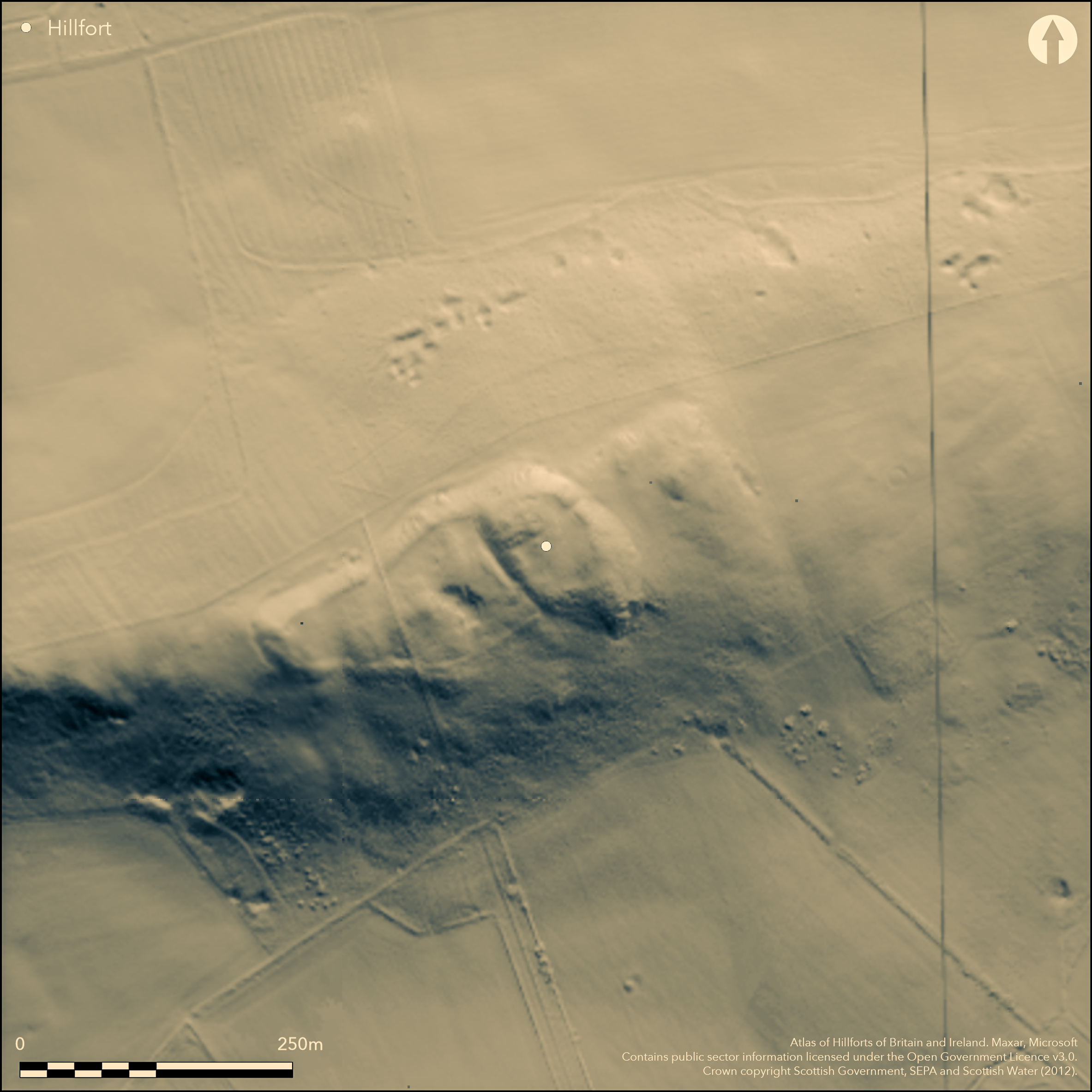
LiDAR 1m DTM Hillshade
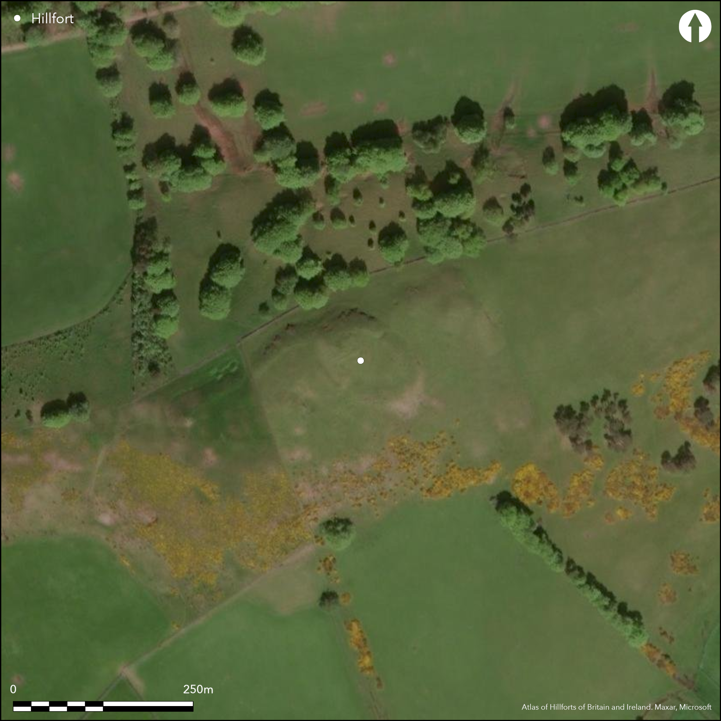
Satellite Imagery
LiDAR 1m DTM Hillshade
Satellite Imagery
Scroll left/right to view further images.
HER: The West of Scotland Archaeology Service 10902 (None)
NMR: NT 03 NW 5 (48683)
SM: 2607
NGR: NT 0480 3936
X: 304800 Y: 639360 (OSGB36)
The fort on the top of Bizzybery Hill comprises two elements, namely an upper enclosure taking in the hillock that forms the very summit of the hill, and a lower enclosure extending along the rocky terrace to the WSW. The upper enclosure is oval on plan, measuring about 55m from NW to SE by 40m transversely (0.17ha) within a single rampart which has been so heavily robbed that no more than a few mounds of rubble can be seen along the NE and SW margins of the summit area. In addition, a ditch 3.5m in breadth by 1m in depth has been cut into the rock at the foot of the SW flank of hillock; a causeway towards its S end may mark the position of an entrance into the upper enclosure on the SSW, and there is possibly a second entrance on the NE. The lower enclosure was first described by David Christison (1890, 333-4) and while not noted by RCAHMS investigators in 1975 (RCAHMS 1978, 92, no.215), subsequent aerial photography under snow reveals the course of its rampart extending along the NW and S lips of the rocky terrace that extends away to a rounded point on the WSW, enclosing a roughly triangular area measuring about 115m from ENE to WSW by 65m transversely. The relationship between the upper and lower enclosures is uncertain, and while the lower is possibly an annexe to the upper, it is perhaps more likely to be the remains of a much larger fort enclosing both the summit hillock and the terrace, an area measuring about 160m from ENE to WSW by 65m transversely (0.77ha). The interiors of both enclosures are featureless and it is unclear whether there are any entrances into the lower, though there is a gap in the rampart in the middle of the NW side.
Citizen Science: ✗
Reliability of Data: Confirmed
Reliability of Interpretation: Confirmed
X: -391171 Y: 7486781 (EPSG: 3857)
Longitude: -3.5139453209180065 Latitude: 55.63847789414553 (EPSG:4326)
Country: Scotland
Current County or Unitary Authority: South Lanarkshire
Historic County: Lanarkshire
Current Parish/Community/Council/Townland: Biggar
None
| Extant | ✓ |
| Cropmark | ✗ |
| Likely Destroyed | ✗ |
None
| Woodland | ✗ |
| Commercial Forestry Plantation | ✗ |
| Parkland | ✗ |
| Pasture (Grazing) | ✓ |
| Arable | ✗ |
| Scrub/Bracken | ✗ |
| Bare Outcrop | ✗ |
| Heather/Moorland | ✓ |
| Heath | ✗ |
| Built-up | ✗ |
| Coastal Grassland | ✗ |
| Other | ✗ |
None
| Contour Fort | ✓ |
| Partial Contour Fort | ✗ |
| Promontory Fort | ✗ |
| Hillslope Fort | ✗ |
| Level Terrain Fort | ✗ |
| Marsh Fort | ✗ |
| Multiple Enclosure Fort | ✗ |
| Hilltop | ✓ |
| Coastal Promontory | ✗ |
| Inland Promontory | ✗ |
| Valley Bottom | ✗ |
| Knoll/Hillock/Outcrop | ✗ |
| Ridge | ✗ |
| Cliff/Plateau-edge/Scarp | ✗ |
| Hillslope | ✗ |
| Lowland | ✗ |
| Spur | ✗ |
Dominant Topographic Feature: None
| North | ✗ |
| Northeast | ✗ |
| East | ✗ |
| Southeast | ✗ |
| South | ✗ |
| Southwest | ✗ |
| West | ✗ |
| Northwest | ✗ |
| Level | ✓ |
Altitude: 363.0m
N/A
In the absence of excavation, there are neither stratified artefacts nor radiocarbon dates to provide a chronology for the defences.
Reliability: D - None
| Pre 1200BC | ✗ |
| 1200BC - 800BC | ✗ |
| 800BC - 400BC | ✗ |
| 400BC - AD50 | ✗ |
| AD50 - AD400 | ✗ |
| AD400 - AD 800 | ✗ |
| Post AD800 | ✗ |
| Unknown | ✓ |
| Pre Hillfort: | None |
| Post Hillfort: | None |
Alexander Gordon noted a group of forts at Broomilaw, one of which was called Bizzyberry (1726, 115). Whether he really meant the fort on the summit, which is otherwise first noted on Forrest's map of 1816, or the rather more obvious fort known as Toftcombs (Atlas No.3229) and perhaps Castlehill, Candybank (Atlas No.3226), is unclear. Photographed by RCAHMS Aerial Survey Programme in 1990
| 1st Identified Written Reference (1726): | Possibly one of two noted by Alexander Gordon (1726,115) |
| 1st Identified Map Depiction (1816): | A Camp is annotated on the summit of Bizzyberry on William Forrest's map of The county of Lanark from actual survey (1816), though it may represent Toftcombs |
| Other (1855): | Noted by George Irving (1855, 15; Irving and Murray 1864, 15) |
| Other (1889): | Description by David Christison (1890, 333-4) |
| Other (1932): | Noted by James Hewat Craw who died in 1933 (RCAHMS MS28/343/4, SAS 343) |
| Other (1967): | Scheduled |
| Other (1972): | Surveyed at 1:2500 by the OS |
| Other (1975): | Description, but almost certainly following an earlier visit (RCAHMS 1978, 92, no.215) |
Featureless
A small spring rises in a boggy hollow outside the fort at the foot of the outcrops on the N side of the hill
| None | ✓ |
| Spring | ✗ |
| Stream | ✗ |
| Pool | ✗ |
| Flush | ✗ |
| Well | ✗ |
| Other | ✗ |
Partly improved pasture
| No Known Features | ✓ |
| Round Stone Structures | ✗ |
| Rectangular Stone Structures | ✗ |
| Curvilinear Platforms | ✗ |
| Other Roundhouse Evidence | ✗ |
| Pits | ✗ |
| Quarry Hollows | ✗ |
| Other | ✗ |
None
| No Known Excavation | ✓ |
| Pits | ✗ |
| Postholes | ✗ |
| Roundhouses | ✗ |
| Rectangular Structures | ✗ |
| Roads/Tracks | ✗ |
| Quarry Hollows | ✗ |
| Other | ✗ |
| Nothing Found | ✗ |
None
| No Known Geophysics | ✓ |
| Pits | ✗ |
| Roundhouses | ✗ |
| Rectangular Structures | ✗ |
| Roads/Tracks | ✗ |
| Quarry Hollows | ✗ |
| Other | ✗ |
| Nothing Found | ✗ |
None
| No Known Finds | ✓ |
| Pottery | ✗ |
| Metal | ✗ |
| Metalworking | ✗ |
| Human Bones | ✗ |
| Animal Bones | ✗ |
| Lithics | ✗ |
| Environmental | ✗ |
| Other | ✗ |
NO APPARENT FEATURES
| APs Not Checked | ✗ |
| None | ✓ |
| Roundhouses | ✗ |
| Rectangular Structures | ✗ |
| Pits | ✗ |
| Postholes | ✗ |
| Roads/Tracks | ✗ |
| Other | ✗ |
See main summary
| 3: | None |
| 2: | None |
Guard Chambers: ✗
Chevaux de Frise: ✗
| 1. Simple Gap (North east): | Into summit enclosure |
| 2. Simple Gap (South west): | marked by causeway across the ditch below the summit enclosure |
Single rampart
| Area 1: | 0.17ha. |
| Area 2: | 0.77ha. |
| Total: | 0.77ha. |
Total Footprint Area: 0.8ha.
None
| ✗ | None |
| ✓ | None |
| NE Quadrant: | 1 |
| SE Quadrant: | 1 |
| SW Quadrant: | 2 |
| NW Quadrant: | 1 |
| Total: | 2 |
| Partial Univallate | ✓ |
| Univallate | ✗ |
| Partial Bivallate | ✓ |
| Bivallate | ✗ |
| Partial Multivallate | ✗ |
| Multivallate | ✗ |
| Unknown | ✗ |
| Partial Univallate | ✗ |
| Univallate | ✗ |
| Partial Bivallate | ✗ |
| Bivallate | ✗ |
| Partial Multivallate | ✗ |
| Multivallate | ✗ |
Grass-grown rubble
| None | ✗ |
| Earthen Bank | ✗ |
| Stone Wall | ✗ |
| Rubble | ✓ |
| Wall-walk | ✗ |
| Evidence of Timber | ✗ |
| Vitrification | ✗ |
| Other Burning | ✗ |
| Palisade | ✗ |
| Counter Scarp Bank | ✗ |
| Berm | ✗ |
| Unfinished | ✗ |
| Other | ✗ |
None
| None | ✗ |
| Earthen Bank | ✗ |
| Stone Wall | ✗ |
| Murus Duplex | ✗ |
| Timber-framed | ✗ |
| Timber-laced | ✗ |
| Vitrification | ✗ |
| Other Burning | ✗ |
| Palisade | ✗ |
| Counter Scarp Bank | ✗ |
| Berm | ✗ |
| Unfinished | ✗ |
| No Known Excavation | ✓ |
| Other | ✗ |
| ✗ | None |
| ✓ | On one side |
Number of Ditches: 1
| ✓ | The lower enclosure might be construed as an annexe to the upper, but it is perhaps more likely to be the remains of a fort taking in the whole of the summit and the lower terrace. |
Christison, D (1890) 'Forts, camps, and motes of the Upper Ward of Lanarkshire'. Proc Soc Antiq Scot 24 (1889-90), 281-352
Gordon, A (1726) Itinerarium Septentrionale: or A Journey Thro' most of the Counties of Scotland And Those in the North of England. London
Irving, G V (1855) 'On ancient camps of the upper ward of Lanarkshire', J Brit Archaeol Ass 10 (1855), 1-32
Irving and Murray, G V and A (1864) The upper ward of Lanarkshire described and delineated, 3v Glasgow
RCAHMS. (1978) The Royal Commission on the Ancient and Historical Monuments of Scotland. Lanarkshire: an inventory of the prehistoric and Roman monuments. HMSO: Edinburgh
Atlas of Hillforts:
Wikidata:
This work is licensed under CC BY-SA 4.0

 and should be cited as:
Lock, Gary and Ralston, Ian. 2024. Atlas of Hillforts of Britain and Ireland. Available at: https://hillforts.arch.ox.ac.uk
Document Version 1.1