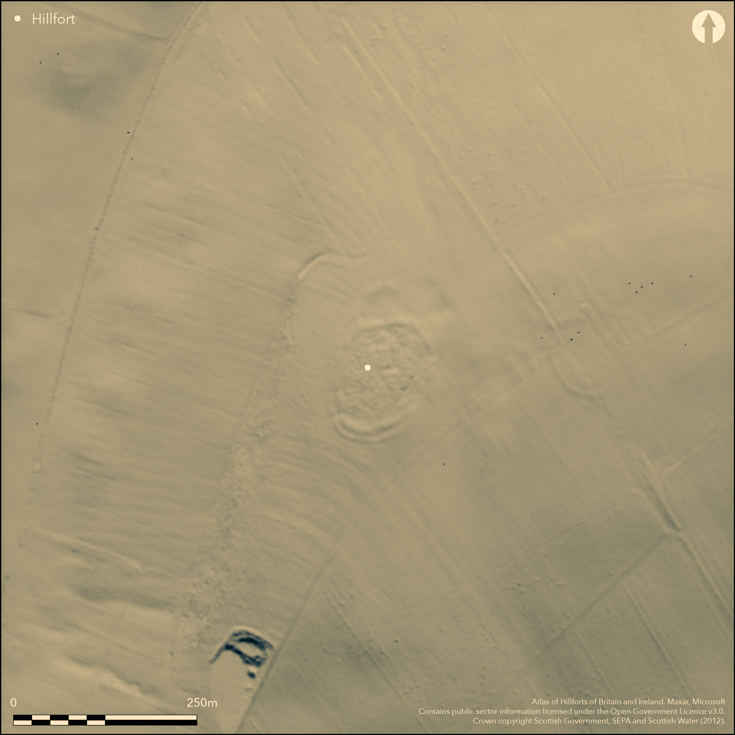
LiDAR 1m DTM Hillshade
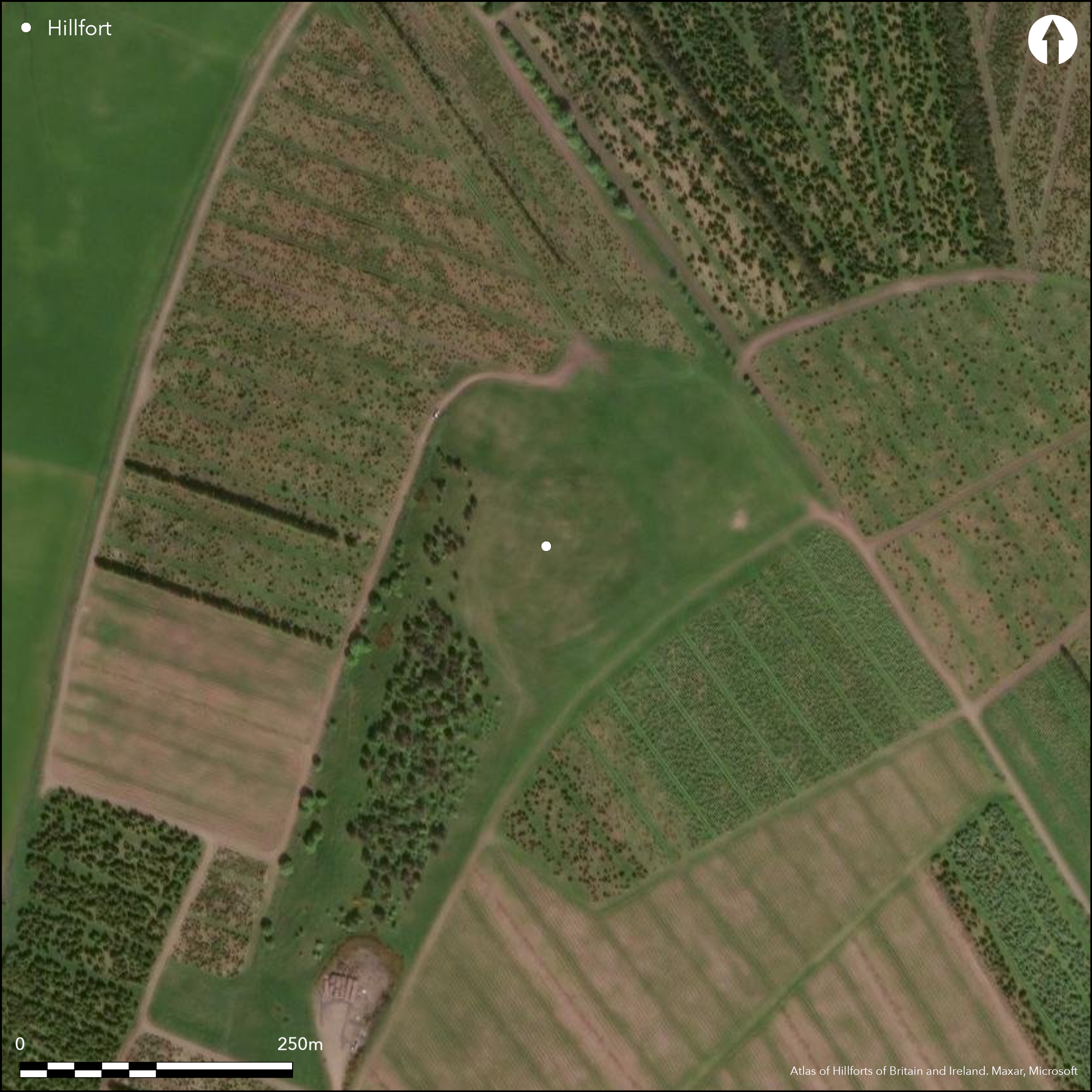
Satellite Imagery
LiDAR 1m DTM Hillshade
Satellite Imagery
Scroll left/right to view further images.
HER: The West of Scotland Archaeology Service 11139 (None)
NMR: NT 04 SW 3 (48981)
SM: None
NGR: NT 0421 4284
X: 304210 Y: 642840 (OSGB36)
This fort is situated on the W shoulder of Cocklaw Hill, where the ground falls away steeply to the W. Roughly oval on plan, it measures 87m from NE to SW by 69m transversely (0.45ha) within a rampart up to 5.8m in thickness by 0.6m in height, which on the SE at least is probably accompanied by an external ditch. An outer rampart can be traced around the S and W flanks, but, as with the inner, on the W it has been reduced by cultivation and an old shelter belt to no more than a stony scarp. Apparently concentric around these flanks, with returns to unite with the inner rampart to either side of an entrance on the SW, the two ramparts may be contemporary, but on the N the outer diverges from this concentric line and has been incorporated into a later enclosure exploiting the gap between them; this divergent course possibly indicates that the outer belongs originally to a larger enclosure on the hill top, measuring as much as 115m from N to S by 85m transversely (0.77ha), though it may be equally be an addition to create an outer annexe on the N. A second entrance in the inner rampart is roughly opposed to the SW entrance on the NE, but there is also a gap opening into the later enclosure on the N, though this may be secondary. The enclosure on the N is presumably the remains of a small late Iron Age homestead.
Citizen Science: ✗
Reliability of Data: Confirmed
Reliability of Interpretation: Confirmed
X: -392349 Y: 7492926 (EPSG: 3857)
Longitude: -3.5245289778464115 Latitude: 55.66961994421211 (EPSG:4326)
Country: Scotland
Current County or Unitary Authority: South Lanarkshire
Historic County: Lanarkshire
Current Parish/Community/Council/Townland: Walston
None
| Extant | ✓ |
| Cropmark | ✗ |
| Likely Destroyed | ✗ |
In clearing in commercial plantation
| Woodland | ✗ |
| Commercial Forestry Plantation | ✗ |
| Parkland | ✗ |
| Pasture (Grazing) | ✗ |
| Arable | ✗ |
| Scrub/Bracken | ✗ |
| Bare Outcrop | ✗ |
| Heather/Moorland | ✓ |
| Heath | ✗ |
| Built-up | ✗ |
| Coastal Grassland | ✗ |
| Other | ✗ |
None
| Contour Fort | ✓ |
| Partial Contour Fort | ✗ |
| Promontory Fort | ✗ |
| Hillslope Fort | ✗ |
| Level Terrain Fort | ✗ |
| Marsh Fort | ✗ |
| Multiple Enclosure Fort | ✗ |
| Hilltop | ✓ |
| Coastal Promontory | ✗ |
| Inland Promontory | ✗ |
| Valley Bottom | ✗ |
| Knoll/Hillock/Outcrop | ✗ |
| Ridge | ✗ |
| Cliff/Plateau-edge/Scarp | ✗ |
| Hillslope | ✗ |
| Lowland | ✗ |
| Spur | ✗ |
Dominant Topographic Feature: None
| North | ✗ |
| Northeast | ✗ |
| East | ✗ |
| Southeast | ✗ |
| South | ✗ |
| Southwest | ✗ |
| West | ✗ |
| Northwest | ✗ |
| Level | ✓ |
Altitude: 310.0m
N/A
In the absence of excavation, there are neither stratified artefacts nor radiocarbon dates to provide a chronology for the defences.
Reliability: D - None
| Pre 1200BC | ✗ |
| 1200BC - 800BC | ✗ |
| 800BC - 400BC | ✗ |
| 400BC - AD50 | ✗ |
| AD50 - AD400 | ✗ |
| AD400 - AD 800 | ✗ |
| Post AD800 | ✗ |
| Unknown | ✓ |
| Pre Hillfort: | None |
| Post Hillfort: | Overlain by what is probably a late Iron Age settlement, but subsequently partly ploughed down and planted with trees |
None
| 1st Identified Written Reference (1793): | Description (Stat Acct, vii (1793, 122) |
| 1st Identified Map Depiction (1816): | Annotated Camp on William Forrest's map of The county of Lanark from actual survey (1816) |
| Other (1840): | Description (NSA, 6, Lanarkshire, 854) |
| Other (1855): | Description by George Irving (1855, 24; Irving and Murray, i, 1864, 22) |
| Other (1859): | Annotated Camp on the 1st edition OS 25-inch map (Lanark 1864, sheet 27.13) |
| Other (1889): | Description by David Christison (1890, 337-8) |
| Earthwork Survey (1959): | Plan (RCAHMS LAD 134/1) |
| Earthwork Survey (1969): | Plan based on the survey of 1959 (RCAHMS 1978, 98-9, no.225, fig 54) |
| Other (1971): | Visited by the OS |
| Other (1999): | Evaluation prior to afforestation in the surrounding area (Dalland 1999) |
Featureless
None
| None | ✓ |
| Spring | ✗ |
| Stream | ✗ |
| Pool | ✗ |
| Flush | ✗ |
| Well | ✗ |
| Other | ✗ |
This has been improved pasture
| No Known Features | ✓ |
| Round Stone Structures | ✗ |
| Rectangular Stone Structures | ✗ |
| Curvilinear Platforms | ✗ |
| Other Roundhouse Evidence | ✗ |
| Pits | ✗ |
| Quarry Hollows | ✗ |
| Other | ✗ |
None
| No Known Excavation | ✓ |
| Pits | ✗ |
| Postholes | ✗ |
| Roundhouses | ✗ |
| Rectangular Structures | ✗ |
| Roads/Tracks | ✗ |
| Quarry Hollows | ✗ |
| Other | ✗ |
| Nothing Found | ✗ |
None
| No Known Geophysics | ✓ |
| Pits | ✗ |
| Roundhouses | ✗ |
| Rectangular Structures | ✗ |
| Roads/Tracks | ✗ |
| Quarry Hollows | ✗ |
| Other | ✗ |
| Nothing Found | ✗ |
None
| No Known Finds | ✓ |
| Pottery | ✗ |
| Metal | ✗ |
| Metalworking | ✗ |
| Human Bones | ✗ |
| Animal Bones | ✗ |
| Lithics | ✗ |
| Environmental | ✗ |
| Other | ✗ |
NO APPARENT FEATURES
| APs Not Checked | ✗ |
| None | ✓ |
| Roundhouses | ✗ |
| Rectangular Structures | ✗ |
| Pits | ✗ |
| Postholes | ✗ |
| Roads/Tracks | ✗ |
| Other | ✗ |
See main summary
| 3: | None |
| 2: | None |
Guard Chambers: ✗
Chevaux de Frise: ✗
| 1. Simple Gap (North): | Possibly an insertion when a later enclosure was built over the outer rampart at this point |
| 2. Simple Gap (North east): | Through inner rampart |
| 3. Passage-way/Corridor (South west): | The outer rampart possibly returns on either side of the gap |
Two ramparts, the inner possibly with an external ditch
| Area 1: | 0.45ha. |
| Area 2: | 0.77ha. |
| Total: | 0.77ha. |
Total Footprint Area: 0.9ha.
None
| ✓ | The small settlement enclosure clearly overlies the defences on the N, but while the relationship between the two ramparts cannot be demonstrated stratigraphically, the divergence of their lines on the N suggests that the outer may be part of an earlier enclosure. |
| ✓ | None |
| NE Quadrant: | 1 |
| SE Quadrant: | 2 |
| SW Quadrant: | 2 |
| NW Quadrant: | 2 |
| Total: | 2 |
| Partial Univallate | ✓ |
| Univallate | ✗ |
| Partial Bivallate | ✓ |
| Bivallate | ✗ |
| Partial Multivallate | ✗ |
| Multivallate | ✗ |
| Unknown | ✗ |
| Partial Univallate | ✗ |
| Univallate | ✓ |
| Partial Bivallate | ✗ |
| Bivallate | ✗ |
| Partial Multivallate | ✗ |
| Multivallate | ✗ |
None
| None | ✗ |
| Earthen Bank | ✓ |
| Stone Wall | ✗ |
| Rubble | ✗ |
| Wall-walk | ✗ |
| Evidence of Timber | ✗ |
| Vitrification | ✗ |
| Other Burning | ✗ |
| Palisade | ✗ |
| Counter Scarp Bank | ✗ |
| Berm | ✗ |
| Unfinished | ✗ |
| Other | ✗ |
None
| None | ✗ |
| Earthen Bank | ✗ |
| Stone Wall | ✗ |
| Murus Duplex | ✗ |
| Timber-framed | ✗ |
| Timber-laced | ✗ |
| Vitrification | ✗ |
| Other Burning | ✗ |
| Palisade | ✗ |
| Counter Scarp Bank | ✗ |
| Berm | ✗ |
| Unfinished | ✗ |
| No Known Excavation | ✓ |
| Other | ✗ |
| ✗ | None |
| ✓ | The inner rampart is probably accompanied by a ditch |
Number of Ditches: 1
| ✓ | The outer rampart takes a wider sweep round the N side, but while this might be construed as an annexe added to the fort, it might equally be an earlier enclosure. |
Christison, D (1890) 'Forts, camps, and motes of the Upper Ward of Lanarkshire'. Proc Soc Antiq Scot 24 (1889-90), 281-352
Dalland, M , Headland Archaeology Ltd. (1999) Archaeological Evaluation: Cocklaw Farm, Elsrickle, South Lanarkshire
Irving, G V (1855) 'On ancient camps of the upper ward of Lanarkshire'. J Brit Archaeol Ass 10 (1855), 1-32
Irving and Murray, G V and A (1864) The upper ward of Lanarkshire described and delineated, 3v Glasgow
RCAHMS. (1978) The Royal Commission on the Ancient and Historical Monuments of Scotland. Lanarkshire: an inventory of the prehistoric and Roman monuments. HMSO: Edinburgh
Atlas of Hillforts:
Wikidata:
This work is licensed under CC BY-SA 4.0

 and should be cited as:
Lock, Gary and Ralston, Ian. 2024. Atlas of Hillforts of Britain and Ireland. Available at: https://hillforts.arch.ox.ac.uk
Document Version 1.1