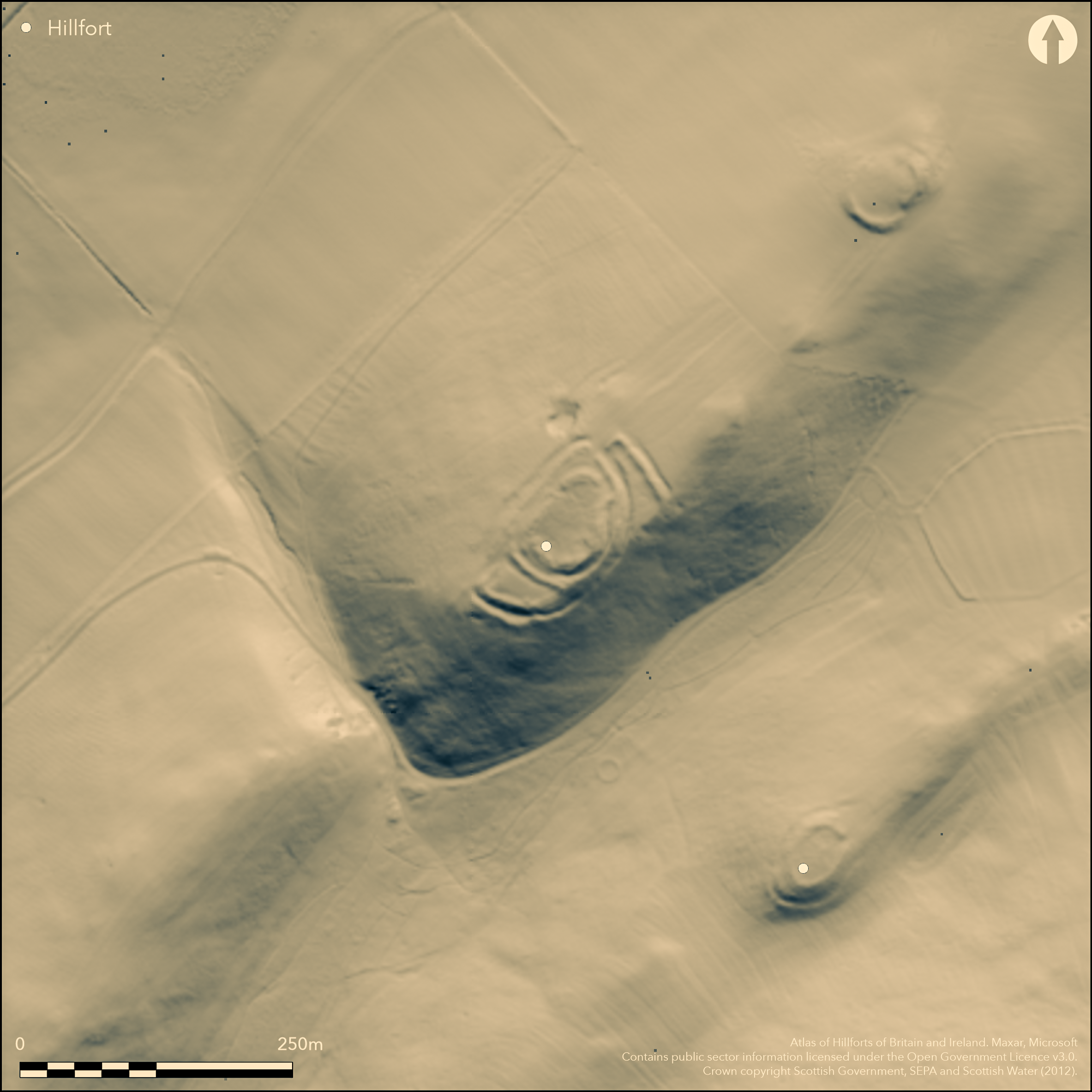
LiDAR 1m DTM Hillshade
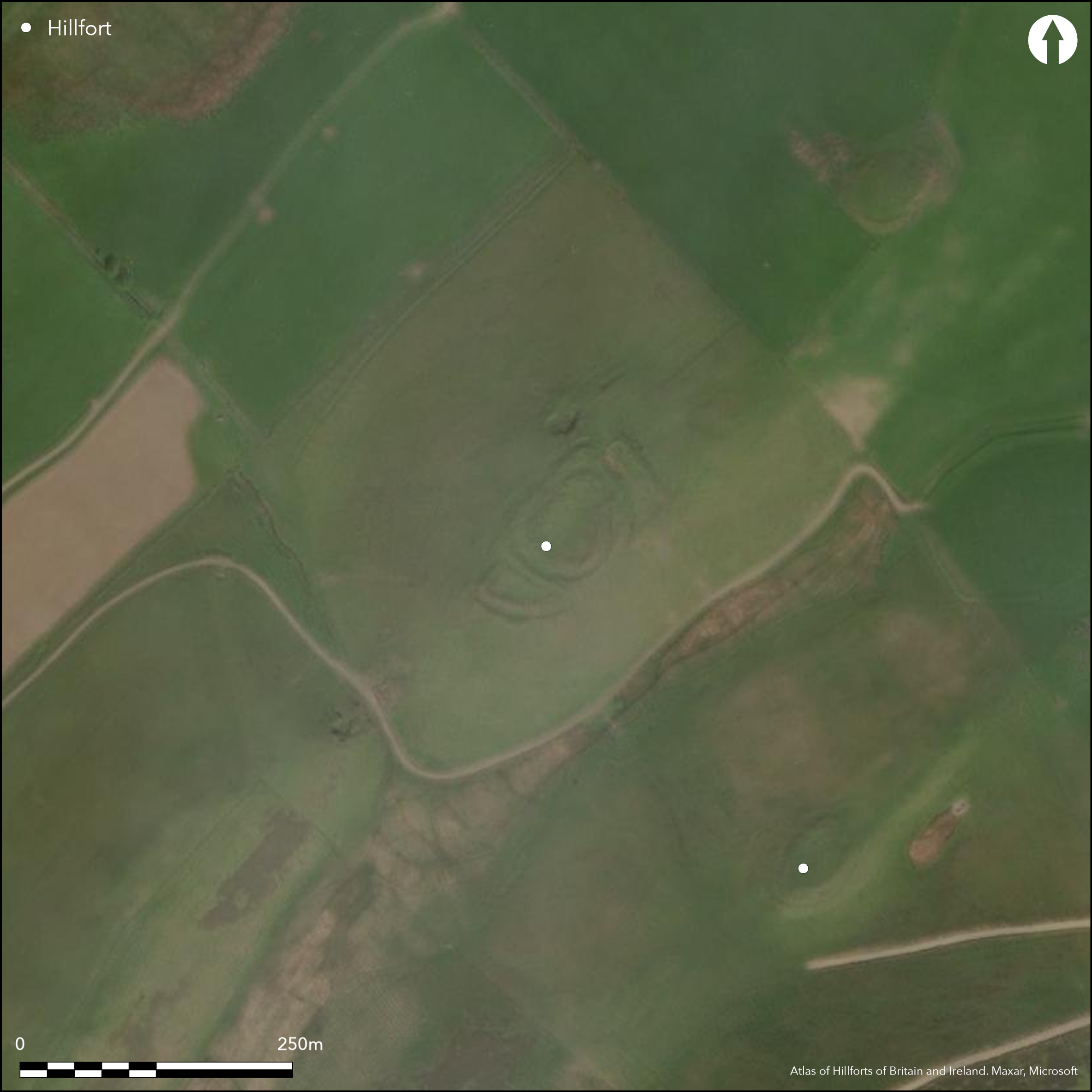
Satellite Imagery
LiDAR 1m DTM Hillshade
Satellite Imagery
Scroll left/right to view further images.
HER: The West of Scotland Archaeology Service 10927 (None)
NMR: NT 03 SW 14 (48745)
SM: 2507
NGR: NT 0425 3311
X: 304250 Y: 633110 (OSGB36)
This fort is situated on part of a long steep-sided ridge that rises up on the SE side of the valley at the foot of Black Hill. Cleft in two by a deep gully, the fort itself stands on the SW end of the NE portion of the ridge, including its summit knoll into the defences, and another settlement enclosure occupies its NE tip (Canmore 48746). The fort has been heavily disturbed by stone-robbing, but the defences evidently represent several periods of construction, and the sequence is probably more complex than the two structural periods identified in 1975 by RCAHMS investigators, in which a fort enclosing the whole of this end of the crest of the ridge was superseded by a smaller bivallate enclosure (RCAHMS 1978, 98-100, no.226); indeed it is likely that the supposedly bivallate defences of the innermost enclosure themselves represent at least two periods of construction, contracting in the later into an oval enclosure largely in the lea of the summit knoll and measuring no more than 43m from N to S by 27m transversely (0.09ha) within a stony bank. This bank does not take a particularly sensible line for a defensive work, whereas the roughly concentric rampart that surrounds it adopts the inner rampart of the earliest circuit for the greater part of its course, only diverging where it cuts back across the interior on the SW; here it is not only accompanied by an external ditch, but also an internal quarry ditch riding up onto the summit knoll behind the rampart. Possibly once an enclosure in its own right, this rampart takes in an area measuring 62m from NE to SW by 47m transversely (0.2ha). What is thought to be the earliest enclosure is larger again, measuring 85m from NE to SW by 46m transversely (0.34ha) within two ramparts, the inner of which on the SW stands 2.4m above the bottom of a medial ditch up to 5m broad. The two ramparts, however, are not entirely concentric and on the NE the outer apparently diverges to enclose an additional area of ground, extending along the crest of the natural slope on the SE for a further 25m, before cutting sharply back with an external ditch towards the NW. Here, just short of the lip of the slope, it returns at right angles to form the SE side of an entrance way leading to a gap in the inner rampart at the N extremity of the interior; a second entrance lies in a similar position at the SW end of the interior, though here the inner of the two ramparts turns inwards to flank the entrance way, thus exposing the visitor's right side. While this additional enclosure on the NE is possibly an annexe, and contains evidence of a large timber round-house with an internal ring-ditch, it is also possible that this originated as part of an even earlier enclosure on this hilltop. In addition to this round-house, at least three others can be seen within the interior of the innermost enclosure.
Citizen Science: ✗
Reliability of Data: Confirmed
Reliability of Interpretation: Confirmed
X: -391901 Y: 7475695 (EPSG: 3857)
Longitude: -3.5205053787730654 Latitude: 55.58223063382015 (EPSG:4326)
Country: Scotland
Current County or Unitary Authority: South Lanarkshire
Historic County: Lanarkshire
Current Parish/Community/Council/Townland: Culter
None
| Extant | ✓ |
| Cropmark | ✗ |
| Likely Destroyed | ✗ |
None
| Woodland | ✗ |
| Commercial Forestry Plantation | ✗ |
| Parkland | ✗ |
| Pasture (Grazing) | ✓ |
| Arable | ✗ |
| Scrub/Bracken | ✗ |
| Bare Outcrop | ✗ |
| Heather/Moorland | ✓ |
| Heath | ✗ |
| Built-up | ✗ |
| Coastal Grassland | ✗ |
| Other | ✗ |
None
| Contour Fort | ✓ |
| Partial Contour Fort | ✗ |
| Promontory Fort | ✗ |
| Hillslope Fort | ✗ |
| Level Terrain Fort | ✗ |
| Marsh Fort | ✗ |
| Multiple Enclosure Fort | ✗ |
| Hilltop | ✓ |
| Coastal Promontory | ✗ |
| Inland Promontory | ✗ |
| Valley Bottom | ✗ |
| Knoll/Hillock/Outcrop | ✗ |
| Ridge | ✗ |
| Cliff/Plateau-edge/Scarp | ✗ |
| Hillslope | ✗ |
| Lowland | ✗ |
| Spur | ✗ |
Dominant Topographic Feature: None
| North | ✗ |
| Northeast | ✗ |
| East | ✗ |
| Southeast | ✗ |
| South | ✗ |
| Southwest | ✗ |
| West | ✗ |
| Northwest | ✗ |
| Level | ✓ |
Altitude: 319.0m
N/A
In the absence of excavation, there are neither stratified artefacts nor radiocarbon dates to provide a chronology for the defences.
Reliability: D - None
| Pre 1200BC | ✗ |
| 1200BC - 800BC | ✗ |
| 800BC - 400BC | ✗ |
| 400BC - AD50 | ✗ |
| AD50 - AD400 | ✗ |
| AD400 - AD 800 | ✗ |
| Post AD800 | ✗ |
| Unknown | ✓ |
| Pre Hillfort: | None |
| Post Hillfort: | Heavy stone robbing and |
CUCAP photographed the fort in 1969 and the RCAHMS Aerial Survey Programme in 1977, 1980, 1981, 1991, 1996 and 2003
| 1st Identified Map Depiction (1816): | Annotated on William Forrest's map of The County of Lanark from actual survey (1816) |
| Earthwork Survey (1855): | Sketch-plan and description by George Irving (1855, 13, pl 2 fig 7; Irving and Murray 1864, 11-12, pl 3 fig 11) |
| Other (1859): | Named in Gothic type on the 1st edition OS 25-inch map (Lanark 1864, sheet 40.6) |
| Earthwork Survey (1889): | Sketch-plan and description by David Christison (1890, 310-12, fig 12 pl 12 upper) |
| Earthwork Survey (1959): | Plan (RCAHMS LAD 135/1) |
| Other (1965): | Scheduled |
| Other (1972): | Revised at 1:2500 by the OS |
| Earthwork Survey (1975): | Revised plan and description (RCAHMS 1978, 98-100, no.226, fig 55; RCAHMS LAD 135/2-4 & SC337251) |
| Other (2014): | Visited by SH |
At least four round-houses with internal ring-ditches can be seen, three of them within the innermost enclosue and one in the possible annexe formed between the inner and outer ramparts on the NE.
None
| None | ✓ |
| Spring | ✗ |
| Stream | ✗ |
| Pool | ✗ |
| Flush | ✗ |
| Well | ✗ |
| Other | ✗ |
At least four ring-ditch houses.
| No Known Features | ✗ |
| Round Stone Structures | ✗ |
| Rectangular Stone Structures | ✗ |
| Curvilinear Platforms | ✗ |
| Other Roundhouse Evidence | ✓ |
| Pits | ✗ |
| Quarry Hollows | ✓ |
| Other | ✗ |
None
| No Known Excavation | ✓ |
| Pits | ✗ |
| Postholes | ✗ |
| Roundhouses | ✗ |
| Rectangular Structures | ✗ |
| Roads/Tracks | ✗ |
| Quarry Hollows | ✗ |
| Other | ✗ |
| Nothing Found | ✗ |
None
| No Known Geophysics | ✓ |
| Pits | ✗ |
| Roundhouses | ✗ |
| Rectangular Structures | ✗ |
| Roads/Tracks | ✗ |
| Quarry Hollows | ✗ |
| Other | ✗ |
| Nothing Found | ✗ |
None
| No Known Finds | ✓ |
| Pottery | ✗ |
| Metal | ✗ |
| Metalworking | ✗ |
| Human Bones | ✗ |
| Animal Bones | ✗ |
| Lithics | ✗ |
| Environmental | ✗ |
| Other | ✗ |
At least four with internal ring-ditches
| APs Not Checked | ✗ |
| None | ✗ |
| Roundhouses | ✓ |
| Rectangular Structures | ✗ |
| Pits | ✗ |
| Postholes | ✗ |
| Roads/Tracks | ✗ |
| Other | ✗ |
See main summary
| 3: | None |
| 2: | Elaborated in three entries below |
Guard Chambers: ✗
Chevaux de Frise: ✗
| 1. Passage-way/Corridor (North): | The outer rampart of the earlier defences turns in to form one side of an entrance way along the lip of the natural slope |
| 2. Over-lapping (South west): | The inner rampart turns inwards to stagger the terminals. Oblique approach exposing right side |
| 2. Simple Gap (South west): | Entrance 2, in the outer ramparts of the earlier fort, leads to a gap in the later defences |
| 2. Oblique (South west): | None |
Multiple ramparts in complex sequences
| Area 1: | 0.2ha. |
| Area 2: | 0.34ha. |
| Total: | 0.34ha. |
Total Footprint Area: 0.65ha.
None
| ✓ | Clearly complex and appears to create a reduction in size in the later phases |
| ✓ | None |
| NE Quadrant: | 3 |
| SE Quadrant: | 2 |
| SW Quadrant: | 4 |
| NW Quadrant: | 3 |
| Total: | 4 |
| Partial Univallate | ✗ |
| Univallate | ✗ |
| Partial Bivallate | ✓ |
| Bivallate | ✗ |
| Partial Multivallate | ✓ |
| Multivallate | ✗ |
| Unknown | ✗ |
| Partial Univallate | ✗ |
| Univallate | ✗ |
| Partial Bivallate | ✗ |
| Bivallate | ✗ |
| Partial Multivallate | ✗ |
| Multivallate | ✗ |
None
| None | ✗ |
| Earthen Bank | ✓ |
| Stone Wall | ✓ |
| Rubble | ✗ |
| Wall-walk | ✗ |
| Evidence of Timber | ✗ |
| Vitrification | ✗ |
| Other Burning | ✗ |
| Palisade | ✗ |
| Counter Scarp Bank | ✗ |
| Berm | ✗ |
| Unfinished | ✗ |
| Other | ✗ |
None
| None | ✗ |
| Earthen Bank | ✗ |
| Stone Wall | ✗ |
| Murus Duplex | ✗ |
| Timber-framed | ✗ |
| Timber-laced | ✗ |
| Vitrification | ✗ |
| Other Burning | ✗ |
| Palisade | ✗ |
| Counter Scarp Bank | ✗ |
| Berm | ✗ |
| Unfinished | ✗ |
| No Known Excavation | ✓ |
| Other | ✗ |
| ✗ | None |
| ✓ | None |
Number of Ditches: 3
| ✓ | What may be a small annexe is formed between the inner and outer ramparts of the earliest phase on the NE, though this may reflect further complexity in the sequence of enclosures here, rather than the deliberate addition of an enclosed space. |
Christison, D (1890) 'Forts, camps, and motes of the Upper Ward of Lanarkshire'. Proc Soc Antiq Scot 24 (1889-90), 281-352
Irving, G V (1855) 'On ancient camps of the upper ward of Lanarkshire'. J Brit Archaeol Ass 10 (1855), 1-32
Irving and Murray, G V and A (1864) The upper ward of Lanarkshire described and delineated, 3v Glasgow
RCAHMS. (1978) The Royal Commission on the Ancient and Historical Monuments of Scotland. Lanarkshire: an inventory of the prehistoric and Roman monuments. HMSO: Edinburgh
Atlas of Hillforts:
Wikidata:
This work is licensed under CC BY-SA 4.0

 and should be cited as:
Lock, Gary and Ralston, Ian. 2024. Atlas of Hillforts of Britain and Ireland. Available at: https://hillforts.arch.ox.ac.uk
Document Version 1.1