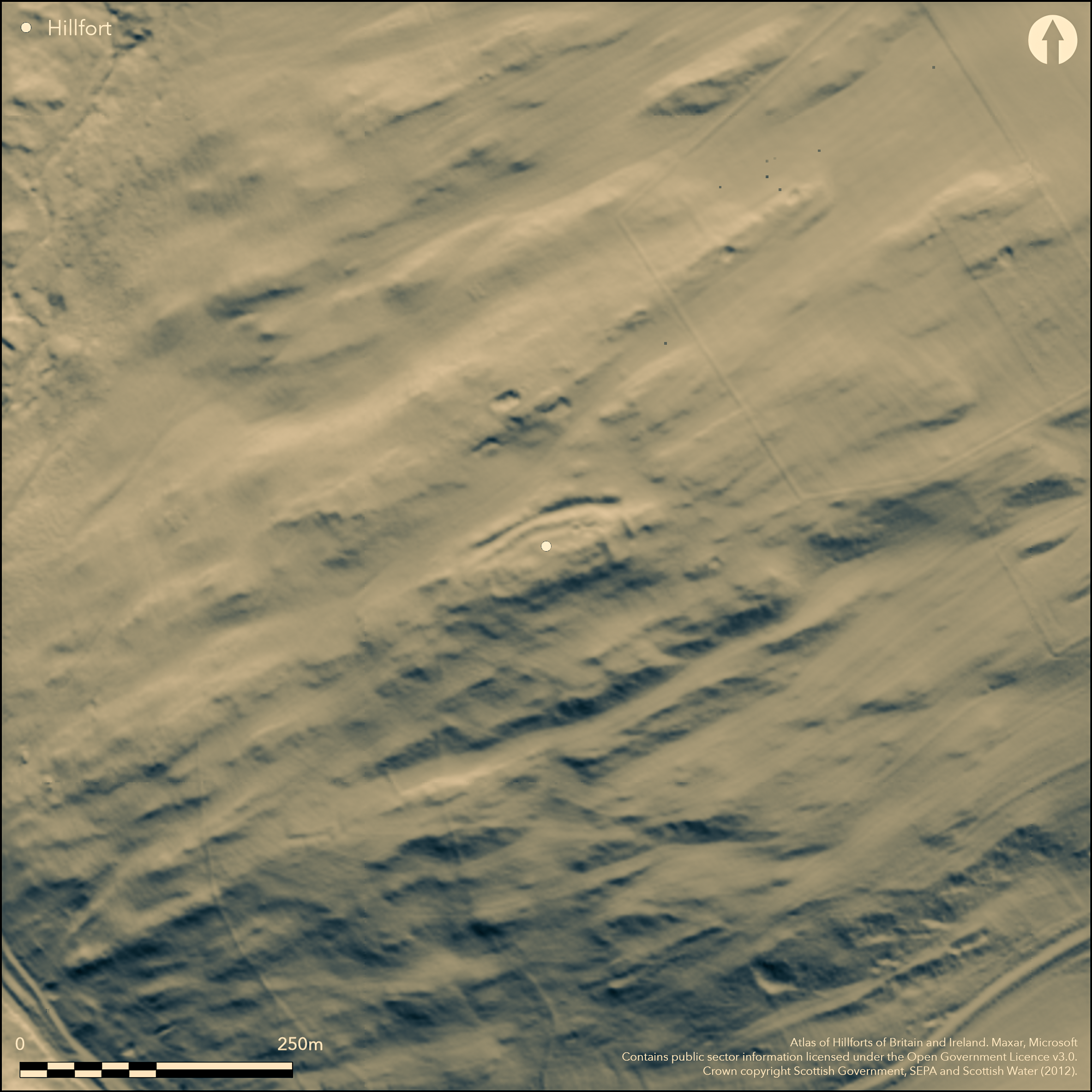
LiDAR 1m DTM Hillshade
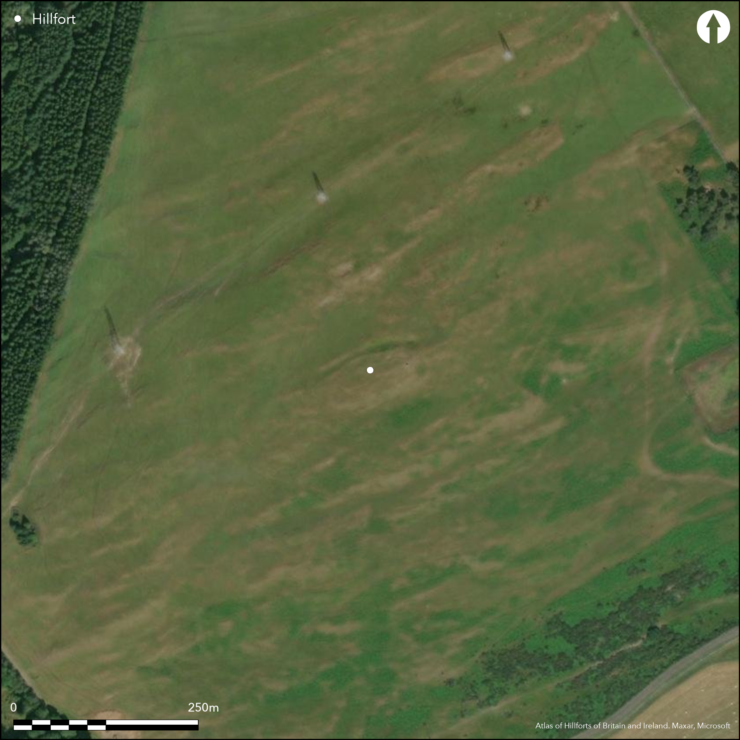
Satellite Imagery
LiDAR 1m DTM Hillshade
Satellite Imagery
Scroll left/right to view further images.
HER: Scottish Borders 54065 (None)
NMR: NT 40 NW 13 (54065)
SM: None
NGR: NT 4312 0821
X: 343120 Y: 608210 (OSGB36)
This fort or fortified settlement is situated on a rocky hillock that forms the SW shoulder of Teinside Hill and is surmounted by a modern marker cairn . Oval on plan, it measures internally some 60m from ENE to WSW by 20m transversely (0.01ha). The defences comprise two ramparts with external ditches, though the inner is heavily reduced, forming a stony bank at both ends, but no more than a scarp on the NNW, and there is no evidence that any of the defences were carried along the steep SSE flank of the hillock. The outer defences, which are not strictly concentric to the inner and might even represent an earlier circuit enclosing an area of about 0.25ha, are comparatively massive, flanked on the NNW by a rock-cut ditch from 6m to 9m in breadth by up to 2.7m in depth, which has been formed from a natural gully on this side and at the E end appears to have been enlarged by later quarrying. There is an entrance through the inner rampart on WSW, and possibly on the ENE also, where there is a gap in the outer defences, but this end of the fort has been heavily disturbed by a series of pits dug into and around the inner rampart, which probably result from the excavations of a Mr Govenlock. The interior is featureless, though Mr Govenlock is reported to have uncovered 'a British hut, eight feet square' (Stuart 1875, 14).
Citizen Science: ✗
Reliability of Data: Confirmed
Reliability of Interpretation: Confirmed
X: -322703 Y: 7432954 (EPSG: 3857)
Longitude: -2.898890755791177 Latitude: 55.364611904061036 (EPSG:4326)
Country: Scotland
Current County or Unitary Authority: Scottish Borders
Historic County: Roxburghshire
Current Parish/Community/Council/Townland: Teviothead
None
| Extant | ✓ |
| Cropmark | ✗ |
| Likely Destroyed | ✗ |
None
| Woodland | ✗ |
| Commercial Forestry Plantation | ✗ |
| Parkland | ✗ |
| Pasture (Grazing) | ✓ |
| Arable | ✗ |
| Scrub/Bracken | ✗ |
| Bare Outcrop | ✗ |
| Heather/Moorland | ✓ |
| Heath | ✗ |
| Built-up | ✗ |
| Coastal Grassland | ✗ |
| Other | ✗ |
None
| Contour Fort | ✓ |
| Partial Contour Fort | ✗ |
| Promontory Fort | ✗ |
| Hillslope Fort | ✗ |
| Level Terrain Fort | ✗ |
| Marsh Fort | ✗ |
| Multiple Enclosure Fort | ✗ |
| Hilltop | ✓ |
| Coastal Promontory | ✗ |
| Inland Promontory | ✗ |
| Valley Bottom | ✗ |
| Knoll/Hillock/Outcrop | ✗ |
| Ridge | ✗ |
| Cliff/Plateau-edge/Scarp | ✗ |
| Hillslope | ✗ |
| Lowland | ✗ |
| Spur | ✗ |
Dominant Topographic Feature: None
| North | ✗ |
| Northeast | ✗ |
| East | ✗ |
| Southeast | ✗ |
| South | ✗ |
| Southwest | ✗ |
| West | ✗ |
| Northwest | ✗ |
| Level | ✓ |
Altitude: 244.0m
N/A
In the absence of modern excavation, there are neither stratified artefacts nor radiocarbon dates to provide a chronology for the defences.
Reliability: D - None
| Pre 1200BC | ✗ |
| 1200BC - 800BC | ✗ |
| 800BC - 400BC | ✗ |
| 400BC - AD50 | ✗ |
| AD50 - AD400 | ✗ |
| AD400 - AD 800 | ✗ |
| Post AD800 | ✗ |
| Unknown | ✓ |
| Pre Hillfort: | None |
| Post Hillfort: | None |
Single photograph by RCAHMS Aerial Survey Programme in 2010
| 1st Identified Map Depiction (1858): | Annotated Fort on the 1st edition OS 25-inch map (Roxburgh 1863, sheet 31.8) |
| Excavation (1873): | Conducted by a Mr Govenlock, but unreported other than in an Anniversary Address to the Berwickshire Naturalist's Club (Stuart 1875, 14) |
| Earthwork Survey (1948): | Plan and description (RCAHMS 1956, 439, no.989, fig 578; RCAHMS RXD 196/1-2) |
| Other (1965): | Resurveyed at 1:2500 by the OS |
Featureless, though a square structure is reported to have been found in excavation
None
| None | ✓ |
| Spring | ✗ |
| Stream | ✗ |
| Pool | ✗ |
| Flush | ✗ |
| Well | ✗ |
| Other | ✗ |
None
| No Known Features | ✓ |
| Round Stone Structures | ✗ |
| Rectangular Stone Structures | ✗ |
| Curvilinear Platforms | ✗ |
| Other Roundhouse Evidence | ✗ |
| Pits | ✗ |
| Quarry Hollows | ✗ |
| Other | ✗ |
Found about 1873 by a Mr Govenlock (Stuart 1875, 14)
| No Known Excavation | ✗ |
| Pits | ✗ |
| Postholes | ✗ |
| Roundhouses | ✗ |
| Rectangular Structures | ✓ |
| Roads/Tracks | ✗ |
| Quarry Hollows | ✗ |
| Other | ✗ |
| Nothing Found | ✗ |
None
| No Known Geophysics | ✓ |
| Pits | ✗ |
| Roundhouses | ✗ |
| Rectangular Structures | ✗ |
| Roads/Tracks | ✗ |
| Quarry Hollows | ✗ |
| Other | ✗ |
| Nothing Found | ✗ |
None
| No Known Finds | ✓ |
| Pottery | ✗ |
| Metal | ✗ |
| Metalworking | ✗ |
| Human Bones | ✗ |
| Animal Bones | ✗ |
| Lithics | ✗ |
| Environmental | ✗ |
| Other | ✗ |
NO APPARENT FEATURES
| APs Not Checked | ✗ |
| None | ✓ |
| Roundhouses | ✗ |
| Rectangular Structures | ✗ |
| Pits | ✗ |
| Postholes | ✗ |
| Roads/Tracks | ✗ |
| Other | ✗ |
See main summary
| 2: | Heavy disturbance of the ENE end and missing sectors elsewhere |
| 2: | None |
Guard Chambers: ✗
Chevaux de Frise: ✗
| 1. Simple Gap (East): | Through the outer rampart |
| 1. Simple Gap (East): | Probably a gap in the inner rampart, but heavily disrupted and not opposite the gap in the outer |
| 2. Simple Gap (West): | In the inner rmapart |
Two ramparts accompanied by external ditches along the NNE flank
| Area 1: | 0.1ha. |
| Area 2: | 0.25ha. |
| Total: | 0.25ha. |
Total Footprint Area: 0.43ha.
None
| ✗ | Not visibly multiperiod, but the outer rampart is eccentric to the outer and there is no evidence that its entrance on the ENE conformed to any gap in the inner at this end. |
| ✗ | None |
| NE Quadrant: | 2 |
| SE Quadrant: | 0 |
| SW Quadrant: | 2 |
| NW Quadrant: | 2 |
| Total: | 2 |
| Partial Univallate | ✗ |
| Univallate | ✗ |
| Partial Bivallate | ✓ |
| Bivallate | ✗ |
| Partial Multivallate | ✗ |
| Multivallate | ✗ |
| Unknown | ✗ |
| Partial Univallate | ✗ |
| Univallate | ✗ |
| Partial Bivallate | ✗ |
| Bivallate | ✗ |
| Partial Multivallate | ✗ |
| Multivallate | ✗ |
None
| None | ✗ |
| Earthen Bank | ✓ |
| Stone Wall | ✗ |
| Rubble | ✗ |
| Wall-walk | ✗ |
| Evidence of Timber | ✗ |
| Vitrification | ✗ |
| Other Burning | ✗ |
| Palisade | ✗ |
| Counter Scarp Bank | ✗ |
| Berm | ✗ |
| Unfinished | ✗ |
| Other | ✗ |
None
| None | ✗ |
| Earthen Bank | ✗ |
| Stone Wall | ✗ |
| Murus Duplex | ✗ |
| Timber-framed | ✗ |
| Timber-laced | ✗ |
| Vitrification | ✗ |
| Other Burning | ✗ |
| Palisade | ✗ |
| Counter Scarp Bank | ✗ |
| Berm | ✗ |
| Unfinished | ✗ |
| No Known Excavation | ✓ |
| Other | ✗ |
| ✗ | None |
| ✓ | Flanking one side |
Number of Ditches: 2
| ✗ | None |
RCAHMS (1956) The Royal Commission on the Ancient and Historical Monuments of Scotland. An inventory of the ancient and historical monuments of Roxburghshire: with the fourteenth report of the Commission, 2v. HMSO: Edinburgh
Stuart, C (1875) 'Address delivered to Berwickshire Naturalist's Club, at Berwick, September 25th, 1873'. Hist Berwickshire Natur Club 7 (1873-5), 3-26
Atlas of Hillforts:
Wikidata:
This work is licensed under CC BY-SA 4.0

 and should be cited as:
Lock, Gary and Ralston, Ian. 2024. Atlas of Hillforts of Britain and Ireland. Available at: https://hillforts.arch.ox.ac.uk
Document Version 1.1