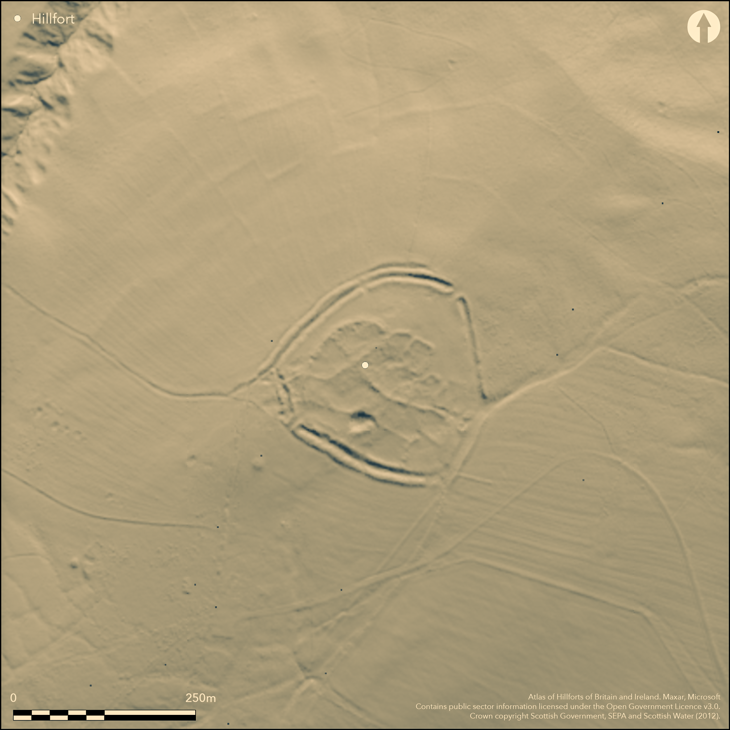
LiDAR 1m DTM Hillshade
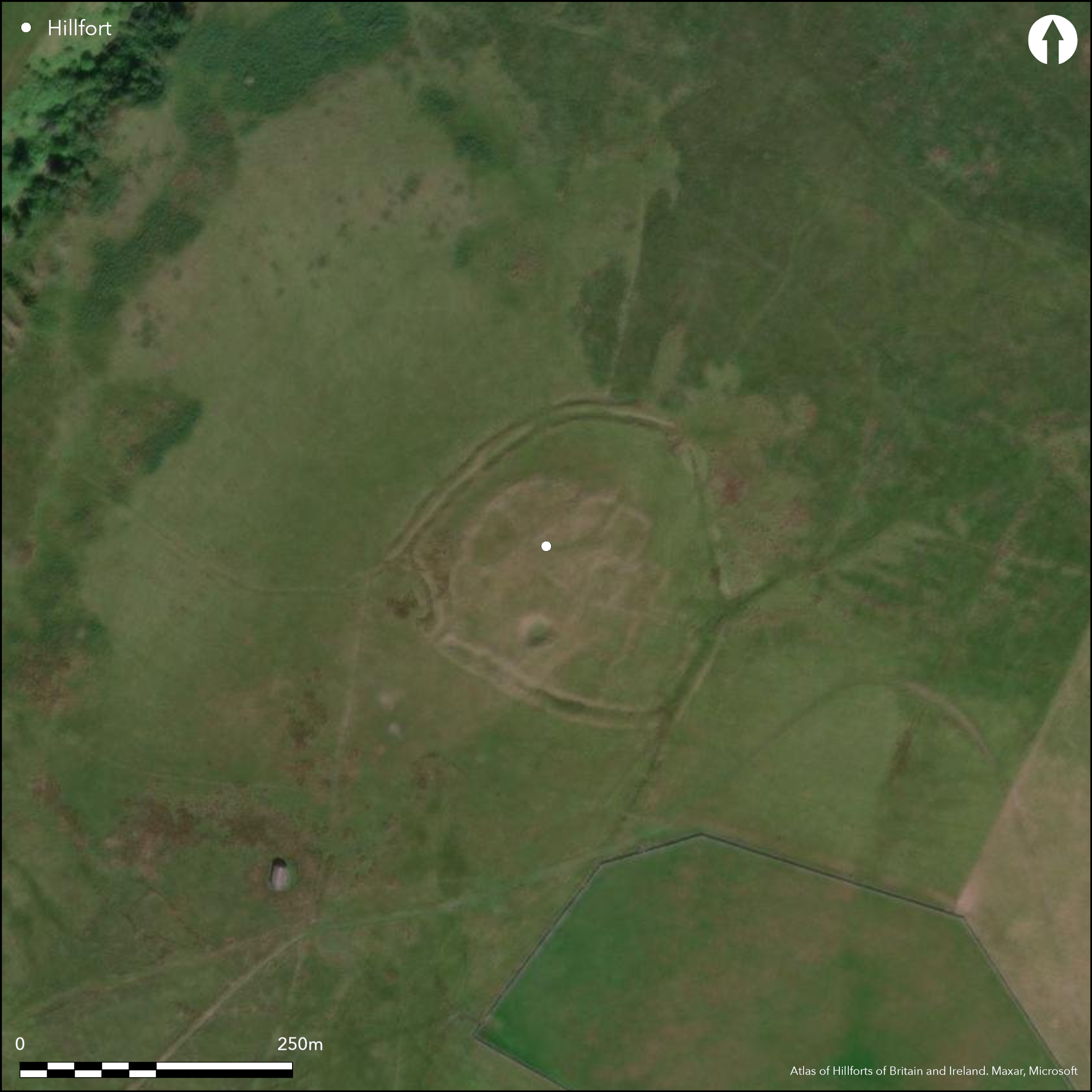
Satellite Imagery
LiDAR 1m DTM Hillshade
Satellite Imagery
Scroll left/right to view further images.
HER: Scottish Borders 55147 (None)
NMR: NT 50 NW 1 (55147)
SM: 2297
NGR: NT 5150 0630
X: 351500 Y: 606300 (OSGB36)
This unusual fortified enclosure lies just off the crest of Blakebillend, dropping down gently eastwards immediately E of the summit of the spur. An irregular polygon on plan, it measures about 150m from NE to SW by 145m transversely (1.6ha) within two ramparts accompanied by external ditches. The inner rampart has been stone-faced, and a run of its outer face is still visible on the S, but large sectors on the NW and NE have apparently been levelled during a later phase of occupation, Nevertheless, where best preserved the inner stands 1m high internally, while the outer is up to 2m high. The ditch between them varies from 4.5m to 7.5m in breadth, contrasting with the relatively minor scale of the outer ditch, which has been virtually obliterated by later cultivation; possibly this ditch was not associated with the construction of the original circuit, but results from additions where it has been incorporated into the lines of a series of later linear earthworks and field boundaries. Later usage has broken through the defences at several places, but there are at least two original entrances, on the NNE and WSW respectively, and at both the ramparts return and unite around the terminals of the ditches. The greater part of the interior is occupied by what is probably a late Iron Age settlement comprising a series of rectilinear and curvilinear yards and at the footings of at least five stone walled round-houses, one of which lies on the line of the inner rampart on the SE. The surrounding area contains extensive traces of earlier fields and boundary works, some of which are evidently associated with post-medieval rig-systems, but these also overlie a system of small rectilinear fields, which is likely to be late Iron Age in date.
Citizen Science: ✗
Reliability of Data: Confirmed
Reliability of Interpretation: Confirmed
X: -307951 Y: 7429770 (EPSG: 3857)
Longitude: -2.766369369869653 Latitude: 55.34835105401371 (EPSG:4326)
Country: Scotland
Current County or Unitary Authority: Scottish Borders
Historic County: Roxburghshire
Current Parish/Community/Council/Townland: Cavers
None
| Extant | ✓ |
| Cropmark | ✗ |
| Likely Destroyed | ✗ |
None
| Woodland | ✗ |
| Commercial Forestry Plantation | ✗ |
| Parkland | ✗ |
| Pasture (Grazing) | ✓ |
| Arable | ✗ |
| Scrub/Bracken | ✗ |
| Bare Outcrop | ✗ |
| Heather/Moorland | ✓ |
| Heath | ✗ |
| Built-up | ✗ |
| Coastal Grassland | ✗ |
| Other | ✗ |
The summit lies immediately outside the earthworks and the interior slopes down gently eastwards
| Contour Fort | ✓ |
| Partial Contour Fort | ✗ |
| Promontory Fort | ✗ |
| Hillslope Fort | ✗ |
| Level Terrain Fort | ✗ |
| Marsh Fort | ✗ |
| Multiple Enclosure Fort | ✗ |
| Hilltop | ✗ |
| Coastal Promontory | ✗ |
| Inland Promontory | ✗ |
| Valley Bottom | ✗ |
| Knoll/Hillock/Outcrop | ✗ |
| Ridge | ✗ |
| Cliff/Plateau-edge/Scarp | ✗ |
| Hillslope | ✗ |
| Lowland | ✗ |
| Spur | ✓ |
Dominant Topographic Feature: None
| North | ✗ |
| Northeast | ✗ |
| East | ✓ |
| Southeast | ✗ |
| South | ✗ |
| Southwest | ✗ |
| West | ✗ |
| Northwest | ✗ |
| Level | ✗ |
Altitude: 290.0m
N/A
In the absence of excavation, there are neither stratified artefacts nor radiocarbon dates to provide a chronology for the defences.
Reliability: D - None
| Pre 1200BC | ✗ |
| 1200BC - 800BC | ✗ |
| 800BC - 400BC | ✗ |
| 400BC - AD50 | ✗ |
| AD50 - AD400 | ✗ |
| AD400 - AD 800 | ✗ |
| Post AD800 | ✗ |
| Unknown | ✓ |
| Pre Hillfort: | None |
| Post Hillfort: | Overlain by Late Iron Age settlement, part of which has been cut by a later quarry, and latterly used in WW2 for a mortar range |
Photographed by RCAHMS Aerial Survey Programme in 1980, 1981, 1984, 2007 and 2010, and by CUCAP in 1945 and 1948
| 1st Identified Map Depiction (1858): | Annotated Camp in Roman type on the 1st edition OS 25-inch map (Roxburgh 1863, sheet 32.12) |
| Earthwork Survey (1948): | Plan and description (RCAHMS 1956, 116-17, no.166, fig 155; RCAHMS RXD 18/1-3) |
| Other (1963): | Scheduled |
| Other (1965): | Surveyed at 1:2500 by the OS |
| Other (1979): | Surveyed at 1:10,000 by the OS |
| Other (1987): | Visited by the Hill-Fort Study Group |
Largely occupied by a late Iron Age settlement comprising at least five hut-circles and a series of enclosed yards
None
| None | ✓ |
| Spring | ✗ |
| Stream | ✗ |
| Pool | ✗ |
| Flush | ✗ |
| Well | ✗ |
| Other | ✗ |
Probably belonging to the overlying Late Iron Age settlement and associated with a series of courts and yards
| No Known Features | ✗ |
| Round Stone Structures | ✓ |
| Rectangular Stone Structures | ✗ |
| Curvilinear Platforms | ✗ |
| Other Roundhouse Evidence | ✗ |
| Pits | ✗ |
| Quarry Hollows | ✗ |
| Other | ✓ |
None
| No Known Excavation | ✓ |
| Pits | ✗ |
| Postholes | ✗ |
| Roundhouses | ✗ |
| Rectangular Structures | ✗ |
| Roads/Tracks | ✗ |
| Quarry Hollows | ✗ |
| Other | ✗ |
| Nothing Found | ✗ |
None
| No Known Geophysics | ✓ |
| Pits | ✗ |
| Roundhouses | ✗ |
| Rectangular Structures | ✗ |
| Roads/Tracks | ✗ |
| Quarry Hollows | ✗ |
| Other | ✗ |
| Nothing Found | ✗ |
parts of two rotary querns found in the ditch during survey in 1948 (NMAS HD 767)
| No Known Finds | ✗ |
| Pottery | ✗ |
| Metal | ✗ |
| Metalworking | ✗ |
| Human Bones | ✗ |
| Animal Bones | ✗ |
| Lithics | ✗ |
| Environmental | ✗ |
| Other | ✓ |
Probably belonging to the overlying Late Iron Age settlement and associated with a series of courts and yards
| APs Not Checked | ✗ |
| None | ✗ |
| Roundhouses | ✓ |
| Rectangular Structures | ✗ |
| Pits | ✗ |
| Postholes | ✗ |
| Roads/Tracks | ✗ |
| Other | ✓ |
See main summary
| 6: | Later activity has broken down the perimeter at several places |
| 2: | None |
Guard Chambers: ✗
Chevaux de Frise: ✗
| 1. Passage-way/Corridor (North east): | Ramparts return and unite around the terminals of the ditch |
| 2. Passage-way/Corridor (West): | Ramparts return and unite around the terminals of the ditch |
Twin ramparts with a medial ditch
| Area 1: | 1.6ha. |
| Total: | 1.6ha. |
Total Footprint Area: 2.2ha.
None
| ✗ | None |
| ✓ | None |
| NE Quadrant: | 2 |
| SE Quadrant: | 2 |
| SW Quadrant: | 2 |
| NW Quadrant: | 2 |
| Total: | 2 |
| Partial Univallate | ✗ |
| Univallate | ✗ |
| Partial Bivallate | ✗ |
| Bivallate | ✓ |
| Partial Multivallate | ✗ |
| Multivallate | ✗ |
| Unknown | ✗ |
| Partial Univallate | ✗ |
| Univallate | ✗ |
| Partial Bivallate | ✗ |
| Bivallate | ✗ |
| Partial Multivallate | ✗ |
| Multivallate | ✗ |
None
| None | ✗ |
| Earthen Bank | ✓ |
| Stone Wall | ✓ |
| Rubble | ✗ |
| Wall-walk | ✗ |
| Evidence of Timber | ✗ |
| Vitrification | ✗ |
| Other Burning | ✗ |
| Palisade | ✗ |
| Counter Scarp Bank | ✗ |
| Berm | ✗ |
| Unfinished | ✗ |
| Other | ✗ |
None
| None | ✗ |
| Earthen Bank | ✗ |
| Stone Wall | ✗ |
| Murus Duplex | ✗ |
| Timber-framed | ✗ |
| Timber-laced | ✗ |
| Vitrification | ✗ |
| Other Burning | ✗ |
| Palisade | ✗ |
| Counter Scarp Bank | ✗ |
| Berm | ✗ |
| Unfinished | ✗ |
| No Known Excavation | ✓ |
| Other | ✗ |
| ✗ | None |
| ✓ | None |
Number of Ditches: 2
| ✗ | None |
RCAHMS (1956) The Royal Commission on the Ancient and Historical Monuments of Scotland. An inventory of the ancient and historical monuments of Roxburghshire: with the fourteenth report of the Commission, 2v. HMSO: Edinburgh
Atlas of Hillforts:
Wikidata:
This work is licensed under CC BY-SA 4.0

 and should be cited as:
Lock, Gary and Ralston, Ian. 2024. Atlas of Hillforts of Britain and Ireland. Available at: https://hillforts.arch.ox.ac.uk
Document Version 1.1