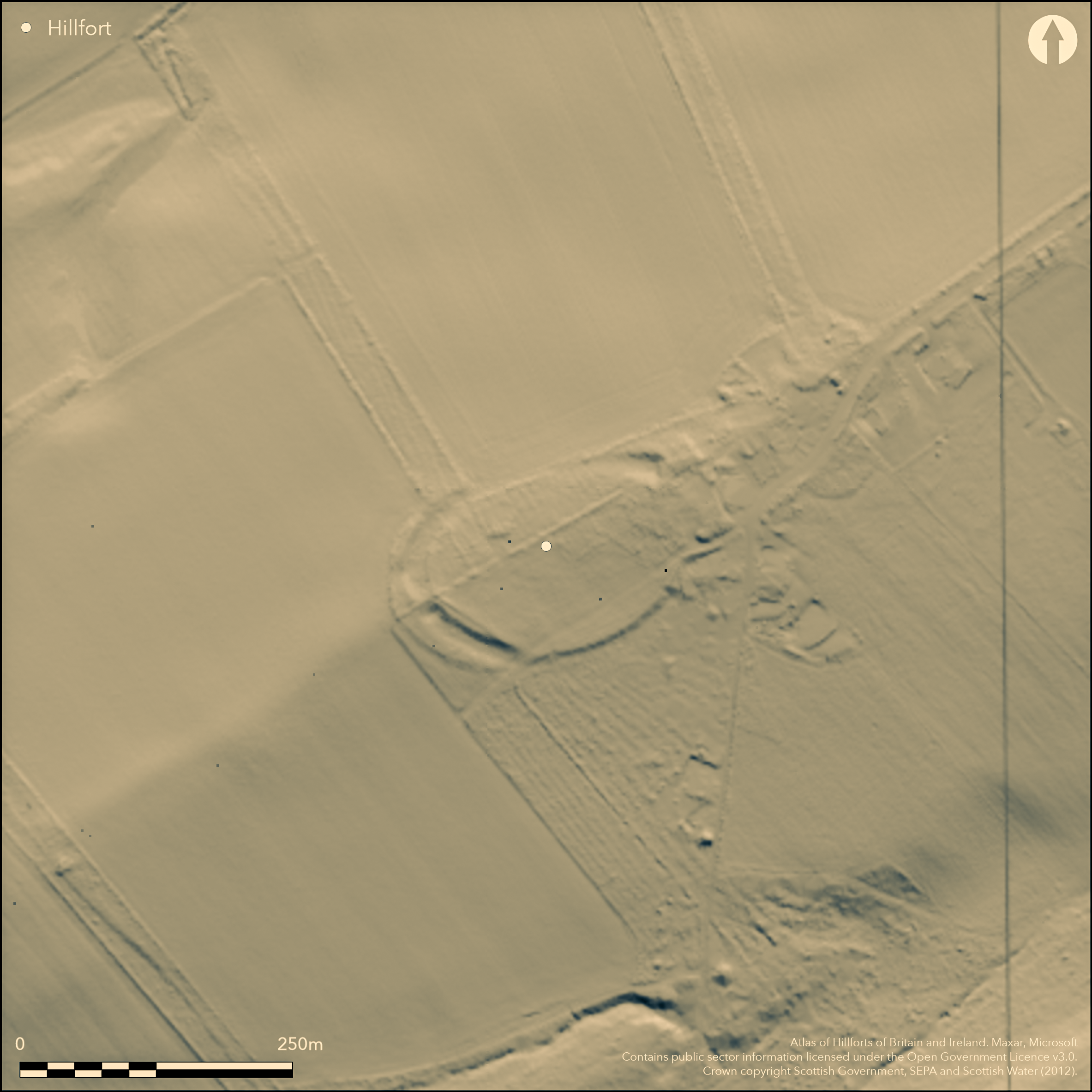
LiDAR 1m DTM Hillshade
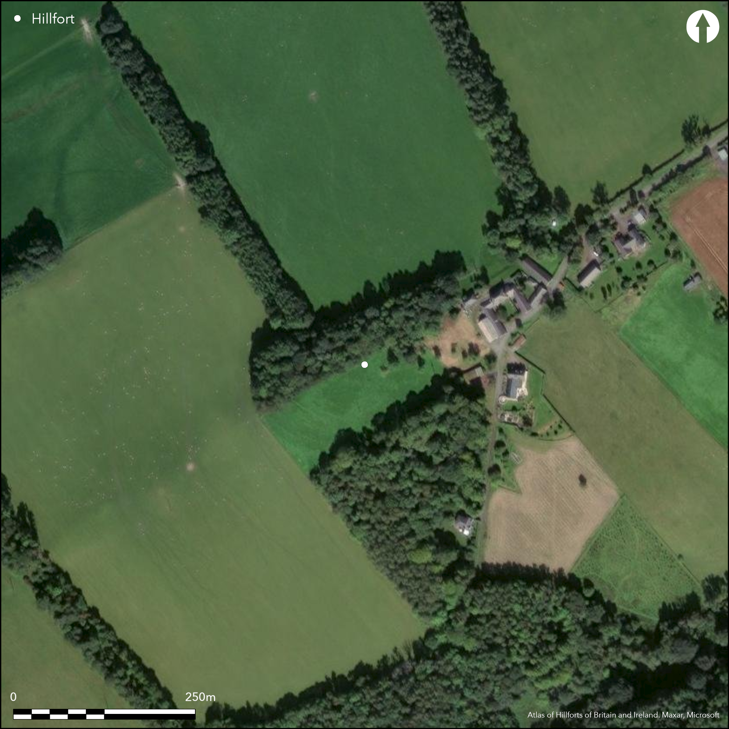
Satellite Imagery
LiDAR 1m DTM Hillshade
Satellite Imagery
Scroll left/right to view further images.
HER: Scottish Borders 55446 (None)
NMR: NT 52 NW 5 (55446)
SM: None
NGR: NT 5476 2906
X: 354763 Y: 629067 (OSGB36)
This fort is situated on a rounded spur which descends gently towards the NE and Kippilaw steading. Its defences probably comprise twin ramparts with a medial ditch, but over half the circuit has been virtually levelled and there is little trace of the inner rampart anywhere. Nevertheless, enough remains to show that the interior measures about 120m from ENE to WSW by 80m transversely (0.77ha), and there was probably an entrance on the WSW, its position marked by a causeway across the ditch. The latter is massive, in the field at the W end measuring up to 14.5m in breadth by 1.5m in depth, and continuing through the adjacent woodland immediately N, while another sector visible on the NE is 2.5m in depth and flanked by a counterscarp rampart 0.6m in height; what may be the scarp of the ditch can also be traced through the woodland on the SE. In addition to these defences, cropmarks photographed in 1976 reveal the ditch of a slighter enclosure extending into the field on the SW, though quite how it relates to the defences is unknown. The ditch is from 2m to 3m in breadth and on plan presents the appearance of a hornwork enclosing an area measuring 50m from NE to SW by 45m transversely and possibly broken by an entrance at the SW apex of the enclosure. Traces of a second ditch can be seen some 10m outside its line on the NW and extending another 40m further out into the field before turning S, and there are traces of other ditches in the field to the S.
Citizen Science: ✗
Reliability of Data: Confirmed
Reliability of Interpretation: Confirmed
X: -302636 Y: 7469984 (EPSG: 3857)
Longitude: -2.718626505954921 Latitude: 55.553223622220436 (EPSG:4326)
Country: Scotland
Current County or Unitary Authority: Scottish Borders
Historic County: Roxburghshire
Current Parish/Community/Council/Townland: Bowden
None
| Extant | ✓ |
| Cropmark | ✓ |
| Likely Destroyed | ✗ |
None
| Woodland | ✓ |
| Commercial Forestry Plantation | ✗ |
| Parkland | ✗ |
| Pasture (Grazing) | ✓ |
| Arable | ✓ |
| Scrub/Bracken | ✗ |
| Bare Outcrop | ✗ |
| Heather/Moorland | ✗ |
| Heath | ✗ |
| Built-up | ✗ |
| Coastal Grassland | ✗ |
| Other | ✗ |
None
| Contour Fort | ✓ |
| Partial Contour Fort | ✗ |
| Promontory Fort | ✗ |
| Hillslope Fort | ✗ |
| Level Terrain Fort | ✗ |
| Marsh Fort | ✗ |
| Multiple Enclosure Fort | ✗ |
| Hilltop | ✗ |
| Coastal Promontory | ✗ |
| Inland Promontory | ✗ |
| Valley Bottom | ✗ |
| Knoll/Hillock/Outcrop | ✗ |
| Ridge | ✗ |
| Cliff/Plateau-edge/Scarp | ✗ |
| Hillslope | ✗ |
| Lowland | ✗ |
| Spur | ✓ |
Dominant Topographic Feature: None
| North | ✗ |
| Northeast | ✗ |
| East | ✗ |
| Southeast | ✗ |
| South | ✗ |
| Southwest | ✗ |
| West | ✗ |
| Northwest | ✗ |
| Level | ✓ |
Altitude: 197.0m
N/A
There are neither stratified artefacts nor radiocarbon dates to provide a chronology for the defences.
Reliability: D - None
| Pre 1200BC | ✗ |
| 1200BC - 800BC | ✗ |
| 800BC - 400BC | ✗ |
| 400BC - AD50 | ✗ |
| AD50 - AD400 | ✗ |
| AD400 - AD 800 | ✗ |
| Post AD800 | ✗ |
| Unknown | ✓ |
| Pre Hillfort: | None |
| Post Hillfort: | Partly levelled for cultivation and large parts of the circuit incorporated into a shelter belt. |
Cropmarks photographed by RCAHMS Aerial Survey Programme in 1976
| 1st Identified Written Reference (1824): | Notes by Kinghorn recorded by George Chalmers (1807-24, iii, 83 note x) |
| 1st Identified Map Depiction (1859): | Annotated Camp on the 1st edition OS 25-inch map (Roxburgh 1863, sheet 14.1), and named in Roman type |
| Other (1894): | Description by David Christison with information from James Wilson (1895, 145) |
| Other (1945): | Description (RCAHMS 1956, 69, no.49) |
| Other (1961): | Resurveyed at 1:2500 by the OS |
| Excavation (2000): | Test pitting and a cable trench revealed no archaeological features (Gooder 2000) |
Featureless
None
| None | ✓ |
| Spring | ✗ |
| Stream | ✗ |
| Pool | ✗ |
| Flush | ✗ |
| Well | ✗ |
| Other | ✗ |
None
| No Known Features | ✓ |
| Round Stone Structures | ✗ |
| Rectangular Stone Structures | ✗ |
| Curvilinear Platforms | ✗ |
| Other Roundhouse Evidence | ✗ |
| Pits | ✗ |
| Quarry Hollows | ✗ |
| Other | ✗ |
None
| No Known Excavation | ✓ |
| Pits | ✗ |
| Postholes | ✗ |
| Roundhouses | ✗ |
| Rectangular Structures | ✗ |
| Roads/Tracks | ✗ |
| Quarry Hollows | ✗ |
| Other | ✗ |
| Nothing Found | ✗ |
None
| No Known Geophysics | ✓ |
| Pits | ✗ |
| Roundhouses | ✗ |
| Rectangular Structures | ✗ |
| Roads/Tracks | ✗ |
| Quarry Hollows | ✗ |
| Other | ✗ |
| Nothing Found | ✗ |
Two fragments of a whetstone found in topsoil near the steading (Gooder 2000)
| No Known Finds | ✗ |
| Pottery | ✗ |
| Metal | ✗ |
| Metalworking | ✗ |
| Human Bones | ✗ |
| Animal Bones | ✗ |
| Lithics | ✗ |
| Environmental | ✗ |
| Other | ✓ |
NO APPARENT FEATURES
| APs Not Checked | ✗ |
| None | ✓ |
| Roundhouses | ✗ |
| Rectangular Structures | ✗ |
| Pits | ✗ |
| Postholes | ✗ |
| Roads/Tracks | ✗ |
| Other | ✗ |
See main summary
| 1: | Large sectors of the defences levelled |
| 2: | None |
Guard Chambers: ✗
Chevaux de Frise: ✗
| 1. Simple Gap (West): | Causeway across the ditch |
Massive ditch, probably with both internal and external ramparts
| Area 1: | 0.77ha. |
| Total: | 0.77ha. |
Total Footprint Area: 1.7ha.
None
| ✗ | None |
| ✓ | Enough remains to suggest a continuous circuit |
| NE Quadrant: | 2 |
| SE Quadrant: | 1 |
| SW Quadrant: | 1 |
| NW Quadrant: | 1 |
| Total: | 2 |
| Partial Univallate | ✓ |
| Univallate | ✗ |
| Partial Bivallate | ✓ |
| Bivallate | ✗ |
| Partial Multivallate | ✗ |
| Multivallate | ✗ |
| Unknown | ✗ |
| Partial Univallate | ✗ |
| Univallate | ✗ |
| Partial Bivallate | ✗ |
| Bivallate | ✗ |
| Partial Multivallate | ✗ |
| Multivallate | ✗ |
None
| None | ✗ |
| Earthen Bank | ✓ |
| Stone Wall | ✗ |
| Rubble | ✗ |
| Wall-walk | ✗ |
| Evidence of Timber | ✗ |
| Vitrification | ✗ |
| Other Burning | ✗ |
| Palisade | ✗ |
| Counter Scarp Bank | ✓ |
| Berm | ✗ |
| Unfinished | ✗ |
| Other | ✗ |
None
| None | ✗ |
| Earthen Bank | ✗ |
| Stone Wall | ✗ |
| Murus Duplex | ✗ |
| Timber-framed | ✗ |
| Timber-laced | ✗ |
| Vitrification | ✗ |
| Other Burning | ✗ |
| Palisade | ✗ |
| Counter Scarp Bank | ✗ |
| Berm | ✗ |
| Unfinished | ✗ |
| No Known Excavation | ✓ |
| Other | ✗ |
| ✗ | None |
| ✓ | This discounts the additional ditches visible as cropmarks at the SW end |
Number of Ditches: 1
| ✗ | None |
Chalmers, G (1807-24) Caledonia, or, An account, historical and topographic, of North Britain
Christison, D (1895) 'The forts of Selkirk, the Gala Water, the Southern slopes of the Lammermoors, and the north of Roxburgh'. Proc Soc Antiq Scot 29 (1894-50), 108-79
Gooder, J (2000) 'Rowchester, Scottish Borders (Bowden parish), watching brief; evaluation'. Disc Exc Scot 1, New Ser (2000), 74
RCAHMS (1956) The Royal Commission on the Ancient and Historical Monuments of Scotland. An inventory of the ancient and historical monuments of Roxburghshire: with the fourteenth report of the Commission, 2v. HMSO: Edinburgh
Atlas of Hillforts:
Wikidata:
This work is licensed under CC BY-SA 4.0

 and should be cited as:
Lock, Gary and Ralston, Ian. 2024. Atlas of Hillforts of Britain and Ireland. Available at: https://hillforts.arch.ox.ac.uk
Document Version 1.1