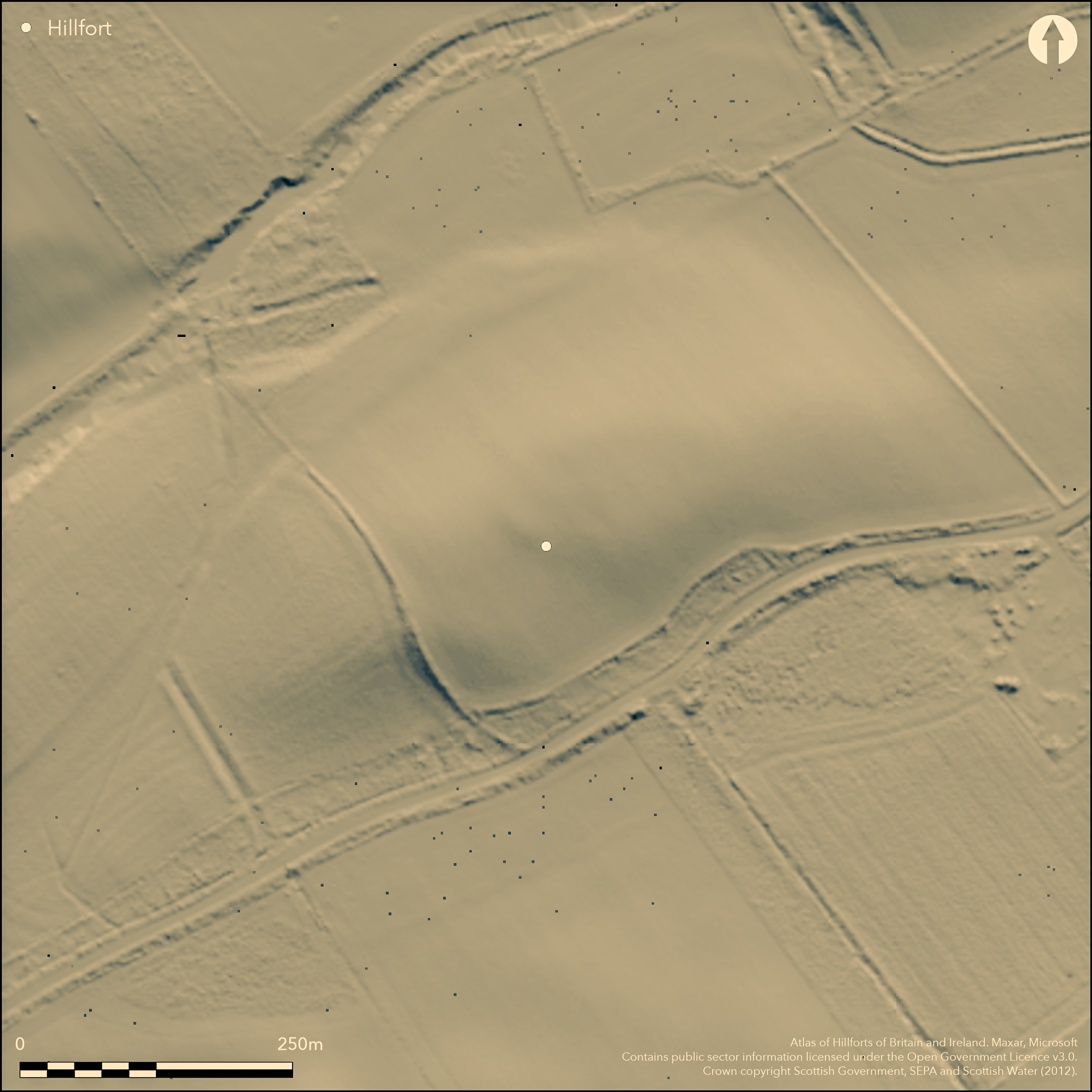
LiDAR 1m DTM Hillshade
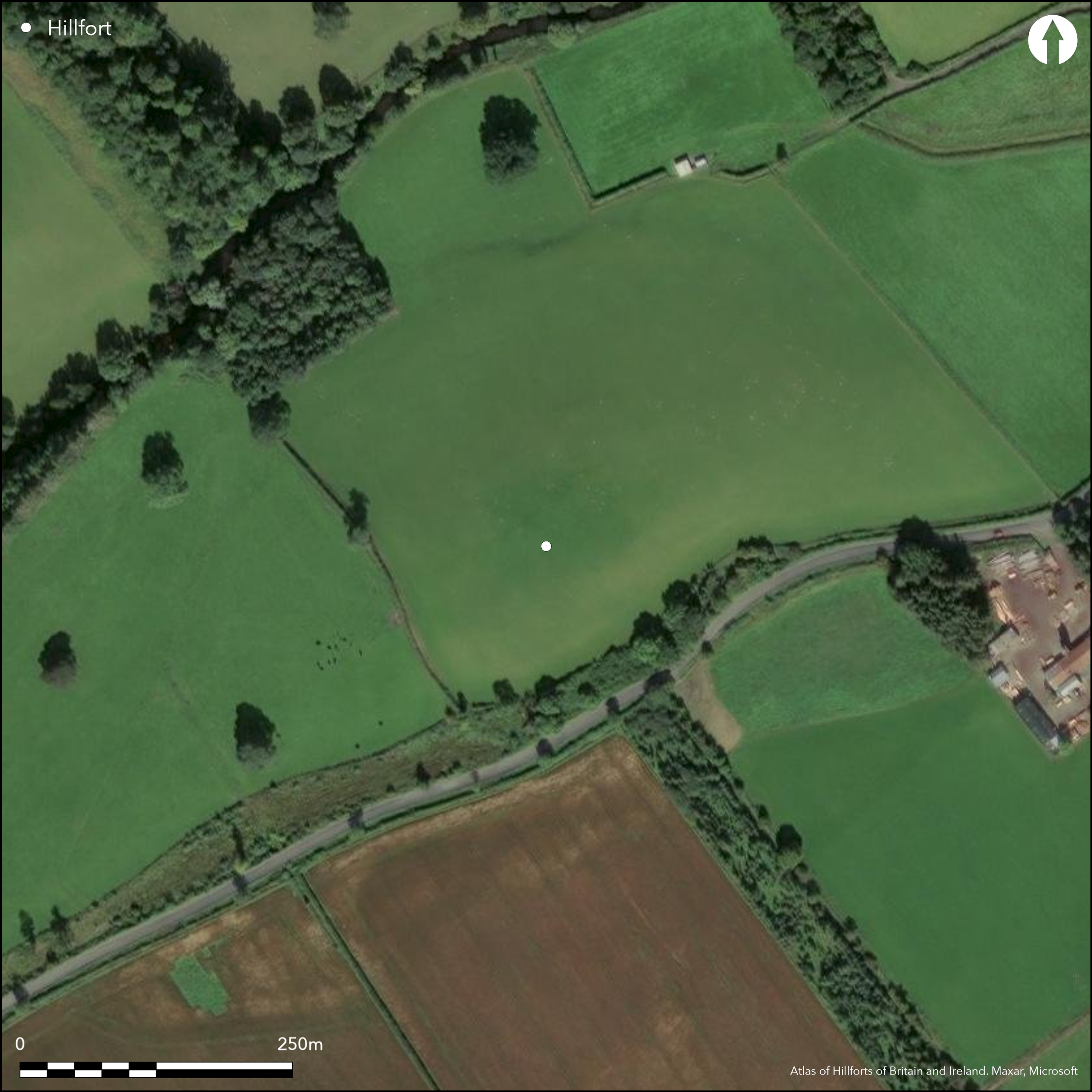
Satellite Imagery
LiDAR 1m DTM Hillshade
Satellite Imagery
Scroll left/right to view further images.
HER: Scottish Borders 55487 (None)
NMR: NT 52 SW 7 (55487)
SM: None
NGR: NT 5242 2438
X: 352420 Y: 624380 (OSGB36)
Cropmarks have revealed a fort situated on the crest of a low hill on the SE side of the Ale Water opposite Riddell. Roughly oval on plan, but with rounded angles at the ENE end, it measures about 100m in length and ranges from 55m in breadth at the rounded WSW end to 38m at the squared ENE (0.29ha) end within two concentric ditches set some 7m apart. There are entrances through both ditches on the N, ENE and W respectively, but while the last is apparently a simple gap, those through the ditches at the other two are not directly opposed, implying an oblique approach way that exposed the visitor's left side; this arrangement is most pronounced at the N entrance where the terminals of the outer ditch are also slightly staggered. The coincidence of all the entrances might suggest that the two ditches and their accompanying ramparts were conceived as part of a single scheme of defence, but whereas the inner is about 2m in breadth, the outer is twice this size, an unusual arrangement in concentric schemes which may indicate that they represent different periods of construction. If so, the inner is perhaps more likely to be the later, inserted concentrically into the larger and more substantial enclosure, and indeed subsequently contracted in size by a third ditch that can be seen cutting across from side to side some 7m short of its ENE end and again including an entrance. While this sequence may be reversed, as a free-standing enclosure, the outer would have measured 115m from ENE to WSW by a maximum of 70m transversely and enclosed an area of about 0.62ha. The fort is evidently traversed by rig and furrow, but the cropmarks also show several dark patches that probably represent the remains of internal structures.
Citizen Science: ✗
Reliability of Data: Confirmed
Reliability of Interpretation: Confirmed
X: -306680 Y: 7461657 (EPSG: 3857)
Longitude: -2.7549560720640014 Latitude: 55.510888623981494 (EPSG:4326)
Country: Scotland
Current County or Unitary Authority: Scottish Borders
Historic County: Roxburghshire
Current Parish/Community/Council/Townland: Lilliesleaf
None
| Extant | ✗ |
| Cropmark | ✓ |
| Likely Destroyed | ✗ |
None
| Woodland | ✗ |
| Commercial Forestry Plantation | ✗ |
| Parkland | ✗ |
| Pasture (Grazing) | ✗ |
| Arable | ✓ |
| Scrub/Bracken | ✗ |
| Bare Outcrop | ✗ |
| Heather/Moorland | ✗ |
| Heath | ✗ |
| Built-up | ✗ |
| Coastal Grassland | ✗ |
| Other | ✗ |
None
| Contour Fort | ✓ |
| Partial Contour Fort | ✗ |
| Promontory Fort | ✗ |
| Hillslope Fort | ✗ |
| Level Terrain Fort | ✗ |
| Marsh Fort | ✗ |
| Multiple Enclosure Fort | ✗ |
| Hilltop | ✓ |
| Coastal Promontory | ✗ |
| Inland Promontory | ✗ |
| Valley Bottom | ✗ |
| Knoll/Hillock/Outcrop | ✗ |
| Ridge | ✗ |
| Cliff/Plateau-edge/Scarp | ✗ |
| Hillslope | ✗ |
| Lowland | ✗ |
| Spur | ✗ |
Dominant Topographic Feature: None
| North | ✗ |
| Northeast | ✗ |
| East | ✗ |
| Southeast | ✗ |
| South | ✗ |
| Southwest | ✗ |
| West | ✗ |
| Northwest | ✗ |
| Level | ✓ |
Altitude: 154.0m
N/A
In the absence of excavation, there are neither stratified artefacts nor radiocarbon dates to provide a chronology for the defences.
Reliability: D - None
| Pre 1200BC | ✗ |
| 1200BC - 800BC | ✗ |
| 800BC - 400BC | ✗ |
| 400BC - AD50 | ✗ |
| AD50 - AD400 | ✗ |
| AD400 - AD 800 | ✗ |
| Post AD800 | ✗ |
| Unknown | ✓ |
| Pre Hillfort: | None |
| Post Hillfort: | Ploughed flat with rig and furrow |
Photographed by CUCAP in 1965 and 1977, it has also been recorded by the RCAHMS Aerial Survey Programme in 1977 (Welfare 1980, 1-2), 1983, 1992, 1995, 1996 and 2000.
| 1st Identified Written Reference (1965): | First photographed by CUCAP |
Several maculae, but none sufficiently well defined to be identified as individual structures
None
| None | ✓ |
| Spring | ✗ |
| Stream | ✗ |
| Pool | ✗ |
| Flush | ✗ |
| Well | ✗ |
| Other | ✗ |
None
| No Known Features | ✓ |
| Round Stone Structures | ✗ |
| Rectangular Stone Structures | ✗ |
| Curvilinear Platforms | ✗ |
| Other Roundhouse Evidence | ✗ |
| Pits | ✗ |
| Quarry Hollows | ✗ |
| Other | ✗ |
None
| No Known Excavation | ✓ |
| Pits | ✗ |
| Postholes | ✗ |
| Roundhouses | ✗ |
| Rectangular Structures | ✗ |
| Roads/Tracks | ✗ |
| Quarry Hollows | ✗ |
| Other | ✗ |
| Nothing Found | ✗ |
None
| No Known Geophysics | ✓ |
| Pits | ✗ |
| Roundhouses | ✗ |
| Rectangular Structures | ✗ |
| Roads/Tracks | ✗ |
| Quarry Hollows | ✗ |
| Other | ✗ |
| Nothing Found | ✗ |
None
| No Known Finds | ✓ |
| Pottery | ✗ |
| Metal | ✗ |
| Metalworking | ✗ |
| Human Bones | ✗ |
| Animal Bones | ✗ |
| Lithics | ✗ |
| Environmental | ✗ |
| Other | ✗ |
Large maculae
| APs Not Checked | ✗ |
| None | ✗ |
| Roundhouses | ✗ |
| Rectangular Structures | ✗ |
| Pits | ✗ |
| Postholes | ✗ |
| Roads/Tracks | ✗ |
| Other | ✓ |
See main summary
| 3: | The whole circuit is levelled |
| 2: | None |
Guard Chambers: ✗
Chevaux de Frise: ✗
| 1. Oblique (North): | Through both ditches. Slightly staggered terminals in the outer ditch. Oblique approach exposing left side |
| 2. Simple Gap (North east): | Through all three ditches at this end. Slightly oblique approach exposing left side |
| 3. Simple Gap (West): | None |
Two ditches, presumably with upcast ramparts, round the whole circuit with a third inserted into the interior at the ENE end
| Area 1: | 0.26ha. |
| Area 2: | 0.29ha. |
| Area 3: | 0.62ha. |
| Total: | 0.62ha. |
Total Footprint Area: Noneha.
None
| ✓ | The differential parching of the crops at the N junction of the ditches at the ENE end of the interior suggests that the third (innermost) ditch is an insertion |
| ✓ | None |
| NE Quadrant: | 3 |
| SE Quadrant: | 2 |
| SW Quadrant: | 2 |
| NW Quadrant: | 2 |
| Total: | 3 |
| Partial Univallate | ✗ |
| Univallate | ✗ |
| Partial Bivallate | ✓ |
| Bivallate | ✗ |
| Partial Multivallate | ✓ |
| Multivallate | ✗ |
| Unknown | ✗ |
| Partial Univallate | ✗ |
| Univallate | ✗ |
| Partial Bivallate | ✗ |
| Bivallate | ✓ |
| Partial Multivallate | ✗ |
| Multivallate | ✗ |
None
| None | ✓ |
| Earthen Bank | ✗ |
| Stone Wall | ✗ |
| Rubble | ✗ |
| Wall-walk | ✗ |
| Evidence of Timber | ✗ |
| Vitrification | ✗ |
| Other Burning | ✗ |
| Palisade | ✗ |
| Counter Scarp Bank | ✗ |
| Berm | ✗ |
| Unfinished | ✗ |
| Other | ✗ |
None
| None | ✗ |
| Earthen Bank | ✗ |
| Stone Wall | ✗ |
| Murus Duplex | ✗ |
| Timber-framed | ✗ |
| Timber-laced | ✗ |
| Vitrification | ✗ |
| Other Burning | ✗ |
| Palisade | ✗ |
| Counter Scarp Bank | ✗ |
| Berm | ✗ |
| Unfinished | ✗ |
| No Known Excavation | ✓ |
| Other | ✗ |
| ✗ | None |
| ✓ | The third ditch inserted at the ENE end is omitted as a minor modification of a coherent ditch system |
Number of Ditches: 2
| ✗ | None |
Welfare, H (1980) 'Jigsaw puzzle and dustbin: air photography and the Iron Age in southern Scotland'. Scot Archaeol Forum 10 (1978), 1-11
Atlas of Hillforts:
Wikidata:
This work is licensed under CC BY-SA 4.0

 and should be cited as:
Lock, Gary and Ralston, Ian. 2024. Atlas of Hillforts of Britain and Ireland. Available at: https://hillforts.arch.ox.ac.uk
Document Version 1.1