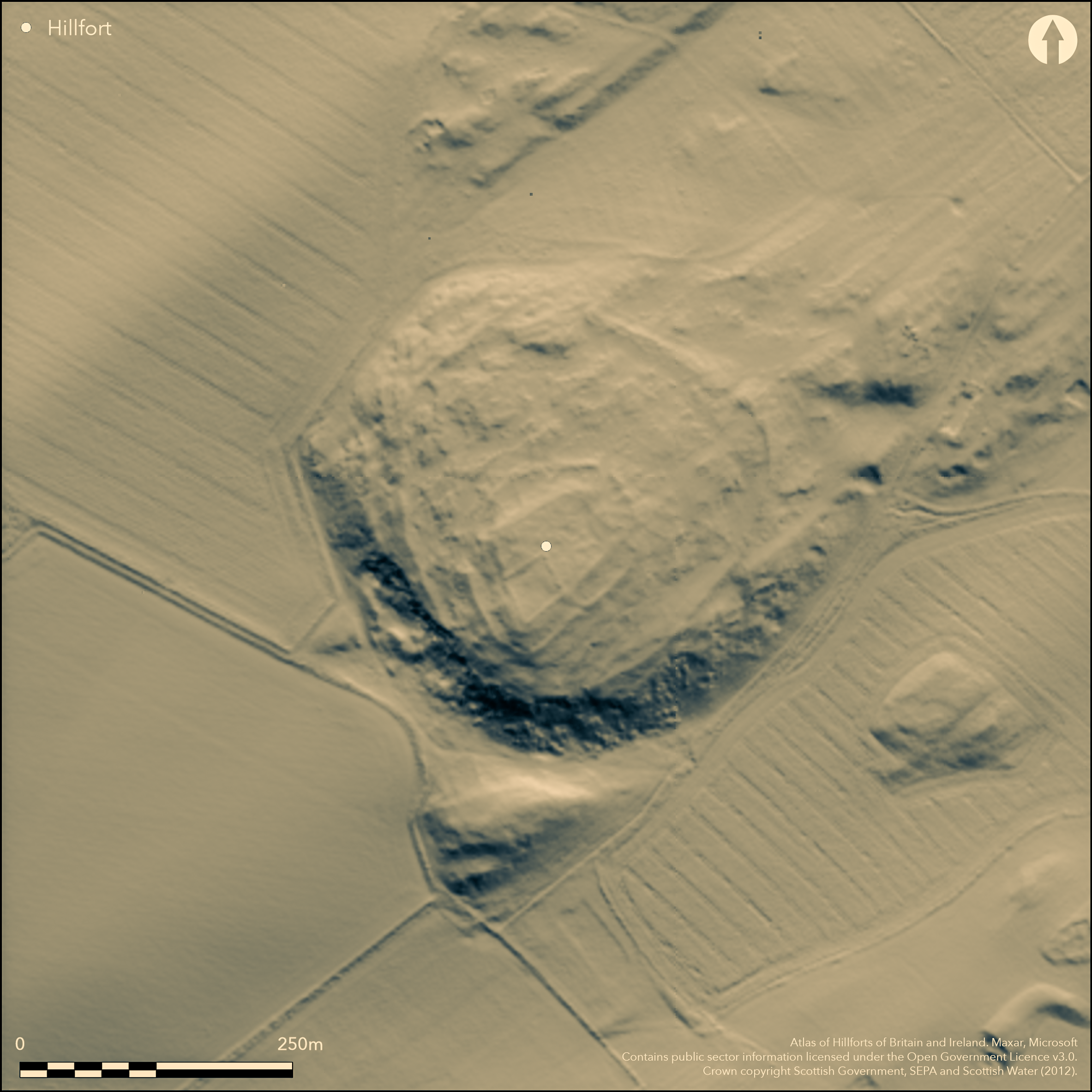
LiDAR 1m DTM Hillshade
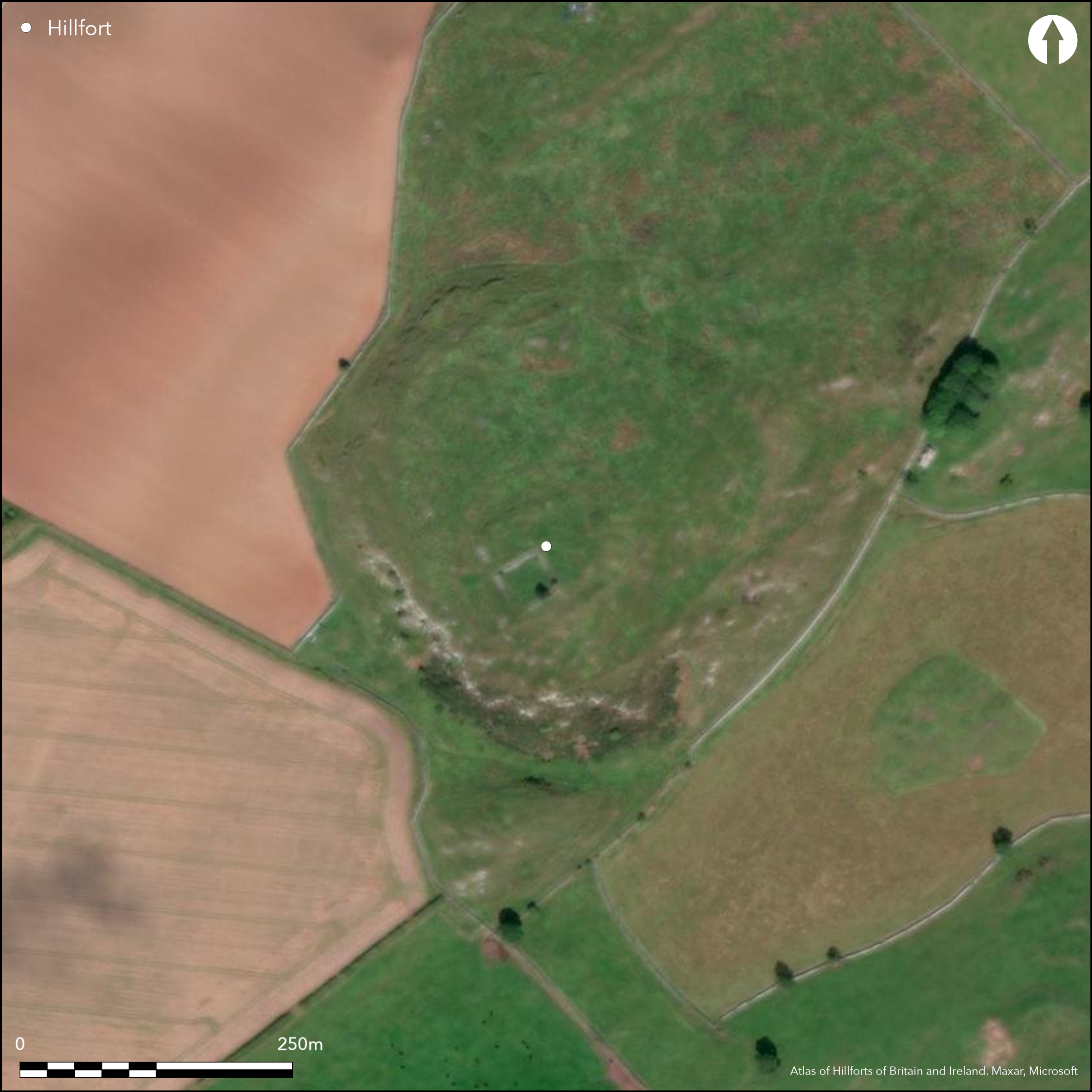
Satellite Imagery
LiDAR 1m DTM Hillshade
Satellite Imagery
Scroll left/right to view further images.
HER: Scottish Borders 57153 (None)
NMR: NT 63 NE 2 (57153)
SM: 5741
NGR: NT 6964 3964
X: 369640 Y: 639640 (OSGB36)
This fort occupies the plateau forming the southern end of Sweethope Hill, which terminates around the S and SW in the cliffs of Sweethope Craig and is defined elsewhere on the NW and SE by steep slopes. The fort has two main elements: an inner enclosure occupying a knoll forming the summit of the hill, and a much larger enclosure that extends round the margins of the plateau. The inner enclosure is roughly trapezoidal on plan, measuring internally a maximum of 75m from NNE to SSW by 45m transversely (0.27ha), and its defences comprise an inner rampart set on the lip of the knoll and an outer rampart around its foot. Both have been heavily robbed, but the outer displays a long run of outer face on the SE. A hollowed trackway pierces both ramparts on the NE, possibly representing an original entrance, but on the SE and WSW respectively the line of the outer rampart is broken by other entrances at which the terminal on one side turns inwards to create a staggered approach exposing the visitor's right side. The outer enclosure is roughly circular on plan and measures some 195m in diameter within a single rampart which has been heavily robbed but can be traced round the margins of the plateau everywhere except above the cliffs on the S and SW. The entrance is on the NE, where the rampart cuts across the relatively level approach from this direction and appears to terminate to either side of the gap in two swollen mounds which the RCAHMS investigators in 1947 thought were probably natural features (RCAHMS 1956, 435, no.977). Apart from a later rectangular building overlying the outermost rampart on the N, the principal features visible within the interior are traces of shallow quarries to the rear of the ramparts at several points, particularly in the inner enclosure, where there is also a small late Iron Age settlement comprising at least on stone-founded round-house and several scooped courts and enclosure banks between the two ramparts. While the outermost rampart is often regarded as part of the same defensive scheme those of the inner enclosure, it is perhaps more likely to represent the remains of a free-standing enclosure.
Citizen Science: ✗
Reliability of Data: Confirmed
Reliability of Interpretation: Confirmed
X: -276516 Y: 7488931 (EPSG: 3857)
Longitude: -2.48398297665146 Latitude: 55.64937917476355 (EPSG:4326)
Country: Scotland
Current County or Unitary Authority: Scottish Borders
Historic County: Roxburghshire
Current Parish/Community/Council/Townland: Stichill
None
| Extant | ✓ |
| Cropmark | ✗ |
| Likely Destroyed | ✗ |
None
| Woodland | ✗ |
| Commercial Forestry Plantation | ✗ |
| Parkland | ✗ |
| Pasture (Grazing) | ✓ |
| Arable | ✗ |
| Scrub/Bracken | ✗ |
| Bare Outcrop | ✗ |
| Heather/Moorland | ✓ |
| Heath | ✗ |
| Built-up | ✗ |
| Coastal Grassland | ✗ |
| Other | ✗ |
None
| Contour Fort | ✓ |
| Partial Contour Fort | ✗ |
| Promontory Fort | ✗ |
| Hillslope Fort | ✗ |
| Level Terrain Fort | ✗ |
| Marsh Fort | ✗ |
| Multiple Enclosure Fort | ✓ |
| Hilltop | ✓ |
| Coastal Promontory | ✗ |
| Inland Promontory | ✗ |
| Valley Bottom | ✗ |
| Knoll/Hillock/Outcrop | ✗ |
| Ridge | ✗ |
| Cliff/Plateau-edge/Scarp | ✗ |
| Hillslope | ✗ |
| Lowland | ✗ |
| Spur | ✗ |
Dominant Topographic Feature: None
| North | ✗ |
| Northeast | ✗ |
| East | ✗ |
| Southeast | ✗ |
| South | ✗ |
| Southwest | ✗ |
| West | ✗ |
| Northwest | ✗ |
| Level | ✓ |
Altitude: 223.0m
N/A
In the absence of excavation, there are neither stratified artefacts nor radiocarbon dates to provide a chronology for the defences, though these probably date from the pre-Roman Iron Age.
Reliability: D - None
| Pre 1200BC | ✗ |
| 1200BC - 800BC | ✗ |
| 800BC - 400BC | ✗ |
| 400BC - AD50 | ✗ |
| AD50 - AD400 | ✗ |
| AD400 - AD 800 | ✗ |
| Post AD800 | ✗ |
| Unknown | ✓ |
| Pre Hillfort: | None |
| Post Hillfort: | Overlain by a late Iron Age settlement, and at a much later date a plantation |
None
| 1st Identified Written Reference (1894): | Noted (Gunn 1895,2 ) |
| 1st Identified Map Depiction (1897): | Annotated Fort on the 2nd edition OS 25-inch map (Roxburghshire 1898, sheet 5.7) |
| Earthwork Survey (1947): | Plan and description (RCAHMS 1956, 435, no.977; 436, fig 574; RCAHMS RXD 193/1-4) |
| Other (1963): | Revised at 1:2500 by the OS |
| Other (1993): | Scheduled |
Largely featureless, apart from traces of quarrying to the rear of the ramparts at several places and a late Iron Age settlement comprising at least one stone-founded round-house and several scooped courts and yards between the ramparts of the inner enclosure
None
| None | ✓ |
| Spring | ✗ |
| Stream | ✗ |
| Pool | ✗ |
| Flush | ✗ |
| Well | ✗ |
| Other | ✗ |
At least one stone-founded round-house and several scooped courts belonging to a late Iron Age settlement. The rectangular building overlies the outermost rampart
| No Known Features | ✗ |
| Round Stone Structures | ✓ |
| Rectangular Stone Structures | ✓ |
| Curvilinear Platforms | ✗ |
| Other Roundhouse Evidence | ✗ |
| Pits | ✗ |
| Quarry Hollows | ✗ |
| Other | ✓ |
None
| No Known Excavation | ✓ |
| Pits | ✗ |
| Postholes | ✗ |
| Roundhouses | ✗ |
| Rectangular Structures | ✗ |
| Roads/Tracks | ✗ |
| Quarry Hollows | ✗ |
| Other | ✗ |
| Nothing Found | ✗ |
None
| No Known Geophysics | ✓ |
| Pits | ✗ |
| Roundhouses | ✗ |
| Rectangular Structures | ✗ |
| Roads/Tracks | ✗ |
| Quarry Hollows | ✗ |
| Other | ✗ |
| Nothing Found | ✗ |
None
| No Known Finds | ✓ |
| Pottery | ✗ |
| Metal | ✗ |
| Metalworking | ✗ |
| Human Bones | ✗ |
| Animal Bones | ✗ |
| Lithics | ✗ |
| Environmental | ✗ |
| Other | ✗ |
NO APPARENT FEATURES
| APs Not Checked | ✗ |
| None | ✓ |
| Roundhouses | ✗ |
| Rectangular Structures | ✗ |
| Pits | ✗ |
| Postholes | ✗ |
| Roads/Tracks | ✗ |
| Other | ✗ |
See main summary
| 4: | None |
| 2: | Generalised to the three in the outer rampart of the inner enclosure; a single entrance is visible in the outer enclosure |
Guard Chambers: ✗
Chevaux de Frise: ✗
| 1. Simple Gap (North east): | Into the outer enclosure between two expanded rampart terminals |
| 2. Simple Gap (North east): | Both the ramparts of the inner enclosure are pierced by a hollow trackway ascending to the summit of the knoll |
| 3. Oblique (South east): | In the outer of the two ramparts of the inner enclosure, one terminal turns inwards. Oblique approach exposing right side |
| 4. Oblique (West): | In the outer of the two ramparts of the inner enclosure, one terminal turns inwards. Oblique approach exposing right side |
Three ramparts disposed in two independent circuits
| Area 1: | 0.27ha. |
| Area 2: | 2.75ha. |
| Total: | 2.75ha. |
Total Footprint Area: Noneha.
None
| ✗ | None |
| ✓ | None |
| NE Quadrant: | 3 |
| SE Quadrant: | 2 |
| SW Quadrant: | 2 |
| NW Quadrant: | 3 |
| Total: | 3 |
| Partial Univallate | ✗ |
| Univallate | ✗ |
| Partial Bivallate | ✓ |
| Bivallate | ✗ |
| Partial Multivallate | ✓ |
| Multivallate | ✗ |
| Unknown | ✗ |
| Partial Univallate | ✓ |
| Univallate | ✗ |
| Partial Bivallate | ✗ |
| Bivallate | ✓ |
| Partial Multivallate | ✗ |
| Multivallate | ✗ |
None
| None | ✗ |
| Earthen Bank | ✗ |
| Stone Wall | ✓ |
| Rubble | ✗ |
| Wall-walk | ✗ |
| Evidence of Timber | ✗ |
| Vitrification | ✗ |
| Other Burning | ✗ |
| Palisade | ✗ |
| Counter Scarp Bank | ✗ |
| Berm | ✗ |
| Unfinished | ✗ |
| Other | ✗ |
None
| None | ✗ |
| Earthen Bank | ✗ |
| Stone Wall | ✗ |
| Murus Duplex | ✗ |
| Timber-framed | ✗ |
| Timber-laced | ✗ |
| Vitrification | ✗ |
| Other Burning | ✗ |
| Palisade | ✗ |
| Counter Scarp Bank | ✗ |
| Berm | ✗ |
| Unfinished | ✗ |
| No Known Excavation | ✓ |
| Other | ✗ |
| ✗ | None |
| ✗ | None |
Number of Ditches: None
| ✗ | None |
Gunn, G (1885) 'Address delivered to the Berwickshire Naturalists' Club at Berwick, 10th October 1894'. Hist Berwickshire Nat Club 15 (1894-5), 1-29
RCAHMS (1956) The Royal Commission on the Ancient and Historical Monuments of Scotland. An inventory of the ancient and historical monuments of Roxburghshire: with the fourteenth report of the Commission, 2v. HMSO: Edinburgh
Atlas of Hillforts:
Wikidata:
This work is licensed under CC BY-SA 4.0

 and should be cited as:
Lock, Gary and Ralston, Ian. 2024. Atlas of Hillforts of Britain and Ireland. Available at: https://hillforts.arch.ox.ac.uk
Document Version 1.1