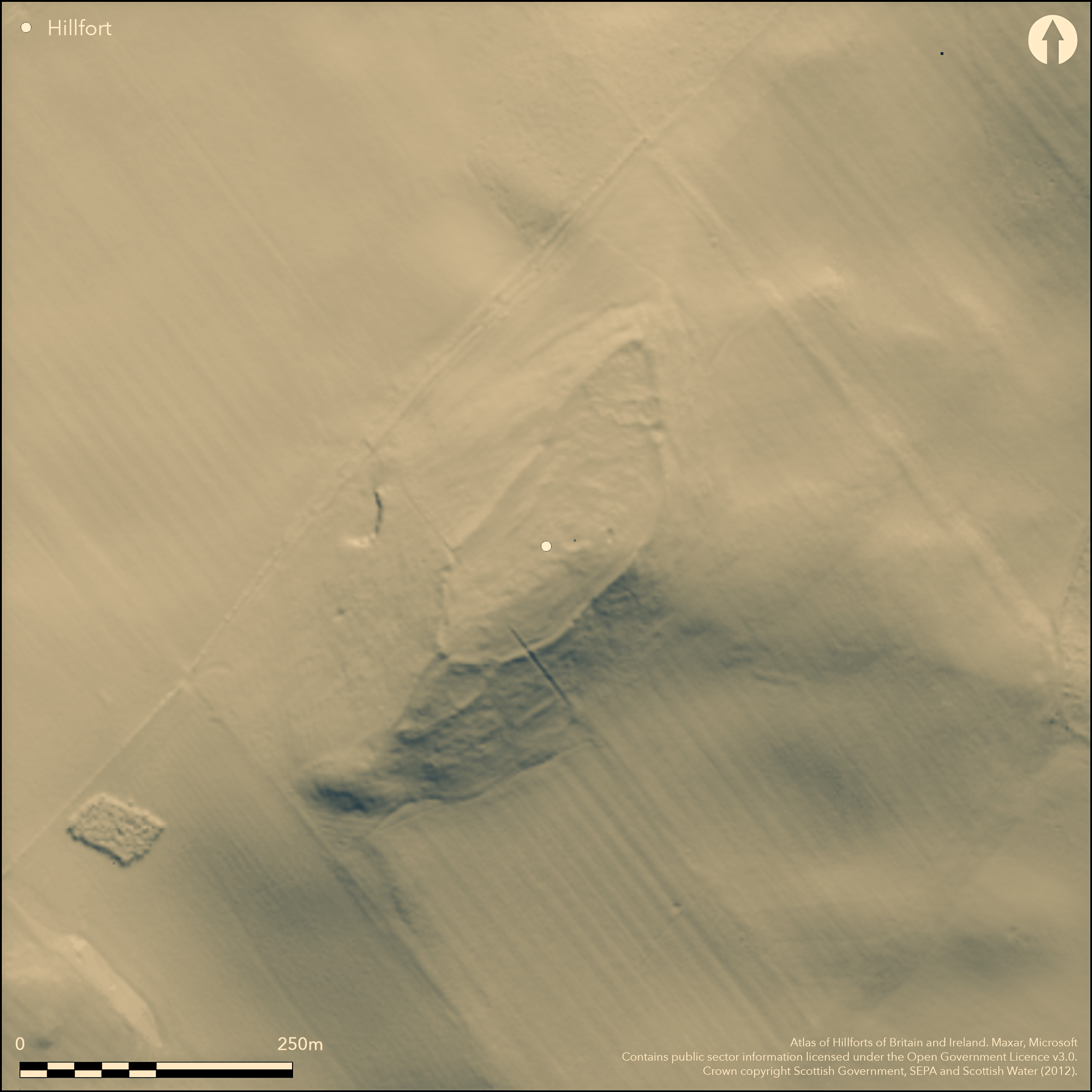
LiDAR 1m DTM Hillshade
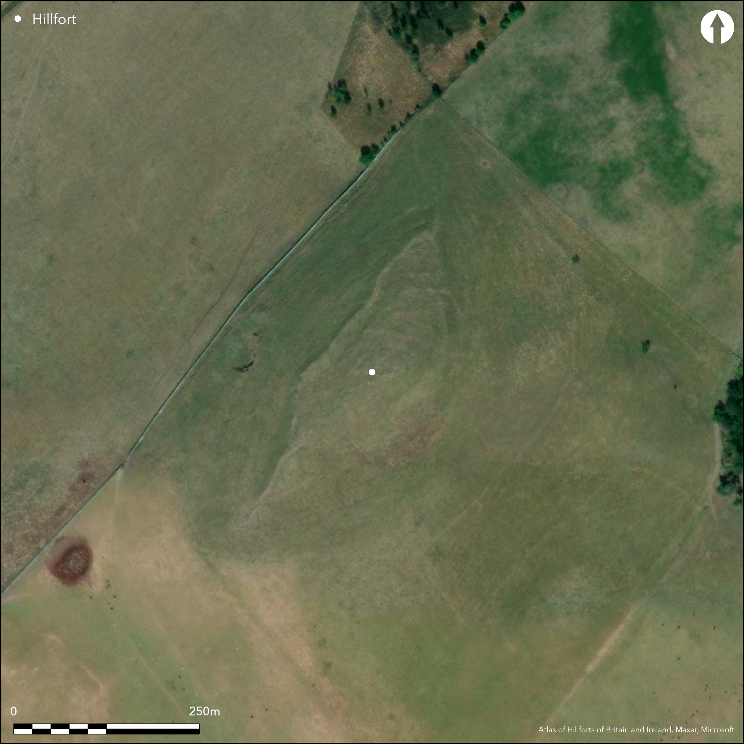
Satellite Imagery
LiDAR 1m DTM Hillshade
Satellite Imagery
Scroll left/right to view further images.
HER: Scottish Borders 58296 (None)
NMR: NT 72 SE 6 (58296)
SM: 1701
NGR: NT 7708 2388
X: 377080 Y: 623880 (OSGB36)
This fort encloses the summit plateau of Morebattle Hill. An irregular oval on plan, it measures 183m from NNE to SSW by 70m transversely (1ha) within a single rampart largely reduced to a scarp extending round the lip of the summit plateau. Internal quarrying has created broad terraces to the rear of the rampart around the SSW end of the fort and a similar feature can be seen within a narrow triangular annexe that extends a further 47m to the SSW. The purpose of this annexe is unclear, though it creates an outer enclosure around the entrance at this end, but there are also entrances through the rampart towards the northern end of both sides, on the NW and NE respectively, and at the apex of the fort on the NNE; a trackway descends obliquely down the slope from the gap on the NE and would have exposed the approaching visitor's right side. The northern tip of the interior beyond the entrance on the NE is occupied by a late Iron Age settlement, which has reused the ramparts to create two sides of a triangular enclosure, its third side incorporating a string of four stone-founded round-houses and three yards or courts. The southernmost of the courts contains a small rectangular building. Elsewhere within the interior of the fort RCAHMS investigators in 1947 recorded three small hollows and a large platform towards the summit of the hill, while aerial photographs suggest the presence of other platforms lower down the slope on the W.
Citizen Science: ✗
Reliability of Data: Confirmed
Reliability of Interpretation: Confirmed
X: -263209 Y: 7461125 (EPSG: 3857)
Longitude: -2.364448425198 Latitude: 55.50818010716607 (EPSG:4326)
Country: Scotland
Current County or Unitary Authority: Scottish Borders
Historic County: Roxburghshire
Current Parish/Community/Council/Townland: Morebattle
None
| Extant | ✓ |
| Cropmark | ✗ |
| Likely Destroyed | ✗ |
None
| Woodland | ✗ |
| Commercial Forestry Plantation | ✗ |
| Parkland | ✗ |
| Pasture (Grazing) | ✓ |
| Arable | ✗ |
| Scrub/Bracken | ✗ |
| Bare Outcrop | ✗ |
| Heather/Moorland | ✓ |
| Heath | ✗ |
| Built-up | ✗ |
| Coastal Grassland | ✗ |
| Other | ✗ |
None
| Contour Fort | ✓ |
| Partial Contour Fort | ✗ |
| Promontory Fort | ✗ |
| Hillslope Fort | ✗ |
| Level Terrain Fort | ✗ |
| Marsh Fort | ✗ |
| Multiple Enclosure Fort | ✗ |
| Hilltop | ✓ |
| Coastal Promontory | ✗ |
| Inland Promontory | ✗ |
| Valley Bottom | ✗ |
| Knoll/Hillock/Outcrop | ✗ |
| Ridge | ✗ |
| Cliff/Plateau-edge/Scarp | ✗ |
| Hillslope | ✗ |
| Lowland | ✗ |
| Spur | ✗ |
Dominant Topographic Feature: None
| North | ✗ |
| Northeast | ✗ |
| East | ✗ |
| Southeast | ✗ |
| South | ✗ |
| Southwest | ✗ |
| West | ✗ |
| Northwest | ✗ |
| Level | ✓ |
Altitude: 219.0m
N/A
In the absence of excavation, there are neither stratified artefacts nor radiocarbon dates to provide a chronology for the defences, though the overlying settlement suggests that they date from the pre-Roman Iron Age.
Reliability: D - None
| Pre 1200BC | ✗ |
| 1200BC - 800BC | ✗ |
| 800BC - 400BC | ✗ |
| 400BC - AD50 | ✗ |
| AD50 - AD400 | ✗ |
| AD400 - AD 800 | ✗ |
| Post AD800 | ✗ |
| Unknown | ✓ |
| Pre Hillfort: | None |
| Post Hillfort: | Overlain by a late Iron Age settlement, and subsequently in the post medieval period traversed by an old boundary dyke |
Photographed by RCAHMS Aerial Survey Programme in 1988, 1995, 2000 and 2010
| 1st Identified Map Depiction (1859): | Annotated Camp on the 1st edition OS 25-inch map (Roxburgh 1863, sheet 16.14) |
| Other (1884): | Noted (Geikie 1884, 140) |
| Earthwork Survey (1947): | Plan and description (RCAHMS 1956, 329-30, no.646, fig 435; RCAHMS RXD 151/1-4) |
| Other (1960): | Scheduled |
| Other (1968): | Visited by the OS |
Apart from a small settlement of stone-founded round-houses at the N end, where a small rectangular building lies within a court, the RCAHMS survey of 1947 have revealed traces of several house platforms elsewhere within the interior
None
| None | ✓ |
| Spring | ✗ |
| Stream | ✗ |
| Pool | ✗ |
| Flush | ✗ |
| Well | ✗ |
| Other | ✗ |
None
| No Known Features | ✗ |
| Round Stone Structures | ✓ |
| Rectangular Stone Structures | ✓ |
| Curvilinear Platforms | ✓ |
| Other Roundhouse Evidence | ✗ |
| Pits | ✗ |
| Quarry Hollows | ✓ |
| Other | ✗ |
None
| No Known Excavation | ✓ |
| Pits | ✗ |
| Postholes | ✗ |
| Roundhouses | ✗ |
| Rectangular Structures | ✗ |
| Roads/Tracks | ✗ |
| Quarry Hollows | ✗ |
| Other | ✗ |
| Nothing Found | ✗ |
None
| No Known Geophysics | ✓ |
| Pits | ✗ |
| Roundhouses | ✗ |
| Rectangular Structures | ✗ |
| Roads/Tracks | ✗ |
| Quarry Hollows | ✗ |
| Other | ✗ |
| Nothing Found | ✗ |
None
| No Known Finds | ✓ |
| Pottery | ✗ |
| Metal | ✗ |
| Metalworking | ✗ |
| Human Bones | ✗ |
| Animal Bones | ✗ |
| Lithics | ✗ |
| Environmental | ✗ |
| Other | ✗ |
None
| APs Not Checked | ✗ |
| None | ✗ |
| Roundhouses | ✓ |
| Rectangular Structures | ✓ |
| Pits | ✗ |
| Postholes | ✗ |
| Roads/Tracks | ✗ |
| Other | ✗ |
See main summary
| 4: | None |
| 2: | None |
Guard Chambers: ✗
Chevaux de Frise: ✗
| 1. Simple Gap (North): | Through the apex of the fort into the late Iron Age enclosure |
| 2. Oblique (North east): | Trackway through staggered rampart terminals. Oblique approach exposing left side |
| 3. Simple Gap (South west): | Opening into the annexe, which probably had an entrance to the exterior at its far tip |
| 4. Simple Gap (North west): | Through the rampart |
Single rampart
| Area 1: | 1.0ha. |
| Total: | 1.0ha. |
Total Footprint Area: Noneha.
None
| ✓ | Overlain by a late Iron Age settlement at the NNE end |
| ✓ | None |
| NE Quadrant: | 1 |
| SE Quadrant: | 1 |
| SW Quadrant: | 1 |
| NW Quadrant: | 1 |
| Total: | 1 |
| Partial Univallate | ✗ |
| Univallate | ✓ |
| Partial Bivallate | ✗ |
| Bivallate | ✗ |
| Partial Multivallate | ✗ |
| Multivallate | ✗ |
| Unknown | ✗ |
| Partial Univallate | ✗ |
| Univallate | ✗ |
| Partial Bivallate | ✗ |
| Bivallate | ✗ |
| Partial Multivallate | ✗ |
| Multivallate | ✗ |
Grass-grown rubble
| None | ✗ |
| Earthen Bank | ✓ |
| Stone Wall | ✗ |
| Rubble | ✓ |
| Wall-walk | ✗ |
| Evidence of Timber | ✗ |
| Vitrification | ✗ |
| Other Burning | ✗ |
| Palisade | ✗ |
| Counter Scarp Bank | ✗ |
| Berm | ✗ |
| Unfinished | ✗ |
| Other | ✗ |
None
| None | ✗ |
| Earthen Bank | ✗ |
| Stone Wall | ✗ |
| Murus Duplex | ✗ |
| Timber-framed | ✗ |
| Timber-laced | ✗ |
| Vitrification | ✗ |
| Other Burning | ✗ |
| Palisade | ✗ |
| Counter Scarp Bank | ✗ |
| Berm | ✗ |
| Unfinished | ✗ |
| No Known Excavation | ✓ |
| Other | ✗ |
| ✗ | None |
| ✗ | None |
Number of Ditches: None
| ✓ | A small triangular annexe is attached to the SSW end of the fort, forming an enclosure some 47m in length by a maximum of 30m transversely (0.1ha) within a single rampart. The side peter out at the southern end, probably indicating the position of an entrance, and the only feature visible within its interior is an internal quarry to the rear of the rampart on the W |
Geikie, J (1884) «List of hill forts, intrenched camps, etc. in Roxburghshire on the Scotch side of the Cheviots». Hist Berwickshire Natur Club 10 (1882-4) 139-44
RCAHMS (1956) The Royal Commission on the Ancient and Historical Monuments of Scotland. An inventory of the ancient and historical monuments of Roxburghshire: with the fourteenth report of the Commission, 2v. HMSO: Edinburgh
Atlas of Hillforts:
Wikidata:
This work is licensed under CC BY-SA 4.0

 and should be cited as:
Lock, Gary and Ralston, Ian. 2024. Atlas of Hillforts of Britain and Ireland. Available at: https://hillforts.arch.ox.ac.uk
Document Version 1.1