Satellite Imagery
Satellite Imagery
HER: Scottish Borders 49914 (None)
NMR: NT 13 SW 23 (49914)
SM: 2984
NGR: NT 1415 3443
X: 314155 Y: 634439 (OSGB36)
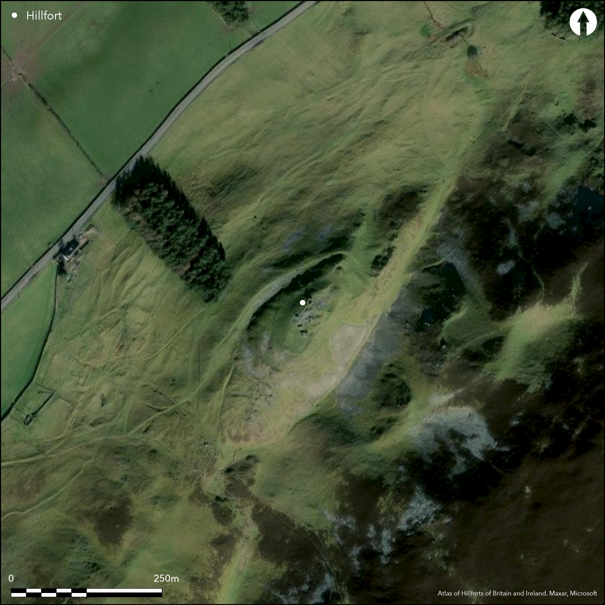
This fort is situated beneath the ruin of Tinnis Castle, which crowns a ridge carved out by a glacial meltwater channel at the foot of the W flank of Vane Law. The castle itself, which dates from the 15th or early 16th century (See RCAHMS 1967, 272-3, no.531), comprises a quadrangular courtyard with towers at the NE and SW corners, and the working assumption has been that all the defensive ramparts lying outside the castle walls belong to a fort rather than an earlier castle on the same site. Be that as it may, the summit area of the ridge, measuring some 60m from NE to SW by 26m transversely (0.15ha), has been enclosed by a single rampart, and the discovery of in situ vitrified stone by RCAHMS investigators in 1959 at the SW end, and loose amongst fallen rubble on the W flank. indicates that it was probably timber-laced. At both ends two further walls have been drawn across the crest of the ridge, the outer on the SW with an internal ditch, while the lower end of the ridge at the SW end is apparently enclosed on the W by a ditch with an external bank, and on the E by a rampart reduced to a scarp. Quite how these various elements functioned as a defensive scheme, and the extent to which they may have been built or modified in the medieval period is uncertain. There is an entrance in the SW end, but the outer of the two walls here has apparently been reconstructed to block access through it, while the entrance visible at the NE end seems to have been the principal approach to the castle, zigzagging up through the ramparts from a well-formed trackway and may be entirely medieval in date.
Citizen Science: ✗
Reliability of Data: Confirmed
Reliability of Interpretation: Confirmed
X: -374461 Y: 7478411 (EPSG: 3857)
Longitude: -3.3638416896408216 Latitude: 55.596016538750405 (EPSG:4326)
Country: Scotland
Current County or Unitary Authority: Scottish Borders
Historic County: Peeblesshire
Current Parish/Community/Council/Townland: Drumelzier
None
| Extant | ✓ |
| Cropmark | ✗ |
| Likely Destroyed | ✗ |
None
| Woodland | ✗ |
| Commercial Forestry Plantation | ✗ |
| Parkland | ✗ |
| Pasture (Grazing) | ✓ |
| Arable | ✗ |
| Scrub/Bracken | ✗ |
| Bare Outcrop | ✗ |
| Heather/Moorland | ✓ |
| Heath | ✗ |
| Built-up | ✗ |
| Coastal Grassland | ✗ |
| Other | ✗ |
None
| Contour Fort | ✓ |
| Partial Contour Fort | ✗ |
| Promontory Fort | ✗ |
| Hillslope Fort | ✗ |
| Level Terrain Fort | ✗ |
| Marsh Fort | ✗ |
| Multiple Enclosure Fort | ✗ |
| Hilltop | ✓ |
| Coastal Promontory | ✗ |
| Inland Promontory | ✗ |
| Valley Bottom | ✗ |
| Knoll/Hillock/Outcrop | ✗ |
| Ridge | ✗ |
| Cliff/Plateau-edge/Scarp | ✗ |
| Hillslope | ✗ |
| Lowland | ✗ |
| Spur | ✗ |
Dominant Topographic Feature: None
| North | ✗ |
| Northeast | ✗ |
| East | ✗ |
| Southeast | ✗ |
| South | ✗ |
| Southwest | ✗ |
| West | ✗ |
| Northwest | ✗ |
| Level | ✓ |
Altitude: 287.0m
N/A
In the absence of excavation, there are neither stratified artefacts nor radiocarbon dates to provide a chronology for the defences.
Reliability: D - None
| Pre 1200BC | ✗ |
| 1200BC - 800BC | ✗ |
| 800BC - 400BC | ✗ |
| 400BC - AD50 | ✗ |
| AD50 - AD400 | ✗ |
| AD400 - AD 800 | ✗ |
| Post AD800 | ✗ |
| Unknown | ✓ |
| Pre Hillfort: | None |
| Post Hillfort: | Occupied by a late medieval castle |
The Remains of the Castle is shown on Mostyn Armstrong's Map of the County of Peebles or Tweedale (1775. Photographed by CUCAP in 1971 and RCAHMS Aerial Survey Programme in 1981, 2001, 2002, 2010 and 2012
| 1st Identified Map Depiction (1856): | Named in Gothic type on the 1st edition OS 25-inch map (Peebles 1856, sheet 16.5 & 6) |
| Earthwork Survey (1886): | Sketch-plan and description by David Christison (1887, 70-1) |
| Earthwork Survey (1959): | Plan and description (RCAHMS 1967, 142-4, no.320, fig 134; RCAHMS PBD 142/1-4) |
| Earthwork Survey (1962): | Plan (RCAHMS PBD 265/1-2) |
| Other (1970): | Scheduled |
| Other (1972): | Resurveyed at 1:2500 by the OS |
Featureless apart from the castle
None
| None | ✓ |
| Spring | ✗ |
| Stream | ✗ |
| Pool | ✗ |
| Flush | ✗ |
| Well | ✗ |
| Other | ✗ |
None
| No Known Features | ✓ |
| Round Stone Structures | ✗ |
| Rectangular Stone Structures | ✗ |
| Curvilinear Platforms | ✗ |
| Other Roundhouse Evidence | ✗ |
| Pits | ✗ |
| Quarry Hollows | ✗ |
| Other | ✗ |
None
| No Known Excavation | ✓ |
| Pits | ✗ |
| Postholes | ✗ |
| Roundhouses | ✗ |
| Rectangular Structures | ✗ |
| Roads/Tracks | ✗ |
| Quarry Hollows | ✗ |
| Other | ✗ |
| Nothing Found | ✗ |
None
| No Known Geophysics | ✓ |
| Pits | ✗ |
| Roundhouses | ✗ |
| Rectangular Structures | ✗ |
| Roads/Tracks | ✗ |
| Quarry Hollows | ✗ |
| Other | ✗ |
| Nothing Found | ✗ |
None
| No Known Finds | ✓ |
| Pottery | ✗ |
| Metal | ✗ |
| Metalworking | ✗ |
| Human Bones | ✗ |
| Animal Bones | ✗ |
| Lithics | ✗ |
| Environmental | ✗ |
| Other | ✗ |
NO APPARENT FEATURES
| APs Not Checked | ✗ |
| None | ✓ |
| Roundhouses | ✗ |
| Rectangular Structures | ✗ |
| Pits | ✗ |
| Postholes | ✗ |
| Roads/Tracks | ✗ |
| Other | ✗ |
See main summary
| 2: | None |
| 2: | None |
Guard Chambers: ✗
Chevaux de Frise: ✗
| 1. Other Forms (North east): | Complex zigzag approach, probably relating to the castle |
| 2. Blocked (South west): | Thought to have been blocked when access to the castle was constructed on the NE |
| 2. Simple Gap (South west): | None |
An inner enclosure with two outlying ramparts at either end
| Area 1: | 0.15ha. |
| Total: | 0.15ha. |
Total Footprint Area: 1.4ha.
None
| ✗ | None |
| ✓ | None |
| NE Quadrant: | 3 |
| SE Quadrant: | 1 |
| SW Quadrant: | 4 |
| NW Quadrant: | 1 |
| Total: | 4 |
| Partial Univallate | ✓ |
| Univallate | ✗ |
| Partial Bivallate | ✗ |
| Bivallate | ✗ |
| Partial Multivallate | ✓ |
| Multivallate | ✗ |
| Unknown | ✗ |
| Partial Univallate | ✗ |
| Univallate | ✗ |
| Partial Bivallate | ✗ |
| Bivallate | ✗ |
| Partial Multivallate | ✗ |
| Multivallate | ✗ |
None
| None | ✗ |
| Earthen Bank | ✓ |
| Stone Wall | ✗ |
| Rubble | ✓ |
| Wall-walk | ✗ |
| Evidence of Timber | ✗ |
| Vitrification | ✓ |
| Other Burning | ✗ |
| Palisade | ✗ |
| Counter Scarp Bank | ✗ |
| Berm | ✗ |
| Unfinished | ✗ |
| Other | ✗ |
None
| None | ✗ |
| Earthen Bank | ✗ |
| Stone Wall | ✗ |
| Murus Duplex | ✗ |
| Timber-framed | ✗ |
| Timber-laced | ✗ |
| Vitrification | ✗ |
| Other Burning | ✗ |
| Palisade | ✗ |
| Counter Scarp Bank | ✗ |
| Berm | ✗ |
| Unfinished | ✗ |
| No Known Excavation | ✓ |
| Other | ✗ |
| ✗ | None |
| ✓ | At the SW end |
Number of Ditches: 2
| ✓ | The lower earthwork on the SW might be termed an annexe, but its date and purpose are unknown and there is no particular reason why it should be associated with the fort rather than the castle |
Christison, D (1887) 'The prehistoric forts of Peeblesshire'. Proc Soc Antiq Scot 21 (1886-7), 13-82
RCAHMS (1967) The Royal Commission on the Ancient and Historical Monuments of Scotland. Peeblesshire: an inventory of the ancient monuments, 2v. HMSO: Edinburgh
Atlas of Hillforts:
Wikidata:
This work is licensed under CC BY-SA 4.0

 and should be cited as:
Lock, Gary and Ralston, Ian. 2024. Atlas of Hillforts of Britain and Ireland. Available at: https://hillforts.arch.ox.ac.uk
Document Version 1.1