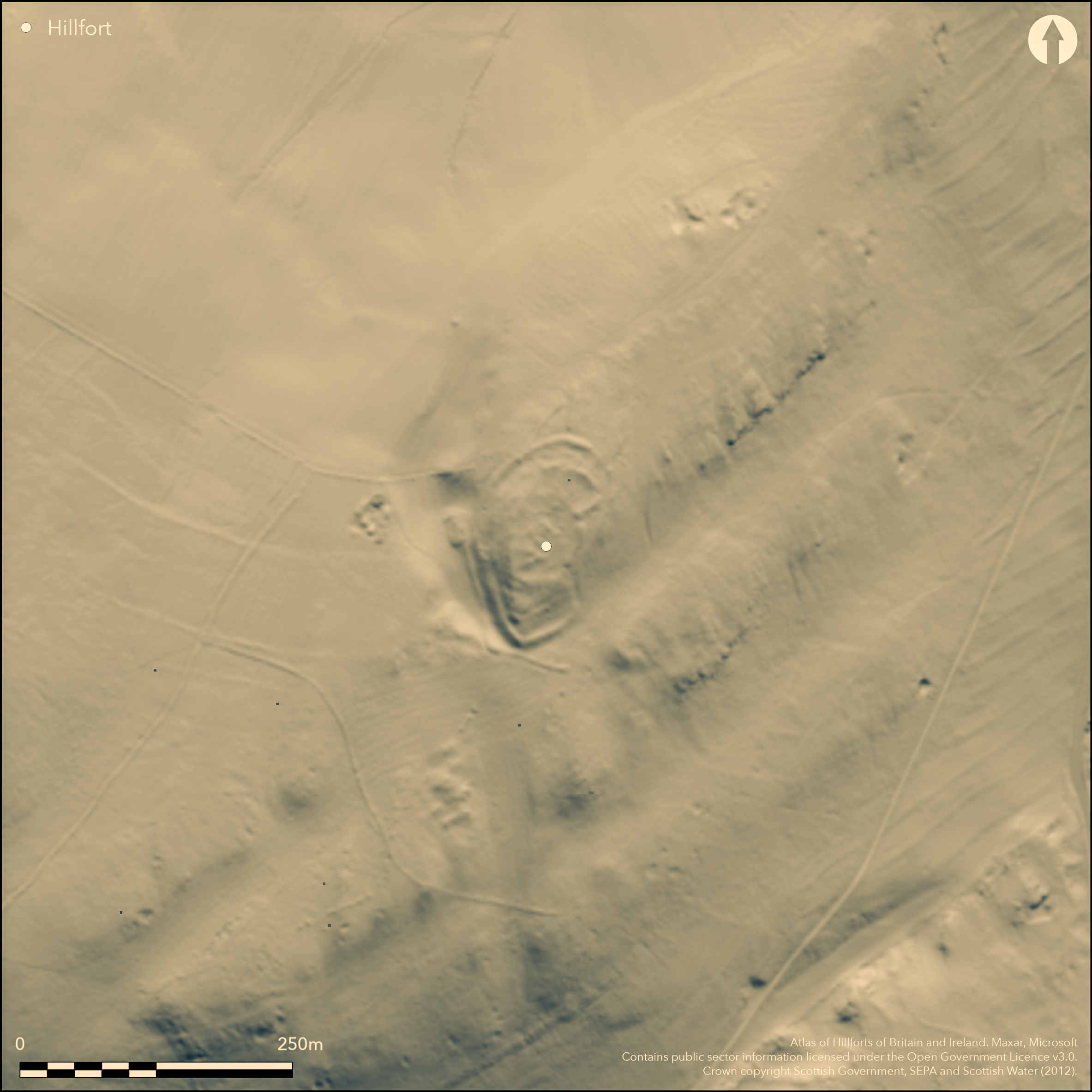
LiDAR 1m DTM Hillshade
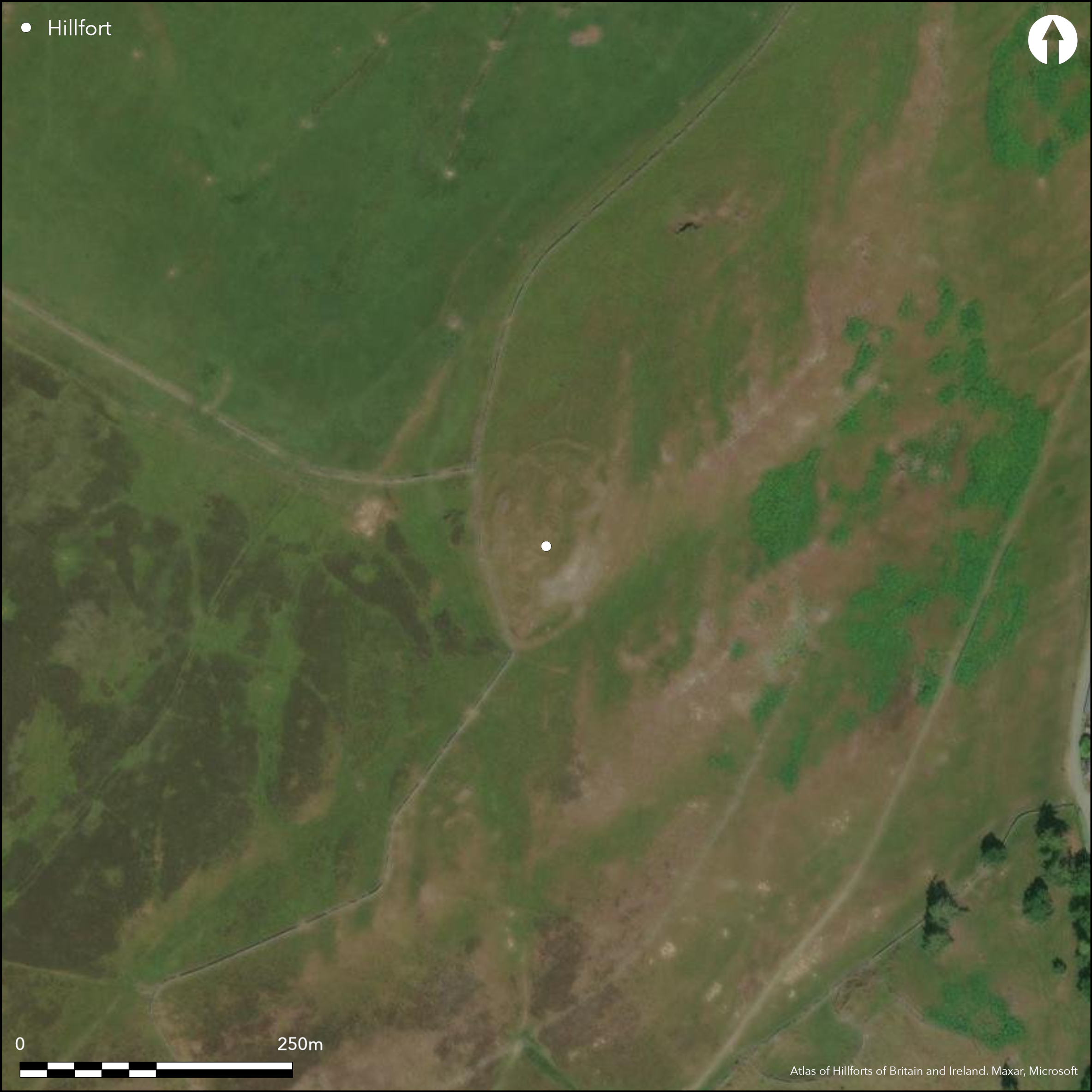
Satellite Imagery
LiDAR 1m DTM Hillshade
Satellite Imagery
Scroll left/right to view further images.
HER: Scottish Borders 51333 (None)
NMR: NT 23 NW 6 (51333)
SM: 3051
NGR: NT 2089 3731
X: 320890 Y: 637310 (OSGB36)
This fort is situated on the rocky hillock forming the summit of Woodhouse Hill, which forms the NE spur of the higher ground to the SW. The ground falls away particularly steeply to either side of the fort, on the W into a gully and on the E down into the Manor valley, despite which there is extensive evidence of post-medieval cultivation before the area was put to trees in the 19th century. The defences of the fort are evidently complex and almost certainly represent several periods of construction, the inner enclosure on the summit of the hillock representing the latest. Roughly oval on plan, this measures 61m from NNE to SSW by 30m transversely (0.15ha) within a wall reduced to a mound of rubble and contains five circular rock-cut house-platforms. The entrance is on the E, and is unusual, the N side turning deeply into the interior to terminate in a mound of rubble opposite a shallow inturn with a similar mound of rubble on the S; in doing so, the visitor's right side is exposed, particularly if approaching from the N of two gaps in the outer rampart on this side. The RCAHMS investigators drawing up a plan in 1962 suggested that the expanded mounds of rubble at the terminals might hide gate-towers, but it is more probable that the wall merely increased in height as it approached the gateway, and in any case differential preservation of the remains may also have played some part in their appearance. Partly because of later robbing and disturbance, the relationship of this inner enclosure to the second rampart, which shares its line on the NNE, is ambiguous, but the second and third ramparts may have been elements of an essentially bivallate scheme enclosing a rather larger area of about 0.27ha against a single rampart extending along the lip of the slope on the ESE. There are entrances at the junctions of the bivallate defences with this single line on both the NNE and SSE, and at both the outer rampart on the W side of the gap appears to swing inwards to unite with its neighbour and form one side of the entrance way; while at the NNE entrance this exposes the visitor's right side, at the SSE gap it is the left side. Both these entrances also give access to the entrance into the inner enclosure. An additional rampart can also be seen at the foot of the slope on the W, where all told four lines of defence can be seen, but the character of this outer work is uncertain. Northwards it peters out, only for its line to be taken up by what the RCAHMS investigators termed a marker trench, while at its S end it is conflated with a bank and ditch on a rather different and much straighter line. Recognising the awkwardness of the junction, the RCAHMS investigators suggested this S sector was perhaps an independent linear earthwork barring access from the S, but there are also a series of successive agricultural enclosures on the hillside to the W, probably largely of post-medieval date, and the investigators probably underestimated the extent of this later activity and its impact on the remains of the fort, so much so it is difficult to be confident that the supposed marker trench is associated with the defences of the fort.
Citizen Science: ✗
Reliability of Data: Confirmed
Reliability of Interpretation: Confirmed
X: -362659 Y: 7483719 (EPSG: 3857)
Longitude: -3.2578181324371784 Latitude: 55.622949399803595 (EPSG:4326)
Country: Scotland
Current County or Unitary Authority: Scottish Borders
Historic County: Peeblesshire
Current Parish/Community/Council/Townland: Manor
None
| Extant | ✓ |
| Cropmark | ✗ |
| Likely Destroyed | ✗ |
Formerly in a plantation
| Woodland | ✗ |
| Commercial Forestry Plantation | ✗ |
| Parkland | ✗ |
| Pasture (Grazing) | ✓ |
| Arable | ✗ |
| Scrub/Bracken | ✗ |
| Bare Outcrop | ✗ |
| Heather/Moorland | ✓ |
| Heath | ✗ |
| Built-up | ✗ |
| Coastal Grassland | ✗ |
| Other | ✗ |
None
| Contour Fort | ✓ |
| Partial Contour Fort | ✗ |
| Promontory Fort | ✗ |
| Hillslope Fort | ✗ |
| Level Terrain Fort | ✗ |
| Marsh Fort | ✗ |
| Multiple Enclosure Fort | ✗ |
| Hilltop | ✗ |
| Coastal Promontory | ✗ |
| Inland Promontory | ✗ |
| Valley Bottom | ✗ |
| Knoll/Hillock/Outcrop | ✓ |
| Ridge | ✗ |
| Cliff/Plateau-edge/Scarp | ✗ |
| Hillslope | ✗ |
| Lowland | ✗ |
| Spur | ✓ |
Dominant Topographic Feature: None
| North | ✗ |
| Northeast | ✗ |
| East | ✗ |
| Southeast | ✗ |
| South | ✗ |
| Southwest | ✗ |
| West | ✗ |
| Northwest | ✗ |
| Level | ✓ |
Altitude: 343.0m
N/A
In the absence of excavation, there are neither stratified artefacts nor radiocarbon dates to provide a chronology for the defences.
Reliability: D - None
| Pre 1200BC | ✗ |
| 1200BC - 800BC | ✗ |
| 800BC - 400BC | ✗ |
| 400BC - AD50 | ✗ |
| AD50 - AD400 | ✗ |
| AD400 - AD 800 | ✗ |
| Post AD800 | ✗ |
| Unknown | ✓ |
| Pre Hillfort: | None |
| Post Hillfort: | Planted with trees in the 19th century |
Photographed by RCAHMS Aerial Survey Programme 1981 and 1982
| 1st Identified Written Reference (1834): | Noted (NSA, 3, Peeblesshire, 116) |
| 1st Identified Map Depiction (1856): | Annotated Fort on the 1st edition OS 25-inch map (Peebles 1859, sheet 12.16) |
| Other (1886): | Listed as a site by David Christison (1887, 68) |
| Earthwork Survey (1962): | Plan and description (RCAHMS 1967, 154-5, no.334, fig 147; RCAHMS PBD 155/1-3) |
| Other (1971): | Scheduled |
| Other (1971): | Surveyed at 1:2500 by the OS |
At least five house platforms
None
| None | ✓ |
| Spring | ✗ |
| Stream | ✗ |
| Pool | ✗ |
| Flush | ✗ |
| Well | ✗ |
| Other | ✗ |
None
| No Known Features | ✗ |
| Round Stone Structures | ✗ |
| Rectangular Stone Structures | ✗ |
| Curvilinear Platforms | ✓ |
| Other Roundhouse Evidence | ✗ |
| Pits | ✗ |
| Quarry Hollows | ✗ |
| Other | ✗ |
None
| No Known Excavation | ✓ |
| Pits | ✗ |
| Postholes | ✗ |
| Roundhouses | ✗ |
| Rectangular Structures | ✗ |
| Roads/Tracks | ✗ |
| Quarry Hollows | ✗ |
| Other | ✗ |
| Nothing Found | ✗ |
None
| No Known Geophysics | ✓ |
| Pits | ✗ |
| Roundhouses | ✗ |
| Rectangular Structures | ✗ |
| Roads/Tracks | ✗ |
| Quarry Hollows | ✗ |
| Other | ✗ |
| Nothing Found | ✗ |
None
| No Known Finds | ✓ |
| Pottery | ✗ |
| Metal | ✗ |
| Metalworking | ✗ |
| Human Bones | ✗ |
| Animal Bones | ✗ |
| Lithics | ✗ |
| Environmental | ✗ |
| Other | ✗ |
None
| APs Not Checked | ✗ |
| None | ✗ |
| Roundhouses | ✓ |
| Rectangular Structures | ✗ |
| Pits | ✗ |
| Postholes | ✗ |
| Roads/Tracks | ✗ |
| Other | ✗ |
See main summary
| 5: | Two gaps in the inner enclosure caused by forestry operations |
| 2: | Two through the outer ramparts but only one into the inner enclosure |
Guard Chambers: ✗
Chevaux de Frise: ✗
| 1. In-turned (South east): | The terminal turn inwards asymmetrically. Oblique approach exposing right side |
| 2. Passage-way/Corridor (North east): | Ramparts return and unite on one side of the entrance way |
| 3. Passage-way/Corridor (South east): | Ramparts return and unite on one side of the entrance way |
| 3. Oblique (South east): | Oblique approach exposing left side |
Up to four ramparts, but probably representing more than one scheme of defence
| Area 1: | 0.15ha. |
| Area 2: | 0.27ha. |
| Total: | 0.27ha. |
Total Footprint Area: 0.6ha.
None
| ✓ | The inner enclosure probably overlies the second rampart on the NNE, though the junction is ambiguous |
| ✓ | None |
| NE Quadrant: | 2 |
| SE Quadrant: | 2 |
| SW Quadrant: | 4 |
| NW Quadrant: | 4 |
| Total: | 4 |
| Partial Univallate | ✗ |
| Univallate | ✗ |
| Partial Bivallate | ✓ |
| Bivallate | ✗ |
| Partial Multivallate | ✓ |
| Multivallate | ✗ |
| Unknown | ✗ |
| Partial Univallate | ✗ |
| Univallate | ✗ |
| Partial Bivallate | ✗ |
| Bivallate | ✗ |
| Partial Multivallate | ✗ |
| Multivallate | ✗ |
Grass-grown rubble. The supposed marker trench is not particularly convincing as an unfinished defence
| None | ✗ |
| Earthen Bank | ✗ |
| Stone Wall | ✗ |
| Rubble | ✓ |
| Wall-walk | ✗ |
| Evidence of Timber | ✗ |
| Vitrification | ✗ |
| Other Burning | ✗ |
| Palisade | ✗ |
| Counter Scarp Bank | ✗ |
| Berm | ✗ |
| Unfinished | ✓ |
| Other | ✗ |
None
| None | ✗ |
| Earthen Bank | ✗ |
| Stone Wall | ✗ |
| Murus Duplex | ✗ |
| Timber-framed | ✗ |
| Timber-laced | ✗ |
| Vitrification | ✗ |
| Other Burning | ✗ |
| Palisade | ✗ |
| Counter Scarp Bank | ✗ |
| Berm | ✗ |
| Unfinished | ✗ |
| No Known Excavation | ✓ |
| Other | ✗ |
| ✗ | None |
| ✗ | None |
Number of Ditches: None
| ✗ | None |
Christison, D (1887) 'The prehistoric forts of Peeblesshire'. Proc Soc Antiq Scot 21 (1886-7), 13-82
NSA (1834-1845) The new statistical account of Scotland by the ministers of the respective parishes under the superintendence of a committee of the society for the benefit of the sons and daughters of the clergy.
RCAHMS (1967) The Royal Commission on the Ancient and Historical Monuments of Scotland. Peeblesshire: an inventory of the ancient monuments, 2v. HMSO: Edinburgh
Atlas of Hillforts:
Wikidata:
This work is licensed under CC BY-SA 4.0

 and should be cited as:
Lock, Gary and Ralston, Ian. 2024. Atlas of Hillforts of Britain and Ireland. Available at: https://hillforts.arch.ox.ac.uk
Document Version 1.1