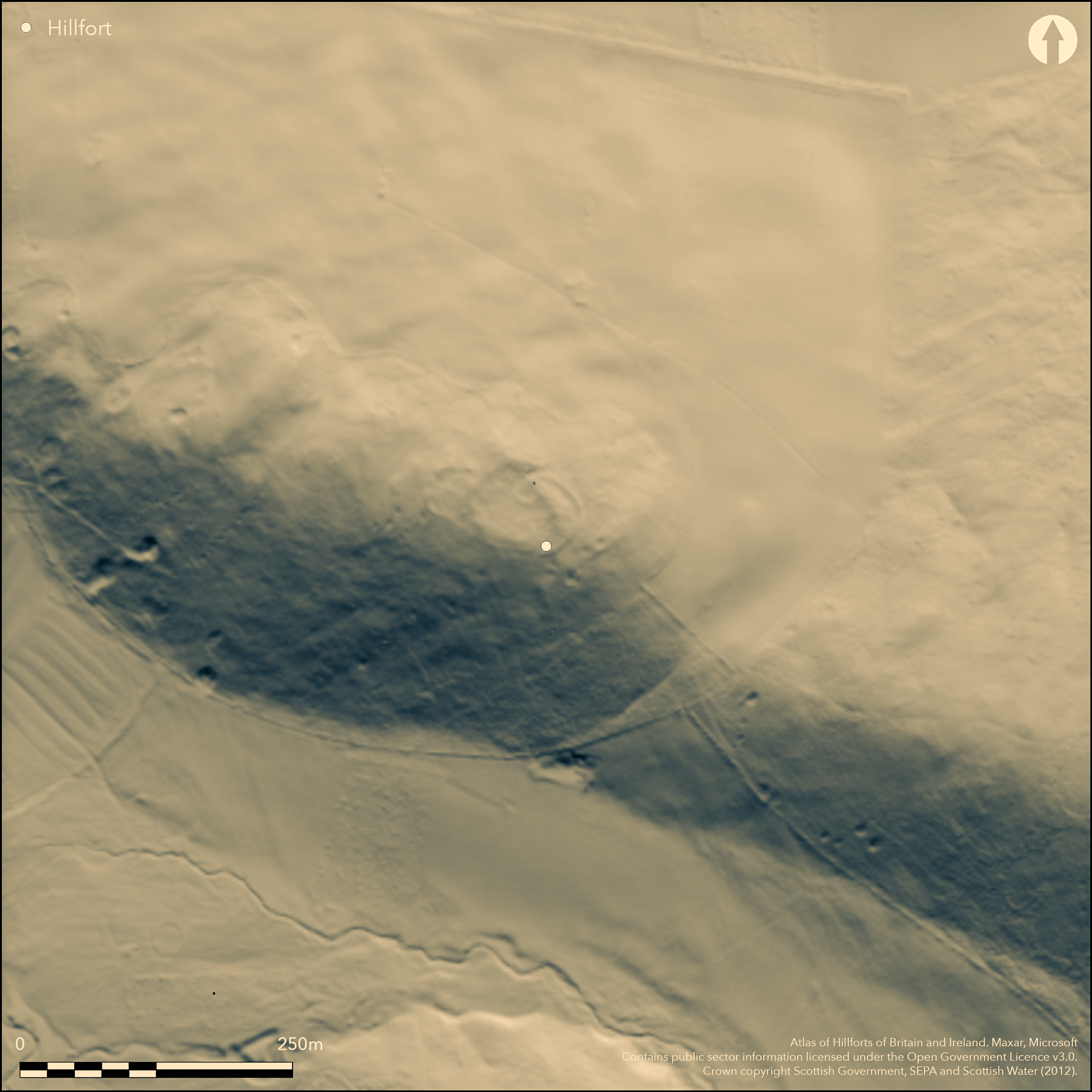
LiDAR 1m DTM Hillshade
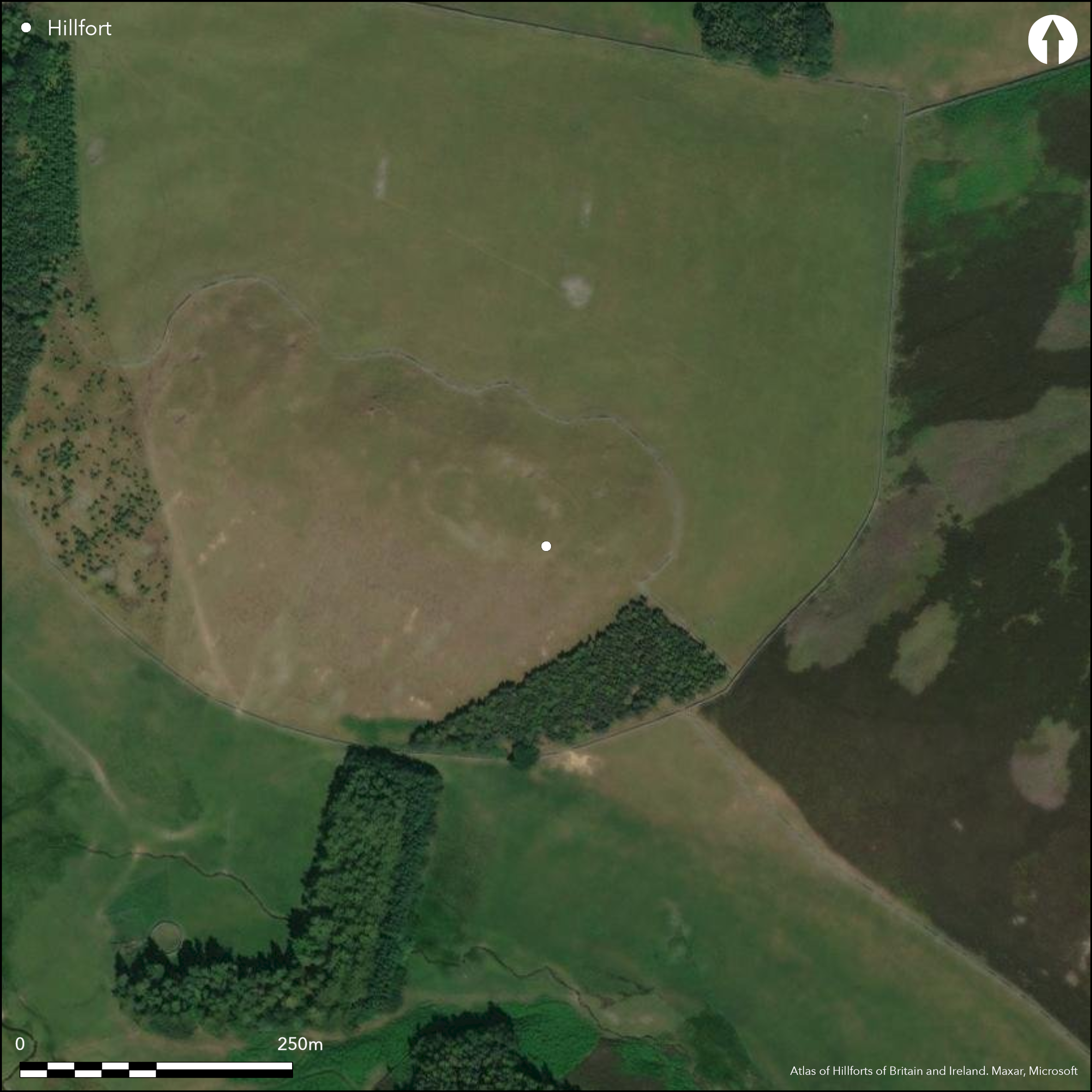
Satellite Imagery
LiDAR 1m DTM Hillshade
Satellite Imagery
Scroll left/right to view further images.
HER: Scottish Borders 51286 (None)
NMR: NT 23 NW 17 (51286)
SM: 2991
NGR: NT 2368 3606
X: 323680 Y: 636060 (OSGB36)
This fort occupies the summit of Chester Hill, which is a lower spur of Hundleshope Heights, with steep slopes falling away along the N and S flanks. The defences of the fort comprise two elements, namely an inner oval enclosure and an irregular outer enclosure, which in the interpretation of RCAHMS investigators in 1962 is the remains of the fort (RCAHMS 1967, 108-9, no.271). Be that as it may, the wall of the inner enclosure was evidently quite substantial and in places the rubble is spread some 12m in thickness; it was sectioned in 1939 by Miss P A M Keef, who found several lines of inner and outer facing within its thickness at various points around the circuit (1946). The interior, which measures 45m from ESE to WNW by 33m transversely (0.11ha), contains at least two stone-founded round-houses and possibly a third; Miss Keef excavated within the one still visible on the E side of the entrance, but also excavated trenches across what may have been the third on its W side. As planned subsequently by RCAHMS investigators, the E round-house appears to impinge on the entrance passage and may therefore be of later date. The entrance was also excavated, revealing two pairs of post-holes, but whether they belong to a single gateway structure or two separate periods of construction is unclear. Lying eccentrically to the inner rampart, and indeed possibly underlying it on the N, the irregular outer enclosure was probably a free-standing enclosure and measures internally some 75m from ESE to WNW by 45m transversely (0.24ha). Its heavily-robbed rampart, which follows the contours of the hill, is accompanied by an external ditch on the ESE, though Miss Keef's excavations indicate that it is a fairly shallow feature.
Citizen Science: ✗
Reliability of Data: Confirmed
Reliability of Interpretation: Confirmed
X: -357689 Y: 7481593 (EPSG: 3857)
Longitude: -3.213177503338113 Latitude: 55.612166331135846 (EPSG:4326)
Country: Scotland
Current County or Unitary Authority: Scottish Borders
Historic County: Peeblesshire
Current Parish/Community/Council/Townland: Manor
None
| Extant | ✓ |
| Cropmark | ✗ |
| Likely Destroyed | ✗ |
None
| Woodland | ✗ |
| Commercial Forestry Plantation | ✗ |
| Parkland | ✗ |
| Pasture (Grazing) | ✓ |
| Arable | ✗ |
| Scrub/Bracken | ✗ |
| Bare Outcrop | ✗ |
| Heather/Moorland | ✓ |
| Heath | ✗ |
| Built-up | ✗ |
| Coastal Grassland | ✗ |
| Other | ✗ |
None
| Contour Fort | ✓ |
| Partial Contour Fort | ✗ |
| Promontory Fort | ✗ |
| Hillslope Fort | ✗ |
| Level Terrain Fort | ✗ |
| Marsh Fort | ✗ |
| Multiple Enclosure Fort | ✗ |
| Hilltop | ✓ |
| Coastal Promontory | ✗ |
| Inland Promontory | ✗ |
| Valley Bottom | ✗ |
| Knoll/Hillock/Outcrop | ✗ |
| Ridge | ✗ |
| Cliff/Plateau-edge/Scarp | ✗ |
| Hillslope | ✗ |
| Lowland | ✗ |
| Spur | ✓ |
Dominant Topographic Feature: None
| North | ✗ |
| Northeast | ✗ |
| East | ✗ |
| Southeast | ✗ |
| South | ✗ |
| Southwest | ✗ |
| West | ✗ |
| Northwest | ✗ |
| Level | ✓ |
Altitude: 313.0m
N/A
There are neither stratified artefacts nor radiocarbon dates to provide a chronology for the defences.
Reliability: D - None
| Pre 1200BC | ✗ |
| 1200BC - 800BC | ✗ |
| 800BC - 400BC | ✗ |
| 400BC - AD50 | ✗ |
| AD50 - AD400 | ✗ |
| AD400 - AD 800 | ✗ |
| Post AD800 | ✗ |
| Unknown | ✓ |
| Pre Hillfort: | None |
| Post Hillfort: | Planted with trees in the 19th century |
Photographed by CUCAP in 1957, and RCAHMS Aerial Survey Programme in 1992
| 1st Identified Map Depiction (1775): | Concentric ring symbol, albeit that it looks out of position, on Mostyn Armstrong's map of The County of Peebles or Tweedale (1775) |
| Other (1834): | Noted (NSA, 3, Peeblesshire, 115-16) |
| Other (1855): | Annotated Fort on the 1st edition OS 25-inch map (Peebles 1860, sheet 17.1) |
| Other (1864): | Listed by William Chambers (1864, 29) |
| Earthwork Survey (1886): | Sketch-plan and description by David Christison (1887, 28-9, fig 11) |
| Earthwork Survey (1939): | Plan by A H A Hogg and Stuart Cruden (Keef 1946, fig 1; RCAHMS PBD 97/3) |
| Excavation (1939): | By Miss P A M Keef (1946); the trenches were dug amongst standing trees and it is difficult to interpret the results |
| Earthwork Survey (1962): | Plan and description (RCAHMS 1967, 108-9, no.271, fig 86; RCAHMS PBD 97/1-2) |
| Other (1970): | Scheduled |
| Other (1971): | Surveyed at 1:2500 by the OS |
Occupied by what was interpreted in 1962 by RCAHMS investigators as a settlement containing at least two stone-founded round-houses
None
| None | ✓ |
| Spring | ✗ |
| Stream | ✗ |
| Pool | ✗ |
| Flush | ✗ |
| Well | ✗ |
| Other | ✗ |
Settlement enclosure
| No Known Features | ✗ |
| Round Stone Structures | ✓ |
| Rectangular Stone Structures | ✗ |
| Curvilinear Platforms | ✗ |
| Other Roundhouse Evidence | ✗ |
| Pits | ✗ |
| Quarry Hollows | ✗ |
| Other | ✓ |
Walls of at least one stone-founded round-house sectioned by Keek in 1939
| No Known Excavation | ✗ |
| Pits | ✓ |
| Postholes | ✓ |
| Roundhouses | ✓ |
| Rectangular Structures | ✗ |
| Roads/Tracks | ✗ |
| Quarry Hollows | ✗ |
| Other | ✗ |
| Nothing Found | ✗ |
None
| No Known Geophysics | ✓ |
| Pits | ✗ |
| Roundhouses | ✗ |
| Rectangular Structures | ✗ |
| Roads/Tracks | ✗ |
| Quarry Hollows | ✗ |
| Other | ✗ |
| Nothing Found | ✗ |
Nothing was found in excavation, but a medieval hoard of silver coins was discovered in a vessel here before in 1819 (NSA, 3, Peeblesshire, 116)
| No Known Finds | ✗ |
| Pottery | ✗ |
| Metal | ✗ |
| Metalworking | ✗ |
| Human Bones | ✗ |
| Animal Bones | ✗ |
| Lithics | ✗ |
| Environmental | ✗ |
| Other | ✓ |
NO APPARENT FEATURES
| APs Not Checked | ✗ |
| None | ✓ |
| Roundhouses | ✗ |
| Rectangular Structures | ✗ |
| Pits | ✗ |
| Postholes | ✗ |
| Roads/Tracks | ✗ |
| Other | ✗ |
See main summary
| 1: | None |
| 2: | None |
Guard Chambers: ✗
Chevaux de Frise: ✗
| 1. Simple Gap (North east): | None |
Apparently two ramparts, but interpreted by RCAHMS investigators in 1962 as the remains of a settlement inserted into an earlier fort, but the settlement wall appears to have been quite substantial and may have been a fortification in its own right.
| Area 1: | 0.11ha. |
| Area 2: | 0.24ha. |
| Total: | 0.24ha. |
Total Footprint Area: Noneha.
None
| ✓ | In their collapsed state the inner wall possibly overlies the outer rampart on the N |
| ✓ | None |
| NE Quadrant: | 2 |
| SE Quadrant: | 2 |
| SW Quadrant: | 2 |
| NW Quadrant: | 2 |
| Total: | 2 |
| Partial Univallate | ✗ |
| Univallate | ✗ |
| Partial Bivallate | ✗ |
| Bivallate | ✓ |
| Partial Multivallate | ✗ |
| Multivallate | ✗ |
| Unknown | ✗ |
| Partial Univallate | ✗ |
| Univallate | ✓ |
| Partial Bivallate | ✗ |
| Bivallate | ✗ |
| Partial Multivallate | ✗ |
| Multivallate | ✗ |
None
| None | ✗ |
| Earthen Bank | ✓ |
| Stone Wall | ✓ |
| Rubble | ✗ |
| Wall-walk | ✗ |
| Evidence of Timber | ✗ |
| Vitrification | ✗ |
| Other Burning | ✗ |
| Palisade | ✗ |
| Counter Scarp Bank | ✗ |
| Berm | ✗ |
| Unfinished | ✗ |
| Other | ✗ |
In places the excavator was of the opinion that the inner wall displayed evidence of two sets of facings, one set behind the other.
| None | ✗ |
| Earthen Bank | ✗ |
| Stone Wall | ✓ |
| Murus Duplex | ✗ |
| Timber-framed | ✗ |
| Timber-laced | ✗ |
| Vitrification | ✗ |
| Other Burning | ✗ |
| Palisade | ✗ |
| Counter Scarp Bank | ✗ |
| Berm | ✗ |
| Unfinished | ✗ |
| No Known Excavation | ✗ |
| Other | ✗ |
| ✗ | None |
| ✓ | Accompanying the outer rampart |
Number of Ditches: 1
| ✗ | None |
Chambers, W (1864) A History of Peeblesshire. William and Robert Chambers: Edinburgh and London
Christison, D (1887) 'The prehistoric forts of Peeblesshire'. Proc Soc Antiq Scot 21 (1886-7), 13-82
Keef, P A M (1946) 'Excavations at Chester Hill Fort, Hundleshope, in Manor Parish, 1939'. Proc Soc Antiq Scot 80 (1945-6), 66-73
NSA (1834-1845) The new statistical account of Scotland by the ministers of the respective parishes under the superintendence of a committee of the society for the benefit of the sons and daughters of the clergy.
RCAHMS (1967) The Royal Commission on the Ancient and Historical Monuments of Scotland. Peeblesshire: an inventory of the ancient monuments, 2v. HMSO: Edinburgh
Atlas of Hillforts:
Wikidata:
This work is licensed under CC BY-SA 4.0

 and should be cited as:
Lock, Gary and Ralston, Ian. 2024. Atlas of Hillforts of Britain and Ireland. Available at: https://hillforts.arch.ox.ac.uk
Document Version 1.1