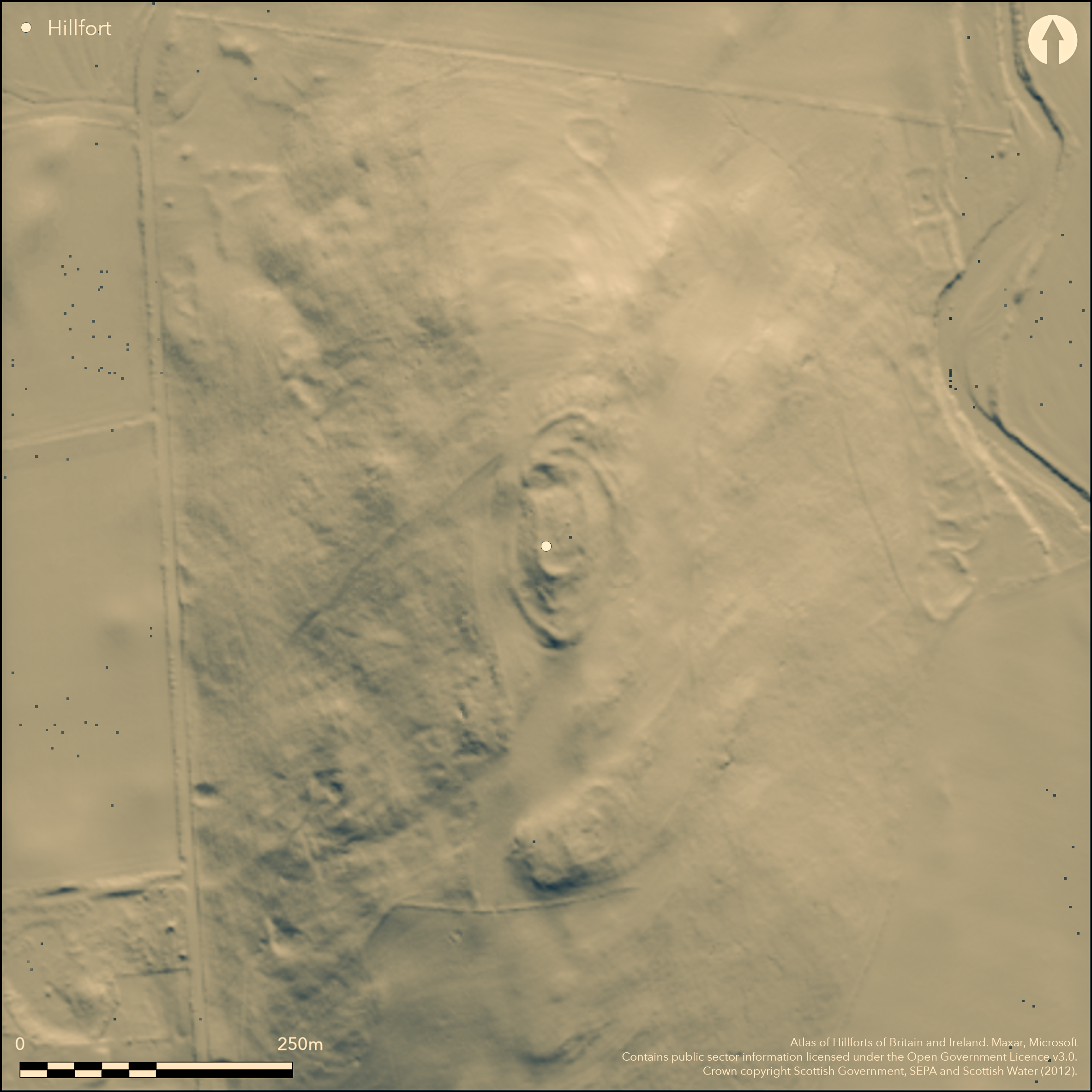
LiDAR 1m DTM Hillshade
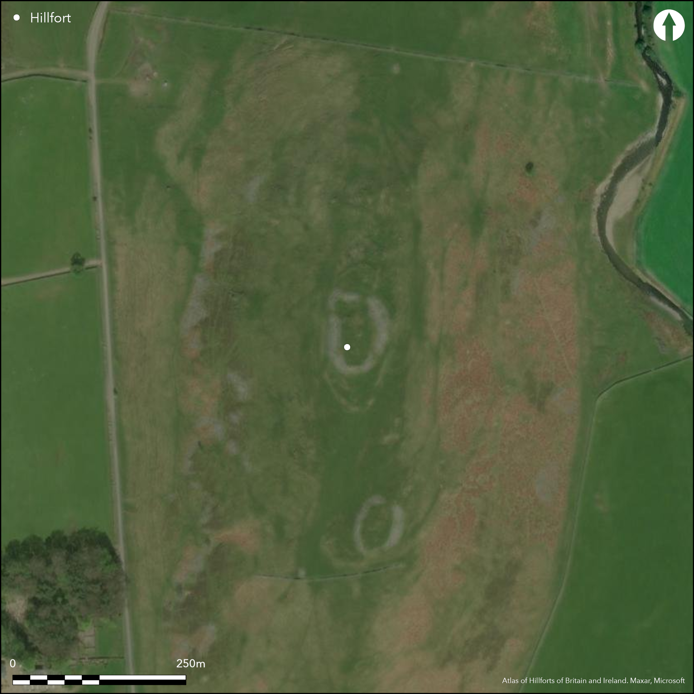
Satellite Imagery
LiDAR 1m DTM Hillshade
Satellite Imagery
Scroll left/right to view further images.
HER: Scottish Borders 51350 (None)
NMR: NT 23 SW 1 (51350)
SM: 3056
NGR: NT 2054 3341
X: 320540 Y: 633410 (OSGB36)
This fort crowns the summit of Wood Hill, which rises out of the floor of the Manor valley between Posso on the W and Glenrath on the E. The defences of the fort comprise two probably successive elements, the later a roughly oval circuit with a thick stone wall, and the earlier a less regular enclosure with up to three ramparts. The wall of the oval enclosure, which measures internally some 53m from N to S by 26m transversely (0.14ha), was thought by RCAHMS investigators in 1962 to largely overlie and mask the inner rampart of the earlier fort, though there is little evidence to demonstrate this is the case, apart from where it cuts across the earlier interior on the N. The whole of this later circuit is characterised by a massive scree of rubble in which occasional outer facing-stones are visible, extending around the flanks of the summit and dismounting only on the NW to either side of an entrance; some of the facing of a possible second entrance was noted in the rubble on the SSE. The N arc of the earlier inner rampart appears to disappear beneath the later wall on the W side of the summit, but while it may follow a similar course on the E side, the extension of its line on the plan follows a stony scarp down the slope and around the E flank, probably forming a rather larger enclosure with what the investigators believed was the second rampart at the S end. This is perhaps a more likely configuration of the earlier defences, with two roughly concentric ramparts around the N, W and S, terminating on the S at an entrance formed with the single rampart on the E. If this is correct, the interior of the fort is rather larger than has been recognised previously, measuring 80m from N to S by about 40m transversely (0.3ha). The outermost element in the defences recorded on the RCAHMS plan lies a further 10m to 20m down the slope on the N and W; projected, this would have formed a much bigger enclosure on the hilltop, but it is uncertain whether this is the remains of a rampart or perhaps no more than a later agricultural boundary on the hill. While the interior of the fort is featureless, a stony ring-bank overlies the defences on the SSW.
Citizen Science: ✗
Reliability of Data: Confirmed
Reliability of Interpretation: Confirmed
X: -363152 Y: 7476803 (EPSG: 3857)
Longitude: -3.2622488938113423 Latitude: 55.58785758205262 (EPSG:4326)
Country: Scotland
Current County or Unitary Authority: Scottish Borders
Historic County: Peeblesshire
Current Parish/Community/Council/Townland: Manor
None
| Extant | ✓ |
| Cropmark | ✗ |
| Likely Destroyed | ✗ |
None
| Woodland | ✗ |
| Commercial Forestry Plantation | ✗ |
| Parkland | ✗ |
| Pasture (Grazing) | ✓ |
| Arable | ✗ |
| Scrub/Bracken | ✗ |
| Bare Outcrop | ✗ |
| Heather/Moorland | ✓ |
| Heath | ✗ |
| Built-up | ✗ |
| Coastal Grassland | ✗ |
| Other | ✗ |
None
| Contour Fort | ✓ |
| Partial Contour Fort | ✗ |
| Promontory Fort | ✗ |
| Hillslope Fort | ✗ |
| Level Terrain Fort | ✗ |
| Marsh Fort | ✗ |
| Multiple Enclosure Fort | ✗ |
| Hilltop | ✓ |
| Coastal Promontory | ✗ |
| Inland Promontory | ✗ |
| Valley Bottom | ✗ |
| Knoll/Hillock/Outcrop | ✗ |
| Ridge | ✗ |
| Cliff/Plateau-edge/Scarp | ✗ |
| Hillslope | ✗ |
| Lowland | ✗ |
| Spur | ✗ |
Dominant Topographic Feature: None
| North | ✗ |
| Northeast | ✗ |
| East | ✗ |
| Southeast | ✗ |
| South | ✗ |
| Southwest | ✗ |
| West | ✗ |
| Northwest | ✗ |
| Level | ✓ |
Altitude: 335.0m
N/A
In the absence of excavation, there are neither stratified artefacts nor radiocarbon dates to provide a chronology for the defences.
Reliability: D - None
| Pre 1200BC | ✗ |
| 1200BC - 800BC | ✗ |
| 800BC - 400BC | ✗ |
| 400BC - AD50 | ✗ |
| AD50 - AD400 | ✗ |
| AD400 - AD 800 | ✗ |
| Post AD800 | ✗ |
| Unknown | ✓ |
| Pre Hillfort: | None |
| Post Hillfort: | None |
Photographed by RCAHMS Aerial Survey Programme in 1980 and 1982
| 1st Identified Map Depiction (1856): | Named in Gothic type on the 1st edition OS 25-inch map (Peebles 1859, sheet 16.8) |
| Earthwork Survey (1886): | Sketch-plan and description by David Christison (1887, 25-6, pl 3, fig 53) |
| Earthwork Survey (1956): | Plan (RCAHMS PBD 154/3-4) |
| Earthwork Survey (1962): | Plan and description (RCAHMS 1967, 154, no.333, fig 146;RCAHMS PBD 154/1-2) |
| Other (1971): | Scheduled |
| Other (1974): | Visited by the OS |
| Other (1981): | Visited by Ian Smith (1990, Annex A, no.27) |
Featureless
None
| None | ✓ |
| Spring | ✗ |
| Stream | ✗ |
| Pool | ✗ |
| Flush | ✗ |
| Well | ✗ |
| Other | ✗ |
None
| No Known Features | ✓ |
| Round Stone Structures | ✗ |
| Rectangular Stone Structures | ✗ |
| Curvilinear Platforms | ✗ |
| Other Roundhouse Evidence | ✗ |
| Pits | ✗ |
| Quarry Hollows | ✗ |
| Other | ✗ |
None
| No Known Excavation | ✓ |
| Pits | ✗ |
| Postholes | ✗ |
| Roundhouses | ✗ |
| Rectangular Structures | ✗ |
| Roads/Tracks | ✗ |
| Quarry Hollows | ✗ |
| Other | ✗ |
| Nothing Found | ✗ |
None
| No Known Geophysics | ✓ |
| Pits | ✗ |
| Roundhouses | ✗ |
| Rectangular Structures | ✗ |
| Roads/Tracks | ✗ |
| Quarry Hollows | ✗ |
| Other | ✗ |
| Nothing Found | ✗ |
None
| No Known Finds | ✓ |
| Pottery | ✗ |
| Metal | ✗ |
| Metalworking | ✗ |
| Human Bones | ✗ |
| Animal Bones | ✗ |
| Lithics | ✗ |
| Environmental | ✗ |
| Other | ✗ |
NO APPARENT FEATURES
| APs Not Checked | ✗ |
| None | ✓ |
| Roundhouses | ✗ |
| Rectangular Structures | ✗ |
| Pits | ✗ |
| Postholes | ✗ |
| Roads/Tracks | ✗ |
| Other | ✗ |
See main summary
| 2: | None |
| 2: | Two through the wall of the summit enclosure (1-2), and one through the earlier defences (3) |
Guard Chambers: ✗
Chevaux de Frise: ✗
| 1. Simple Gap (West): | Through inner wall |
| 2. Simple Gap (South east): | Through inner wall |
| 3. Simple Gap (South): | Through outer ramparts |
The latest phase is defended by a thick stone wall encircling the summit, while the earlier defences appear to comprise twin ramparts
| Area 1: | 0.14ha. |
| Area 2: | 0.3ha. |
| Total: | 0.3ha. |
Total Footprint Area: 0.59ha.
None
| ✗ | None |
| ✓ | Excludes the outermost scarp shown on the RCAHMS plan |
| NE Quadrant: | 3 |
| SE Quadrant: | 2 |
| SW Quadrant: | 3 |
| NW Quadrant: | 2 |
| Total: | 3 |
| Partial Univallate | ✗ |
| Univallate | ✗ |
| Partial Bivallate | ✓ |
| Bivallate | ✗ |
| Partial Multivallate | ✓ |
| Multivallate | ✗ |
| Unknown | ✗ |
| Partial Univallate | ✗ |
| Univallate | ✗ |
| Partial Bivallate | ✗ |
| Bivallate | ✗ |
| Partial Multivallate | ✗ |
| Multivallate | ✗ |
None
| None | ✗ |
| Earthen Bank | ✗ |
| Stone Wall | ✓ |
| Rubble | ✓ |
| Wall-walk | ✗ |
| Evidence of Timber | ✗ |
| Vitrification | ✗ |
| Other Burning | ✗ |
| Palisade | ✗ |
| Counter Scarp Bank | ✗ |
| Berm | ✗ |
| Unfinished | ✗ |
| Other | ✗ |
None
| None | ✗ |
| Earthen Bank | ✗ |
| Stone Wall | ✗ |
| Murus Duplex | ✗ |
| Timber-framed | ✗ |
| Timber-laced | ✗ |
| Vitrification | ✗ |
| Other Burning | ✗ |
| Palisade | ✗ |
| Counter Scarp Bank | ✗ |
| Berm | ✗ |
| Unfinished | ✗ |
| No Known Excavation | ✓ |
| Other | ✗ |
| ✗ | None |
| ✗ | None |
Number of Ditches: None
| ✗ | None |
Christison, D (1887) 'The prehistoric forts of Peeblesshire'. Proc Soc Antiq Scot 21 (1886-7), 13-82
RCAHMS (1967) The Royal Commission on the Ancient and Historical Monuments of Scotland. Peeblesshire: an inventory of the ancient monuments, 2v. HMSO: Edinburgh
Smith, I M (1990) The archaeological background to the emergent kingdoms of the Tweed basin in the early historic period. Unpublished PhD thesis submitted to the University of Durham
Atlas of Hillforts:
Wikidata:
This work is licensed under CC BY-SA 4.0

 and should be cited as:
Lock, Gary and Ralston, Ian. 2024. Atlas of Hillforts of Britain and Ireland. Available at: https://hillforts.arch.ox.ac.uk
Document Version 1.1