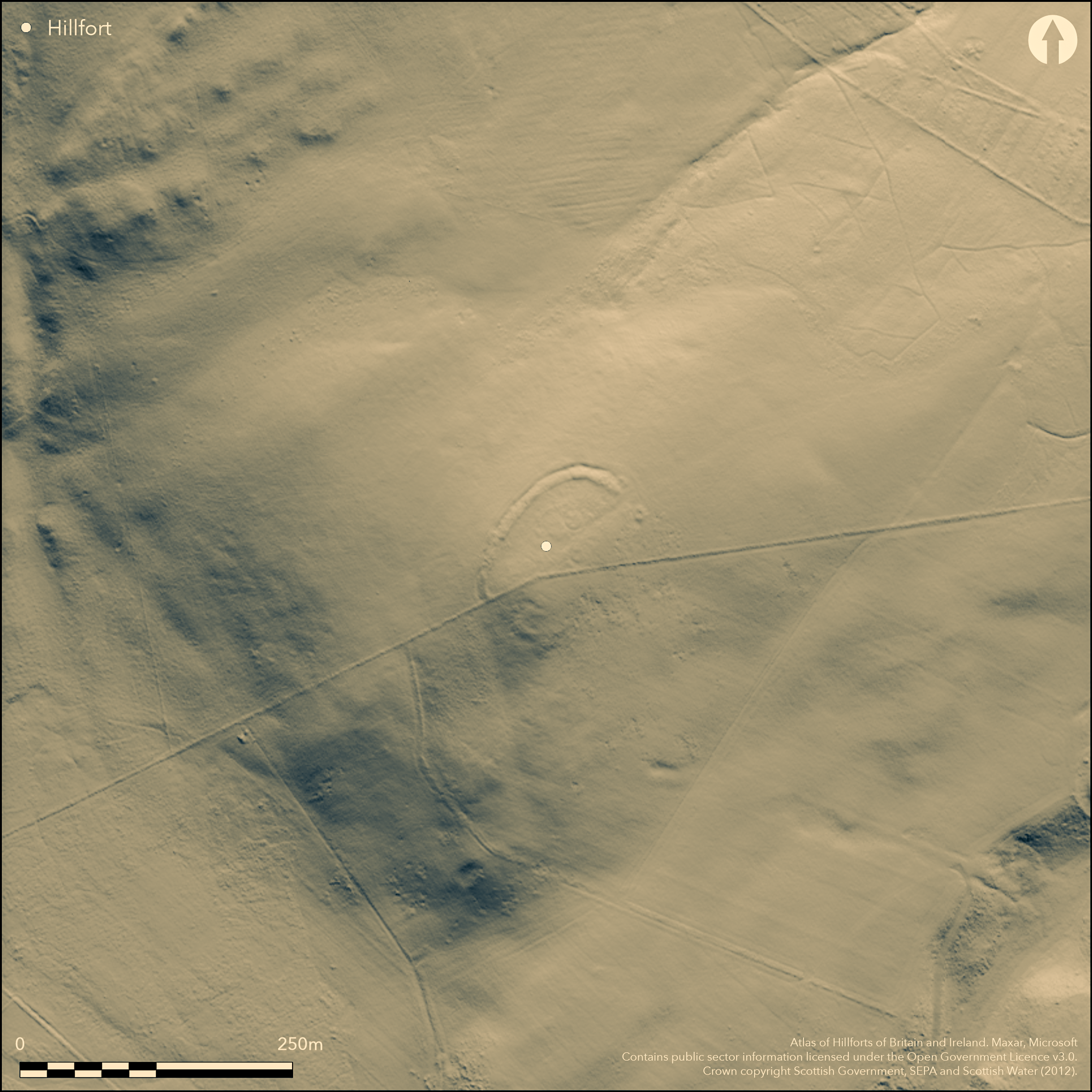
LiDAR 1m DTM Hillshade
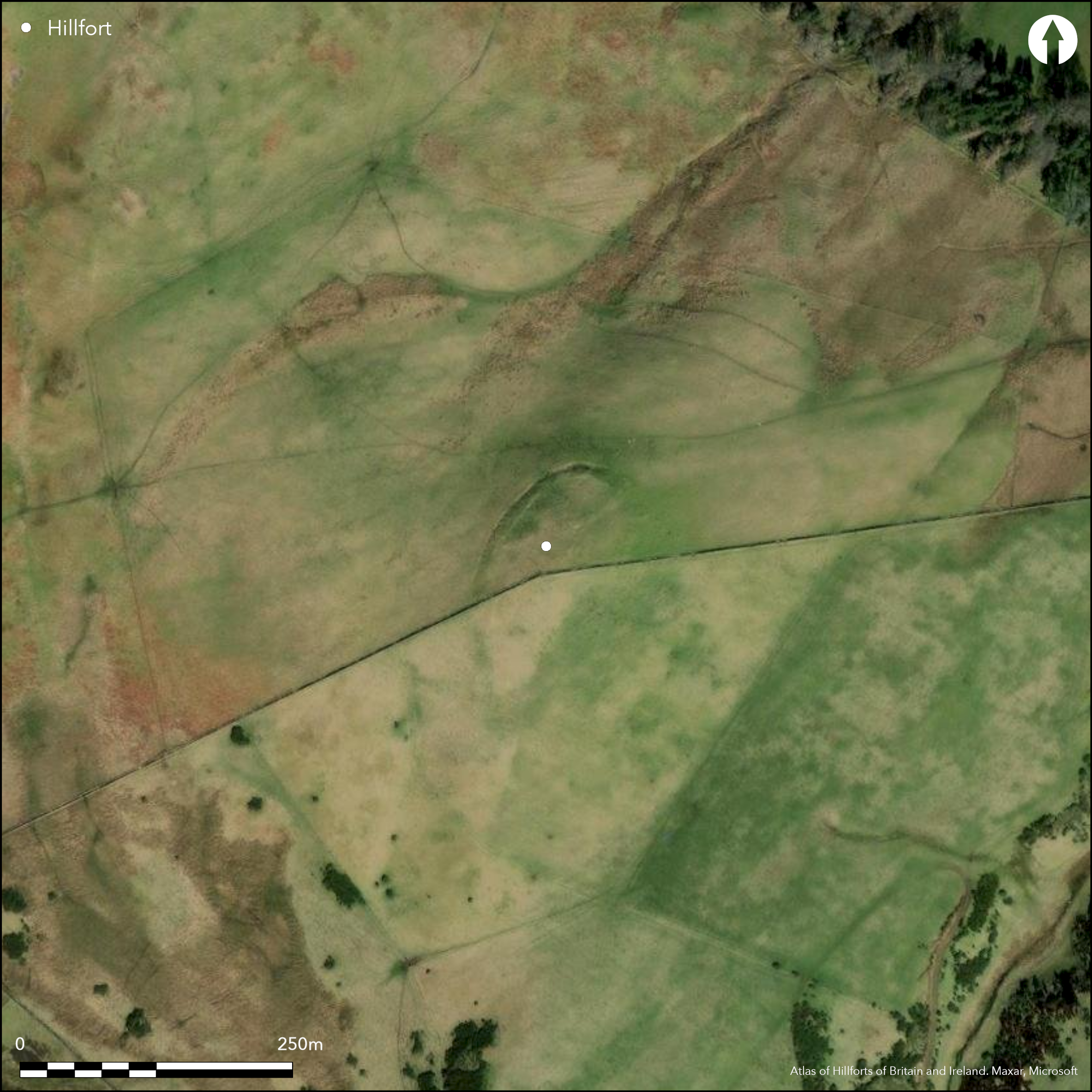
Satellite Imagery
LiDAR 1m DTM Hillshade
Satellite Imagery
Scroll left/right to view further images.
HER: Midlothian per East Lothian Council MEL8213 (None)
NMR: NT 26 SW 7 (51913)
SM: 1173
NGR: NT 2163 6218
X: 321630 Y: 662180 (OSGB36)
This fort occupies a conical minor summit forming a spur at the foot of the SE flank of Turnhouse Hill. Oval on plan, it measures 85m from NNE to SSW by 60m transversely (0.4ha) within a single rampart with an external ditch. Around the NW half of the circuit, where the rampart is better preserved, it stands 1.7m above the bottom of the ditch, but elsewhere it has been severely degraded by cultivation, to the point where it can barely be traced around the quarter to the S of the stone dyke that traverses the hill. There are entrances on the NE and SW, and traces of at least nine timber round-houses and a palisade trench within the interior. The houses include two well-defined ring-ditch houses some 13m in diameter, which are probably amongst the latest in a sequence of structures. The southern of two small platforms encircled by shallow shelves cut into the slope on the uphill side is intersected by the palisade trench, though the relationship between them is unclear, and the palisade trench itself, which ha s probably enclosed an area some 30m in diameter, has been obliterated by the construction of other round-houses houses representing at least two phases of construction on the S and E. The only other features of note are two turf-built structures overlying the terminals of the ditch either side of the NE entrance; they are probably herd's bothies of medieval or post-medieval date.
Citizen Science: ✗
Reliability of Data: Confirmed
Reliability of Interpretation: Confirmed
X: -362145 Y: 7527915 (EPSG: 3857)
Longitude: -3.2532083251487633 Latitude: 55.84647938020174 (EPSG:4326)
Country: Scotland
Current County or Unitary Authority: Midlothian
Historic County: Midlothian
Current Parish/Community/Council/Townland: Glencorse
None
| Extant | ✓ |
| Cropmark | ✗ |
| Likely Destroyed | ✓ |
None
| Woodland | ✗ |
| Commercial Forestry Plantation | ✗ |
| Parkland | ✗ |
| Pasture (Grazing) | ✓ |
| Arable | ✗ |
| Scrub/Bracken | ✗ |
| Bare Outcrop | ✗ |
| Heather/Moorland | ✓ |
| Heath | ✗ |
| Built-up | ✗ |
| Coastal Grassland | ✗ |
| Other | ✗ |
None
| Contour Fort | ✓ |
| Partial Contour Fort | ✗ |
| Promontory Fort | ✗ |
| Hillslope Fort | ✗ |
| Level Terrain Fort | ✗ |
| Marsh Fort | ✗ |
| Multiple Enclosure Fort | ✗ |
| Hilltop | ✓ |
| Coastal Promontory | ✗ |
| Inland Promontory | ✗ |
| Valley Bottom | ✗ |
| Knoll/Hillock/Outcrop | ✗ |
| Ridge | ✗ |
| Cliff/Plateau-edge/Scarp | ✗ |
| Hillslope | ✗ |
| Lowland | ✗ |
| Spur | ✓ |
Dominant Topographic Feature: None
| North | ✗ |
| Northeast | ✗ |
| East | ✗ |
| Southeast | ✗ |
| South | ✗ |
| Southwest | ✗ |
| West | ✗ |
| Northwest | ✗ |
| Level | ✓ |
Altitude: 374.0m
N/A
In the absence of excavation, there are neither stratified artefacts nor radiocarbon dates to provide a chronology for the defences.
Reliability: D - None
| Pre 1200BC | ✗ |
| 1200BC - 800BC | ✗ |
| 800BC - 400BC | ✗ |
| 400BC - AD50 | ✗ |
| AD50 - AD400 | ✗ |
| AD400 - AD 800 | ✗ |
| Post AD800 | ✗ |
| Unknown | ✓ |
| Pre Hillfort: | None |
| Post Hillfort: | The ditch terminals at the NE entrance are overlain by what are probably turf huts of medieval or later date |
Photographed by RCAHMS Aerial Survey Programme in 1980, 1981 and 1986; drone photography taken by G Geddes in 2015
| 1st Identified Map Depiction (1852): | Annotated Fort on the 1st edition OS 6-inch map (Edinburghshire 1854, sheet 12) |
| Earthwork Survey (1913): | Plan and description (RCAHMS 1929, 75, no.103, fig 98; RCAHMS MLD 51/1) |
| Other (1935): | Scheduled |
| Other (1955): | Visited during RCAHMS Survey of Marginal Lands (Feachem 1963, 136) |
| Other (1970): | Resurveyed at 1:2500 by the OS |
| Other (1975): | Visited by the OS |
| Earthwork Survey (1982): | Plan by S Halliday |
A palisaded enclosure and at least nine timber round-houses, including two well-defined ring-ditch houses some 13m in diameter, and a small platform encircled by a shallow groove.
None
| None | ✓ |
| Spring | ✗ |
| Stream | ✗ |
| Pool | ✗ |
| Flush | ✗ |
| Well | ✗ |
| Other | ✗ |
Platform within ring-groove. Ring-ditch houses
| No Known Features | ✗ |
| Round Stone Structures | ✗ |
| Rectangular Stone Structures | ✗ |
| Curvilinear Platforms | ✗ |
| Other Roundhouse Evidence | ✓ |
| Pits | ✗ |
| Quarry Hollows | ✗ |
| Other | ✗ |
None
| No Known Excavation | ✓ |
| Pits | ✗ |
| Postholes | ✗ |
| Roundhouses | ✗ |
| Rectangular Structures | ✗ |
| Roads/Tracks | ✗ |
| Quarry Hollows | ✗ |
| Other | ✗ |
| Nothing Found | ✗ |
None
| No Known Geophysics | ✓ |
| Pits | ✗ |
| Roundhouses | ✗ |
| Rectangular Structures | ✗ |
| Roads/Tracks | ✗ |
| Quarry Hollows | ✗ |
| Other | ✗ |
| Nothing Found | ✗ |
None
| No Known Finds | ✓ |
| Pottery | ✗ |
| Metal | ✗ |
| Metalworking | ✗ |
| Human Bones | ✗ |
| Animal Bones | ✗ |
| Lithics | ✗ |
| Environmental | ✗ |
| Other | ✗ |
None
| APs Not Checked | ✗ |
| None | ✗ |
| Roundhouses | ✓ |
| Rectangular Structures | ✗ |
| Pits | ✗ |
| Postholes | ✗ |
| Roads/Tracks | ✗ |
| Other | ✗ |
See main summary
| 2: | Large sectors broken down by cultivation |
| 2: | None |
Guard Chambers: ✗
Chevaux de Frise: ✗
| 1. Simple Gap (North east): | None |
| 2. Simple Gap (South west): | None |
Single rampart and ditch
| Area 1: | 0.4ha. |
| Total: | 0.4ha. |
Total Footprint Area: 0.57ha.
None
| ✗ | None |
| ✓ | None |
| NE Quadrant: | 1 |
| SE Quadrant: | 1 |
| SW Quadrant: | 1 |
| NW Quadrant: | 1 |
| Total: | 1 |
| Partial Univallate | ✗ |
| Univallate | ✓ |
| Partial Bivallate | ✗ |
| Bivallate | ✗ |
| Partial Multivallate | ✗ |
| Multivallate | ✗ |
| Unknown | ✗ |
| Partial Univallate | ✗ |
| Univallate | ✗ |
| Partial Bivallate | ✗ |
| Bivallate | ✗ |
| Partial Multivallate | ✗ |
| Multivallate | ✗ |
None
| None | ✗ |
| Earthen Bank | ✓ |
| Stone Wall | ✗ |
| Rubble | ✗ |
| Wall-walk | ✗ |
| Evidence of Timber | ✗ |
| Vitrification | ✗ |
| Other Burning | ✗ |
| Palisade | ✓ |
| Counter Scarp Bank | ✗ |
| Berm | ✗ |
| Unfinished | ✗ |
| Other | ✗ |
None
| None | ✗ |
| Earthen Bank | ✗ |
| Stone Wall | ✗ |
| Murus Duplex | ✗ |
| Timber-framed | ✗ |
| Timber-laced | ✗ |
| Vitrification | ✗ |
| Other Burning | ✗ |
| Palisade | ✗ |
| Counter Scarp Bank | ✗ |
| Berm | ✗ |
| Unfinished | ✗ |
| No Known Excavation | ✓ |
| Other | ✗ |
| ✗ | None |
| ✓ | None |
Number of Ditches: 1
| ✗ | None |
Feachem, R W (1963) A guide to prehistoric Scotland. Batsford: London
RCAHMS (1929) The Royal Commission on the Ancient and Historical Monuments and Constructions of Scotland. Tenth report with Inventory of Monuments and Constructions in the Counties of Midlothian and West Lothian. HMSO: Edinburgh
Atlas of Hillforts:
Wikidata:
This work is licensed under CC BY-SA 4.0

 and should be cited as:
Lock, Gary and Ralston, Ian. 2024. Atlas of Hillforts of Britain and Ireland. Available at: https://hillforts.arch.ox.ac.uk
Document Version 1.1