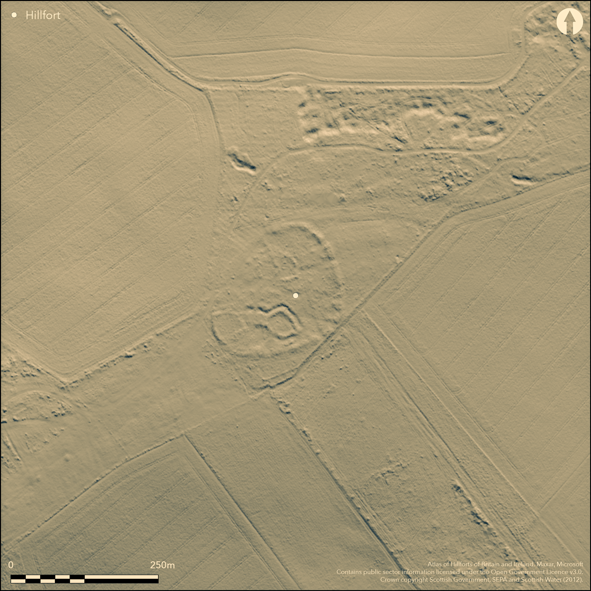
LiDAR 1m DTM Hillshade
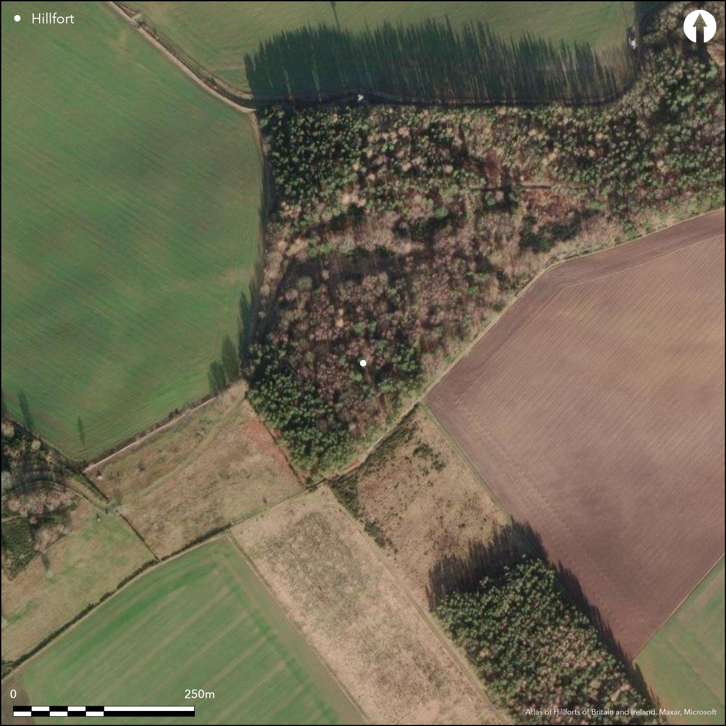
Satellite Imagery
LiDAR 1m DTM Hillshade
Satellite Imagery
Scroll left/right to view further images.
HER: Midlothian per East Lothian Council MEL8439 (None)
NMR: NT 36 SE 1 (53537)
SM: 1164
NGR: NT 3595 6380
X: 335950 Y: 663800 (OSGB36)
What is either a fort or a fortified settlement is situated on the broad summit of a hill within the shelter belts of Camp Wood. Oval on plan, it measures about 128m from NE to SW by 110m transversely (1.1ha) within a rampart up to 8.5m in thickness by 1m in height. No evidence of a ditch is visible, and several breaks in the rampart are probably relatively recent, particularly long sectors that have been levelled on the NW and SW respectively. Nevertheless, a gap on the W is probably original, though whether the inturned terminal on its S, which would have exposed the visitor's right side, forms part of its architecture or is the result of a later enclosure built into the rear of the rampart is not known. This small oval enclosure is one of a series within the interior, the most prominent of which lies in the southern half and comprises two conjoined earthworks, apparently bounded by twin banks with a medial ditch; the ditch is some 3.5m in breadth by 0.6m in depth and the inner bank stands up to 1,2m high, returning around the terminals of the ditch at an entrance on the ESE. Presumably this, the enclosure in the rear of the rampart on the W, and two small enclosures on the NW of the interior, represent a late Iron Age occupation of the fort. Minor excavations were carried out here prior to reinstatement of damage, and a section across the rampart revealed a stone foundation of flat stones beneath a rubble core capped with a clay mound (Cook 2009).
Citizen Science: ✗
Reliability of Data: Confirmed
Reliability of Interpretation: Confirmed
X: -336734 Y: 7531221 (EPSG: 3857)
Longitude: -3.024932498346881 Latitude: 55.86314920876799 (EPSG:4326)
Country: Scotland
Current County or Unitary Authority: Midlothian
Historic County: Midlothian
Current Parish/Community/Council/Townland: Newbattle
None
| Extant | ✓ |
| Cropmark | ✗ |
| Likely Destroyed | ✗ |
None
| Woodland | ✓ |
| Commercial Forestry Plantation | ✗ |
| Parkland | ✗ |
| Pasture (Grazing) | ✗ |
| Arable | ✗ |
| Scrub/Bracken | ✗ |
| Bare Outcrop | ✗ |
| Heather/Moorland | ✗ |
| Heath | ✗ |
| Built-up | ✗ |
| Coastal Grassland | ✗ |
| Other | ✗ |
None
| Contour Fort | ✓ |
| Partial Contour Fort | ✗ |
| Promontory Fort | ✗ |
| Hillslope Fort | ✗ |
| Level Terrain Fort | ✗ |
| Marsh Fort | ✗ |
| Multiple Enclosure Fort | ✗ |
| Hilltop | ✓ |
| Coastal Promontory | ✗ |
| Inland Promontory | ✗ |
| Valley Bottom | ✗ |
| Knoll/Hillock/Outcrop | ✗ |
| Ridge | ✗ |
| Cliff/Plateau-edge/Scarp | ✗ |
| Hillslope | ✗ |
| Lowland | ✗ |
| Spur | ✗ |
Dominant Topographic Feature: None
| North | ✗ |
| Northeast | ✗ |
| East | ✗ |
| Southeast | ✗ |
| South | ✗ |
| Southwest | ✗ |
| West | ✗ |
| Northwest | ✗ |
| Level | ✓ |
Altitude: 269.0m
N/A
There are neither stratified artefacts nor radiocarbon dates to provide a chronology for the defences.
Reliability: D - None
| Pre 1200BC | ✗ |
| 1200BC - 800BC | ✗ |
| 800BC - 400BC | ✗ |
| 400BC - AD50 | ✗ |
| AD50 - AD400 | ✗ |
| AD400 - AD 800 | ✗ |
| Post AD800 | ✗ |
| Unknown | ✓ |
| Pre Hillfort: | None |
| Post Hillfort: | Overlain by later enclosures and planted with conifers before the end of the 18th century |
None
| 1st Identified Map Depiction (1773): | Square symbol annotated Roman Camp on Mostyn Armstrong's Map of the three Lothians (1773) |
| 1st Identified Written Reference (1794): | Description (Stat Acct, x, 1794, 213n), by which time it had already been planted with conifers |
| Other (1853): | Annotated Roman Camp in Roman type on the 1st edition OS 6-inch map (Edinburghshire 1854, sheet 13) |
| Earthwork Survey (1913): | Plan and description (RCAHMS 1929, 147, no.187, fig 190; RCAHMS MLD 11/1) |
| Other (1924): | Scheduled |
| Other (1955): | Description for RCAHMS Survey of Marginal Lands |
| Other (1975): | Visited by the OS |
| Other (1995): | Re-Scheduled |
| Excavation (2009): | Evaluation prior to reinstatement (Cook 2009) |
Contains several small earthwork enclosures, compared by Kenneth Steer in 1955 to the small homesteads clustered aroun the fort on Whitcastle Hill Roxburghshire (Atlas No.3272)
None
| None | ✓ |
| Spring | ✗ |
| Stream | ✗ |
| Pool | ✗ |
| Flush | ✗ |
| Well | ✗ |
| Other | ✗ |
Small earthwork enclosures probably representing late Iron Age settlement
| No Known Features | ✗ |
| Round Stone Structures | ✗ |
| Rectangular Stone Structures | ✗ |
| Curvilinear Platforms | ✗ |
| Other Roundhouse Evidence | ✗ |
| Pits | ✗ |
| Quarry Hollows | ✗ |
| Other | ✓ |
None
| No Known Excavation | ✓ |
| Pits | ✗ |
| Postholes | ✗ |
| Roundhouses | ✗ |
| Rectangular Structures | ✗ |
| Roads/Tracks | ✗ |
| Quarry Hollows | ✗ |
| Other | ✗ |
| Nothing Found | ✗ |
None
| No Known Geophysics | ✓ |
| Pits | ✗ |
| Roundhouses | ✗ |
| Rectangular Structures | ✗ |
| Roads/Tracks | ✗ |
| Quarry Hollows | ✗ |
| Other | ✗ |
| Nothing Found | ✗ |
None
| No Known Finds | ✓ |
| Pottery | ✗ |
| Metal | ✗ |
| Metalworking | ✗ |
| Human Bones | ✗ |
| Animal Bones | ✗ |
| Lithics | ✗ |
| Environmental | ✗ |
| Other | ✗ |
Obscured by trees
| APs Not Checked | ✗ |
| None | ✓ |
| Roundhouses | ✗ |
| Rectangular Structures | ✗ |
| Pits | ✗ |
| Postholes | ✗ |
| Roads/Tracks | ✗ |
| Other | ✗ |
See main summary
| 5: | appear on the RCAHMS plan of 1913 |
| 2: | None |
Guard Chambers: ✗
Chevaux de Frise: ✗
| 1. Oblique (West): | Seems to have a shallow inturn on one side, exposing the right side |
Single rampart without visible ditch
| Area 1: | 1.1ha. |
| Total: | 1.1ha. |
Total Footprint Area: Noneha.
None
| ✗ | None |
| ✓ | None |
| NE Quadrant: | 1 |
| SE Quadrant: | 1 |
| SW Quadrant: | 1 |
| NW Quadrant: | 1 |
| Total: | 1 |
| Partial Univallate | ✗ |
| Univallate | ✓ |
| Partial Bivallate | ✗ |
| Bivallate | ✗ |
| Partial Multivallate | ✗ |
| Multivallate | ✗ |
| Unknown | ✗ |
| Partial Univallate | ✗ |
| Univallate | ✗ |
| Partial Bivallate | ✗ |
| Bivallate | ✗ |
| Partial Multivallate | ✗ |
| Multivallate | ✗ |
None
| None | ✗ |
| Earthen Bank | ✓ |
| Stone Wall | ✗ |
| Rubble | ✗ |
| Wall-walk | ✗ |
| Evidence of Timber | ✗ |
| Vitrification | ✗ |
| Other Burning | ✗ |
| Palisade | ✗ |
| Counter Scarp Bank | ✗ |
| Berm | ✗ |
| Unfinished | ✗ |
| Other | ✗ |
Stone foundation and core beneath the bank
| None | ✗ |
| Earthen Bank | ✓ |
| Stone Wall | ✗ |
| Murus Duplex | ✗ |
| Timber-framed | ✗ |
| Timber-laced | ✗ |
| Vitrification | ✗ |
| Other Burning | ✗ |
| Palisade | ✗ |
| Counter Scarp Bank | ✗ |
| Berm | ✗ |
| Unfinished | ✗ |
| No Known Excavation | ✗ |
| Other | ✓ |
| ✗ | None |
| ✗ | None |
Number of Ditches: None
| ✗ | None |
Cook, M (2009) 'Campwood Reinstatement, Midlothian (Newbattle parish), evaluation'. Disc Exc Scot, New ser, 10 (2009), 121
RCAHMS (1929) The Royal Commission on the Ancient and Historical Monuments and Constructions of Scotland. Tenth report with Inventory of Monuments and Constructions in the Counties of Midlothian and West Lothian. HMSO: Edinburgh
Atlas of Hillforts:
Wikidata:
This work is licensed under CC BY-SA 4.0

 and should be cited as:
Lock, Gary and Ralston, Ian. 2024. Atlas of Hillforts of Britain and Ireland. Available at: https://hillforts.arch.ox.ac.uk
Document Version 1.1