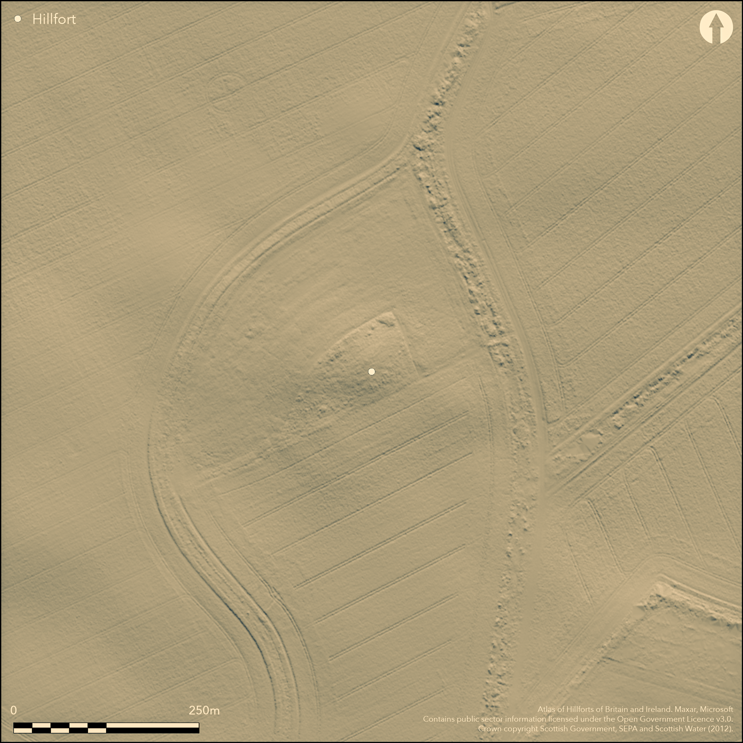
LiDAR 1m DTM Hillshade
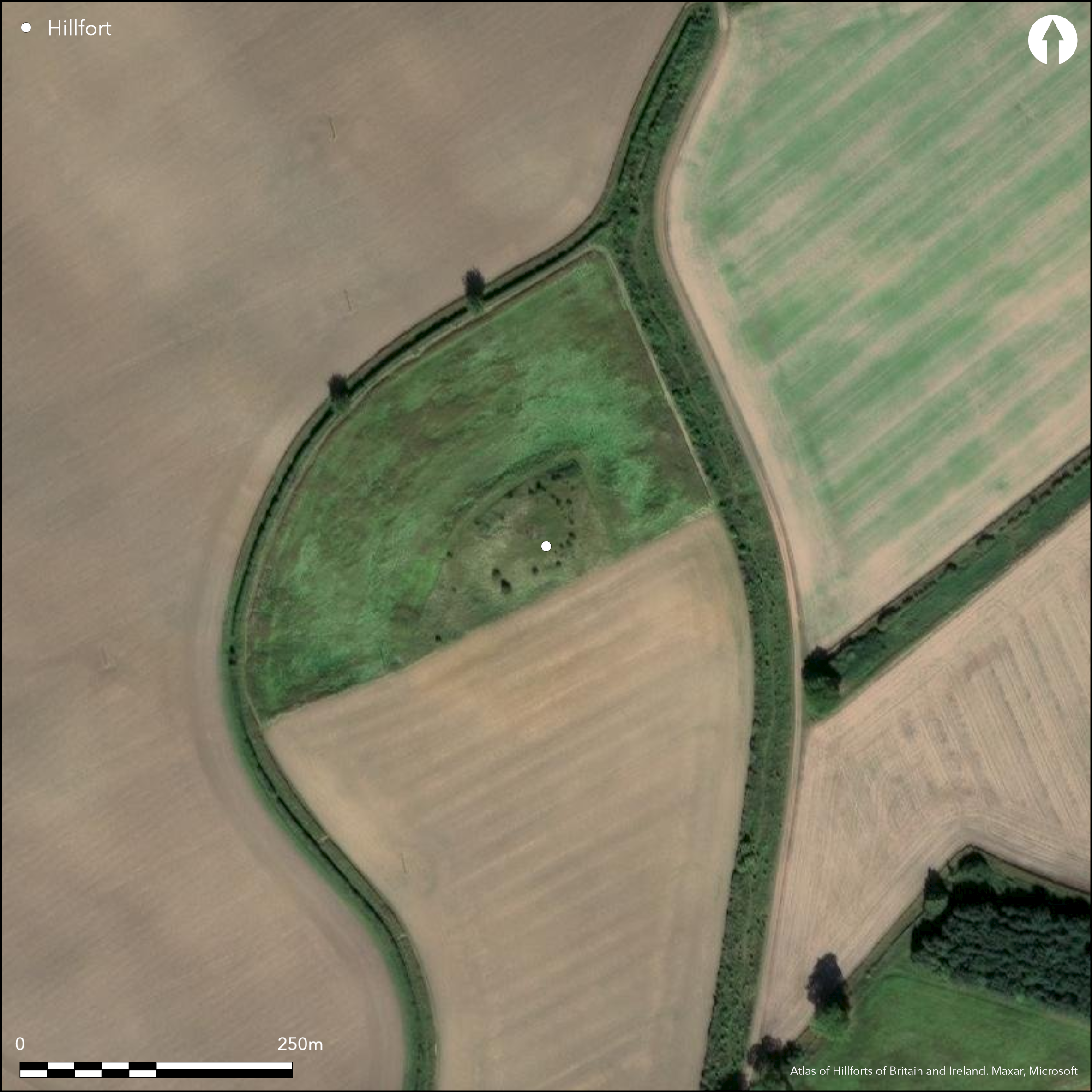
Satellite Imagery
LiDAR 1m DTM Hillshade
Satellite Imagery
Scroll left/right to view further images.
HER: East Lothian Council MEL430 (None)
NMR: NT 46 SW 1 (54795)
SM: 5754
NGR: NT 4207 6382
X: 342070 Y: 663820 (OSGB36)
The fort noted in the 18th century on Dodridge Law, the N spur of a higher ridge that extends southwards and provides the line for the old county boundary, had been largely ploughed down by the end of the 19th century and is now known only from cropmarks on aerial photographs. These reveal no fewer than four ditches, though the innermost is confused by other markings within the interior, which possibly hide other lines of enclosure. If so, the inner defences must represent at least two periods of construction, while the two outer ditches, which are not strictly concentric, swinging rather wider round the E side, are likely to represent a third, albeit that no sequence between them can be determined from the aerial photographs. With these caveats, the interior is oval and may measure in the order of 90m from E to W by 70m transversely (0.5ha). There are no clear entrances visible into the inner enclosure, though the diffuse character of the markings on the WSW and E possibly hide such features, while the wider arc of the pair of outer ditches on the E probably indicates the position of an outer entrance in this sector; in 1954 RCAHMS investigators noted an entrance on the E on an oblique photograph taken by the RAF in 1930, but it has not proved possible to review this image in the preparation of the Atlas entry. The ditches are between 5m and 6m in breadth and if all were open at one time the defences would have formed a belt in excess of 50m deep. The erosion of the defences had evidently begun by the late 18th century, and Mostyn Armstrong's Map of the three Lothians (1773), which depicts the fort with widely-spaced inner and outer defences, may indicate that middle lines had already been reduced by that date. In 1793, however, noting the robbing that had taken place by then, the minister also described three 'walls, at the distance of 15 feet from each other, built with very large stones... No information can be got about the height of the walls; but the proprietor of the lands remembers that the parts of them which he has seen, were 16 feet thick.' (Stat Acct 6, 1793, 162n); he also mentions the discovery of a Trajanic coin, a fibula and a patera within the interior.
Citizen Science: ✗
Reliability of Data: Confirmed
Reliability of Interpretation: Confirmed
X: -325851 Y: 7531410 (EPSG: 3857)
Longitude: -2.9271685818714737 Latitude: 55.8641041970601 (EPSG:4326)
Country: Scotland
Current County or Unitary Authority: East Lothian
Historic County: East Lothian
Current Parish/Community/Council/Townland: Ormiston
None
| Extant | ✗ |
| Cropmark | ✓ |
| Likely Destroyed | ✗ |
None
| Woodland | ✗ |
| Commercial Forestry Plantation | ✗ |
| Parkland | ✗ |
| Pasture (Grazing) | ✗ |
| Arable | ✓ |
| Scrub/Bracken | ✗ |
| Bare Outcrop | ✗ |
| Heather/Moorland | ✗ |
| Heath | ✗ |
| Built-up | ✗ |
| Coastal Grassland | ✗ |
| Other | ✗ |
None
| Contour Fort | ✓ |
| Partial Contour Fort | ✗ |
| Promontory Fort | ✗ |
| Hillslope Fort | ✗ |
| Level Terrain Fort | ✗ |
| Marsh Fort | ✗ |
| Multiple Enclosure Fort | ✗ |
| Hilltop | ✗ |
| Coastal Promontory | ✗ |
| Inland Promontory | ✗ |
| Valley Bottom | ✗ |
| Knoll/Hillock/Outcrop | ✗ |
| Ridge | ✗ |
| Cliff/Plateau-edge/Scarp | ✗ |
| Hillslope | ✗ |
| Lowland | ✗ |
| Spur | ✓ |
Dominant Topographic Feature: None
| North | ✗ |
| Northeast | ✗ |
| East | ✗ |
| Southeast | ✗ |
| South | ✗ |
| Southwest | ✗ |
| West | ✗ |
| Northwest | ✗ |
| Level | ✓ |
Altitude: 215.0m
N/A
While the patera, brooch and Trajanic coin found within the earthworks in the late 18th century possibly indicate a period of occupation in the Roman Iron Age, there is no reason to suppose the defences were still in use.
Reliability: D - None
| Pre 1200BC | ✗ |
| 1200BC - 800BC | ✗ |
| 800BC - 400BC | ✗ |
| 400BC - AD50 | ✗ |
| AD50 - AD400 | ✗ |
| AD400 - AD 800 | ✗ |
| Post AD800 | ✗ |
| Unknown | ✓ |
| Pre Hillfort: | None |
| Post Hillfort: | The discovery of a coin of Trajan, a brooch and a patera within the earthworks in the late 18th century. |
| Artefactual: | Coin of Trajan, a brooch and a patera |
Photographed by CUCAP in 1945 and 1965, and RCAHMS Aerial Survey Programme in 1976, 1977, 1981, 1983, 1986, 1988, 1990, 1991, 1992, 1994, 1998
| 1st Identified Map Depiction (1755): | While General William Roy does not annotate it, The Military Map of Scotland (1747-55) depicts the hill with concentric lines |
| Other (1773): | Concentric inner and outer ring symbols on Andrew and Mostyn Armstrong's Map of the three Lothians (1773) |
| 1st Identified Written Reference (1793): | Description (Stat Acct 6, 1793, 162n) |
| Other (1853): | Annotated Fort on the 1st edition OS 6-inch map (Haddingtonshire 1854, sheet 18) |
| Other (1892): | Depicted on the OS 25-inch map (Edinburghshire 1894, sheet 9.14) |
| Other (1913): | Description (RCAHMS 1924, 81-2, no.131) |
| Other (1954): | Description during RCAHMS Survey of Marginal Lands |
| Other (1975): | Visited by the OS |
| Other (1993): | Scheduled |
No clear features in a confused pattern of cropmarking that probably indicates extensive surviving deposits
None
| None | ✓ |
| Spring | ✗ |
| Stream | ✗ |
| Pool | ✗ |
| Flush | ✗ |
| Well | ✗ |
| Other | ✗ |
None
| No Known Features | ✓ |
| Round Stone Structures | ✗ |
| Rectangular Stone Structures | ✗ |
| Curvilinear Platforms | ✗ |
| Other Roundhouse Evidence | ✗ |
| Pits | ✗ |
| Quarry Hollows | ✗ |
| Other | ✗ |
None
| No Known Excavation | ✓ |
| Pits | ✗ |
| Postholes | ✗ |
| Roundhouses | ✗ |
| Rectangular Structures | ✗ |
| Roads/Tracks | ✗ |
| Quarry Hollows | ✗ |
| Other | ✗ |
| Nothing Found | ✗ |
None
| No Known Geophysics | ✓ |
| Pits | ✗ |
| Roundhouses | ✗ |
| Rectangular Structures | ✗ |
| Roads/Tracks | ✗ |
| Quarry Hollows | ✗ |
| Other | ✗ |
| Nothing Found | ✗ |
None
| No Known Finds | ✓ |
| Pottery | ✗ |
| Metal | ✗ |
| Metalworking | ✗ |
| Human Bones | ✗ |
| Animal Bones | ✗ |
| Lithics | ✗ |
| Environmental | ✗ |
| Other | ✗ |
NO APPARENT FEATURES
| APs Not Checked | ✗ |
| None | ✓ |
| Roundhouses | ✗ |
| Rectangular Structures | ✗ |
| Pits | ✗ |
| Postholes | ✗ |
| Roads/Tracks | ✗ |
| Other | ✗ |
See main summary
| 0: | None |
| 2: | No clear gaps are visible, although, as the general summary indicates, several likely locations can be suggested |
Guard Chambers: ✗
Chevaux de Frise: ✗
At least four ditches, and traces of the ramparts were identified as scarp-lines on the S when last visited by the OS in 1975. In 1793 the defences were described as three walls (Stat Acct 6, 1793, 162n)
| Area 1: | 0.5ha. |
| Total: | 0.5ha. |
Total Footprint Area: 2.7ha.
None
| ✗ | None |
| ✓ | None |
| NE Quadrant: | 4 |
| SE Quadrant: | 4 |
| SW Quadrant: | 4 |
| NW Quadrant: | 4 |
| Total: | 4 |
| Partial Univallate | ✗ |
| Univallate | ✗ |
| Partial Bivallate | ✗ |
| Bivallate | ✗ |
| Partial Multivallate | ✗ |
| Multivallate | ✓ |
| Unknown | ✗ |
| Partial Univallate | ✗ |
| Univallate | ✗ |
| Partial Bivallate | ✗ |
| Bivallate | ✗ |
| Partial Multivallate | ✗ |
| Multivallate | ✗ |
None
| None | ✗ |
| Earthen Bank | ✓ |
| Stone Wall | ✗ |
| Rubble | ✗ |
| Wall-walk | ✗ |
| Evidence of Timber | ✗ |
| Vitrification | ✗ |
| Other Burning | ✗ |
| Palisade | ✗ |
| Counter Scarp Bank | ✗ |
| Berm | ✗ |
| Unfinished | ✗ |
| Other | ✗ |
18th century demolition rather than antiquarian excavation
| None | ✗ |
| Earthen Bank | ✗ |
| Stone Wall | ✓ |
| Murus Duplex | ✗ |
| Timber-framed | ✗ |
| Timber-laced | ✗ |
| Vitrification | ✗ |
| Other Burning | ✗ |
| Palisade | ✗ |
| Counter Scarp Bank | ✗ |
| Berm | ✗ |
| Unfinished | ✗ |
| No Known Excavation | ✗ |
| Other | ✗ |
| ✗ | None |
| ✓ | None |
Number of Ditches: 4
| ✗ | None |
RCAHMS (1924) The Royal Commission on the Ancient and Historical Monuments and Constructions of Scotland. Eighth report with Inventory of Monuments and Constructions in the County of East Lothian. HMSO: Edinburgh
Stat Acct (date) Statistical Account of Scotland: Drawn up from the Communications of the Ministers of the Different Parishes (Sinclair, J ed), 1791-99
Atlas of Hillforts:
Wikidata:
This work is licensed under CC BY-SA 4.0

 and should be cited as:
Lock, Gary and Ralston, Ian. 2024. Atlas of Hillforts of Britain and Ireland. Available at: https://hillforts.arch.ox.ac.uk
Document Version 1.1