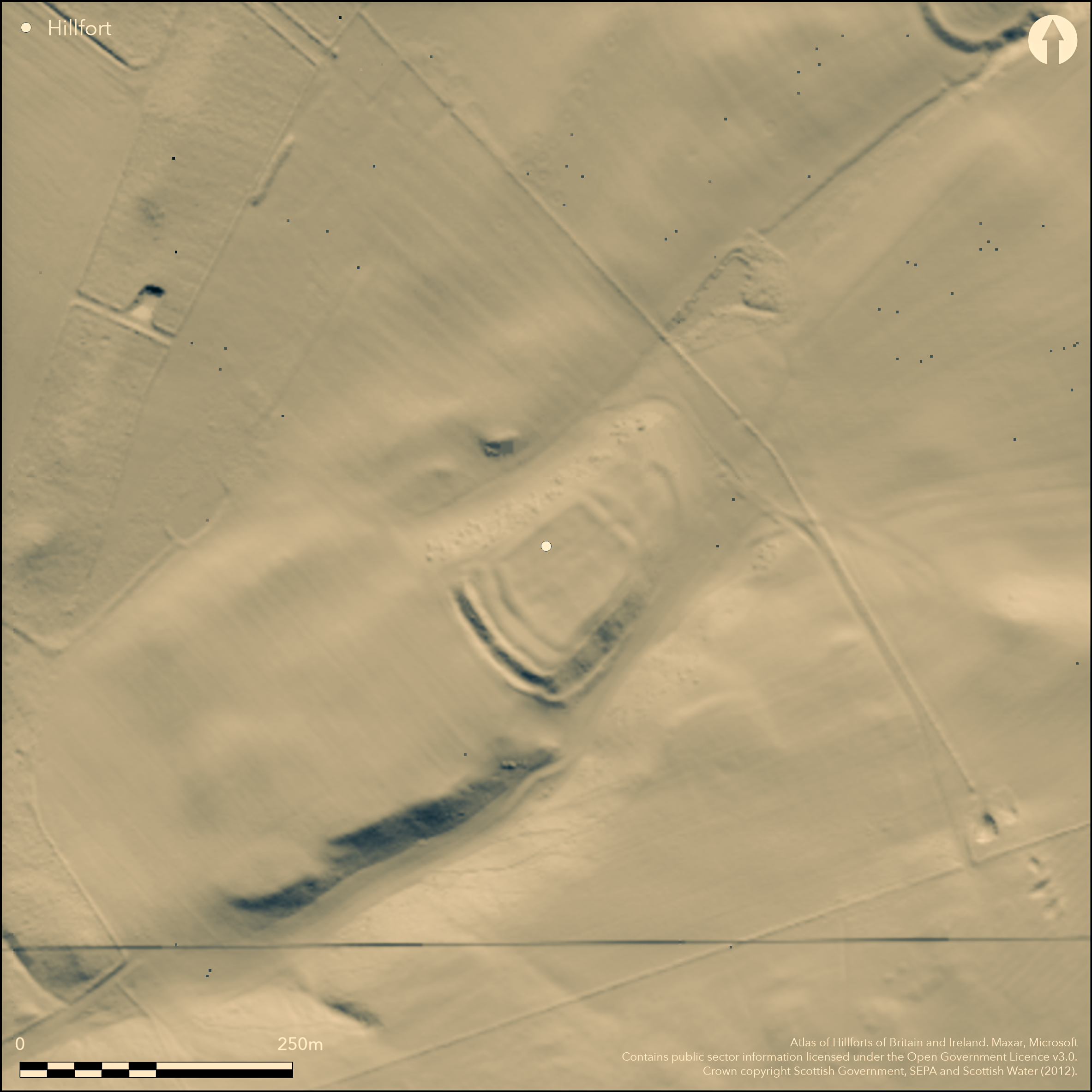
LiDAR 1m DTM Hillshade
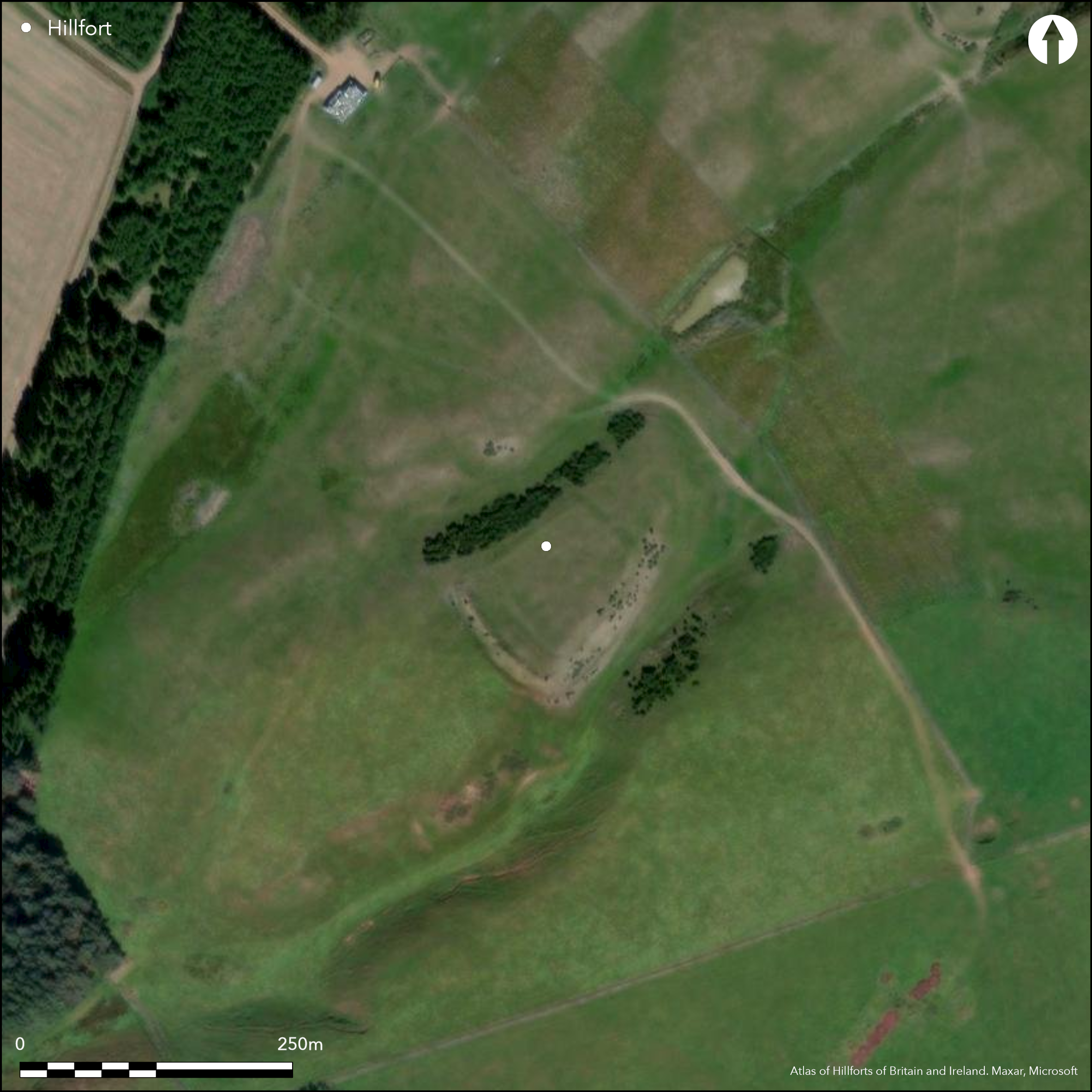
Satellite Imagery
LiDAR 1m DTM Hillshade
Satellite Imagery
Scroll left/right to view further images.
HER: East Lothian Council MEL705 (None)
NMR: NT 56 NE 5 (56104)
SM: 5795
NGR: NT 5710 6520
X: 357100 Y: 665200 (OSGB36)
This fort, which is occupied by a late Iron Age rectilinear settlement enclosure, is sited on the sloping NE end of a low ridge bounded by natural gullies dropping down NE on both the NW and SE towards the Park Burn. At first sight, the best preserved sector of the defences on the SW comprises no fewer than four ramparts with intermediate ditches, but the two inner banks, which have been heavily ploughed down, belong to the rectilinear settlement. This occupies the greater part of the interior of the fort and measures internally about 55m from NE to SW by 50m transversely; in addition to the twin banks visible on the SW, single banks extend down the margins of the ridge to where traces of two more banks with a medial ditch return across the NE end of the fort, albeit that the outer of them describes a shallow curve; this perhaps indicates the second bank here relates to a separate phase of enclosure. The defences of the underlying fort on the SW comprise the two outer ramparts and their medial ditch, which can also be traced round the SE flank to return across the NE end of the ridge, enclosing an area measuring about 105m from NE to SW by up to 55m transversely (0.52ha). At the SW end, the only sector to survive unploughed, the main rampart is up to 2m high, and in 1954 RCAHMS investigators suggested there were traces of a wall along its crest, while the ditch is some 5m broad by 1.5m in depth; both terminate short of the NW margin of the ridge, almost certainly indicating the position of an original entrance at the western extremity of the fort, while a second entrance is marked by a causeway across the ditch in the ploughed-down sector on the NW. The latter was reused for access into the rectilinear settlement, which has an entrance in the middle of its NE side; a second gap in the perimeter of the rectilinear settlement at the earlier entrance at the W corner is probably more recent. The interior is uneven but in its ploughed state no structures are visible.
Citizen Science: ✗
Reliability of Data: Confirmed
Reliability of Interpretation: Confirmed
X: -299145 Y: 7534182 (EPSG: 3857)
Longitude: -2.687260896256965 Latitude: 55.87807722294454 (EPSG:4326)
Country: Scotland
Current County or Unitary Authority: East Lothian
Historic County: East Lothian
Current Parish/Community/Council/Townland: Garvald And Bara
None
| Extant | ✓ |
| Cropmark | ✗ |
| Likely Destroyed | ✗ |
None
| Woodland | ✗ |
| Commercial Forestry Plantation | ✗ |
| Parkland | ✗ |
| Pasture (Grazing) | ✓ |
| Arable | ✗ |
| Scrub/Bracken | ✗ |
| Bare Outcrop | ✗ |
| Heather/Moorland | ✗ |
| Heath | ✗ |
| Built-up | ✗ |
| Coastal Grassland | ✗ |
| Other | ✗ |
None
| Contour Fort | ✗ |
| Partial Contour Fort | ✗ |
| Promontory Fort | ✗ |
| Hillslope Fort | ✓ |
| Level Terrain Fort | ✗ |
| Marsh Fort | ✗ |
| Multiple Enclosure Fort | ✗ |
| Hilltop | ✗ |
| Coastal Promontory | ✗ |
| Inland Promontory | ✗ |
| Valley Bottom | ✗ |
| Knoll/Hillock/Outcrop | ✗ |
| Ridge | ✗ |
| Cliff/Plateau-edge/Scarp | ✗ |
| Hillslope | ✓ |
| Lowland | ✗ |
| Spur | ✓ |
Dominant Topographic Feature: None
| North | ✗ |
| Northeast | ✓ |
| East | ✗ |
| Southeast | ✗ |
| South | ✗ |
| Southwest | ✗ |
| West | ✗ |
| Northwest | ✗ |
| Level | ✗ |
Altitude: 297.0m
N/A
In the absence of excavation, there are neither stratified artefacts nor radiocarbon dates to provide a chronology for the defences, but the overlying settlement indicates that they belong in the pre-Roman Iron Age.
Reliability: D - None
| Pre 1200BC | ✗ |
| 1200BC - 800BC | ✗ |
| 800BC - 400BC | ✗ |
| 400BC - AD50 | ✗ |
| AD50 - AD400 | ✗ |
| AD400 - AD 800 | ✗ |
| Post AD800 | ✗ |
| Unknown | ✓ |
| Pre Hillfort: | None |
| Post Hillfort: | Occupied by Late Iron Age rectilinear settlement |
Photographed by CUCAP in 1955, John Dewar in 1971 (held by RCAHMS), Mike Brookes of Historic Scotland in 1979, and RCAHMS Aerial Survey Programme in 1983, 1988, 2007, 2008 and 2010
| 1st Identified Map Depiction (1773): | Concentric ring symbol on Andrew and Mostyn Armstrong's Map of the three Lothians (1773) |
| Other (1853): | Annotated Fort on the 1st edition OS 6-inch map (Haddingtonshire 1855, sheet 15) |
| Other (1892): | Depicted on the OS 25-inch map (Haddingtonshire 1894, sheet 16.9) |
| Other (1913): | Description (RCAHMS 1924, 33-4, no.48) |
| Earthwork Survey (1954): | Plan and description during RCAHMS Survey of Marginal Lands (RCAHMS ELD 3/1; Feachem 1963, 123) |
| Other (1965): | Surveyed at 1:2500 by the OS |
| Other (1993): | Scheduled |
Featureless apart from the rectilinear settlement enclosure
None
| None | ✓ |
| Spring | ✗ |
| Stream | ✗ |
| Pool | ✗ |
| Flush | ✗ |
| Well | ✗ |
| Other | ✗ |
None
| No Known Features | ✓ |
| Round Stone Structures | ✗ |
| Rectangular Stone Structures | ✗ |
| Curvilinear Platforms | ✗ |
| Other Roundhouse Evidence | ✗ |
| Pits | ✗ |
| Quarry Hollows | ✗ |
| Other | ✗ |
None
| No Known Excavation | ✓ |
| Pits | ✗ |
| Postholes | ✗ |
| Roundhouses | ✗ |
| Rectangular Structures | ✗ |
| Roads/Tracks | ✗ |
| Quarry Hollows | ✗ |
| Other | ✗ |
| Nothing Found | ✗ |
None
| No Known Geophysics | ✓ |
| Pits | ✗ |
| Roundhouses | ✗ |
| Rectangular Structures | ✗ |
| Roads/Tracks | ✗ |
| Quarry Hollows | ✗ |
| Other | ✗ |
| Nothing Found | ✗ |
None
| No Known Finds | ✓ |
| Pottery | ✗ |
| Metal | ✗ |
| Metalworking | ✗ |
| Human Bones | ✗ |
| Animal Bones | ✗ |
| Lithics | ✗ |
| Environmental | ✗ |
| Other | ✗ |
Rectilinear settlement enclosure
| APs Not Checked | ✗ |
| None | ✗ |
| Roundhouses | ✗ |
| Rectangular Structures | ✗ |
| Pits | ✗ |
| Postholes | ✗ |
| Roads/Tracks | ✗ |
| Other | ✓ |
See main summary
| 2: | None |
| 2: | None |
Guard Chambers: ✗
Chevaux de Frise: ✗
| 1. Simple Gap (North east): | None |
| 2. Simple Gap (West): | None |
Twin ramparts with a medial ditch can be traced round three sides and may also have extended down the NW but have been obscured by cultivation and the overlying settlement
| Area 1: | 0.52ha. |
| Total: | 0.52ha. |
Total Footprint Area: 0.98ha.
None
| ✓ | Clearly overlain by the rectilinear settlement |
| ✗ | This omits the perimeter of the rectilinear settlement occupying the interior |
| NE Quadrant: | 2 |
| SE Quadrant: | 2 |
| SW Quadrant: | 2 |
| NW Quadrant: | 0 |
| Total: | 2 |
| Partial Univallate | ✗ |
| Univallate | ✗ |
| Partial Bivallate | ✓ |
| Bivallate | ✗ |
| Partial Multivallate | ✗ |
| Multivallate | ✗ |
| Unknown | ✗ |
| Partial Univallate | ✗ |
| Univallate | ✗ |
| Partial Bivallate | ✗ |
| Bivallate | ✗ |
| Partial Multivallate | ✗ |
| Multivallate | ✗ |
None
| None | ✗ |
| Earthen Bank | ✓ |
| Stone Wall | ✗ |
| Rubble | ✗ |
| Wall-walk | ✗ |
| Evidence of Timber | ✗ |
| Vitrification | ✗ |
| Other Burning | ✗ |
| Palisade | ✗ |
| Counter Scarp Bank | ✗ |
| Berm | ✗ |
| Unfinished | ✗ |
| Other | ✗ |
None
| None | ✗ |
| Earthen Bank | ✗ |
| Stone Wall | ✗ |
| Murus Duplex | ✗ |
| Timber-framed | ✗ |
| Timber-laced | ✗ |
| Vitrification | ✗ |
| Other Burning | ✗ |
| Palisade | ✗ |
| Counter Scarp Bank | ✗ |
| Berm | ✗ |
| Unfinished | ✗ |
| No Known Excavation | ✓ |
| Other | ✗ |
| ✗ | None |
| ✓ | None |
Number of Ditches: 1
| ✗ | None |
Feachem, R W (1963) A guide to prehistoric Scotland. Batsford: London
RCAHMS (1924) The Royal Commission on the Ancient and Historical Monuments and Constructions of Scotland. Eighth report with Inventory of Monuments and Constructions in the County of East Lothian. HMSO: Edinburgh
Atlas of Hillforts:
Wikidata:
This work is licensed under CC BY-SA 4.0

 and should be cited as:
Lock, Gary and Ralston, Ian. 2024. Atlas of Hillforts of Britain and Ireland. Available at: https://hillforts.arch.ox.ac.uk
Document Version 1.1