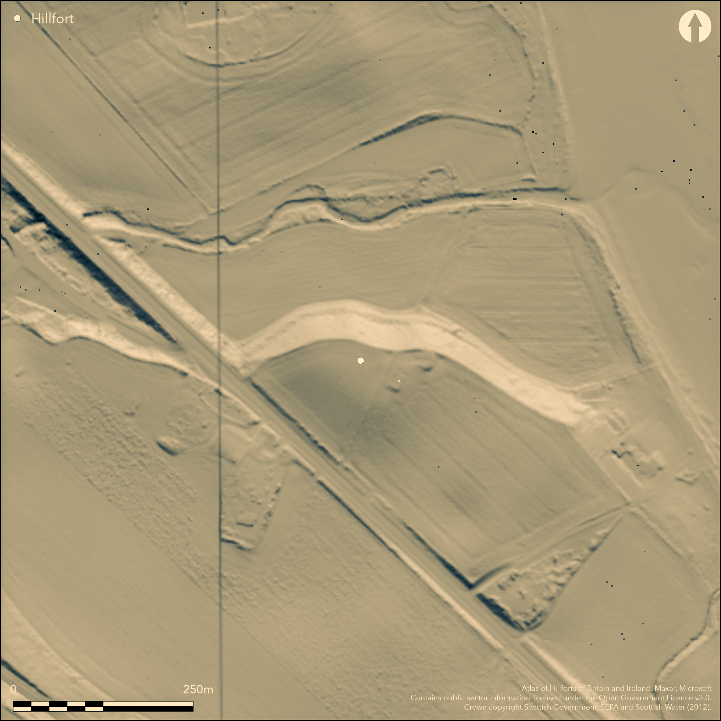
LiDAR 1m DTM Hillshade
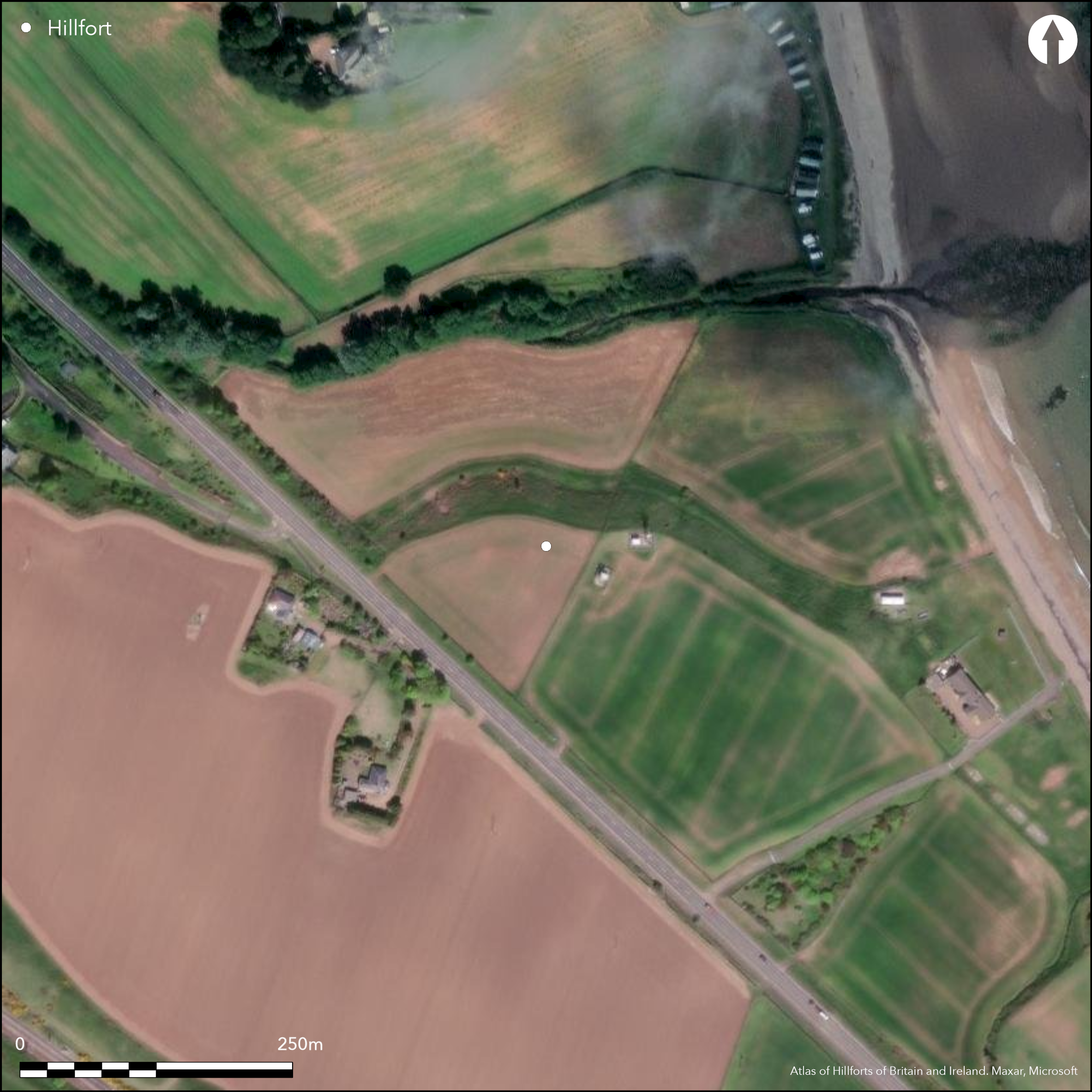
Satellite Imagery
LiDAR 1m DTM Hillshade
Satellite Imagery
Scroll left/right to view further images.
HER: East Lothian Council MEL1832 (None)
NMR: NT 77 SE 5 (58892)
SM: None
NGR: NT 7511 7409
X: 375110 Y: 674090 (OSGB36)
This fort occupies a low hillock on the NE side of the AI public road, backing onto a steep escarpment to the S of the mouth of the Thornton Burn. An irregular D-shape on plan, it measures a maximum of 125m from E to W along the sinuous lip of the escarpment by 45m transversely (0.42ha) within an asymmetric arc of two ditches up to 8m broad and 7m apart; a third ditch about 3m in breadth can be traced round the SE flank. James Hewat Craw, who first noted the cropmark from the train in 1919, recorded the inner and outer ditches at 3.6m and 2.7m in breadth respectively, but on the aerial photographs they not only appear much broader, but the mark of the inner displays several lines within its overall breadth, one along the inner lip being particularly prominent; without excavation it is unclear whether this feature simply reflects aspects of the underlying ditch fill, perhaps slumping along the inner lip, or whether the mark of the ditch has become conflated with that of another feature immediately up the slope. Nevertheless, allowing for the presence of an inner rampart commensurate with the ditches, the interior probably extended to about 0.33ha. Craw identified the marks of two hut-circles on the N side of the interior, and though these particular features have not been observed on more recent aerial photographs, there is at least one circular macula adjacent to the lip of the escarpment on the NW. The photographs also show a clearly-defined causeway across the inner ditch on the SW, but it is not clear whether there is a corresponding gap in the second ditch at this point. Conversely the second ditch, and possibly the third, terminate just short of the edge of the escarpment on the NE, implying an entrance-way approaching along its lip, but the inner ditch at this point appears to run straight out onto the slope. If these observations are correct, the defences represent several periods of construction.
Citizen Science: ✗
Reliability of Data: Confirmed
Reliability of Interpretation: Confirmed
X: -267192 Y: 7550302 (EPSG: 3857)
Longitude: -2.400228578086023 Latitude: 55.95922212624881 (EPSG:4326)
Country: Scotland
Current County or Unitary Authority: East Lothian
Historic County: East Lothian
Current Parish/Community/Council/Townland: Innerwick
None
| Extant | ✗ |
| Cropmark | ✓ |
| Likely Destroyed | ✗ |
None
| Woodland | ✗ |
| Commercial Forestry Plantation | ✗ |
| Parkland | ✗ |
| Pasture (Grazing) | ✗ |
| Arable | ✓ |
| Scrub/Bracken | ✗ |
| Bare Outcrop | ✗ |
| Heather/Moorland | ✗ |
| Heath | ✗ |
| Built-up | ✗ |
| Coastal Grassland | ✗ |
| Other | ✗ |
None
| Contour Fort | ✓ |
| Partial Contour Fort | ✗ |
| Promontory Fort | ✗ |
| Hillslope Fort | ✗ |
| Level Terrain Fort | ✗ |
| Marsh Fort | ✗ |
| Multiple Enclosure Fort | ✗ |
| Hilltop | ✗ |
| Coastal Promontory | ✗ |
| Inland Promontory | ✗ |
| Valley Bottom | ✗ |
| Knoll/Hillock/Outcrop | ✗ |
| Ridge | ✗ |
| Cliff/Plateau-edge/Scarp | ✓ |
| Hillslope | ✗ |
| Lowland | ✗ |
| Spur | ✗ |
Dominant Topographic Feature: None
| North | ✗ |
| Northeast | ✗ |
| East | ✗ |
| Southeast | ✗ |
| South | ✗ |
| Southwest | ✗ |
| West | ✗ |
| Northwest | ✗ |
| Level | ✓ |
Altitude: 22.0m
N/A
In the absence of excavation, there are neither stratified artefacts nor radiocarbon dates to provide a chronology for the defences.
Reliability: D - None
| Pre 1200BC | ✗ |
| 1200BC - 800BC | ✗ |
| 800BC - 400BC | ✗ |
| 400BC - AD50 | ✗ |
| AD50 - AD400 | ✗ |
| AD400 - AD 800 | ✗ |
| Post AD800 | ✗ |
| Unknown | ✓ |
| Pre Hillfort: | None |
| Post Hillfort: | Ploughed flat and now overlain by two radio-communication instalations |
Photographed by John Dewar in 1975 (held by RCAHMS), and by RCAHMS Aerial Survey Programme in 1978, 1979 and 1995
| Earthwork Survey (1919): | Observed as a cropmark from the train by James Hewat Craw en route to Traprain Law (Craw 1922) |
| Other (1924): | Undated description, possibly simply taken from Craw (RCAHMS 1924, 56, no.94) |
| Other (1966): | Visited by the OS |
At least one circular macula visible on the aerial photographs, probably indicating the position of a round-house, and Craw may have observed two others in 1919
None
| None | ✓ |
| Spring | ✗ |
| Stream | ✗ |
| Pool | ✗ |
| Flush | ✗ |
| Well | ✗ |
| Other | ✗ |
None
| No Known Features | ✓ |
| Round Stone Structures | ✗ |
| Rectangular Stone Structures | ✗ |
| Curvilinear Platforms | ✗ |
| Other Roundhouse Evidence | ✗ |
| Pits | ✗ |
| Quarry Hollows | ✗ |
| Other | ✗ |
None
| No Known Excavation | ✓ |
| Pits | ✗ |
| Postholes | ✗ |
| Roundhouses | ✗ |
| Rectangular Structures | ✗ |
| Roads/Tracks | ✗ |
| Quarry Hollows | ✗ |
| Other | ✗ |
| Nothing Found | ✗ |
None
| No Known Geophysics | ✓ |
| Pits | ✗ |
| Roundhouses | ✗ |
| Rectangular Structures | ✗ |
| Roads/Tracks | ✗ |
| Quarry Hollows | ✗ |
| Other | ✗ |
| Nothing Found | ✗ |
None
| No Known Finds | ✓ |
| Pottery | ✗ |
| Metal | ✗ |
| Metalworking | ✗ |
| Human Bones | ✗ |
| Animal Bones | ✗ |
| Lithics | ✗ |
| Environmental | ✗ |
| Other | ✗ |
At least one circular macula
| APs Not Checked | ✗ |
| None | ✗ |
| Roundhouses | ✓ |
| Rectangular Structures | ✗ |
| Pits | ✗ |
| Postholes | ✗ |
| Roads/Tracks | ✗ |
| Other | ✗ |
See main summary
| 2: | Ploughed flat |
| 2: | None |
Guard Chambers: ✗
Chevaux de Frise: ✗
| 1. Simple Gap (East): | Apparently a terminal to the 2nd ditch adjacent the scarp edge |
| 1. Blocked (East): | Entrance 1 is apparently blocked by the inner ditch |
| 2. Simple Gap (South west): | Clear causeway across the inner ditch |
| 2. Blocked (South west): | The second ditch possibly blocks the gap in the inner, but the cropmarks are too diffuse in this sector to be certain |
Asymmetric arc of two ditches, presumably with upcast ramparts, backing onto the edge of an escarpment and with a third ditch on one flank.
| Area 1: | 0.33ha. |
| Total: | 0.33ha. |
Total Footprint Area: 0.7ha.
None
| ✓ | The observation of the apparent lack of corresponding gaps in the inner ditch on the E opposite a causeway in the 2nd ditch implies sequential construction of the defences; the observations of the SW entrance are less secure, and the terminals of the second ditch are perhaps hidden in the natural cropmarking. |
| ✗ | None |
| NE Quadrant: | 0 |
| SE Quadrant: | 3 |
| SW Quadrant: | 2 |
| NW Quadrant: | 0 |
| Total: | 3 |
| Partial Univallate | ✗ |
| Univallate | ✗ |
| Partial Bivallate | ✓ |
| Bivallate | ✗ |
| Partial Multivallate | ✓ |
| Multivallate | ✗ |
| Unknown | ✗ |
| Partial Univallate | ✗ |
| Univallate | ✗ |
| Partial Bivallate | ✗ |
| Bivallate | ✗ |
| Partial Multivallate | ✗ |
| Multivallate | ✗ |
None
| None | ✓ |
| Earthen Bank | ✗ |
| Stone Wall | ✗ |
| Rubble | ✗ |
| Wall-walk | ✗ |
| Evidence of Timber | ✗ |
| Vitrification | ✗ |
| Other Burning | ✗ |
| Palisade | ✗ |
| Counter Scarp Bank | ✗ |
| Berm | ✗ |
| Unfinished | ✗ |
| Other | ✗ |
None
| None | ✗ |
| Earthen Bank | ✗ |
| Stone Wall | ✗ |
| Murus Duplex | ✗ |
| Timber-framed | ✗ |
| Timber-laced | ✗ |
| Vitrification | ✗ |
| Other Burning | ✗ |
| Palisade | ✗ |
| Counter Scarp Bank | ✗ |
| Berm | ✗ |
| Unfinished | ✗ |
| No Known Excavation | ✓ |
| Other | ✗ |
| ✗ | None |
| ✓ | None |
Number of Ditches: 3
| ✗ | None |
Craw, J H (1922) 'Traces of an early fort at Thornton-Loch, East Lothian'. Hist Berwickshire Natur Club 24 (1919-22), 106
RCAHMS (1924) The Royal Commission on the Ancient and Historical Monuments and Constructions of Scotland. Eighth report with Inventory of Monuments and Constructions in the County of East Lothian. HMSO: Edinburgh
Atlas of Hillforts:
Wikidata:
This work is licensed under CC BY-SA 4.0

 and should be cited as:
Lock, Gary and Ralston, Ian. 2024. Atlas of Hillforts of Britain and Ireland. Available at: https://hillforts.arch.ox.ac.uk
Document Version 1.1