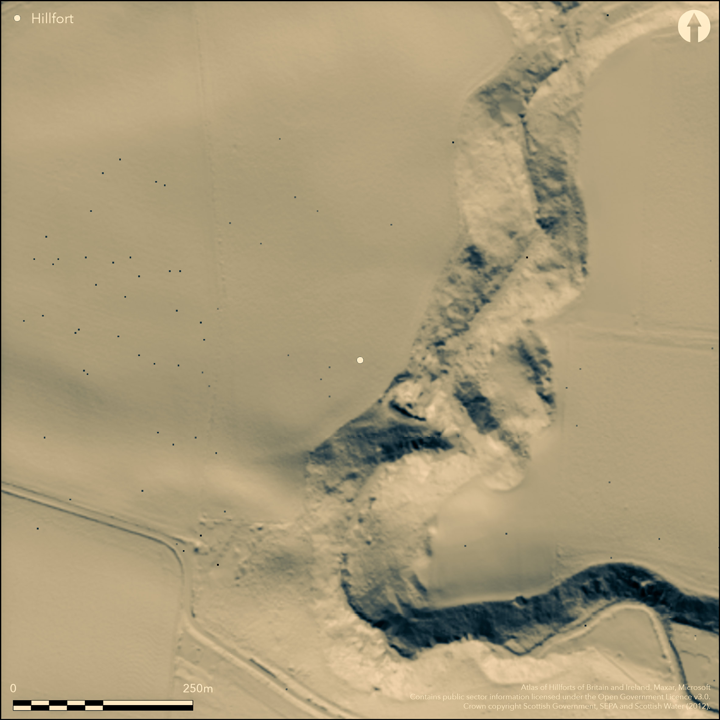
LiDAR 1m DTM Hillshade
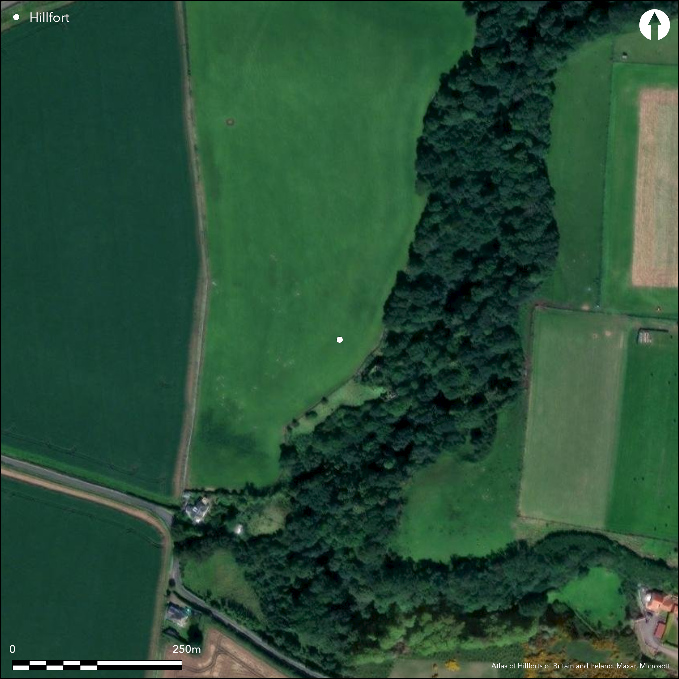
Satellite Imagery
LiDAR 1m DTM Hillshade
Satellite Imagery
Scroll left/right to view further images.
HER: East Lothian Council MEL1854 (None)
NMR: NT 77 SW 20 (58923)
SM: 5771
NGR: NT 7347 7372
X: 373476 Y: 673729 (OSGB36)
Cropmarks have revealed that the rocky promontory occupied by Innerwick Castle, which juts out ESE into a meander of the Thornton Burn, formed the focus for a semicircular arc of defences barring access from the N and W quarters. No fewr than five ditches are visible on the aerial photographs, and though none is particularly well-defined, they measure between 2m and 6m in breadth and form a belt apparently some 40m deep. The variation in the breadth of the ditches, in which the innermost is the narrowest and the outermost is the broadest, the other three averaging about 4m in breadth, may indicate that they are not an unitary scheme, but represent several periods of construction. Indeed, photographs taken in 1988 hint that on the NNW the outermost ditch is a conflation of two features which are otherwise lost in the diffuse markings recorded in other years. Be that as it may, the arc of the relatively narrow innermost ditch encloses an area measuring just short of 100m from NE to SW along the edge of the escarpment dropping down to the Thornton Burn, by 60m transversely from the lip of the massive rock-cut ditch cutting across the promontory in front of the stone castle, an area of about 0.42ha; including the castle, the interior increases to about 0.48ha. No entrance causeways are visible crossing the ditch system, but the outer ditches cut in more tightly as they approach the edge of the field on the SW, halving the overall breadth of the ditch-system and probably indicating the position of an entrance way approaching along the lip of the escarpment; a similar feature may occur on the NE, but the cropmarks are even more diffuse here. Apart from the castle, the only features visible within the interior are several narrow ditches on the NE. The castle was probably built no earlier than the beginning of the 15th century and there is no particular reason to believe that these ploughed out defences are part of a medieval fortification rather than an earlier fort.
Citizen Science: ✗
Reliability of Data: Confirmed
Reliability of Interpretation: Confirmed
X: -270102 Y: 7549640 (EPSG: 3857)
Longitude: -2.4263638395686944 Latitude: 55.95589089999534 (EPSG:4326)
Country: Scotland
Current County or Unitary Authority: East Lothian
Historic County: East Lothian
Current Parish/Community/Council/Townland: Innerwick
None
| Extant | ✗ |
| Cropmark | ✓ |
| Likely Destroyed | ✗ |
None
| Woodland | ✓ |
| Commercial Forestry Plantation | ✗ |
| Parkland | ✗ |
| Pasture (Grazing) | ✗ |
| Arable | ✓ |
| Scrub/Bracken | ✓ |
| Bare Outcrop | ✗ |
| Heather/Moorland | ✗ |
| Heath | ✗ |
| Built-up | ✓ |
| Coastal Grassland | ✗ |
| Other | ✗ |
None
| Contour Fort | ✗ |
| Partial Contour Fort | ✗ |
| Promontory Fort | ✓ |
| Hillslope Fort | ✗ |
| Level Terrain Fort | ✗ |
| Marsh Fort | ✗ |
| Multiple Enclosure Fort | ✗ |
| Hilltop | ✗ |
| Coastal Promontory | ✗ |
| Inland Promontory | ✓ |
| Valley Bottom | ✗ |
| Knoll/Hillock/Outcrop | ✗ |
| Ridge | ✗ |
| Cliff/Plateau-edge/Scarp | ✗ |
| Hillslope | ✗ |
| Lowland | ✗ |
| Spur | ✗ |
Dominant Topographic Feature: None
| North | ✗ |
| Northeast | ✗ |
| East | ✗ |
| Southeast | ✗ |
| South | ✗ |
| Southwest | ✗ |
| West | ✗ |
| Northwest | ✗ |
| Level | ✓ |
Altitude: 65.0m
N/A
In the absence of excavation, there are neither stratified artefacts nor radiocarbon dates to provide a chronology for the fort defences.
Reliability: D - None
| Pre 1200BC | ✗ |
| 1200BC - 800BC | ✗ |
| 800BC - 400BC | ✗ |
| 400BC - AD50 | ✗ |
| AD50 - AD400 | ✗ |
| AD400 - AD 800 | ✗ |
| Post AD800 | ✗ |
| Unknown | ✓ |
| Pre Hillfort: | None |
| Post Hillfort: | Part of the interior is occupied from at least the beginning of the 15th century by a castle (See RCAHMS 1924, 53-4, no.87); the defences of the fort have also been ploughed flat |
The ruins of the castle have been long recorded (see RCAHMS Canmore 58912; Grose 1789-91, i, 91-2; MacGibbon and Ross 1887-92, iii, 325-8; RCAHMS 1924, 53-6, no.87) and were Scheduled in 1936 (SM773). Photographed by CUCAP in 1964, 1967 and 1971, and by RCAHMS Aerial Survey Programme in 1978, 1980, 1988 and 1990
| 1st Identified Written Reference (1964): | Cropmarks of the fort defences first photographed by CUCAP |
| Other (1993): | Scheduled |
Lengths of two narrow ditches on the NE, but it is unclear what their date and purpose may have been
None
| None | ✓ |
| Spring | ✗ |
| Stream | ✗ |
| Pool | ✗ |
| Flush | ✗ |
| Well | ✗ |
| Other | ✗ |
None
| No Known Features | ✓ |
| Round Stone Structures | ✗ |
| Rectangular Stone Structures | ✗ |
| Curvilinear Platforms | ✗ |
| Other Roundhouse Evidence | ✗ |
| Pits | ✗ |
| Quarry Hollows | ✗ |
| Other | ✗ |
None
| No Known Excavation | ✓ |
| Pits | ✗ |
| Postholes | ✗ |
| Roundhouses | ✗ |
| Rectangular Structures | ✗ |
| Roads/Tracks | ✗ |
| Quarry Hollows | ✗ |
| Other | ✗ |
| Nothing Found | ✗ |
None
| No Known Geophysics | ✓ |
| Pits | ✗ |
| Roundhouses | ✗ |
| Rectangular Structures | ✗ |
| Roads/Tracks | ✗ |
| Quarry Hollows | ✗ |
| Other | ✗ |
| Nothing Found | ✗ |
None
| No Known Finds | ✓ |
| Pottery | ✗ |
| Metal | ✗ |
| Metalworking | ✗ |
| Human Bones | ✗ |
| Animal Bones | ✗ |
| Lithics | ✗ |
| Environmental | ✗ |
| Other | ✗ |
Two lengths of narrow ditch
| APs Not Checked | ✗ |
| None | ✗ |
| Roundhouses | ✗ |
| Rectangular Structures | ✗ |
| Pits | ✗ |
| Postholes | ✗ |
| Roads/Tracks | ✗ |
| Other | ✓ |
See main summary
| 1: | The whole circuit is ploughed flat |
| 2: | None |
Guard Chambers: ✗
Chevaux de Frise: ✗
| 1. Simple Gap (South west): | between the ditch system and the lip of the escarpment |
At least five ditches, presumably with upcast ramparts, backing onto an escarpment
| Area 1: | 0.48ha. |
| Total: | 0.48ha. |
Total Footprint Area: Noneha.
None
| ✗ | None |
| ✗ | None |
| NE Quadrant: | 5 |
| SE Quadrant: | 0 |
| SW Quadrant: | 5 |
| NW Quadrant: | 5 |
| Total: | 5 |
| Partial Univallate | ✗ |
| Univallate | ✗ |
| Partial Bivallate | ✗ |
| Bivallate | ✗ |
| Partial Multivallate | ✓ |
| Multivallate | ✗ |
| Unknown | ✗ |
| Partial Univallate | ✗ |
| Univallate | ✗ |
| Partial Bivallate | ✗ |
| Bivallate | ✗ |
| Partial Multivallate | ✗ |
| Multivallate | ✗ |
None
| None | ✓ |
| Earthen Bank | ✗ |
| Stone Wall | ✗ |
| Rubble | ✗ |
| Wall-walk | ✗ |
| Evidence of Timber | ✗ |
| Vitrification | ✗ |
| Other Burning | ✗ |
| Palisade | ✗ |
| Counter Scarp Bank | ✗ |
| Berm | ✗ |
| Unfinished | ✗ |
| Other | ✗ |
None
| None | ✗ |
| Earthen Bank | ✗ |
| Stone Wall | ✗ |
| Murus Duplex | ✗ |
| Timber-framed | ✗ |
| Timber-laced | ✗ |
| Vitrification | ✗ |
| Other Burning | ✗ |
| Palisade | ✗ |
| Counter Scarp Bank | ✗ |
| Berm | ✗ |
| Unfinished | ✗ |
| No Known Excavation | ✓ |
| Other | ✗ |
| ✗ | None |
| ✓ | None |
Number of Ditches: 5
| ✗ | None |
Grose, F (1789-91) The antiquities of Scotland (2v). London
MacGibbon, D and Ross, T (1887-92) The castellated and domestic architecture of Scotland from the twelfth to the eighteenth centuries (5v). Edinburgh
RCAHMS (1924) The Royal Commission on the Ancient and Historical Monuments and Constructions of Scotland. Eighth report with Inventory of Monuments and Constructions in the County of East Lothian. HMSO: Edinburgh
Atlas of Hillforts:
Wikidata:
This work is licensed under CC BY-SA 4.0

 and should be cited as:
Lock, Gary and Ralston, Ian. 2024. Atlas of Hillforts of Britain and Ireland. Available at: https://hillforts.arch.ox.ac.uk
Document Version 1.1