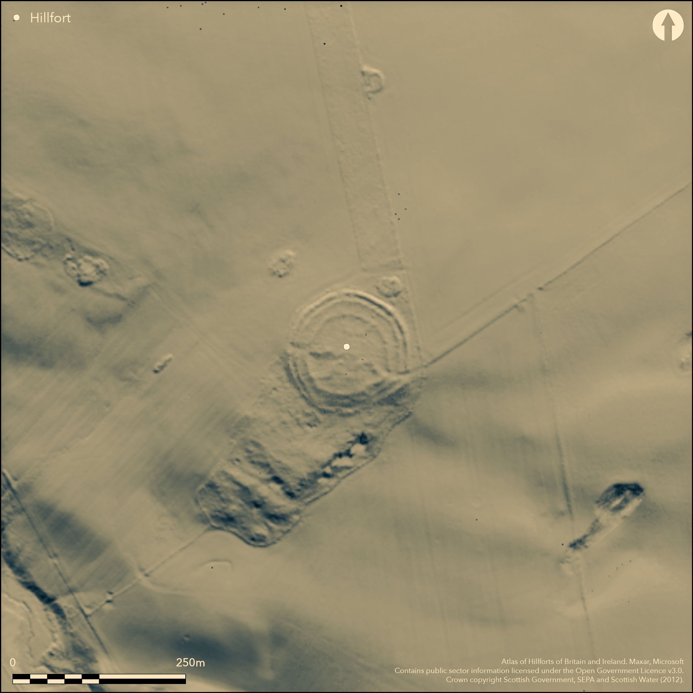
LiDAR 1m DTM Hillshade
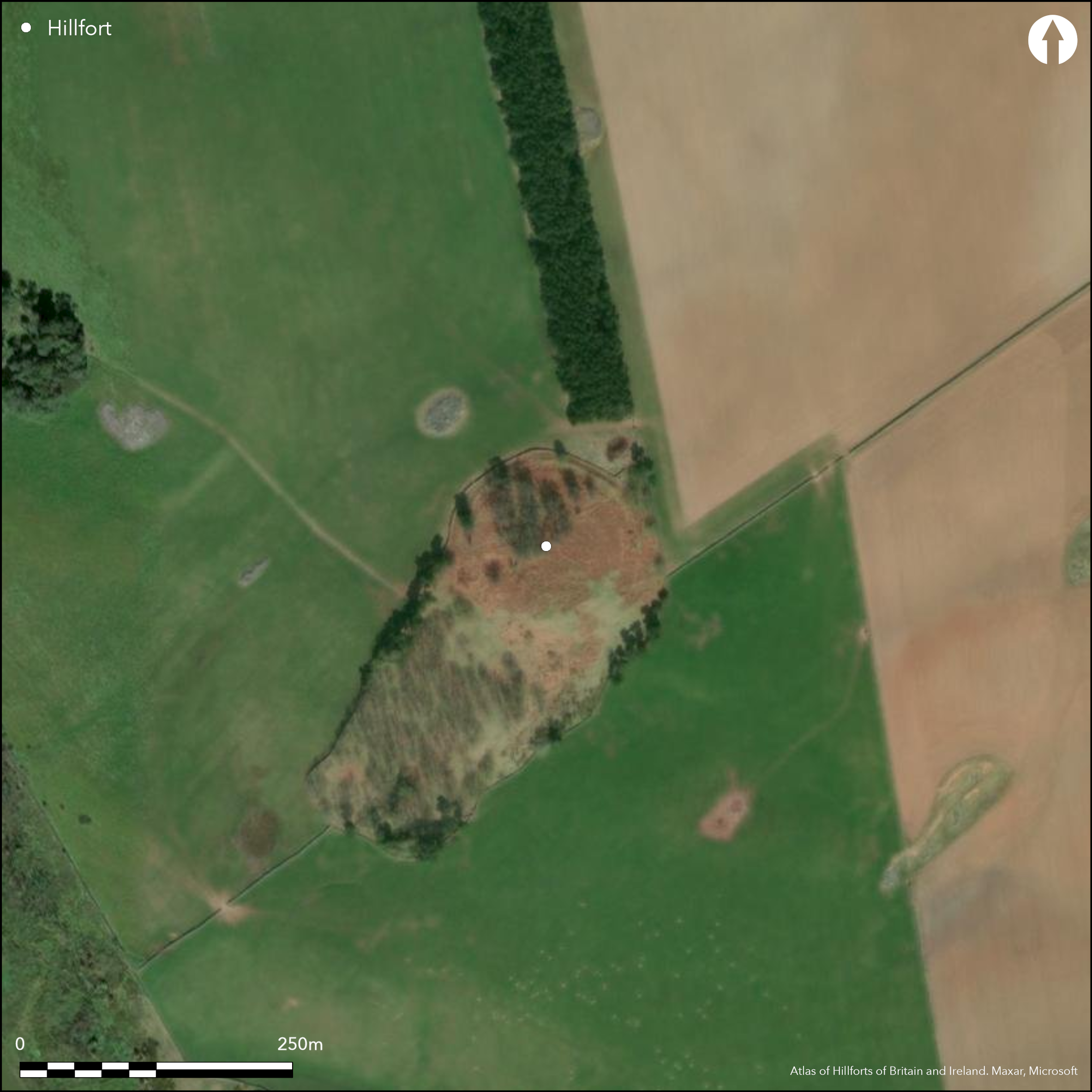
Satellite Imagery
LiDAR 1m DTM Hillshade
Satellite Imagery
Scroll left/right to view further images.
HER: Scottish Borders 55823 (None)
NMR: NT 54 NE 4 (55823)
SM: 4612
NGR: NT 5705 4845
X: 357050 Y: 648450 (OSGB36)
This fort is situated on the S shoulder of Thirlestane Hill, where the ground begins to drop away more steeply from the broad rounded summit area. Roughly circular on plan, it was already under young conifers when briefly noted by James Tait in 1883 (1884, 311), and all subsequent records have been drawn up in the face of impenetrable trees or dense undergrowth. The only plan, prepared by James Hewat Craw in 1912 (RCAHMS 1915, 117-18, no.220, fig 108), can therefore only be relied upon in broad outline rather than close detail, depicting three concentric banks forming a circular enclosure, the interior of which appears to have been partly occupied by a series of small yards; Craw placed entrances on the ESE and WSW, though the OS 25 inch maps and satellite imagery suggest these lie closer to the SE and W respectively. Craws profile drawing across the ramparts on the N is informative, however, confirming David Christison and Alexander Curle's observation that the innermost circuit is of comparatively slight proportions, forming a bank about 3m thick and no more than 0.3m high in this sector. It is consistently set about 6.5m within the outer ramparts, enclosing an area some 65m in diameter (0.32ha), and is more likely to represent a later settlement enclosure inserted into the interior of an earlier fort, and the yards recorded within its interior are probably the remains of a still later late Iron Age occupation. The fort as such is thus represented by the two outer circuits, though on the N at least the outer of them was then evidently considerably larger, some 7m thick by 1.8m high externally, while the inner was only 0.6m to 0.9m high there and elsewhere around the entire circuit. Nor is there any evidence of a ditch between them, while Craw's section showing that the outer was rather higher externally than internally is probably evidence that it was accompanied by an external ditch. The evidence that the two outer circuits are part of a contemporary scheme enclosing an area some 82m in diameter (0.52ha) is thus far from certain, and the possibility remains that the outermost rampart represents an earlier fort; indeed, if the outer rampart was the original perimeter, it would have enclosed upwards 0.65ha.
Citizen Science: ✗
Reliability of Data: Confirmed
Reliability of Interpretation: Confirmed
X: -298939 Y: 7504375 (EPSG: 3857)
Longitude: -2.685411106983454 Latitude: 55.72758225520424 (EPSG:4326)
Country: Scotland
Current County or Unitary Authority: Scottish Borders
Historic County: Berwickshire
Current Parish/Community/Council/Townland: Lauder
None
| Extant | ✓ |
| Cropmark | ✗ |
| Likely Destroyed | ✗ |
Incorporated into a coniferous plantation planted shortly before 1883, and now partly cleared but clothed in bracken and a clump of deciduous trees
| Woodland | ✓ |
| Commercial Forestry Plantation | ✗ |
| Parkland | ✗ |
| Pasture (Grazing) | ✗ |
| Arable | ✗ |
| Scrub/Bracken | ✓ |
| Bare Outcrop | ✗ |
| Heather/Moorland | ✗ |
| Heath | ✗ |
| Built-up | ✗ |
| Coastal Grassland | ✗ |
| Other | ✗ |
None
| Contour Fort | ✓ |
| Partial Contour Fort | ✗ |
| Promontory Fort | ✗ |
| Hillslope Fort | ✗ |
| Level Terrain Fort | ✗ |
| Marsh Fort | ✗ |
| Multiple Enclosure Fort | ✗ |
| Hilltop | ✓ |
| Coastal Promontory | ✗ |
| Inland Promontory | ✗ |
| Valley Bottom | ✗ |
| Knoll/Hillock/Outcrop | ✗ |
| Ridge | ✗ |
| Cliff/Plateau-edge/Scarp | ✗ |
| Hillslope | ✗ |
| Lowland | ✗ |
| Spur | ✓ |
Dominant Topographic Feature: None
| North | ✗ |
| Northeast | ✗ |
| East | ✗ |
| Southeast | ✗ |
| South | ✗ |
| Southwest | ✗ |
| West | ✗ |
| Northwest | ✗ |
| Level | ✓ |
Altitude: 250.0m
N/A
In the absence of excavation, there are neither stratified artefacts nor radiocarbon dates to provide a chronology for the defences.
Reliability: D - None
| Pre 1200BC | ✗ |
| 1200BC - 800BC | ✗ |
| 800BC - 400BC | ✗ |
| 400BC - AD50 | ✗ |
| AD50 - AD400 | ✗ |
| AD400 - AD 800 | ✗ |
| Post AD800 | ✗ |
| Unknown | ✓ |
| Pre Hillfort: | None |
| Post Hillfort: | The internal enclosures noted by James Hewat Craw probably indicate a late Iron Age occupation. It was planted with conifers shortly before 1883 |
Photographed by RCAHMS Aerial Survey Programme in 1998
| 1st Identified Map Depiction (1771): | Concentric ring symbol on Andrew and Mostyn Armstrong's Map of the County of Berwick (1771) |
| Other (1859): | Annotated Camp on the 1st edition OS 25-inch map (Berwick 1862, sheet 20.6) |
| Other (1883): | Description by James Tait (1884, 311), at which time the fort was not long planted with trees |
| Other (1894): | Description by David Christison (1895, 139) and under almost impenetrable conifers |
| Other (1908): | Description (RCAHMS 1909, 40, no.194) |
| Earthwork Survey (1912): | Plan by Jame Hewat Craw and description (RCAHMS 1915, 117-18, no.220, fig 108; RCAHMS BWD 19/1; Drawings BWD 19/1/8 ) |
| Other (1952): | Description during RCAHMS Survey of Marginal Lands |
| Other (1955): | Visited by the OS |
| Other (1962): | Revised at 1:2500 by the OS |
| Other (1989): | Scheduled |
Traces of enclosures within the innermost circuit are recorded on Craws plan (RCAHMS 1915, 117-18, no.220, fig 108) and probably represent the remains of a late Iron Age settlement
None
| None | ✓ |
| Spring | ✗ |
| Stream | ✗ |
| Pool | ✗ |
| Flush | ✗ |
| Well | ✗ |
| Other | ✗ |
Enclosures
| No Known Features | ✗ |
| Round Stone Structures | ✗ |
| Rectangular Stone Structures | ✗ |
| Curvilinear Platforms | ✗ |
| Other Roundhouse Evidence | ✗ |
| Pits | ✗ |
| Quarry Hollows | ✗ |
| Other | ✓ |
None
| No Known Excavation | ✓ |
| Pits | ✗ |
| Postholes | ✗ |
| Roundhouses | ✗ |
| Rectangular Structures | ✗ |
| Roads/Tracks | ✗ |
| Quarry Hollows | ✗ |
| Other | ✗ |
| Nothing Found | ✗ |
None
| No Known Geophysics | ✓ |
| Pits | ✗ |
| Roundhouses | ✗ |
| Rectangular Structures | ✗ |
| Roads/Tracks | ✗ |
| Quarry Hollows | ✗ |
| Other | ✗ |
| Nothing Found | ✗ |
None
| No Known Finds | ✓ |
| Pottery | ✗ |
| Metal | ✗ |
| Metalworking | ✗ |
| Human Bones | ✗ |
| Animal Bones | ✗ |
| Lithics | ✗ |
| Environmental | ✗ |
| Other | ✗ |
NO APPARENT FEATURES
| APs Not Checked | ✓ |
| None | ✗ |
| Roundhouses | ✗ |
| Rectangular Structures | ✗ |
| Pits | ✗ |
| Postholes | ✗ |
| Roads/Tracks | ✗ |
| Other | ✗ |
See main summary
| 2: | None |
| 2: | None |
Guard Chambers: ✗
Chevaux de Frise: ✗
| 1. Simple Gap (South east): | Through all three circuits |
| 2. Simple Gap (West): | Through all three circuits |
Three concentric circuits are recorded but they are unlikely to represent a contemporary scheme and the relatively slight innermost is likely to be an inserted settlement enclosure
| Area 1: | 0.52ha. |
| Total: | 0.52ha. |
Total Footprint Area: 0.91ha.
None
| ✗ | None |
| ✓ | Omits the innermost circuit, which is unlikely to be part of the defensive scheme |
| NE Quadrant: | 2 |
| SE Quadrant: | 2 |
| SW Quadrant: | 2 |
| NW Quadrant: | 2 |
| Total: | 2 |
| Partial Univallate | ✗ |
| Univallate | ✗ |
| Partial Bivallate | ✗ |
| Bivallate | ✓ |
| Partial Multivallate | ✗ |
| Multivallate | ✗ |
| Unknown | ✗ |
| Partial Univallate | ✗ |
| Univallate | ✗ |
| Partial Bivallate | ✗ |
| Bivallate | ✗ |
| Partial Multivallate | ✗ |
| Multivallate | ✗ |
None
| None | ✗ |
| Earthen Bank | ✓ |
| Stone Wall | ✗ |
| Rubble | ✗ |
| Wall-walk | ✗ |
| Evidence of Timber | ✗ |
| Vitrification | ✗ |
| Other Burning | ✗ |
| Palisade | ✗ |
| Counter Scarp Bank | ✗ |
| Berm | ✗ |
| Unfinished | ✗ |
| Other | ✗ |
None
| None | ✗ |
| Earthen Bank | ✗ |
| Stone Wall | ✗ |
| Murus Duplex | ✗ |
| Timber-framed | ✗ |
| Timber-laced | ✗ |
| Vitrification | ✗ |
| Other Burning | ✗ |
| Palisade | ✗ |
| Counter Scarp Bank | ✗ |
| Berm | ✗ |
| Unfinished | ✗ |
| No Known Excavation | ✓ |
| Other | ✗ |
| ✗ | None |
| ✗ | None recorded, but there is probably a ditch outside the outermost rampart (see main summary) |
Number of Ditches: None
| ✗ | None |
Christison, D (1895) 'The forts of Selkirk, the Gala Water, the Southern slopes of the Lammermoors, and the north of Roxburgh'. Proc Soc Antiq Scot 29 (1894-50), 108-79
RCAHMS (1909) The Royal Commission on the Ancient and Historical Monuments and Constructions of Scotland. First report and Inventory of Monuments and Constructions in the County of Berwick. HMSO: Edinburgh.
RCAHMS (1915) The Royal Commission on the Ancient and Historical Monuments and Constructions of Scotland. Sixth report and Inventory of Monuments and Constructions in the County of Berwick (Revised Issue). HMSO: Edinburgh
Tait, J (1884) 'On the Black Dyke and some British camps in the west of Berwickshire'. Hist Berwickshire Natur Club 10 (1882-4), 307-12
Atlas of Hillforts:
Wikidata:
This work is licensed under CC BY-SA 4.0

 and should be cited as:
Lock, Gary and Ralston, Ian. 2024. Atlas of Hillforts of Britain and Ireland. Available at: https://hillforts.arch.ox.ac.uk
Document Version 1.1