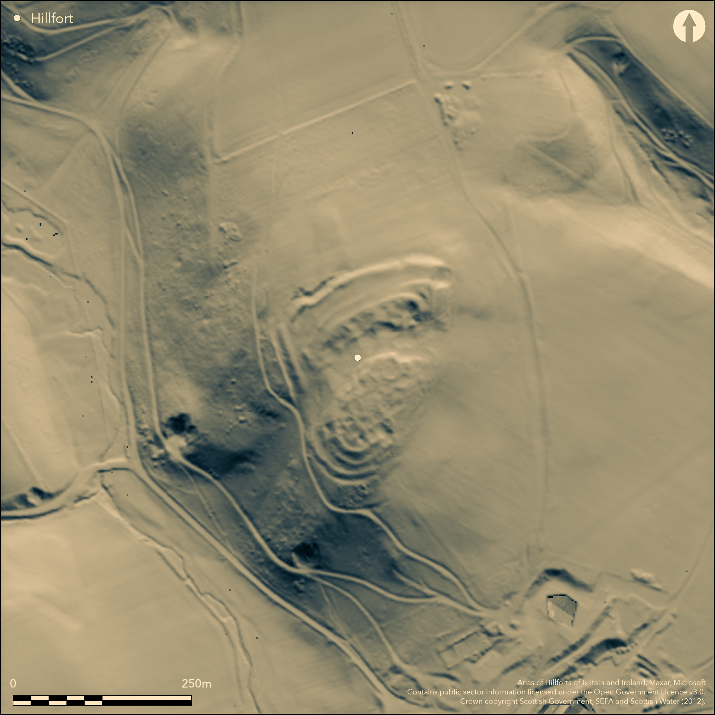
LiDAR 1m DTM Hillshade
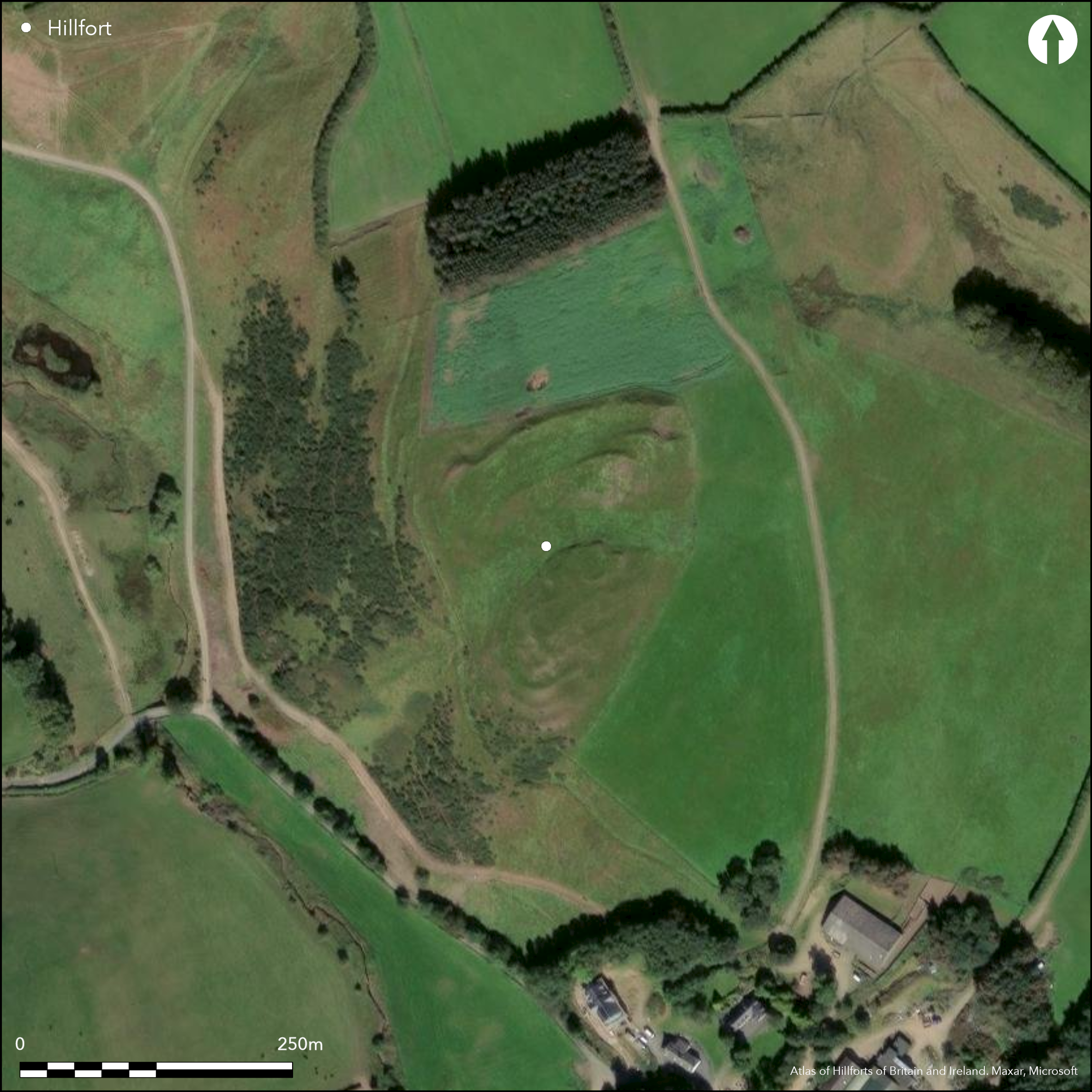
Satellite Imagery
LiDAR 1m DTM Hillshade
Satellite Imagery
Scroll left/right to view further images.
HER: Scottish Borders 55998 (None)
NMR: NT 55 NW 8 (55998)
SM: 4627
NGR: NT 5049 5539
X: 350499 Y: 655391 (OSGB36)
This fort is situated on the summit of the spur projecting southwards from the foot of Ditcher Law overlooking the farm at Hillhouse. A rounded triangle in overall plan, its defences are evidently complex, with three or four ramparts forming a belt in excess of 30m deep on the N and S respectively, though the sequence of their construction is unclear, partly as a result of later quarrying but also the evidence of intense occupation that extends across the whole interior. At its core there has possibly been a relatively small oval enclosure measuring internally about 80m from NE to SW by 45m transversely (0.3ha), but in its final multivallate incarnation it was considerably larger, enclosing an area measuring a maximum of 125m from NE to SW by 70m transversely (0.57ha). Its ramparts are reduced to terraces around much of the circuit, but the outermost on the NW, which still stands 0.9m high internally, presents an external scarp 2.7m high dropping into a substantial ditch with traces of a counterscarp bank; excavation would probably reveal evidence of ditches elsewhere around the circuit. A curious dogleg in the line of the outer defences where the N side meets the W side is not shown as a gap on James Hewat Craw's plan drawn up about 1912 (RCAHMS 1915, 13-14, no.28, fig 10), but must surely be the remains of a blocked entrance with a shallow hornwork to create overlapping rampart terminals, and though no other entrances are known there are natural re-entrants on the E and W flanks that are likely to have been exploited for access. The character of the house platforms that sprawl across the interior is uncertain, and while traces of encircling ring-grooves are visible on a few, others may well be stone founded round-houses, in some cases on the N probably impinging upon the line of the inner rampart.
Citizen Science: ✗
Reliability of Data: Confirmed
Reliability of Interpretation: Confirmed
X: -310689 Y: 7516588 (EPSG: 3857)
Longitude: -2.7909674890353866 Latitude: 55.78931658308026 (EPSG:4326)
Country: Scotland
Current County or Unitary Authority: Scottish Borders
Historic County: Berwickshire
Current Parish/Community/Council/Townland: Channelkirk
None
| Extant | ✓ |
| Cropmark | ✗ |
| Likely Destroyed | ✗ |
None
| Woodland | ✗ |
| Commercial Forestry Plantation | ✗ |
| Parkland | ✗ |
| Pasture (Grazing) | ✓ |
| Arable | ✗ |
| Scrub/Bracken | ✗ |
| Bare Outcrop | ✗ |
| Heather/Moorland | ✗ |
| Heath | ✗ |
| Built-up | ✗ |
| Coastal Grassland | ✗ |
| Other | ✗ |
None
| Contour Fort | ✓ |
| Partial Contour Fort | ✗ |
| Promontory Fort | ✗ |
| Hillslope Fort | ✗ |
| Level Terrain Fort | ✗ |
| Marsh Fort | ✗ |
| Multiple Enclosure Fort | ✗ |
| Hilltop | ✓ |
| Coastal Promontory | ✗ |
| Inland Promontory | ✗ |
| Valley Bottom | ✗ |
| Knoll/Hillock/Outcrop | ✗ |
| Ridge | ✗ |
| Cliff/Plateau-edge/Scarp | ✗ |
| Hillslope | ✗ |
| Lowland | ✗ |
| Spur | ✓ |
Dominant Topographic Feature: None
| North | ✗ |
| Northeast | ✗ |
| East | ✗ |
| Southeast | ✗ |
| South | ✗ |
| Southwest | ✗ |
| West | ✗ |
| Northwest | ✗ |
| Level | ✓ |
Altitude: 305.0m
N/A
In the absence of excavation, there are neither stratified artefacts nor radiocarbon dates to provide a chronology for the defences.
Reliability: D - None
| Pre 1200BC | ✗ |
| 1200BC - 800BC | ✗ |
| 800BC - 400BC | ✗ |
| 400BC - AD50 | ✗ |
| AD50 - AD400 | ✗ |
| AD400 - AD 800 | ✗ |
| Post AD800 | ✗ |
| Unknown | ✓ |
| Pre Hillfort: | None |
| Post Hillfort: | There are probably round-house overlying the inner rampart and thus probably indicating the presence of a late Iron Age settlement here |
None
| 1st Identified Map Depiction (1755): | On General William Roy's Military Map of Scotland (1747-55) |
| Other (1853): | Annotated Camp on the 1st edition OS 25-inch map (Berwick 1854, sheet 13.3; Name Book, Berwickshire, No.6, p 26) |
| Other (1894): | Description by David Christison based on the OS map and probably unvisited (1895, 129) |
| Other (1900): | Description by Archibald Allan (1900, 650-2) |
| Other (1908): | Description (RCAHMS 1909, 6, no.27) |
| Earthwork Survey (1912): | Plan drawn up by James Hewat Craw, possibly as early as 1910 (RCAHMS 1915, 13-14, no.28, fig 10; RCAHMS BWD 17/1) |
| Other (1963): | Revised at 1:2500 by the OS |
| Other (1989): | Scheduled |
Aerial photography reveals traces of platforms for round-houses throughout the interior; some have traces of encircling grooves, while others have low banks and thus may be the remains of stone-founded round-houses, which on the N may overlie the inner rampart.
None
| None | ✓ |
| Spring | ✗ |
| Stream | ✗ |
| Pool | ✗ |
| Flush | ✗ |
| Well | ✗ |
| Other | ✗ |
Ring-grooves encircling platforms
| No Known Features | ✗ |
| Round Stone Structures | ✓ |
| Rectangular Stone Structures | ✗ |
| Curvilinear Platforms | ✓ |
| Other Roundhouse Evidence | ✓ |
| Pits | ✗ |
| Quarry Hollows | ✗ |
| Other | ✗ |
None
| No Known Excavation | ✓ |
| Pits | ✗ |
| Postholes | ✗ |
| Roundhouses | ✗ |
| Rectangular Structures | ✗ |
| Roads/Tracks | ✗ |
| Quarry Hollows | ✗ |
| Other | ✗ |
| Nothing Found | ✗ |
None
| No Known Geophysics | ✓ |
| Pits | ✗ |
| Roundhouses | ✗ |
| Rectangular Structures | ✗ |
| Roads/Tracks | ✗ |
| Quarry Hollows | ✗ |
| Other | ✗ |
| Nothing Found | ✗ |
A lead ball the size of a walnut (possibly a Roman glandes) was found in quarrying about 1893 (Allan 1900, 652). In 1857 'a ring, a Roman coin, and also some British coins' were found in ploughing (Name Book, Berwickshire, No.6, p 26)
| No Known Finds | ✗ |
| Pottery | ✗ |
| Metal | ✓ |
| Metalworking | ✗ |
| Human Bones | ✗ |
| Animal Bones | ✗ |
| Lithics | ✗ |
| Environmental | ✗ |
| Other | ✗ |
Clearly revealed by snow, throughout the interior
| APs Not Checked | ✗ |
| None | ✗ |
| Roundhouses | ✓ |
| Rectangular Structures | ✗ |
| Pits | ✗ |
| Postholes | ✗ |
| Roads/Tracks | ✗ |
| Other | ✗ |
See main summary
| 3: | The continuity of the ramparts is broken in the natural re-entrants on the E and W |
| 2: | None |
Guard Chambers: ✗
Chevaux de Frise: ✗
| 1. Blocked (North west): | Revealed by a curious dogleg in the line of the outer rampart |
| 1. Hornwork (North west): | Dogleg creating shallow hornwork |
Up to four ramparts, at least one accompanied by a ditch, surviving at either end, but the continuity between them has been eroded along the E and W flanks.
| Area 1: | 0.57ha. |
| Total: | 0.57ha. |
Total Footprint Area: 1.9ha.
None
| ✓ | There has evidently been a complex sequence here, but it is not possible to unravel it from the present records. The inner rampart at the S end gives the impression that it turned back across the interior on the N to form a smaller enclosure, while the probable blocked entrance on the NW hints at other complexity |
| ✓ | None |
| NE Quadrant: | 3 |
| SE Quadrant: | 1 |
| SW Quadrant: | 3 |
| NW Quadrant: | 4 |
| Total: | 4 |
| Partial Univallate | ✓ |
| Univallate | ✗ |
| Partial Bivallate | ✗ |
| Bivallate | ✗ |
| Partial Multivallate | ✓ |
| Multivallate | ✗ |
| Unknown | ✗ |
| Partial Univallate | ✗ |
| Univallate | ✗ |
| Partial Bivallate | ✗ |
| Bivallate | ✗ |
| Partial Multivallate | ✗ |
| Multivallate | ✗ |
None
| None | ✗ |
| Earthen Bank | ✓ |
| Stone Wall | ✗ |
| Rubble | ✗ |
| Wall-walk | ✗ |
| Evidence of Timber | ✗ |
| Vitrification | ✗ |
| Other Burning | ✗ |
| Palisade | ✗ |
| Counter Scarp Bank | ✓ |
| Berm | ✗ |
| Unfinished | ✗ |
| Other | ✗ |
None
| None | ✗ |
| Earthen Bank | ✗ |
| Stone Wall | ✗ |
| Murus Duplex | ✗ |
| Timber-framed | ✗ |
| Timber-laced | ✗ |
| Vitrification | ✗ |
| Other Burning | ✗ |
| Palisade | ✗ |
| Counter Scarp Bank | ✗ |
| Berm | ✗ |
| Unfinished | ✗ |
| No Known Excavation | ✓ |
| Other | ✗ |
| ✗ | None |
| ✓ | None |
Number of Ditches: 1
| ✗ | None |
Allan, A (1900) History of Channelkirk. James Thin: Edinburgh
Christison, D (1895) 'The forts of Selkirk, the Gala Water, the Southern slopes of the Lammermoors, and the north of Roxburgh'. Proc Soc Antiq Scot 29 (1894-50), 108-79
Name Book, Ordnance Survey Object Name Books (6 inch and 1/2500 scale); available https://www.scotlandsplaces.gov.uk/
RCAHMS (1909) The Royal Commission on the Ancient and Historical Monuments and Constructions of Scotland. First report and Inventory of Monuments and Constructions in the County of Berwick. HMSO: Edinburgh.
RCAHMS (1915) The Royal Commission on the Ancient and Historical Monuments and Constructions of Scotland. Sixth report and Inventory of Monuments and Constructions in the County of Berwick (Revised Issue). HMSO: Edinburgh
Atlas of Hillforts:
Wikidata:
This work is licensed under CC BY-SA 4.0

 and should be cited as:
Lock, Gary and Ralston, Ian. 2024. Atlas of Hillforts of Britain and Ireland. Available at: https://hillforts.arch.ox.ac.uk
Document Version 1.1