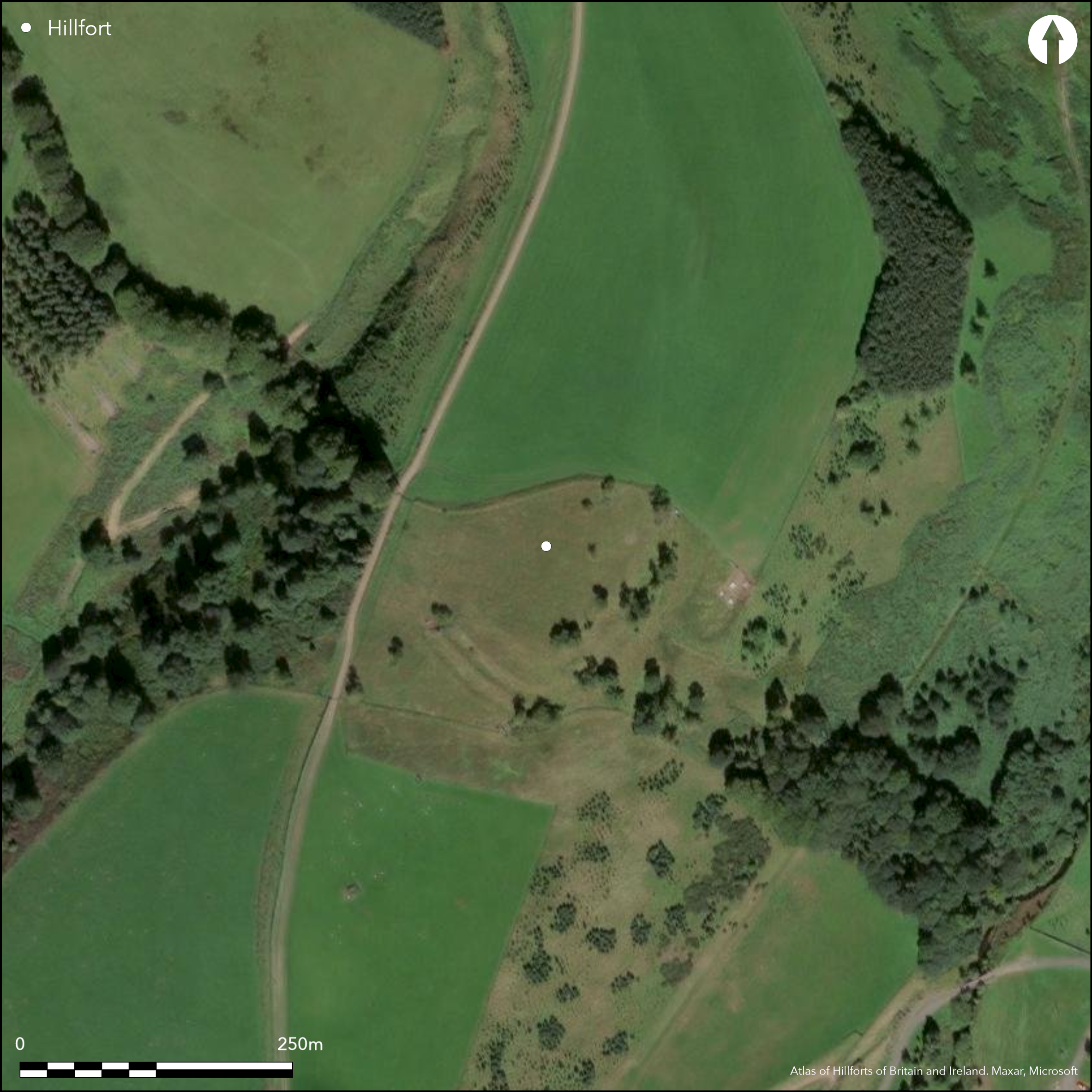
Satellite Imagery
Satellite Imagery
HER: Scottish Borders 56028 (None)
NMR: NT 55 SW 12 (56028)
SM: 4656
NGR: NT 5399 5178
X: 353990 Y: 651780 (OSGB36)
This fort is situated on a steep-sided spur formed between the gully of the Lylestone Burn and the valley of the Earnscleugh Water. The greater part of the fort was incorporated into a plantation by the mid 19th century, but before then it had been extensively ploughed and only a short sector of the outer ramparts on the SW remains intact. Even here the innermost rampart and its broad external ditch have been ploughed down, and it is difficult to trace the defences along the eastern and western flanks to link up with the ditches revealed by cropmarks in the field to the N, where James Hewat Craw depicted fragments of five ramparts on the plan he drew up for the Berwickshire County Inventory. Indeed, it is difficult to correlate the elements shown by these various sources, other than to conclude that the defences represent at least two periods of enclosure, revealed most clearly on the N, where the cropmarks of at least three concentric ditches swing round this flank on a much wider arc than the one or possibly two ditches adjacent to the plantation boundary. The problem of correlation may lie in the mensuration of Craw's plan, nevertheless, there appears to be an oval inner enclosure measuring about 105m from NNE to SSW by 75m transversely within at least one rampart and ditch, and the ditch of this enclosure, visible in the cropmarks on the N, intersects the inner ditch of the outer enclosure on the NW. The latter presumably incorporates at least the two ramparts and ditches with an outer counterscarp bank on the SW and encloses an area measuring at least 130m from NNE to SSW by 75m transversely (1ha). No entrances are visible, either in the cropmarks or the upstanding remains, and the interior is traversed by straight low rigs probably dating from the early 19th century.
Citizen Science: ✗
Reliability of Data: Confirmed
Reliability of Interpretation: Confirmed
X: -304424 Y: 7510236 (EPSG: 3857)
Longitude: -2.734690265205497 Latitude: 55.757219198147716 (EPSG:4326)
Country: Scotland
Current County or Unitary Authority: Scottish Borders
Historic County: Berwickshire
Current Parish/Community/Council/Townland: Lauder
None
| Extant | ✓ |
| Cropmark | ✓ |
| Likely Destroyed | ✗ |
Scattered trees surviving from when the greater part of the interior and the defences lay within a 19th-century plantation
| Woodland | ✗ |
| Commercial Forestry Plantation | ✗ |
| Parkland | ✗ |
| Pasture (Grazing) | ✓ |
| Arable | ✓ |
| Scrub/Bracken | ✗ |
| Bare Outcrop | ✗ |
| Heather/Moorland | ✗ |
| Heath | ✗ |
| Built-up | ✗ |
| Coastal Grassland | ✗ |
| Other | ✗ |
None
| Contour Fort | ✓ |
| Partial Contour Fort | ✗ |
| Promontory Fort | ✗ |
| Hillslope Fort | ✗ |
| Level Terrain Fort | ✗ |
| Marsh Fort | ✗ |
| Multiple Enclosure Fort | ✗ |
| Hilltop | ✓ |
| Coastal Promontory | ✗ |
| Inland Promontory | ✗ |
| Valley Bottom | ✗ |
| Knoll/Hillock/Outcrop | ✗ |
| Ridge | ✗ |
| Cliff/Plateau-edge/Scarp | ✗ |
| Hillslope | ✗ |
| Lowland | ✗ |
| Spur | ✗ |
Dominant Topographic Feature: None
| North | ✗ |
| Northeast | ✗ |
| East | ✗ |
| Southeast | ✗ |
| South | ✗ |
| Southwest | ✗ |
| West | ✗ |
| Northwest | ✗ |
| Level | ✓ |
Altitude: 325.0m
N/A
In the absence of excavation, there are neither stratified artefacts nor radiocarbon dates to provide a chronology for the defences.
Reliability: D - None
| Pre 1200BC | ✗ |
| 1200BC - 800BC | ✗ |
| 800BC - 400BC | ✗ |
| 400BC - AD50 | ✗ |
| AD50 - AD400 | ✗ |
| AD400 - AD 800 | ✗ |
| Post AD800 | ✗ |
| Unknown | ✓ |
| Pre Hillfort: | None |
| Post Hillfort: | Ploughed down and partly incorporated into a plantation in the early 19th century |
Photographed by CUCAP in 1967, and by RCAHMS Aerial Survey Programme in 1983, 1998, 1999, 2006 and 2010
| 1st Identified Map Depiction (1755): | On General William Roy's Military Map of Scotland (1747-55) |
| Other (1857): | Annotated Camp on the 1st edition OS 25-inch map (Berwick 1862, sheet 14.13) |
| Other (1894): | Description by David Christison (1895, 134) |
| Other (1908): | Description (RCAHMS 1909, 38, no.188 |
| Earthwork Survey (1912): | Plan drawn up by James Hewat Craw, possibly as early as 1910 (RCAHMS 1915, 112-13, no.214, fig 103; RCAHMS BWD 12/1) |
| Other (1963): | Revised at 1:2500 by the OS |
| Other (1975): | Surveyed at 1:10,000 by the OS |
| Other (1989): | Scheduled |
Featureless
None
| None | ✓ |
| Spring | ✗ |
| Stream | ✗ |
| Pool | ✗ |
| Flush | ✗ |
| Well | ✗ |
| Other | ✗ |
Cultivated in shallow rigs before going under an old plantation
| No Known Features | ✓ |
| Round Stone Structures | ✗ |
| Rectangular Stone Structures | ✗ |
| Curvilinear Platforms | ✗ |
| Other Roundhouse Evidence | ✗ |
| Pits | ✗ |
| Quarry Hollows | ✗ |
| Other | ✗ |
None
| No Known Excavation | ✓ |
| Pits | ✗ |
| Postholes | ✗ |
| Roundhouses | ✗ |
| Rectangular Structures | ✗ |
| Roads/Tracks | ✗ |
| Quarry Hollows | ✗ |
| Other | ✗ |
| Nothing Found | ✗ |
None
| No Known Geophysics | ✓ |
| Pits | ✗ |
| Roundhouses | ✗ |
| Rectangular Structures | ✗ |
| Roads/Tracks | ✗ |
| Quarry Hollows | ✗ |
| Other | ✗ |
| Nothing Found | ✗ |
None
| No Known Finds | ✓ |
| Pottery | ✗ |
| Metal | ✗ |
| Metalworking | ✗ |
| Human Bones | ✗ |
| Animal Bones | ✗ |
| Lithics | ✗ |
| Environmental | ✗ |
| Other | ✗ |
NO APPARENT FEATURES
| APs Not Checked | ✗ |
| None | ✓ |
| Roundhouses | ✗ |
| Rectangular Structures | ✗ |
| Pits | ✗ |
| Postholes | ✗ |
| Roads/Tracks | ✗ |
| Other | ✗ |
See main summary
| 0: | Largely ploughed out |
| 2: | None known |
Guard Chambers: ✗
Chevaux de Frise: ✗
Up to five ramparts and ditches, but probably representing several periods of construction
| Area 1: | 0.58ha. |
| Area 2: | 1.0ha. |
| Total: | 1.0ha. |
Total Footprint Area: Noneha.
None
| ✓ | Clear evidence that elements of the defences intersect on the NW |
| ✓ | None |
| NE Quadrant: | 3 |
| SE Quadrant: | 3 |
| SW Quadrant: | 3 |
| NW Quadrant: | 4 |
| Total: | 4 |
| Partial Univallate | ✗ |
| Univallate | ✗ |
| Partial Bivallate | ✗ |
| Bivallate | ✗ |
| Partial Multivallate | ✗ |
| Multivallate | ✓ |
| Unknown | ✗ |
| Partial Univallate | ✓ |
| Univallate | ✗ |
| Partial Bivallate | ✓ |
| Bivallate | ✗ |
| Partial Multivallate | ✗ |
| Multivallate | ✗ |
None
| None | ✗ |
| Earthen Bank | ✓ |
| Stone Wall | ✗ |
| Rubble | ✗ |
| Wall-walk | ✗ |
| Evidence of Timber | ✗ |
| Vitrification | ✗ |
| Other Burning | ✗ |
| Palisade | ✗ |
| Counter Scarp Bank | ✓ |
| Berm | ✗ |
| Unfinished | ✗ |
| Other | ✗ |
None
| None | ✗ |
| Earthen Bank | ✗ |
| Stone Wall | ✗ |
| Murus Duplex | ✗ |
| Timber-framed | ✗ |
| Timber-laced | ✗ |
| Vitrification | ✗ |
| Other Burning | ✗ |
| Palisade | ✗ |
| Counter Scarp Bank | ✗ |
| Berm | ✗ |
| Unfinished | ✗ |
| No Known Excavation | ✓ |
| Other | ✗ |
| ✗ | None |
| ✓ | At least four representing a minimum of two schemes |
Number of Ditches: 4
| ✗ | None |
RCAHMS (1909) The Royal Commission on the Ancient and Historical Monuments and Constructions of Scotland. First report and Inventory of Monuments and Constructions in the County of Berwick. HMSO: Edinburgh.
RCAHMS (1915) The Royal Commission on the Ancient and Historical Monuments and Constructions of Scotland. Sixth report and Inventory of Monuments and Constructions in the County of Berwick (Revised Issue). HMSO: Edinburgh
Atlas of Hillforts:
Wikidata:
This work is licensed under CC BY-SA 4.0

 and should be cited as:
Lock, Gary and Ralston, Ian. 2024. Atlas of Hillforts of Britain and Ireland. Available at: https://hillforts.arch.ox.ac.uk
Document Version 1.1