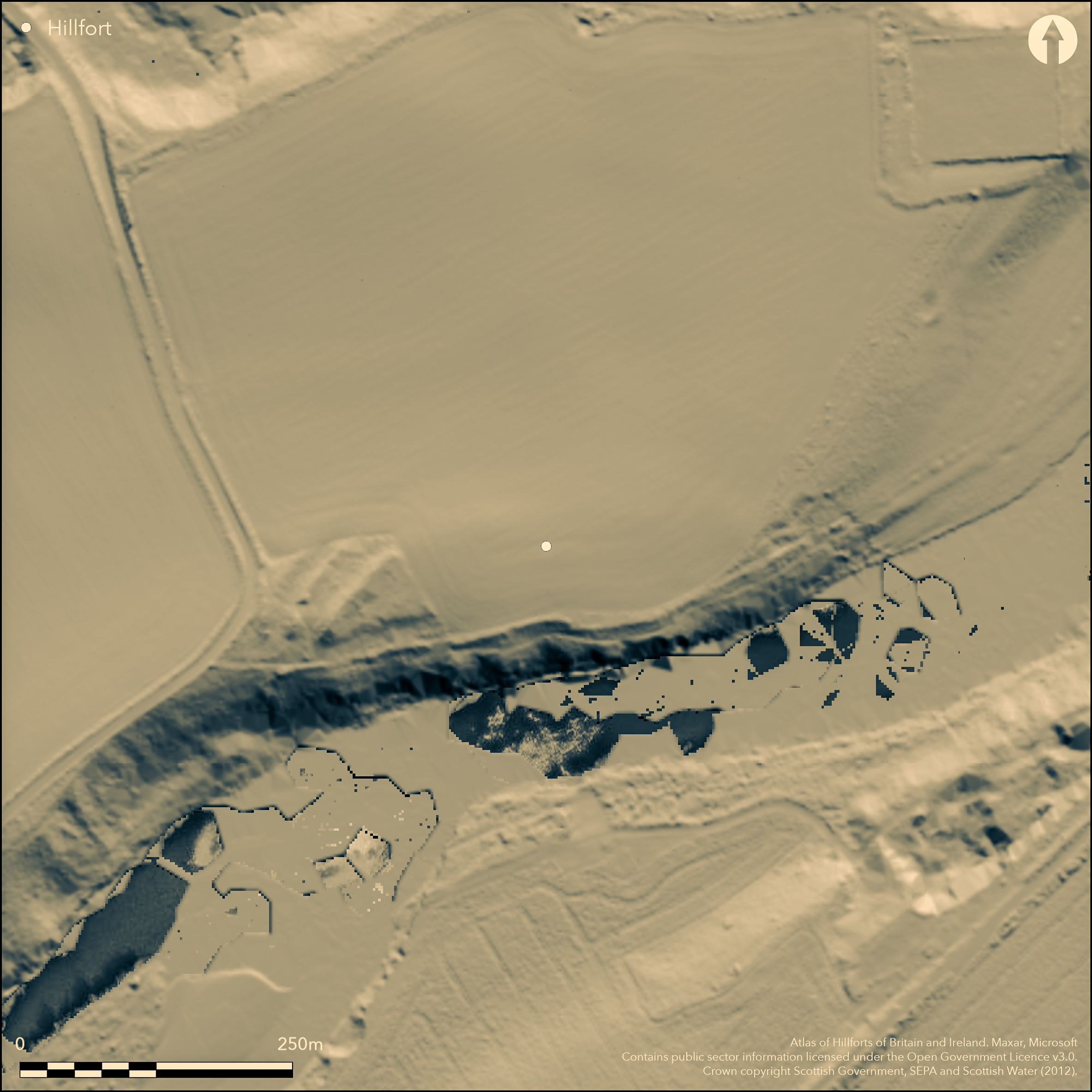
LiDAR 1m DTM Hillshade
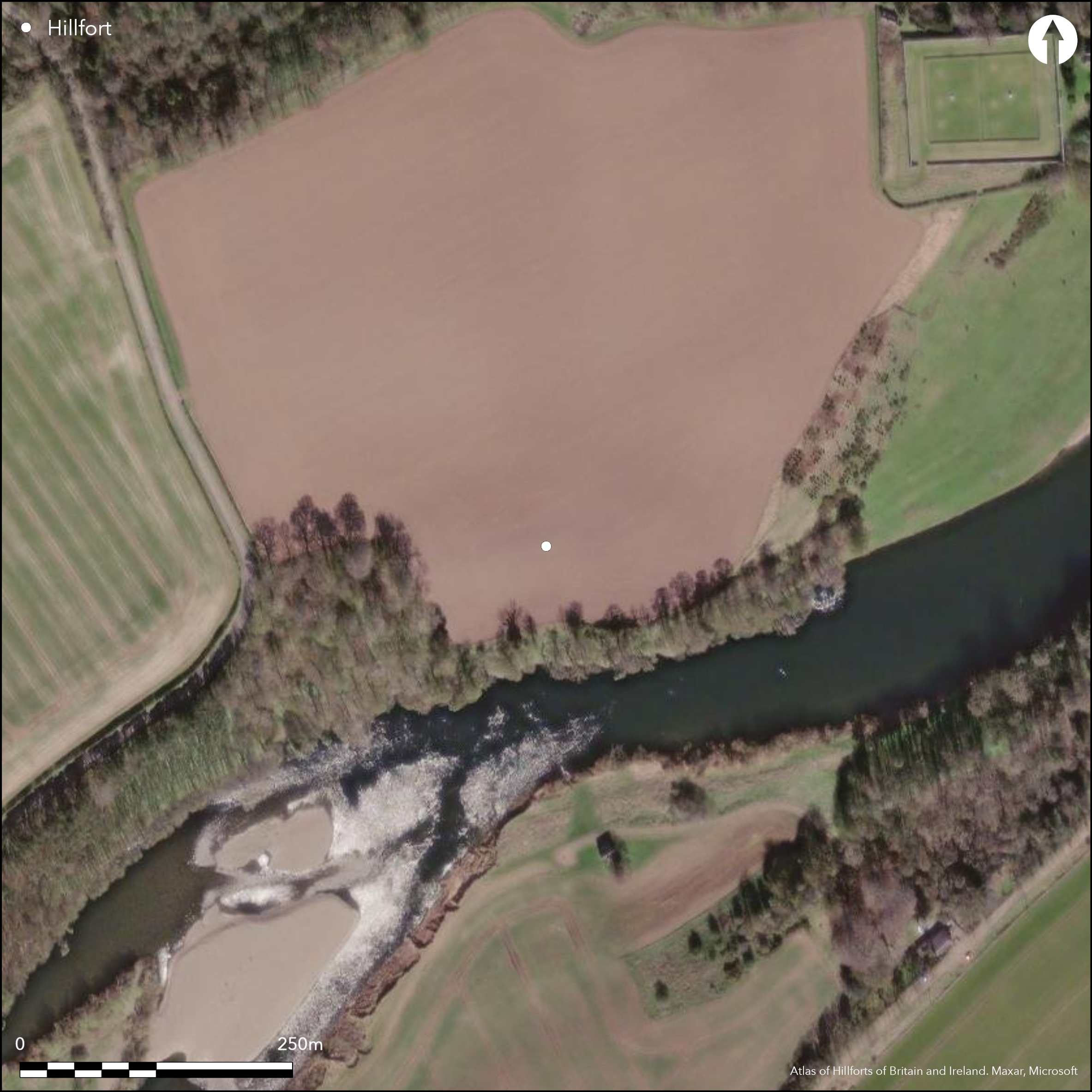
Satellite Imagery
LiDAR 1m DTM Hillshade
Satellite Imagery
Scroll left/right to view further images.
HER: Scottish Borders 59579 (None)
NMR: NT 84 SE 14 (59579)
SM: 12401
NGR: NT 8734 4383
X: 387343 Y: 643838 (OSGB36)
This fort, which occupies the NE end of a low ridge that falls away in a cliff to the River Tweed along its S flank, must have been an impressive earthwork before it was partly demolished and ploughed down. Nevertheless, the terminals of three ramparts with intermediate ditches survive in a small copse beside the corner of the public road at the W end, forming a massive belt in excess of 40m deep. The innermost of these ramparts measures about 9m in thickness and stands 4m high above both the interior and its external ditch, which itself is about 9m in breadth. At 7m in thickness, the second rampart is slightly smaller, standing 2.5m and 3m above the bottoms of the inner and outer ditches respectively while the third is also 7m thick and stands 2m above the bottom of the outer ditch. Terminating just short of the bluff above the river, this may have been the entrance, but soilmarks in the field to the E suggest that the defences were formerly as substantial elsewhere, extending in a straight line parallel to the river before turning through an obtuse angle to meet the cliff at the E end. About 1912, James Hewat Craw's plan (RCAHMS 1915, 56-7, no.104, fig 55) shows one of the ramparts, probably the medial rampart rather than the inner, terminating just short of the cliff here, which indicates that there was probably also an entrance at this end. The interior measures about 185m from E to W by 50m transversely (0.95ha) and is now featureless, though documentary sources suggest there may have been a minor tower or bastle-house standing here at the beginning of the 16th century (Milne Home 1862, 454-5).
Citizen Science: ✗
Reliability of Data: Confirmed
Reliability of Interpretation: Confirmed
X: -245223 Y: 7496532 (EPSG: 3857)
Longitude: -2.202875802364148 Latitude: 55.68788638578234 (EPSG:4326)
Country: Scotland
Current County or Unitary Authority: Scottish Borders
Historic County: Berwickshire
Current Parish/Community/Council/Townland: Coldstream
None
| Extant | ✓ |
| Cropmark | ✓ |
| Likely Destroyed | ✗ |
None
| Woodland | ✓ |
| Commercial Forestry Plantation | ✗ |
| Parkland | ✗ |
| Pasture (Grazing) | ✗ |
| Arable | ✓ |
| Scrub/Bracken | ✗ |
| Bare Outcrop | ✗ |
| Heather/Moorland | ✗ |
| Heath | ✗ |
| Built-up | ✗ |
| Coastal Grassland | ✗ |
| Other | ✗ |
None
| Contour Fort | ✓ |
| Partial Contour Fort | ✗ |
| Promontory Fort | ✗ |
| Hillslope Fort | ✗ |
| Level Terrain Fort | ✗ |
| Marsh Fort | ✗ |
| Multiple Enclosure Fort | ✗ |
| Hilltop | ✗ |
| Coastal Promontory | ✗ |
| Inland Promontory | ✗ |
| Valley Bottom | ✗ |
| Knoll/Hillock/Outcrop | ✗ |
| Ridge | ✗ |
| Cliff/Plateau-edge/Scarp | ✓ |
| Hillslope | ✗ |
| Lowland | ✗ |
| Spur | ✗ |
Dominant Topographic Feature: None
| North | ✗ |
| Northeast | ✗ |
| East | ✗ |
| Southeast | ✗ |
| South | ✗ |
| Southwest | ✗ |
| West | ✗ |
| Northwest | ✗ |
| Level | ✓ |
Altitude: 30.0m
N/A
In the absence of excavation, there are neither stratified artefacts nor radiocarbon dates to provide a chronology for the defences.
Reliability: D - None
| Pre 1200BC | ✗ |
| 1200BC - 800BC | ✗ |
| 800BC - 400BC | ✗ |
| 400BC - AD50 | ✗ |
| AD50 - AD400 | ✗ |
| AD400 - AD 800 | ✗ |
| Post AD800 | ✗ |
| Unknown | ✓ |
| Pre Hillfort: | None |
| Post Hillfort: | Site of a tower or bastle-house, but the earthwork defences were partly demolished before the middle of the 19th century |
Photographed by RCAHMS Aerial Survey Programme in 1977, 1982 and 1990
| 1st Identified Map Depiction (1826): | Annotated Camp on T Sharp, Christopher Greenwood and William Fowler's map of The County of Berwick (1826) |
| Other (1858): | Annotated Camp on the 1st edition OS 25-inch map (Berwick 1862, sheet 23.14 & 23.15) |
| Earthwork Survey (1862): | Description and map by David Milne Home (1862, 454-5, pl xiv) |
| Other (1908): | Description (RCAHMS 1909, 20, no.107) |
| Earthwork Survey (1912): | Plan by James Hewat Craw and description (RCAHMS 1915, 56-7, no.104, fig 55; RCAHMS BWD 18/1 ; BWD 18/1 /7 & DP225494) |
| Other (1955): | Visited by the OS |
| Other (1966): | Revised at 1:2500 by the OS |
| Other (1979): | Description by RCAHMS |
| Other (2008): | Scheduled |
Featureless, though probably the site of a bastle-house or tower
None
| None | ✓ |
| Spring | ✗ |
| Stream | ✗ |
| Pool | ✗ |
| Flush | ✗ |
| Well | ✗ |
| Other | ✗ |
None
| No Known Features | ✓ |
| Round Stone Structures | ✗ |
| Rectangular Stone Structures | ✗ |
| Curvilinear Platforms | ✗ |
| Other Roundhouse Evidence | ✗ |
| Pits | ✗ |
| Quarry Hollows | ✗ |
| Other | ✗ |
None
| No Known Excavation | ✓ |
| Pits | ✗ |
| Postholes | ✗ |
| Roundhouses | ✗ |
| Rectangular Structures | ✗ |
| Roads/Tracks | ✗ |
| Quarry Hollows | ✗ |
| Other | ✗ |
| Nothing Found | ✗ |
None
| No Known Geophysics | ✓ |
| Pits | ✗ |
| Roundhouses | ✗ |
| Rectangular Structures | ✗ |
| Roads/Tracks | ✗ |
| Quarry Hollows | ✗ |
| Other | ✗ |
| Nothing Found | ✗ |
None
| No Known Finds | ✓ |
| Pottery | ✗ |
| Metal | ✗ |
| Metalworking | ✗ |
| Human Bones | ✗ |
| Animal Bones | ✗ |
| Lithics | ✗ |
| Environmental | ✗ |
| Other | ✗ |
NO APPARENT FEATURES
| APs Not Checked | ✗ |
| None | ✓ |
| Roundhouses | ✗ |
| Rectangular Structures | ✗ |
| Pits | ✗ |
| Postholes | ✗ |
| Roads/Tracks | ✗ |
| Other | ✗ |
See main summary
| 2: | The eastern two-thirds has bee ploughed down |
| 2: | None |
Guard Chambers: ✗
Chevaux de Frise: ✗
| 1. Simple Gap (East): | None |
| 2. Simple Gap (West): | None |
Three massive ramparts with intermediate ditches forming a D-shaped enclosure backing onto a cliff
| Area 1: | 0.95ha. |
| Total: | 0.95ha. |
Total Footprint Area: Noneha.
None
| ✗ | None |
| ✗ | None |
| NE Quadrant: | 3 |
| SE Quadrant: | 0 |
| SW Quadrant: | 0 |
| NW Quadrant: | 3 |
| Total: | 3 |
| Partial Univallate | ✗ |
| Univallate | ✗ |
| Partial Bivallate | ✗ |
| Bivallate | ✗ |
| Partial Multivallate | ✓ |
| Multivallate | ✗ |
| Unknown | ✗ |
| Partial Univallate | ✗ |
| Univallate | ✗ |
| Partial Bivallate | ✗ |
| Bivallate | ✗ |
| Partial Multivallate | ✗ |
| Multivallate | ✗ |
None
| None | ✗ |
| Earthen Bank | ✓ |
| Stone Wall | ✗ |
| Rubble | ✗ |
| Wall-walk | ✗ |
| Evidence of Timber | ✗ |
| Vitrification | ✗ |
| Other Burning | ✗ |
| Palisade | ✗ |
| Counter Scarp Bank | ✗ |
| Berm | ✗ |
| Unfinished | ✗ |
| Other | ✗ |
None
| None | ✗ |
| Earthen Bank | ✗ |
| Stone Wall | ✗ |
| Murus Duplex | ✗ |
| Timber-framed | ✗ |
| Timber-laced | ✗ |
| Vitrification | ✗ |
| Other Burning | ✗ |
| Palisade | ✗ |
| Counter Scarp Bank | ✗ |
| Berm | ✗ |
| Unfinished | ✗ |
| No Known Excavation | ✓ |
| Other | ✗ |
| ✗ | None |
| ✓ | None |
Number of Ditches: 2
| ✗ | None |
Milne Home, D (1862) 'Notices of the remains of ancient camps on both banks of the River Tweed, near Milne-Graden'. Hist Berwickshire Natur Club 4 (1857-62), 454-58
RCAHMS (1909) The Royal Commission on the Ancient and Historical Monuments and Constructions of Scotland. First report and Inventory of Monuments and Constructions in the County of Berwick. HMSO: Edinburgh.
RCAHMS (1915) The Royal Commission on the Ancient and Historical Monuments and Constructions of Scotland. Sixth report and Inventory of Monuments and Constructions in the County of Berwick (Revised Issue). HMSO: Edinburgh
Atlas of Hillforts:
Wikidata:
This work is licensed under CC BY-SA 4.0

 and should be cited as:
Lock, Gary and Ralston, Ian. 2024. Atlas of Hillforts of Britain and Ireland. Available at: https://hillforts.arch.ox.ac.uk
Document Version 1.1