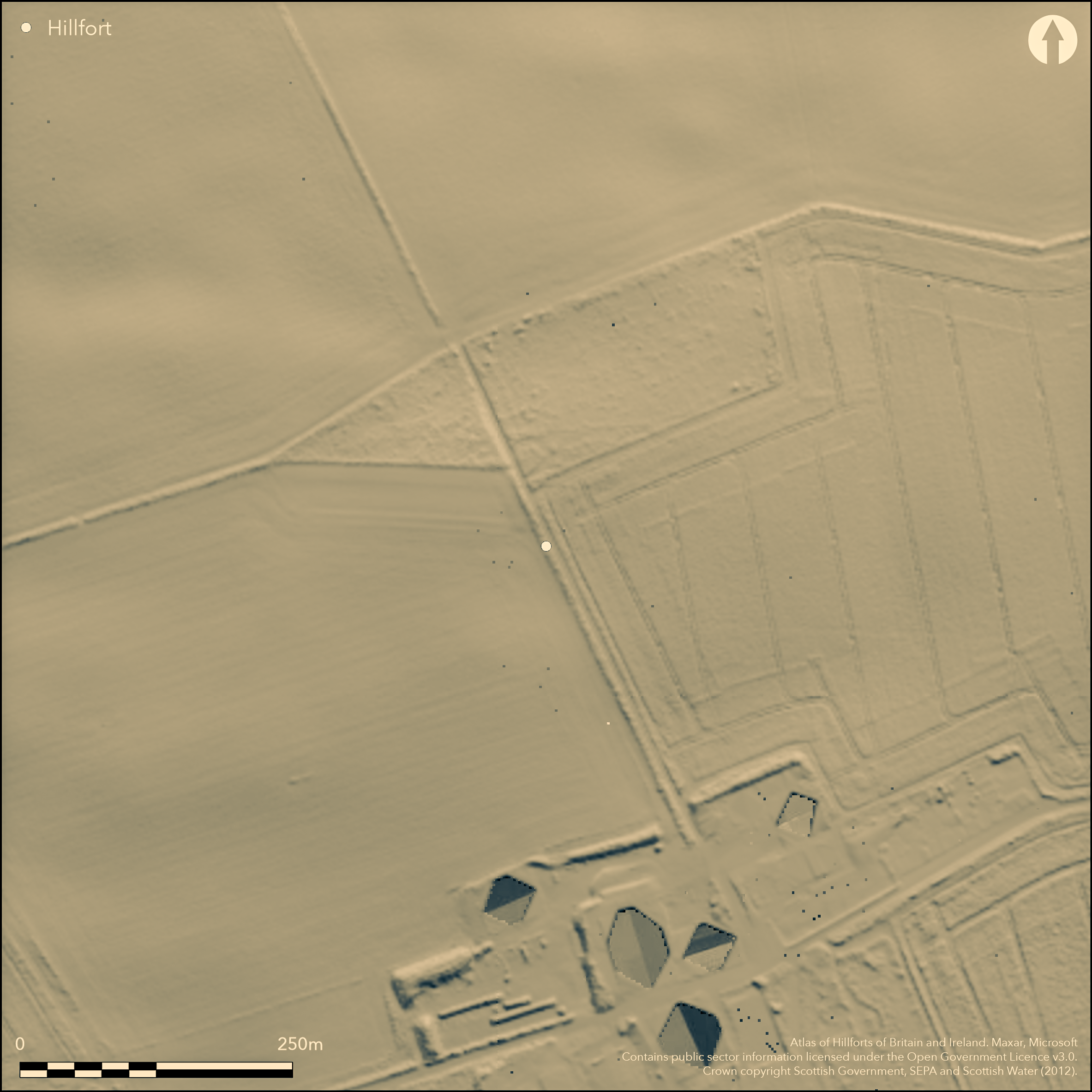
LiDAR 1m DTM Hillshade
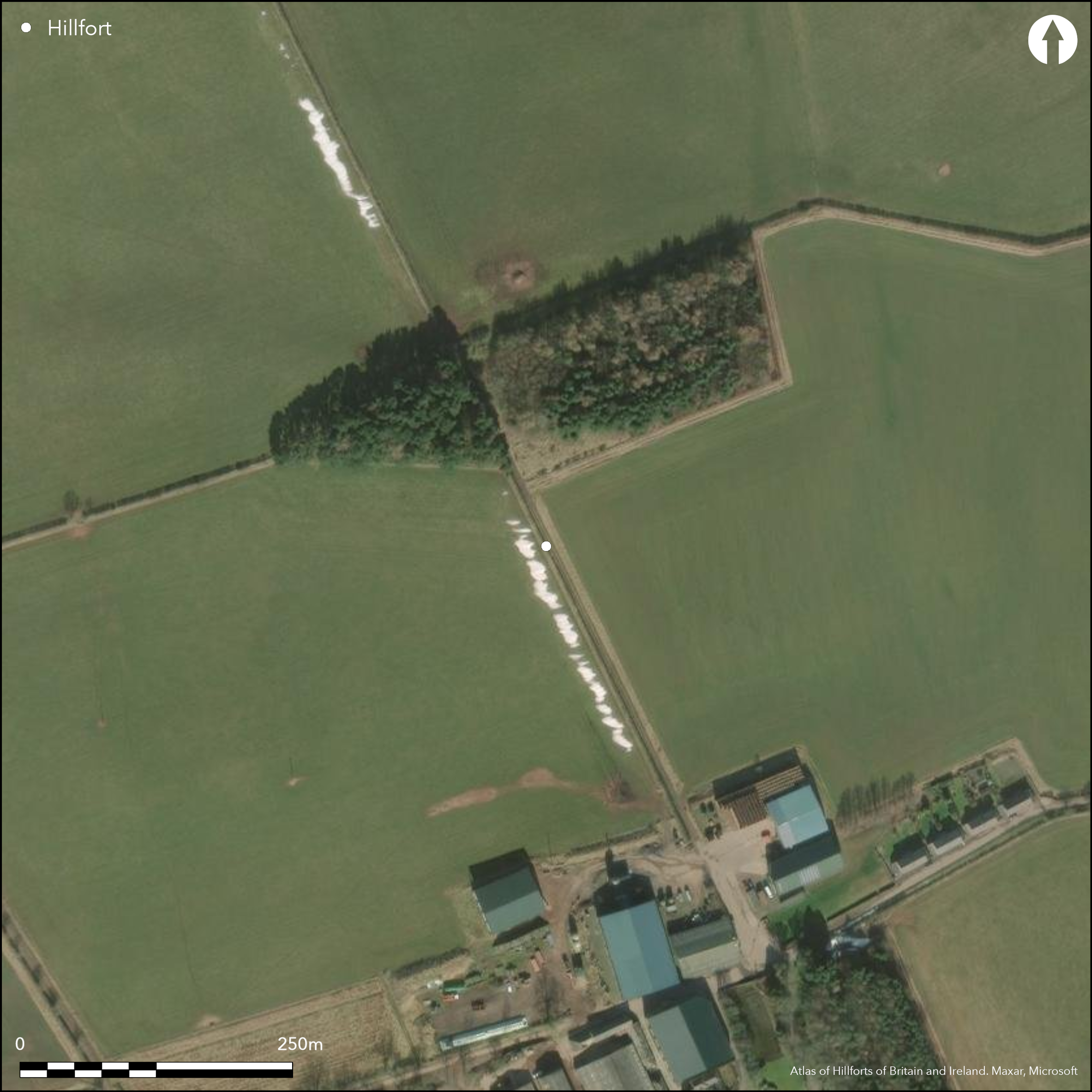
Satellite Imagery
LiDAR 1m DTM Hillshade
Satellite Imagery
Scroll left/right to view further images.
HER: Scottish Borders 59655 (None)
NMR: NT 85 NE 25 (59655)
SM: 5228
NGR: NT 8638 5860
X: 386386 Y: 658600 (OSGB36)
The site of this fort, which is situated on the NW shoulder of an undulating plateau, is marked by a broad hollow NNW of Oldcastles, between the steading and the steeper ground dropping down to the Billiemire Burn on the N and W. Evidently remembered in the place-name, but probably already demolished before the late 18th century, cropmarks reveal three ditches, though they probably represent several periods of construction. The innermost ditch, which is the narrowest of them, is between 2m and 3m in breadth and encloses a roughly circular area about 80m in diameter (0.5ha). It has entrances on the ENE and WSW, but while the latter was perhaps approached obliquely through gaps in the outer defences, there is little evidence of any corresponding causeways across the middle and outer ditches on the ENE. In part this may be because the outer ditch is intersected at this point by a diffuse linear mark, which has all the appearance of a track approaching the entrance into the inner enclosure, but there is also a clear causeway across the outermost ditch further round on the NNE. Only one side of the gap in the middle ditch is visible here, but this is a better candidate for an entrance through the outer defences on this side, and the complete absence of an equivalent causeway across the innermost ditch strongly suggests that the two outer ditches belong to one or more independent phases of enclosure. Around most of the circuit these two ditches lie about 10m apart, and at some 6m in maximum breadth, the outermost is rather broader than the middle ditch, but assuming they formed a single scheme they enclosed an oval area measuring 105m from ENE to WSW by 95m transversely (0.85ha). In addition to the entrance on the NNE, the outer ditch turns slightly inwards on either side of the entrance on the WSW, and the causeways appear sufficiently broad that the ramparts may have returned and united around the terminals of the ditches to either side. Making some allowance for the presence of an inner rampart, its interior enclosed about 0.64ha, though if the broader outer ditch was itself an independent enclosure, its rampart would have taken in 1ha. No clear features have been recorded within the interior of the fort.
Citizen Science: ✗
Reliability of Data: Confirmed
Reliability of Interpretation: Confirmed
X: -247000 Y: 7522765 (EPSG: 3857)
Longitude: -2.2188388973022812 Latitude: 55.82049922295267 (EPSG:4326)
Country: Scotland
Current County or Unitary Authority: Scottish Borders
Historic County: Berwickshire
Current Parish/Community/Council/Townland: Chirnside
None
| Extant | ✓ |
| Cropmark | ✓ |
| Likely Destroyed | ✗ |
None
| Woodland | ✗ |
| Commercial Forestry Plantation | ✗ |
| Parkland | ✗ |
| Pasture (Grazing) | ✗ |
| Arable | ✓ |
| Scrub/Bracken | ✗ |
| Bare Outcrop | ✗ |
| Heather/Moorland | ✗ |
| Heath | ✗ |
| Built-up | ✗ |
| Coastal Grassland | ✗ |
| Other | ✗ |
None
| Contour Fort | ✗ |
| Partial Contour Fort | ✗ |
| Promontory Fort | ✗ |
| Hillslope Fort | ✗ |
| Level Terrain Fort | ✓ |
| Marsh Fort | ✗ |
| Multiple Enclosure Fort | ✗ |
| Hilltop | ✗ |
| Coastal Promontory | ✗ |
| Inland Promontory | ✗ |
| Valley Bottom | ✗ |
| Knoll/Hillock/Outcrop | ✗ |
| Ridge | ✗ |
| Cliff/Plateau-edge/Scarp | ✓ |
| Hillslope | ✗ |
| Lowland | ✗ |
| Spur | ✗ |
Dominant Topographic Feature: None
| North | ✗ |
| Northeast | ✗ |
| East | ✗ |
| Southeast | ✗ |
| South | ✗ |
| Southwest | ✗ |
| West | ✗ |
| Northwest | ✗ |
| Level | ✓ |
Altitude: 106.0m
N/A
In the absence of excavation, there are neither stratified artefacts nor radiocarbon dates to provide a chronology for the defences.
Reliability: D - None
| Pre 1200BC | ✗ |
| 1200BC - 800BC | ✗ |
| 800BC - 400BC | ✗ |
| 400BC - AD50 | ✗ |
| AD50 - AD400 | ✗ |
| AD400 - AD 800 | ✗ |
| Post AD800 | ✗ |
| Unknown | ✓ |
| Pre Hillfort: | None |
| Post Hillfort: | Ploughed down and overlain by hedgerows |
Photographed by CUCAP in 1964, and by RCAHMS Aerial Survey Programme in 1976, 1978, 1984, 1990, 1994, and 1999
| 1st Identified Written Reference (1795): | Noted (Stat Acct, xiv, 1795, 34) |
| Other (1964): | Cropmarks first photographed by CUCAP |
| Other (1971): | Visited by the OS |
| Other (1979): | Visited by RCAHMS |
| Other (1991): | Scheduled |
| Other (2009): | Re-Scheduled |
No clear features
None
| None | ✓ |
| Spring | ✗ |
| Stream | ✗ |
| Pool | ✗ |
| Flush | ✗ |
| Well | ✗ |
| Other | ✗ |
None
| No Known Features | ✓ |
| Round Stone Structures | ✗ |
| Rectangular Stone Structures | ✗ |
| Curvilinear Platforms | ✗ |
| Other Roundhouse Evidence | ✗ |
| Pits | ✗ |
| Quarry Hollows | ✗ |
| Other | ✗ |
None
| No Known Excavation | ✓ |
| Pits | ✗ |
| Postholes | ✗ |
| Roundhouses | ✗ |
| Rectangular Structures | ✗ |
| Roads/Tracks | ✗ |
| Quarry Hollows | ✗ |
| Other | ✗ |
| Nothing Found | ✗ |
None
| No Known Geophysics | ✓ |
| Pits | ✗ |
| Roundhouses | ✗ |
| Rectangular Structures | ✗ |
| Roads/Tracks | ✗ |
| Quarry Hollows | ✗ |
| Other | ✗ |
| Nothing Found | ✗ |
None
| No Known Finds | ✓ |
| Pottery | ✗ |
| Metal | ✗ |
| Metalworking | ✗ |
| Human Bones | ✗ |
| Animal Bones | ✗ |
| Lithics | ✗ |
| Environmental | ✗ |
| Other | ✗ |
NO APPARENT FEATURES
| APs Not Checked | ✗ |
| None | ✓ |
| Roundhouses | ✗ |
| Rectangular Structures | ✗ |
| Pits | ✗ |
| Postholes | ✗ |
| Roads/Tracks | ✗ |
| Other | ✗ |
See main summary
| 2: | None |
| 2: | Generalised in the inner circuit, but a causeway in the outer defences (1) is listed separately |
Guard Chambers: ✗
Chevaux de Frise: ✗
| 1. Simple Gap (North east): | Apparent causeway across the middle and outer ditches |
| 2. Simple Gap (East): | In the innermost ditch, with possible scar of wear intersecting the middle and outer ditches |
| 3. Simple Gap (West): | Piercing all three ditches, though the gap in the inner is slightly staggered to one side, and the outer gaps are broad enough to suggest that the ramparts may have returned and united around the terminals of the outer ditches |
Three ditches, presumably with upcast ramparts, But probably representing at least two periods of construction, and each line was possibly an independent phase of enclosure
| Area 1: | 0.5ha. |
| Area 2: | 0.64ha. |
| Area 3: | 1ha. |
| Total: | 1.0ha. |
Total Footprint Area: Noneha.
None
| ✓ | The entrances into the innermost enclosure are not aligned with the outer defences, suggesting at least two periods of construction, though the sequence is uncertain |
| ✓ | None |
| NE Quadrant: | 3 |
| SE Quadrant: | 3 |
| SW Quadrant: | 3 |
| NW Quadrant: | 3 |
| Total: | 3 |
| Partial Univallate | ✗ |
| Univallate | ✗ |
| Partial Bivallate | ✗ |
| Bivallate | ✗ |
| Partial Multivallate | ✗ |
| Multivallate | ✓ |
| Unknown | ✗ |
| Partial Univallate | ✗ |
| Univallate | ✓ |
| Partial Bivallate | ✗ |
| Bivallate | ✓ |
| Partial Multivallate | ✗ |
| Multivallate | ✗ |
Possible traces of a rampart were noted on the SW in 1979
| None | ✓ |
| Earthen Bank | ✗ |
| Stone Wall | ✗ |
| Rubble | ✗ |
| Wall-walk | ✗ |
| Evidence of Timber | ✗ |
| Vitrification | ✗ |
| Other Burning | ✗ |
| Palisade | ✗ |
| Counter Scarp Bank | ✗ |
| Berm | ✗ |
| Unfinished | ✗ |
| Other | ✗ |
None
| None | ✗ |
| Earthen Bank | ✗ |
| Stone Wall | ✗ |
| Murus Duplex | ✗ |
| Timber-framed | ✗ |
| Timber-laced | ✗ |
| Vitrification | ✗ |
| Other Burning | ✗ |
| Palisade | ✗ |
| Counter Scarp Bank | ✗ |
| Berm | ✗ |
| Unfinished | ✗ |
| No Known Excavation | ✓ |
| Other | ✗ |
| ✗ | None |
| ✓ | Possibly representing several periods |
Number of Ditches: 3
| ✗ | None |
Stat Acct (date) Statistical Account of Scotland: Drawn up from the Communications of the Ministers of the Different Parishes (Sinclair, J ed), 1791-99
Atlas of Hillforts:
Wikidata:
This work is licensed under CC BY-SA 4.0

 and should be cited as:
Lock, Gary and Ralston, Ian. 2024. Atlas of Hillforts of Britain and Ireland. Available at: https://hillforts.arch.ox.ac.uk
Document Version 1.1