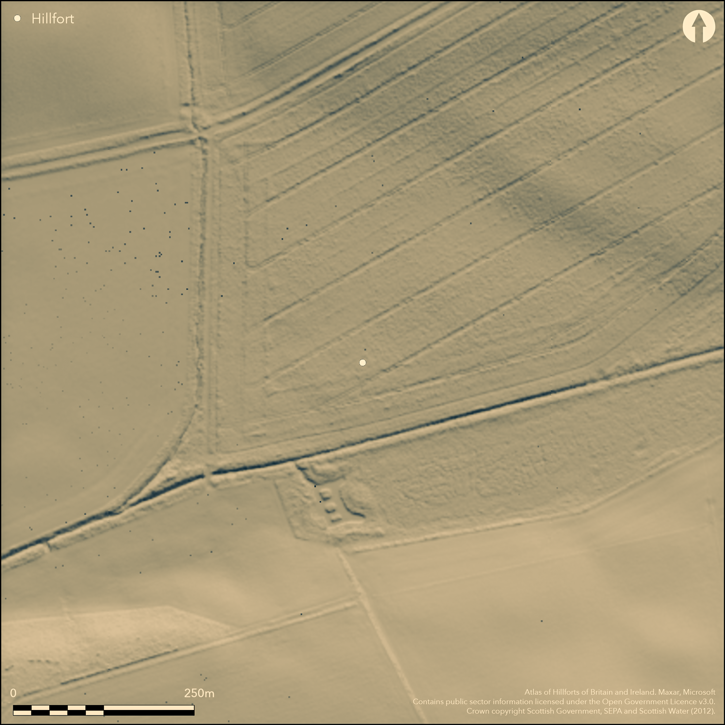
LiDAR 1m DTM Hillshade
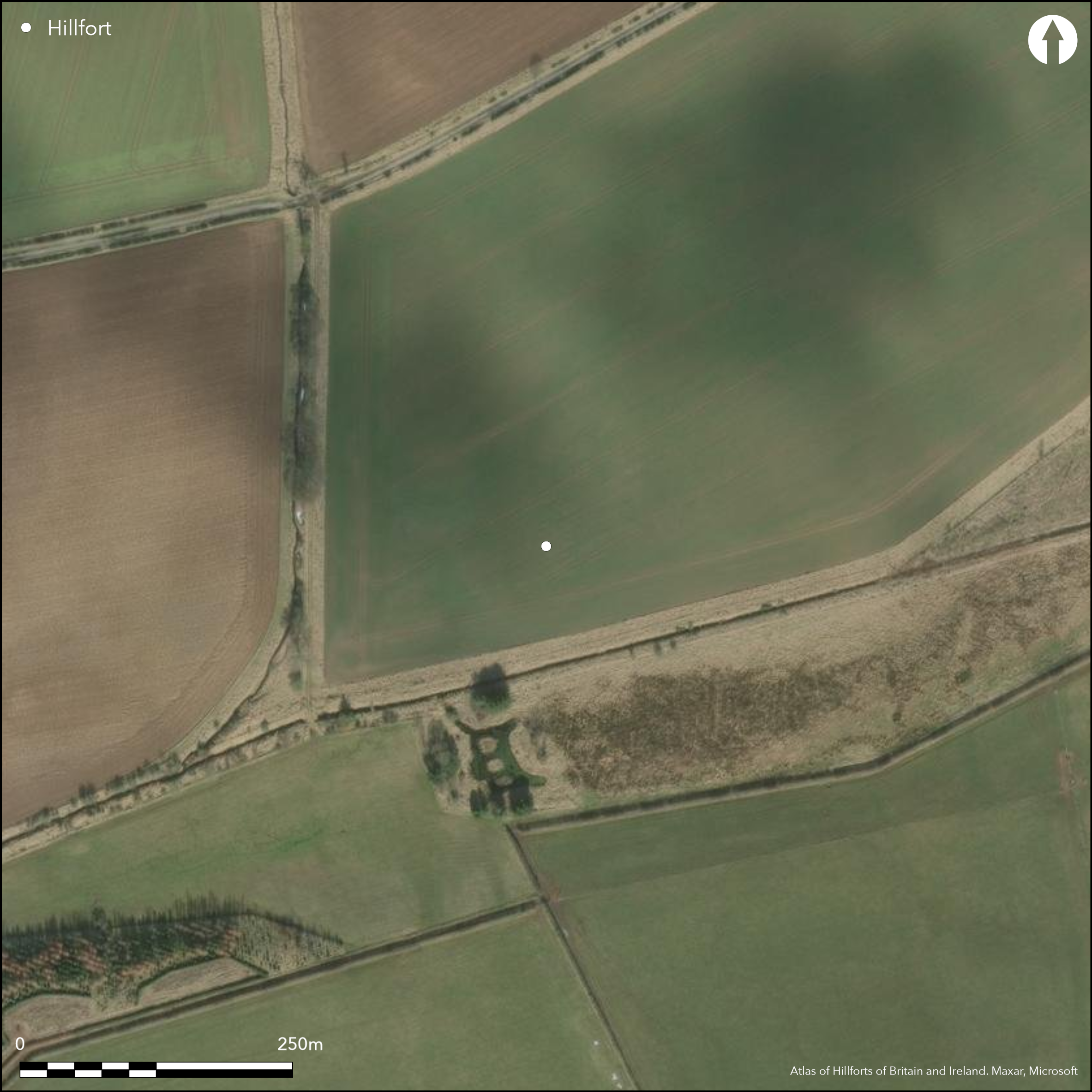
Satellite Imagery
LiDAR 1m DTM Hillshade
Satellite Imagery
Scroll left/right to view further images.
HER: Scottish Borders 59657 (None)
NMR: NT 85 NE 27 (59657)
SM: 5219
NGR: NT 8621 5913
X: 386216 Y: 659131 (OSGB36)
Cropmarks have revealed a complex enclosure situated on a slight rise in the floor of the valley to the ENE of the confluence of the Billiemire and Auchencrow Burns, which prior to drainage schemes in the early 19th century would have been surrounded by the swamp known as Billie Mire. Topographically, the rise is a spur projecting from slightly higher ground on the ENE and tapers into a rounded point on the WSW. Here there are traces of possibly two ditches enclosing an oval area measuring 55m from ENE to WSW by 45m transversely, and though the cropmarks are faint and diffuse, it is presumably the outer of these that first caught the attention of RCAHMS investigators inspecting vertical aerial photographs in 1950. More recent aerial reconnaissance has recorded a much large enclosure on the spur, its principal feature being two concentric ditches some 3m in breadth and set 7m apart cutting across the neck to bar access from the ENE, and the inner returning along the NW flank to dogleg round the outer ditch of the oval enclosure before disappearing in a damper area of the field. Essentially a triangular promontory enclosure, it measures at least 120m in length from ENE to WSW by a maximum of 110m in breadth (0.6ha), though whether as an annexe to the oval enclosure on the tip or as a free-standing perimeter cannot be demonstrated without excavation. There is at least one entrance facing NE near the N apex of the enclosure, and possibly a second on the E at the S margin of the spur, while a series of diffuse maculae within its interior almost certainly indicate the stances of structures. An outlying ditch extends across the field in a gentle arc from NW to SE about 90m to the NE.
Citizen Science: ✗
Reliability of Data: Confirmed
Reliability of Interpretation: Confirmed
X: -247305 Y: 7523709 (EPSG: 3857)
Longitude: -2.2215791694489524 Latitude: 55.825265430980934 (EPSG:4326)
Country: Scotland
Current County or Unitary Authority: Scottish Borders
Historic County: Berwickshire
Current Parish/Community/Council/Townland: Coldingham
None
| Extant | ✗ |
| Cropmark | ✓ |
| Likely Destroyed | ✗ |
None
| Woodland | ✗ |
| Commercial Forestry Plantation | ✗ |
| Parkland | ✗ |
| Pasture (Grazing) | ✗ |
| Arable | ✓ |
| Scrub/Bracken | ✗ |
| Bare Outcrop | ✗ |
| Heather/Moorland | ✗ |
| Heath | ✗ |
| Built-up | ✗ |
| Coastal Grassland | ✗ |
| Other | ✗ |
lowlying promontory previously set amongst marshland
| Contour Fort | ✗ |
| Partial Contour Fort | ✗ |
| Promontory Fort | ✓ |
| Hillslope Fort | ✗ |
| Level Terrain Fort | ✗ |
| Marsh Fort | ✓ |
| Multiple Enclosure Fort | ✗ |
| Hilltop | ✗ |
| Coastal Promontory | ✗ |
| Inland Promontory | ✓ |
| Valley Bottom | ✓ |
| Knoll/Hillock/Outcrop | ✗ |
| Ridge | ✗ |
| Cliff/Plateau-edge/Scarp | ✗ |
| Hillslope | ✗ |
| Lowland | ✗ |
| Spur | ✗ |
Dominant Topographic Feature: None
| North | ✗ |
| Northeast | ✗ |
| East | ✗ |
| Southeast | ✗ |
| South | ✗ |
| Southwest | ✗ |
| West | ✗ |
| Northwest | ✗ |
| Level | ✓ |
Altitude: 68.0m
N/A
In the absence of excavation, there are neither stratified artefacts nor radiocarbon dates to provide a chronology for the defences.
Reliability: D - None
| Pre 1200BC | ✗ |
| 1200BC - 800BC | ✗ |
| 800BC - 400BC | ✗ |
| 400BC - AD50 | ✗ |
| AD50 - AD400 | ✗ |
| AD400 - AD 800 | ✗ |
| Post AD800 | ✗ |
| Unknown | ✓ |
| Pre Hillfort: | None |
| Post Hillfort: | Ploughed flat |
Photographed in 1990 by John Dent, and by RCAHMS Aerial Survey Programme in 1984, 1993, 1996 and 1999
| 1st Identified Written Reference (1950): | Observed on vertical aerial photographs and described for the first time during RCAHMS Survey of Marginal Lands |
| Other (1972): | Visited by the OS |
| Other (1979): | Visited by RCAHMS |
| Other (1984): | First photographed by the RCAHMS Aerial Survey Programme |
| Other (1991): | Scheduled |
Series of diffuse maculae that probably indicate the stances of structures
None
| None | ✓ |
| Spring | ✗ |
| Stream | ✗ |
| Pool | ✗ |
| Flush | ✗ |
| Well | ✗ |
| Other | ✗ |
None
| No Known Features | ✓ |
| Round Stone Structures | ✗ |
| Rectangular Stone Structures | ✗ |
| Curvilinear Platforms | ✗ |
| Other Roundhouse Evidence | ✗ |
| Pits | ✗ |
| Quarry Hollows | ✗ |
| Other | ✗ |
None
| No Known Excavation | ✓ |
| Pits | ✗ |
| Postholes | ✗ |
| Roundhouses | ✗ |
| Rectangular Structures | ✗ |
| Roads/Tracks | ✗ |
| Quarry Hollows | ✗ |
| Other | ✗ |
| Nothing Found | ✗ |
None
| No Known Geophysics | ✓ |
| Pits | ✗ |
| Roundhouses | ✗ |
| Rectangular Structures | ✗ |
| Roads/Tracks | ✗ |
| Quarry Hollows | ✗ |
| Other | ✗ |
| Nothing Found | ✗ |
None
| No Known Finds | ✓ |
| Pottery | ✗ |
| Metal | ✗ |
| Metalworking | ✗ |
| Human Bones | ✗ |
| Animal Bones | ✗ |
| Lithics | ✗ |
| Environmental | ✗ |
| Other | ✗ |
Series of diffuse maculae
| APs Not Checked | ✗ |
| None | ✗ |
| Roundhouses | ✗ |
| Rectangular Structures | ✗ |
| Pits | ✗ |
| Postholes | ✗ |
| Roads/Tracks | ✗ |
| Other | ✓ |
See main summary
| 2: | The whole perimeter is ploughed flat |
| 2: | None |
Guard Chambers: ✗
Chevaux de Frise: ✗
| 1. Simple Gap (North east): | Through the twin ditches of the promontory enclosure |
| 2. Simple Gap (East): | Possible gap through the twin ditches of the promontory enclosure |
An inner enclosure with two ditches and an outer promontory enclosure with two ditches across the neck and the inner extending along at least one flank
| Area 1: | 0.6ha. |
| Total: | 0.6ha. |
Total Footprint Area: Noneha.
None
| ✗ | The relationship between the inner enclosure and the promontory enclosure is unknown |
| ✗ | Representing only the promontory enclosure |
| NE Quadrant: | 2 |
| SE Quadrant: | 0 |
| SW Quadrant: | 0 |
| NW Quadrant: | 1 |
| Total: | 2 |
| Partial Univallate | ✓ |
| Univallate | ✗ |
| Partial Bivallate | ✓ |
| Bivallate | ✗ |
| Partial Multivallate | ✗ |
| Multivallate | ✗ |
| Unknown | ✗ |
| Partial Univallate | ✗ |
| Univallate | ✗ |
| Partial Bivallate | ✗ |
| Bivallate | ✗ |
| Partial Multivallate | ✗ |
| Multivallate | ✗ |
None
| None | ✓ |
| Earthen Bank | ✗ |
| Stone Wall | ✗ |
| Rubble | ✗ |
| Wall-walk | ✗ |
| Evidence of Timber | ✗ |
| Vitrification | ✗ |
| Other Burning | ✗ |
| Palisade | ✗ |
| Counter Scarp Bank | ✗ |
| Berm | ✗ |
| Unfinished | ✗ |
| Other | ✗ |
None
| None | ✗ |
| Earthen Bank | ✗ |
| Stone Wall | ✗ |
| Murus Duplex | ✗ |
| Timber-framed | ✗ |
| Timber-laced | ✗ |
| Vitrification | ✗ |
| Other Burning | ✗ |
| Palisade | ✗ |
| Counter Scarp Bank | ✗ |
| Berm | ✗ |
| Unfinished | ✗ |
| No Known Excavation | ✓ |
| Other | ✗ |
| ✗ | None |
| ✓ | Representing the promontory enclosure |
Number of Ditches: 2
| ✓ | The promontory enclosure is possibly an annexe to the inner enclosure, though it might equally have been a free-standing work. |
No related records
Atlas of Hillforts:
Wikidata:
This work is licensed under CC BY-SA 4.0

 and should be cited as:
Lock, Gary and Ralston, Ian. 2024. Atlas of Hillforts of Britain and Ireland. Available at: https://hillforts.arch.ox.ac.uk
Document Version 1.1