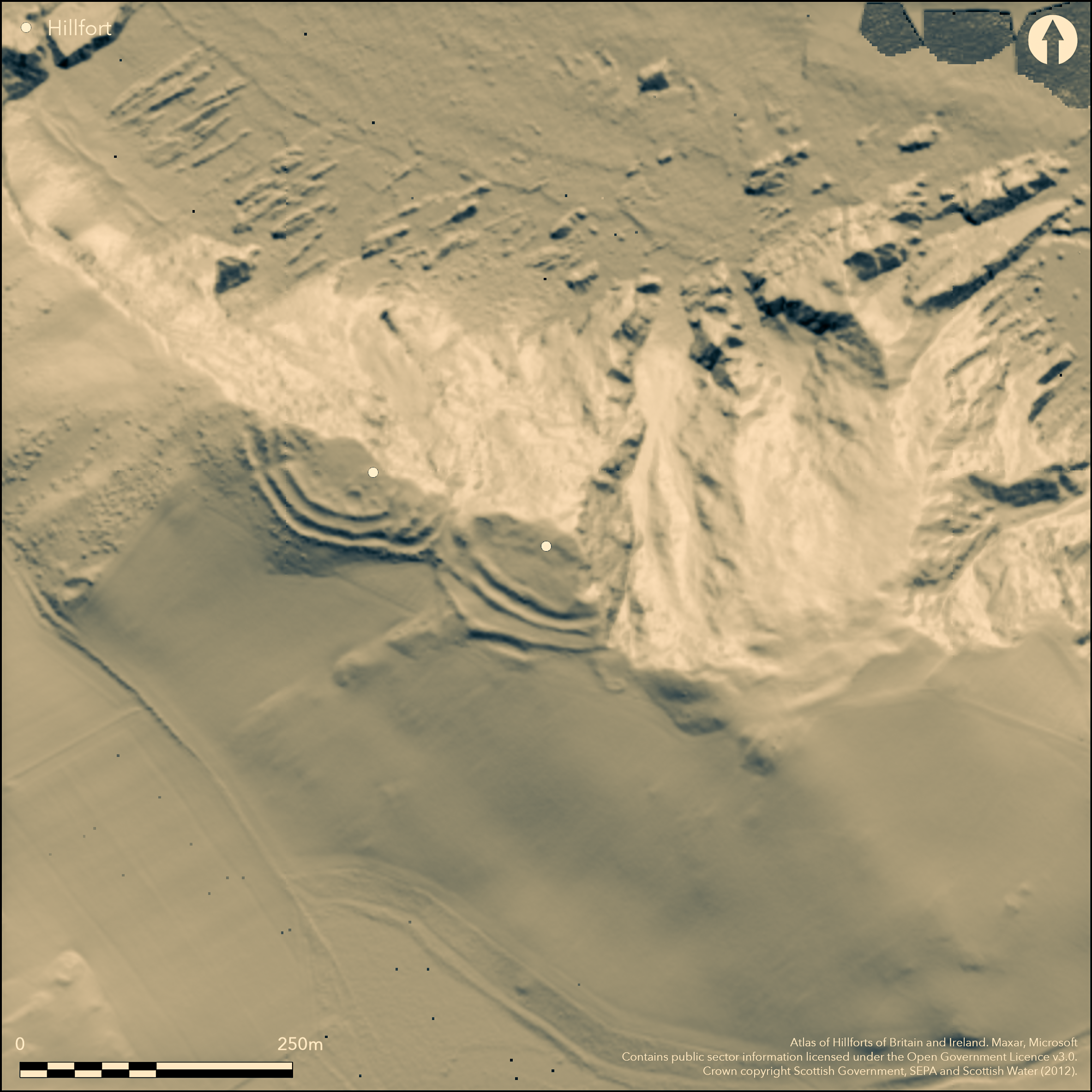
LiDAR 1m DTM Hillshade
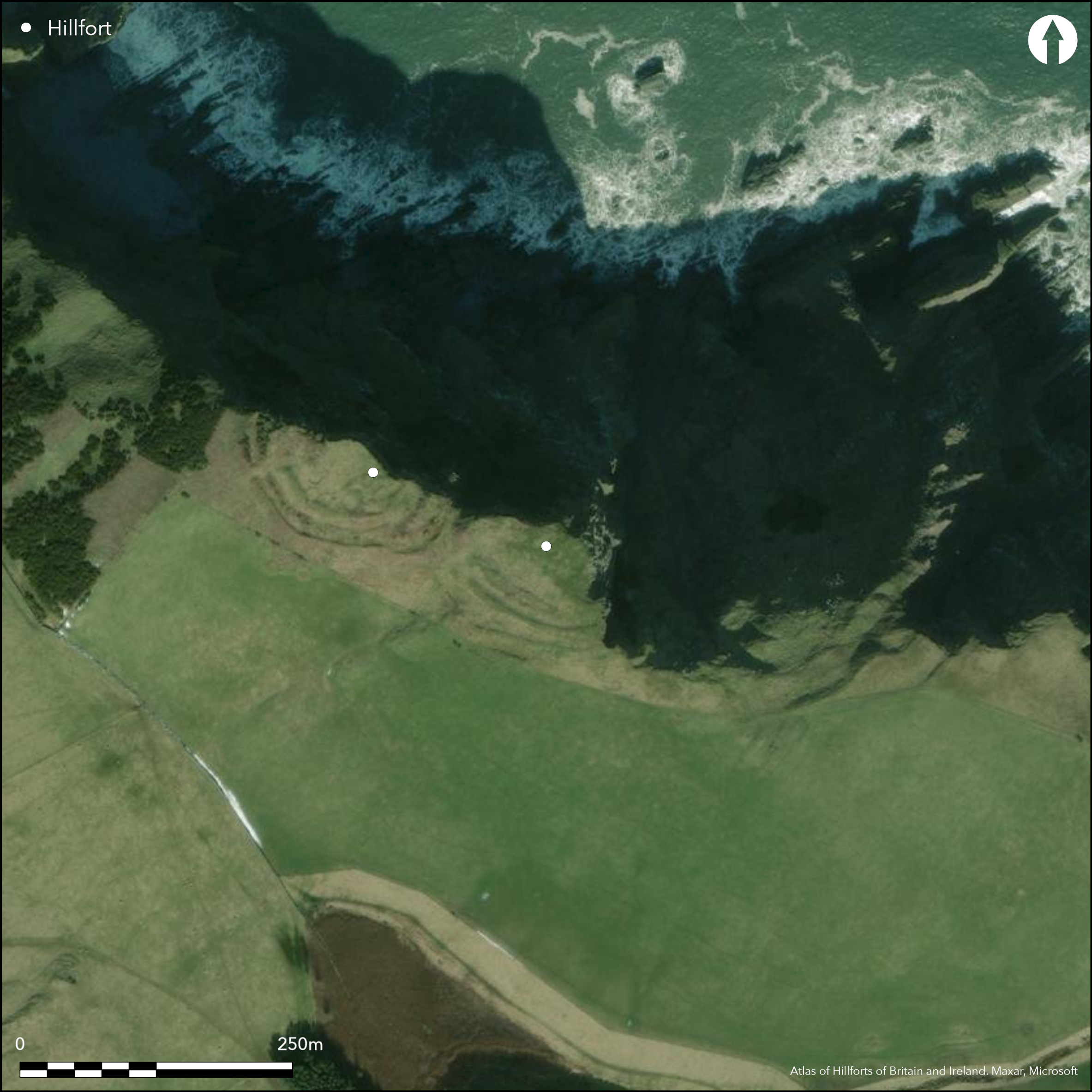
Satellite Imagery
LiDAR 1m DTM Hillshade
Satellite Imagery
Scroll left/right to view further images.
HER: Scottish Borders 59800 (None)
NMR: NT 86 NE 8 (59800)
SM: 368
NGR: NT 8927 6911
X: 389275 Y: 669110 (OSGB36)
This fort is the south-eastern of a pair of forts (see Atlas No.4094) set on a promontory in the shallow saddle between the two summits of Tun Law, which along its NE flank falls away virtually sheer to the sea about 150m below. In the final stages of a complex sequence the defences here were linked to the neighbouring fort on the NW, but as originally built the two forts were discrete entities, the defences of the south-eastern drawn in an arc across the S and W approaches. Like its neighbour, the defences of the initial fort here probably comprised twin ramparts with a medial ditch, which cut off the relatively shallow summit of the promontory, an area measuring about 65m from ESE to WNW by 35m transversely (0.22ha). The interior is featureless and the entrance is on the W. At some stage, presumably when the defences of the SE fort were derelict, the counterscarp rampart outside the entrance was demolished and the outer rampart of the NW fort was reconstructed in a spur that adopts the line of the counterscarp adjacent to cliff-edge. Subsequently the defences of the SE fort seem to have been refurbished and the demolished counterscarp rampart was rebuilt on a new line that butts onto the reconstructed spur rampart of the NW fort; Gordon Childe, who cut a section across the defences of this fort in 1931, also explored this junction, but without conclusively demonstrating the probable stratigraphic relationship (1932, 178-9). A further modification of the defences saw the addition of a third rampart with an external ditch on an eccentric line and apparently butting onto the rebuilt counterscarp rampart outside the original entrance. As first constructed, this entrance was relatively simple, though the terminals of the rampart may have been staggered slightly to either side of the gap, but with the successive modifications of the defences, the gaps in the outer ramparts were staggered eastwards to create a long oblique approach to the inner entrance exposing the visitor's right side. Finds from the excavations were limited to a few sherds of coarse pottery and animal bones (Childe 1932).
Citizen Science: ✗
Reliability of Data: Confirmed
Reliability of Interpretation: Confirmed
X: -241914 Y: 7541514 (EPSG: 3857)
Longitude: -2.173150640342474 Latitude: 55.915005132875045 (EPSG:4326)
Country: Scotland
Current County or Unitary Authority: Scottish Borders
Historic County: Berwickshire
Current Parish/Community/Council/Townland: Coldingham
None
| Extant | ✓ |
| Cropmark | ✗ |
| Likely Destroyed | ✗ |
None
| Woodland | ✗ |
| Commercial Forestry Plantation | ✗ |
| Parkland | ✗ |
| Pasture (Grazing) | ✓ |
| Arable | ✗ |
| Scrub/Bracken | ✗ |
| Bare Outcrop | ✗ |
| Heather/Moorland | ✓ |
| Heath | ✗ |
| Built-up | ✗ |
| Coastal Grassland | ✗ |
| Other | ✗ |
None
| Contour Fort | ✗ |
| Partial Contour Fort | ✗ |
| Promontory Fort | ✓ |
| Hillslope Fort | ✗ |
| Level Terrain Fort | ✗ |
| Marsh Fort | ✗ |
| Multiple Enclosure Fort | ✗ |
| Hilltop | ✗ |
| Coastal Promontory | ✓ |
| Inland Promontory | ✗ |
| Valley Bottom | ✗ |
| Knoll/Hillock/Outcrop | ✗ |
| Ridge | ✗ |
| Cliff/Plateau-edge/Scarp | ✗ |
| Hillslope | ✗ |
| Lowland | ✗ |
| Spur | ✗ |
Dominant Topographic Feature: None
| North | ✗ |
| Northeast | ✗ |
| East | ✗ |
| Southeast | ✗ |
| South | ✗ |
| Southwest | ✗ |
| West | ✗ |
| Northwest | ✗ |
| Level | ✓ |
Altitude: 150.0m
N/A
The sequence incorporating the defences of the neighbouring fort is sufficiently complex to suggest a period of abandonment after the construction of the initial fort; when part of the defences were superseded by the modification of the outer rampart of the NW fort, followed by re-occupation of the SE fort and at least two phases of modification of its defences. Potentially, this might carry the sequence into the early medieval period, particularly if the round-houses in the NW fort, in which a 1st/2nd century enamelled brooch was found, are associated with any of its defences. In practice there is no reason why this should be the case and comparison with other sequences (eg Atlas No.4096) suggests that a post-defensive occupation is inherently more likely. Thus there is no reason why the modification of the SE fort should not date from before the Roman Iron Age.
Reliability: D - None
| Pre 1200BC | ✗ |
| 1200BC - 800BC | ✗ |
| 800BC - 400BC | ✗ |
| 400BC - AD50 | ✗ |
| AD50 - AD400 | ✗ |
| AD400 - AD 800 | ✗ |
| Post AD800 | ✗ |
| Unknown | ✓ |
| Pre Hillfort: | An undecorated food vessel (NMAS: EE 73) is said to have been found in a cist at Earn's Heugh (Proc Soc Antiq Scot 28, 1893-4, 58) |
| Post Hillfort: | A small enclosure with a rectangular building butts against the outer rampart on the E |
Photographed by CUCAP in 1948 and 1968, and by the RCAHMS Aerial Survey Programme in 1982, 2010 and 2013. RCAHMS also hold the photographic archive from Childe's excavations. Richard Feachem has misunderstood the complexity of the fortified sequence and the reconstruction of the outermost rampart of the NW fort in his assertion that the SE fort probably is the earlier of the two (1963, 112), and the two forts were originally discrete entities.
| 1st Identified Map Depiction (1755): | Depicted by Gen William Roy on the Military Map of Scotland (1747-55) |
| 1st Identified Written Reference (1834): | Noted (NSA, ii, Berwickshire, 284) |
| Other (1856): | Annotated Camp on the 1st edition OS 25-inch map (Berwick 1862, sheet 5.3) |
| Earthwork Survey (1894): | Sketch-plan and description by David Christison (1895, 176-9, fig 31) |
| Other (1908): | Description (RCAHMS 1909, 15-16, no.87) |
| Earthwork Survey (1912): | Plan by James Hewat Craw and description (RCAHMS 1915, 45-6, no.80, fig 42; BWD 15/1; BWD 15/1/5 & DP225502) |
| Other (1927): | Scheduled |
| Excavation (1931): | By Gordon Childe and Daryll Forde with the Edinburgh League of Prehistorians (Childe and Forde 1932) |
| Other (1954): | Visited by the OS |
| Other (1966): | Visited by the OS |
| Other (1971): | Re-Scheduled |
| Other (1979): | Description by RCAHMS |
Featureless
None
| None | ✓ |
| Spring | ✗ |
| Stream | ✗ |
| Pool | ✗ |
| Flush | ✗ |
| Well | ✗ |
| Other | ✗ |
None
| No Known Features | ✓ |
| Round Stone Structures | ✗ |
| Rectangular Stone Structures | ✗ |
| Curvilinear Platforms | ✗ |
| Other Roundhouse Evidence | ✗ |
| Pits | ✗ |
| Quarry Hollows | ✗ |
| Other | ✗ |
Deposits forming at the back of the inner rampart
| No Known Excavation | ✗ |
| Pits | ✗ |
| Postholes | ✗ |
| Roundhouses | ✗ |
| Rectangular Structures | ✗ |
| Roads/Tracks | ✗ |
| Quarry Hollows | ✗ |
| Other | ✗ |
| Nothing Found | ✓ |
None
| No Known Geophysics | ✓ |
| Pits | ✗ |
| Roundhouses | ✗ |
| Rectangular Structures | ✗ |
| Roads/Tracks | ✗ |
| Quarry Hollows | ✗ |
| Other | ✗ |
| Nothing Found | ✗ |
None
| No Known Finds | ✗ |
| Pottery | ✓ |
| Metal | ✗ |
| Metalworking | ✗ |
| Human Bones | ✗ |
| Animal Bones | ✓ |
| Lithics | ✗ |
| Environmental | ✗ |
| Other | ✗ |
NO APPARENT FEATURES
| APs Not Checked | ✗ |
| None | ✓ |
| Roundhouses | ✗ |
| Rectangular Structures | ✗ |
| Pits | ✗ |
| Postholes | ✗ |
| Roads/Tracks | ✗ |
| Other | ✗ |
See main summary
| 1: | None |
| 2: | Elaborated in two entries below |
Guard Chambers: ✗
Chevaux de Frise: ✗
| 1. Simple Gap (West): | Possibly slightly staggered terminals in the inner rampart |
| 1. Oblique (West): | Reconstruction of the ramparts staggers the gaps to create a long oblique approach exposing right side |
Three ramparts, representing a complex development from an original twin ramparts with a medial ditch cutting off a promontory
| Area 1: | 0.22ha. |
| Total: | 0.22ha. |
Total Footprint Area: Noneha.
None
| ✓ | Clear evidence of a complex sequence linking with the sequence of the NW fort |
| ✗ | None |
| NE Quadrant: | 0 |
| SE Quadrant: | 3 |
| SW Quadrant: | 3 |
| NW Quadrant: | 2 |
| Total: | 3 |
| Partial Univallate | ✗ |
| Univallate | ✗ |
| Partial Bivallate | ✓ |
| Bivallate | ✗ |
| Partial Multivallate | ✓ |
| Multivallate | ✗ |
| Unknown | ✗ |
| Partial Univallate | ✗ |
| Univallate | ✗ |
| Partial Bivallate | ✓ |
| Bivallate | ✗ |
| Partial Multivallate | ✗ |
| Multivallate | ✗ |
None
| None | ✗ |
| Earthen Bank | ✓ |
| Stone Wall | ✓ |
| Rubble | ✗ |
| Wall-walk | ✗ |
| Evidence of Timber | ✗ |
| Vitrification | ✗ |
| Other Burning | ✗ |
| Palisade | ✗ |
| Counter Scarp Bank | ✗ |
| Berm | ✗ |
| Unfinished | ✗ |
| Other | ✗ |
None
| None | ✗ |
| Earthen Bank | ✗ |
| Stone Wall | ✓ |
| Murus Duplex | ✗ |
| Timber-framed | ✗ |
| Timber-laced | ✗ |
| Vitrification | ✗ |
| Other Burning | ✗ |
| Palisade | ✗ |
| Counter Scarp Bank | ✓ |
| Berm | ✗ |
| Unfinished | ✗ |
| No Known Excavation | ✗ |
| Other | ✗ |
| ✗ | None |
| ✓ | The ditch of the third rampart is an addition to an original scheme with a single ditch |
Number of Ditches: 2
| ✗ | None |
Childe, V G, & Forde, D (1932) 'Excavations in two Iron Age Forts at Earn's Heugh, near Coldingham'. Proc Soc Antiq Scot 66 (1931-2), 152-83
Christison, D (1895) 'The forts of Selkirk, the Gala Water, the Southern slopes of the Lammermoors, and the north of Roxburgh'. Proc Soc Antiq Scot 29 (1894-50), 108-79
Feachem, R W (1963) A guide to prehistoric Scotland. Batsford: London
NSA (1834-1845) The new statistical account of Scotland by the ministers of the respective parishes under the superintendence of a committee of the society for the benefit of the sons and daughters of the clergy.
RCAHMS (1909) The Royal Commission on the Ancient and Historical Monuments and Constructions of Scotland. First report and Inventory of Monuments and Constructions in the County of Berwick. HMSO: Edinburgh.
RCAHMS (1915) The Royal Commission on the Ancient and Historical Monuments and Constructions of Scotland. Sixth report and Inventory of Monuments and Constructions in the County of Berwick (Revised Issue). HMSO: Edinburgh
Atlas of Hillforts:
Wikidata:
This work is licensed under CC BY-SA 4.0

 and should be cited as:
Lock, Gary and Ralston, Ian. 2024. Atlas of Hillforts of Britain and Ireland. Available at: https://hillforts.arch.ox.ac.uk
Document Version 1.1