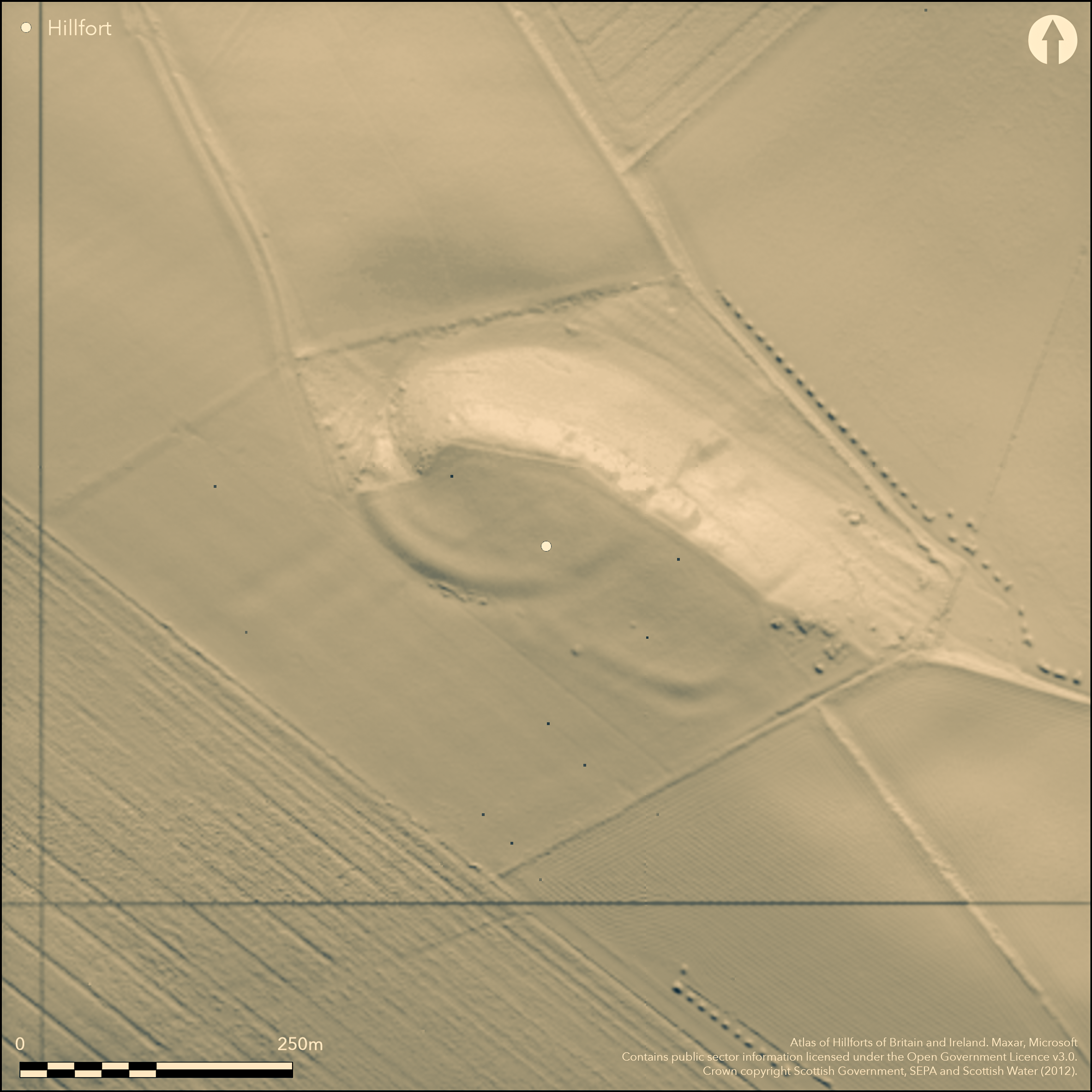
LiDAR 1m DTM Hillshade
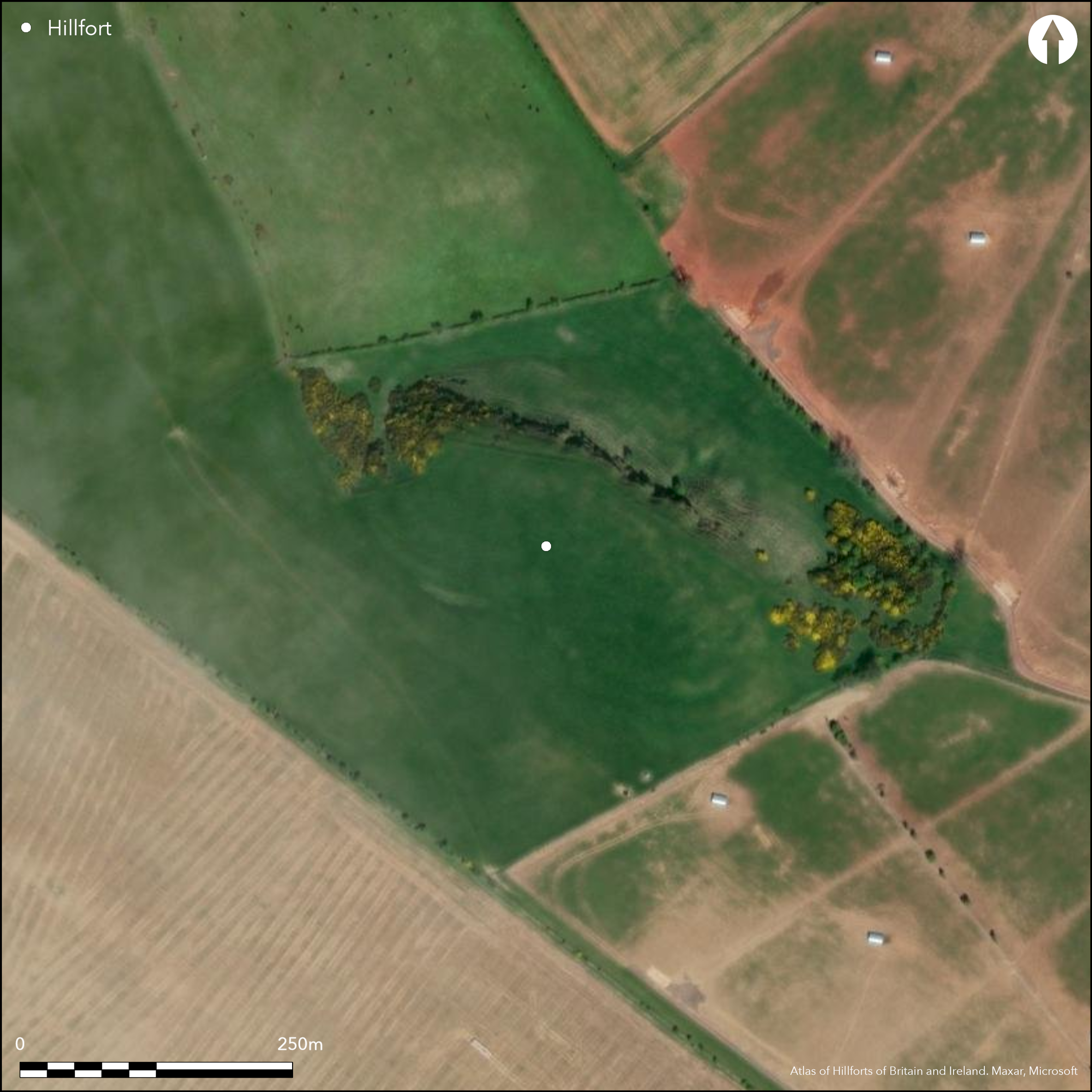
Satellite Imagery
LiDAR 1m DTM Hillshade
Satellite Imagery
Scroll left/right to view further images.
HER: Scottish Borders 60178 (None)
NMR: NT 96 SE 1 (60178)
SM: 4918
NGR: NT 9526 6018
X: 395260 Y: 660180 (OSGB36)
This fort occupies gently shelving ground dropping into a steep escarpment on the NE, which cuts back on the NW to create a shallow promontory. The defences comprise a single massive rampart and ditch, drawn in an arc to block access from the SW and SE, while a probable annexe defended by twin ramparts with a medial ditch extends to the SE, again exploiting the lip of the escarpment. Despite having been cultivated, the rampart of the main enclosure forms a massive bank spread 12m in thickness and 1.5m in internal height, rising 1.8m above the bottom of the adjacent ditch, which measures up to 13.5m in breadth. The only features visible within the interior, which measures 85m from NW to SE by 66m transversely (0.5ha), are a shallow internal quarry scoop behind the rampart and a later field-bank extending along the lip of the escarpment. A gap on the SE is probably the entrance and opens into the annexe, which measures internally 69m from NW to SE by 65m transversely (0.45ha). Its defences are almost as massive, the internal rampart spread 10m in thickness and rising 1.5m in height above the bottom of the medial ditch, which is itself some 10m in breadth; a gap on the SE is probably the entrance and the interior is featureless. The junction of the annexe and the major enclosure is too degraded to be able to show without excavation whether the annexe is either an addition or even possibly an earlier perimeter.
Citizen Science: ✗
Reliability of Data: Confirmed
Reliability of Interpretation: Confirmed
X: -231237 Y: 7525612 (EPSG: 3857)
Longitude: -2.077239247612275 Latitude: 55.83486611016911 (EPSG:4326)
Country: Scotland
Current County or Unitary Authority: Scottish Borders
Historic County: Berwickshire
Current Parish/Community/Council/Townland: Ayton
None
| Extant | ✓ |
| Cropmark | ✗ |
| Likely Destroyed | ✗ |
Ploughed down in the post-medieval period
| Woodland | ✗ |
| Commercial Forestry Plantation | ✗ |
| Parkland | ✗ |
| Pasture (Grazing) | ✓ |
| Arable | ✗ |
| Scrub/Bracken | ✗ |
| Bare Outcrop | ✗ |
| Heather/Moorland | ✗ |
| Heath | ✗ |
| Built-up | ✗ |
| Coastal Grassland | ✗ |
| Other | ✗ |
None
| Contour Fort | ✓ |
| Partial Contour Fort | ✗ |
| Promontory Fort | ✓ |
| Hillslope Fort | ✗ |
| Level Terrain Fort | ✗ |
| Marsh Fort | ✗ |
| Multiple Enclosure Fort | ✗ |
| Hilltop | ✗ |
| Coastal Promontory | ✗ |
| Inland Promontory | ✓ |
| Valley Bottom | ✗ |
| Knoll/Hillock/Outcrop | ✗ |
| Ridge | ✗ |
| Cliff/Plateau-edge/Scarp | ✓ |
| Hillslope | ✗ |
| Lowland | ✗ |
| Spur | ✗ |
Dominant Topographic Feature: None
| North | ✗ |
| Northeast | ✗ |
| East | ✗ |
| Southeast | ✗ |
| South | ✗ |
| Southwest | ✗ |
| West | ✗ |
| Northwest | ✗ |
| Level | ✓ |
Altitude: 171.0m
N/A
The scale of these defences is unusual, leading the RCAHMS investigators who visited in 1979 to speculate informally that the main enclosure was a medieval ringwork rather than a prehistoric fort, and its annexe a bailey, but there is no documentary evidence to suggest a major medieval estate centre here commensurate with the scale of the earthworks. The date of the earthwork can only be resolved by excavation.
Reliability: D - None
| Pre 1200BC | ✗ |
| 1200BC - 800BC | ✗ |
| 800BC - 400BC | ✗ |
| 400BC - AD50 | ✗ |
| AD50 - AD400 | ✗ |
| AD400 - AD 800 | ✗ |
| Post AD800 | ✗ |
| Unknown | ✓ |
| Pre Hillfort: | None |
| Post Hillfort: | Ploughed down and overlain by a field-bank |
None
| 1st Identified Map Depiction (1771): | Almost certainly 'Hindchester', a concentric ring on a hill symbol on Andrew and Mostyn Armstrong's Map of the County of Berwick (1771); see Craw 1921, 250 |
| Other (1856): | Annotated Camp on the 1st edition OS 25-inch map (Berwick 1860, sheet 12.6) |
| Other (1894): | Noted by David Christison, but not visited because he understood there was nothing to be seen (1895, 171) |
| Other (1908): | Description (RCAHMS 1909, 3, no.10) |
| Earthwork Survey (1912): | Plan by James Hewat Craw and description (RCAHMS 1915, 2-3, no.10, fig 2; RCAHMS BWD 17/1; BWD 17/1/3 & DP229121) |
| Other (1933): | Robert KInghorn records the adjacent cultivation terraces and redraws Craw's plan (Kinghorn 1933, 167, fig 6) |
| Other (1954): | Visited by the OS |
| Other (1966): | Resurveyed at 1:2500 by the OS |
| Other (1979): | Description by RCAHMS |
| Other (1990): | Scheduled |
Featureless
None
| None | ✓ |
| Spring | ✗ |
| Stream | ✗ |
| Pool | ✗ |
| Flush | ✗ |
| Well | ✗ |
| Other | ✗ |
None
| No Known Features | ✓ |
| Round Stone Structures | ✗ |
| Rectangular Stone Structures | ✗ |
| Curvilinear Platforms | ✗ |
| Other Roundhouse Evidence | ✗ |
| Pits | ✗ |
| Quarry Hollows | ✗ |
| Other | ✗ |
None
| No Known Excavation | ✓ |
| Pits | ✗ |
| Postholes | ✗ |
| Roundhouses | ✗ |
| Rectangular Structures | ✗ |
| Roads/Tracks | ✗ |
| Quarry Hollows | ✗ |
| Other | ✗ |
| Nothing Found | ✗ |
None
| No Known Geophysics | ✓ |
| Pits | ✗ |
| Roundhouses | ✗ |
| Rectangular Structures | ✗ |
| Roads/Tracks | ✗ |
| Quarry Hollows | ✗ |
| Other | ✗ |
| Nothing Found | ✗ |
None
| No Known Finds | ✓ |
| Pottery | ✗ |
| Metal | ✗ |
| Metalworking | ✗ |
| Human Bones | ✗ |
| Animal Bones | ✗ |
| Lithics | ✗ |
| Environmental | ✗ |
| Other | ✗ |
NO APPARENT FEATURES
| APs Not Checked | ✗ |
| None | ✓ |
| Roundhouses | ✗ |
| Rectangular Structures | ✗ |
| Pits | ✗ |
| Postholes | ✗ |
| Roads/Tracks | ✗ |
| Other | ✗ |
See main summary
| 1: | None |
| 2: | None |
Guard Chambers: ✗
Chevaux de Frise: ✗
| 1. Simple Gap (South east): | Gap opening into the annexe |
Single arc of rampart and ditch backing onto an angle in the escarpment creating a shallow promontory, with what appears to be an annexe on one side
| Area 1: | 0.5ha. |
| Total: | 0.5ha. |
Total Footprint Area: 1.7ha.
None
| ✓ | The angle of approach of the annexe rampart and ditch suggests that it is an addition, but the junction is heavily degraded and it is conceivably part of an earlier enclosure. |
| ✗ | Excludes the twin ramparts and medial ditch of the annexe |
| NE Quadrant: | 0 |
| SE Quadrant: | 1 |
| SW Quadrant: | 1 |
| NW Quadrant: | 0 |
| Total: | 1 |
| Partial Univallate | ✓ |
| Univallate | ✗ |
| Partial Bivallate | ✗ |
| Bivallate | ✗ |
| Partial Multivallate | ✗ |
| Multivallate | ✗ |
| Unknown | ✗ |
| Partial Univallate | ✗ |
| Univallate | ✗ |
| Partial Bivallate | ✗ |
| Bivallate | ✗ |
| Partial Multivallate | ✗ |
| Multivallate | ✗ |
The annexe defence also has a counterscarp rampart
| None | ✗ |
| Earthen Bank | ✓ |
| Stone Wall | ✗ |
| Rubble | ✗ |
| Wall-walk | ✗ |
| Evidence of Timber | ✗ |
| Vitrification | ✗ |
| Other Burning | ✗ |
| Palisade | ✗ |
| Counter Scarp Bank | ✗ |
| Berm | ✗ |
| Unfinished | ✗ |
| Other | ✗ |
None
| None | ✗ |
| Earthen Bank | ✗ |
| Stone Wall | ✗ |
| Murus Duplex | ✗ |
| Timber-framed | ✗ |
| Timber-laced | ✗ |
| Vitrification | ✗ |
| Other Burning | ✗ |
| Palisade | ✗ |
| Counter Scarp Bank | ✗ |
| Berm | ✗ |
| Unfinished | ✗ |
| No Known Excavation | ✓ |
| Other | ✗ |
| ✗ | None |
| ✓ | Excludes the ditch of the annexe |
Number of Ditches: 1
| ✓ | An annexe measuring 69m in length by 65m in breadth (0.45ha) within twin ramparts and a medial ditch extends the axis of the main enclosure on the SE. |
Christison, D (1895) 'The forts of Selkirk, the Gala Water, the Southern slopes of the Lammermoors, and the north of Roxburgh'. Proc Soc Antiq Scot 29 (1894-50), 108-79
Craw, J H (1921) 'Notes on Berwickshire Forts, with a description of those recently discovered'. Proc Soc Antiq Scot 55 (1920-1), 231-55
Kinghorn, R (1935) 'Unrecorded Berwickshire antiquities, being the Chalmers-Jervise Prize essay for 1933'. Proc Soc Antiq Scot 69 (1934-5), 157-67
RCAHMS (1909) The Royal Commission on the Ancient and Historical Monuments and Constructions of Scotland. First report and Inventory of Monuments and Constructions in the County of Berwick. HMSO: Edinburgh.
RCAHMS (1915) The Royal Commission on the Ancient and Historical Monuments and Constructions of Scotland. Sixth report and Inventory of Monuments and Constructions in the County of Berwick (Revised Issue). HMSO: Edinburgh
Atlas of Hillforts:
Wikidata:
This work is licensed under CC BY-SA 4.0

 and should be cited as:
Lock, Gary and Ralston, Ian. 2024. Atlas of Hillforts of Britain and Ireland. Available at: https://hillforts.arch.ox.ac.uk
Document Version 1.1