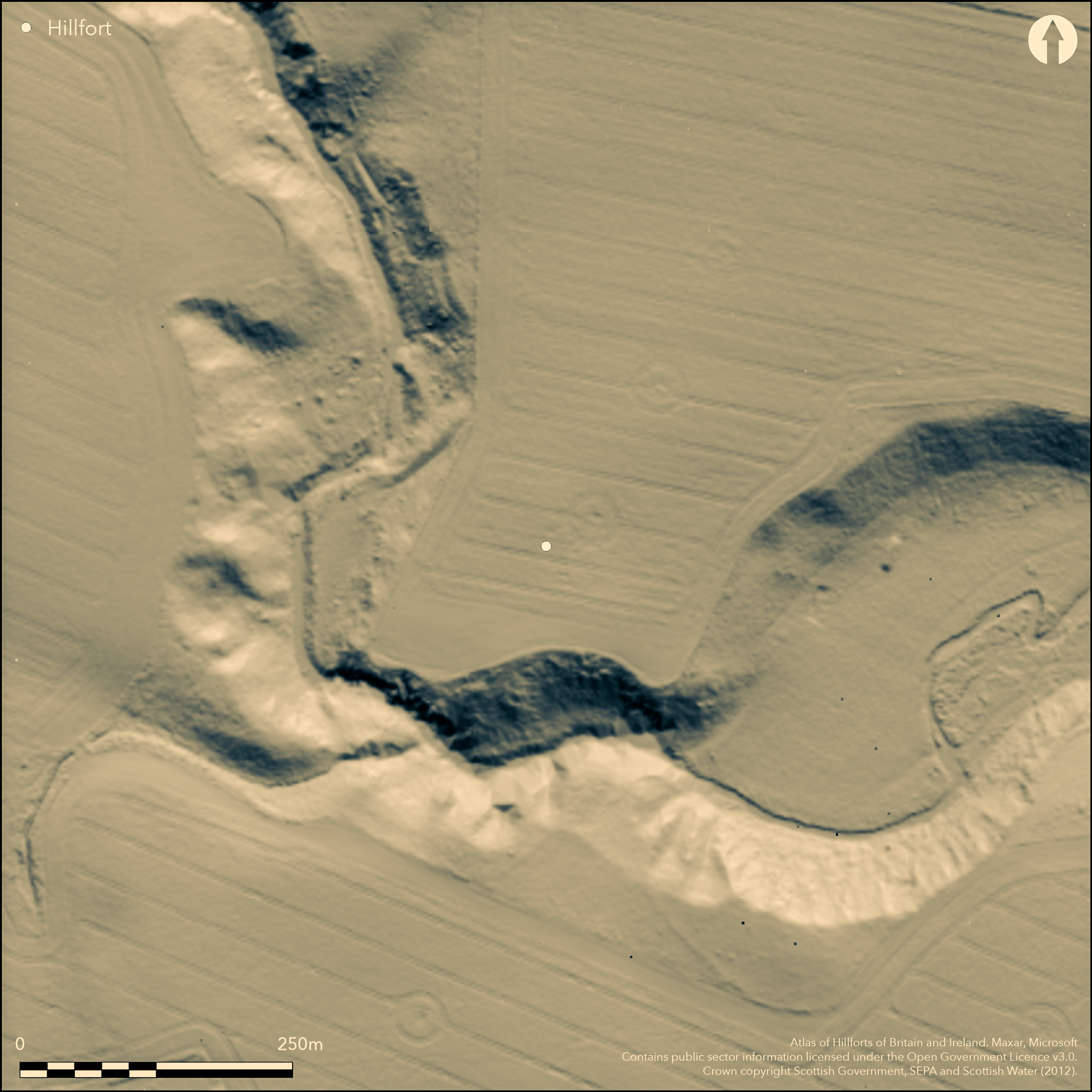
LiDAR 1m DTM Hillshade
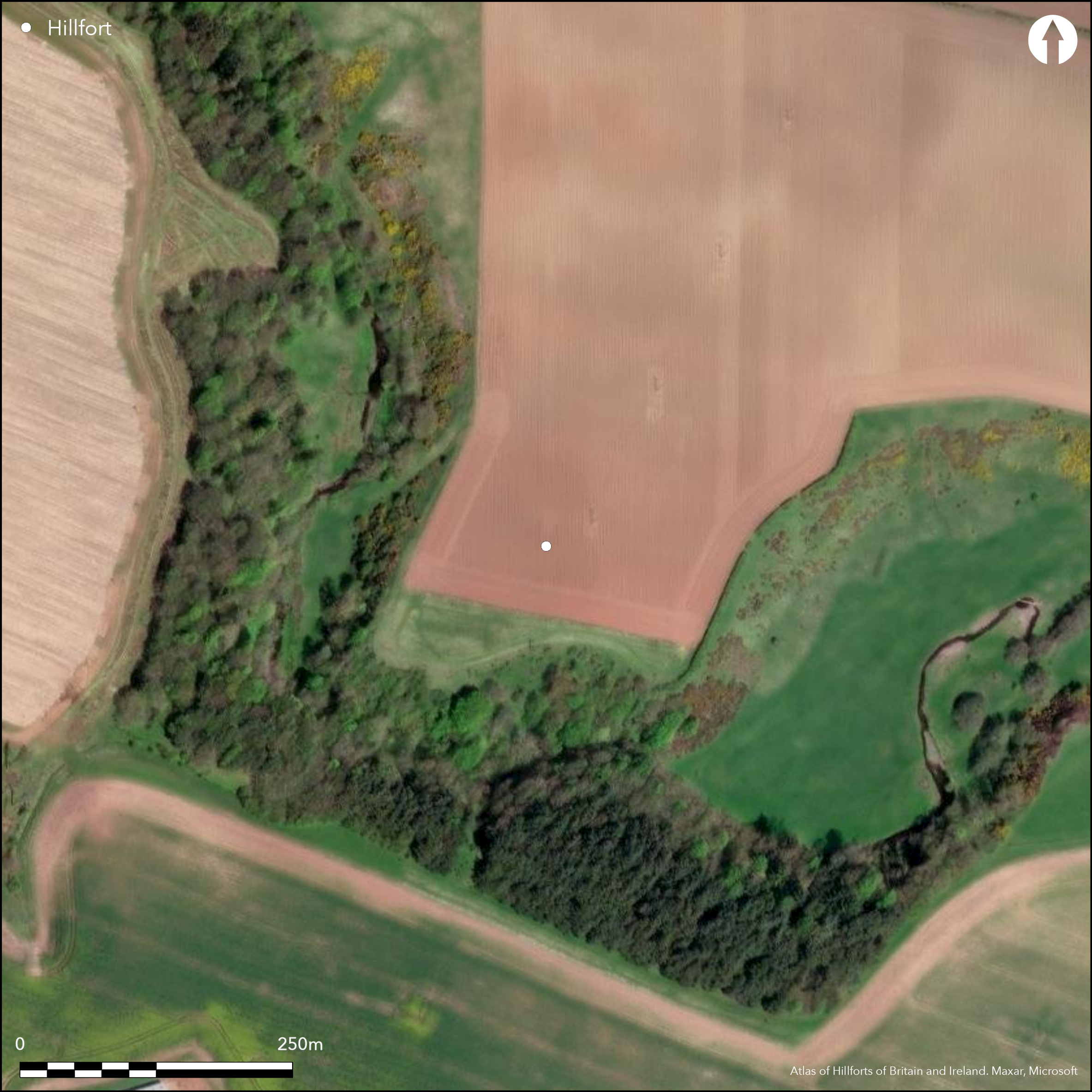
Satellite Imagery
LiDAR 1m DTM Hillshade
Satellite Imagery
Scroll left/right to view further images.
HER: Scottish Borders 60208 (None)
NMR: NT 96 SW 20 (60208)
SM: None
NGR: NT 9228 6280
X: 392280 Y: 662809 (OSGB36)
This fort, which occupies a promontory on the NE side of the Ale Water gorge SW of Linthill, was first revealed by aerial photography. The promontory has formed in a sharp bend in the river and comprises an elevated finger of ground extending SSW over a distance of over 400m parallel to the river on the W. The fort has been placed on the SW corner of the finger, where the escarpment dropping down to the river on the S and W is particularly steep, and is elsewhere defended by at least two wide-spaced ditches drawn across the neck from NW to SE, while a further 70m to the NE a narrower ditch also seems to have been designed to control access from the N, though not necessarily as part of the defences. The triangular area enclosed by the inner ditch measures about 75m in depth from NE to SW by a maximum of 90m transversely (0.42ha). The ditch is at least 6m in breadth, and there are possible traces of another ditch about 3m broad lying 8m in front of it. Both seem to spring from the edge of the escarpment on the S, but terminate short of the edge on the NW, probably indicating the position of an entrance approaching along the W margin of the promontory. Allowing for the presence of an inner rampart, the interior extends to about 0.36ha, but apart from various natural marking is otherwise featureless. In addition to these inner defences, traces of a massive outer ditch up to 8m in breadth lie about 30m to the NE, and are again pierced by an entrance causeway close to the W margin of the promontory. There is no stratigraphic relationship to demonstrate whether all these defences are contemporary or the result of successive periods of construction, but this outer perimeter would have increased the interior to an area measuring about 120m from NE to SW by 140m transversely (0.97ha).
Citizen Science: ✗
Reliability of Data: Confirmed
Reliability of Interpretation: Confirmed
X: -236542 Y: 7530288 (EPSG: 3857)
Longitude: -2.124892822581009 Latitude: 55.85844878897032 (EPSG:4326)
Country: Scotland
Current County or Unitary Authority: Scottish Borders
Historic County: Berwickshire
Current Parish/Community/Council/Townland: Eyemouth
None
| Extant | ✗ |
| Cropmark | ✓ |
| Likely Destroyed | ✗ |
None
| Woodland | ✗ |
| Commercial Forestry Plantation | ✗ |
| Parkland | ✗ |
| Pasture (Grazing) | ✗ |
| Arable | ✓ |
| Scrub/Bracken | ✗ |
| Bare Outcrop | ✗ |
| Heather/Moorland | ✗ |
| Heath | ✗ |
| Built-up | ✗ |
| Coastal Grassland | ✗ |
| Other | ✗ |
None
| Contour Fort | ✗ |
| Partial Contour Fort | ✗ |
| Promontory Fort | ✓ |
| Hillslope Fort | ✗ |
| Level Terrain Fort | ✗ |
| Marsh Fort | ✗ |
| Multiple Enclosure Fort | ✗ |
| Hilltop | ✗ |
| Coastal Promontory | ✗ |
| Inland Promontory | ✓ |
| Valley Bottom | ✗ |
| Knoll/Hillock/Outcrop | ✗ |
| Ridge | ✗ |
| Cliff/Plateau-edge/Scarp | ✗ |
| Hillslope | ✗ |
| Lowland | ✗ |
| Spur | ✗ |
Dominant Topographic Feature: None
| North | ✗ |
| Northeast | ✗ |
| East | ✗ |
| Southeast | ✗ |
| South | ✗ |
| Southwest | ✗ |
| West | ✗ |
| Northwest | ✗ |
| Level | ✓ |
Altitude: 60.0m
N/A
In the absence of excavation, there are neither stratified artefacts nor radiocarbon dates to provide a chronology for the defences.
Reliability: D - None
| Pre 1200BC | ✗ |
| 1200BC - 800BC | ✗ |
| 800BC - 400BC | ✗ |
| 400BC - AD50 | ✗ |
| AD50 - AD400 | ✗ |
| AD400 - AD 800 | ✗ |
| Post AD800 | ✗ |
| Unknown | ✓ |
| Pre Hillfort: | None |
| Post Hillfort: | Ploughed flat |
Andrew and Mostyn Armstrong's Map of the County of Berwick (1771) shows an ancient enclosure in this neighbourhood, but on the opposite side of the river; and though the OS suggested there were traces of an oval enclosure there on vertical aerial photographs (See Canmore 60189; Craw 1921, 250), its existence there has yet to be convincingly demonstrated. Photographed by RCAHMS Aerial Survey Programme in 1978, 1979, 1984, 1990 and 1994
| 1st Identified Written Reference (1978): | First photographed by the RCAHMS Aerial Survey Programme |
| Other (1979): | Visited by RCAHMS |
Featureless
None
| None | ✓ |
| Spring | ✗ |
| Stream | ✗ |
| Pool | ✗ |
| Flush | ✗ |
| Well | ✗ |
| Other | ✗ |
None
| No Known Features | ✓ |
| Round Stone Structures | ✗ |
| Rectangular Stone Structures | ✗ |
| Curvilinear Platforms | ✗ |
| Other Roundhouse Evidence | ✗ |
| Pits | ✗ |
| Quarry Hollows | ✗ |
| Other | ✗ |
None
| No Known Excavation | ✓ |
| Pits | ✗ |
| Postholes | ✗ |
| Roundhouses | ✗ |
| Rectangular Structures | ✗ |
| Roads/Tracks | ✗ |
| Quarry Hollows | ✗ |
| Other | ✗ |
| Nothing Found | ✗ |
None
| No Known Geophysics | ✓ |
| Pits | ✗ |
| Roundhouses | ✗ |
| Rectangular Structures | ✗ |
| Roads/Tracks | ✗ |
| Quarry Hollows | ✗ |
| Other | ✗ |
| Nothing Found | ✗ |
None
| No Known Finds | ✓ |
| Pottery | ✗ |
| Metal | ✗ |
| Metalworking | ✗ |
| Human Bones | ✗ |
| Animal Bones | ✗ |
| Lithics | ✗ |
| Environmental | ✗ |
| Other | ✗ |
NO APPARENT FEATURES
| APs Not Checked | ✗ |
| None | ✓ |
| Roundhouses | ✗ |
| Rectangular Structures | ✗ |
| Pits | ✗ |
| Postholes | ✗ |
| Roads/Tracks | ✗ |
| Other | ✗ |
See main summary
| 1: | None |
| 2: | None |
Guard Chambers: ✗
Chevaux de Frise: ✗
| 1. Simple Gap (North): | Through the inner defences |
| 1. Simple Gap (North): | Through the outermost ditch with slightly staggered terminals |
Up to three ditches, presumably with upcast ramparts, cutting across a promontory, but the spacing of the defences possibly representing two periods of construction
| Area 1: | 0.36ha. |
| Area 2: | 0.97ha. |
| Total: | 0.97ha. |
Total Footprint Area: Noneha.
None
| ✗ | None |
| ✗ | None |
| NE Quadrant: | 3 |
| SE Quadrant: | 0 |
| SW Quadrant: | 0 |
| NW Quadrant: | 0 |
| Total: | 3 |
| Partial Univallate | ✗ |
| Univallate | ✗ |
| Partial Bivallate | ✗ |
| Bivallate | ✗ |
| Partial Multivallate | ✓ |
| Multivallate | ✗ |
| Unknown | ✗ |
| Partial Univallate | ✗ |
| Univallate | ✗ |
| Partial Bivallate | ✗ |
| Bivallate | ✗ |
| Partial Multivallate | ✗ |
| Multivallate | ✗ |
None
| None | ✓ |
| Earthen Bank | ✗ |
| Stone Wall | ✗ |
| Rubble | ✗ |
| Wall-walk | ✗ |
| Evidence of Timber | ✗ |
| Vitrification | ✗ |
| Other Burning | ✗ |
| Palisade | ✗ |
| Counter Scarp Bank | ✗ |
| Berm | ✗ |
| Unfinished | ✗ |
| Other | ✗ |
None
| None | ✗ |
| Earthen Bank | ✗ |
| Stone Wall | ✗ |
| Murus Duplex | ✗ |
| Timber-framed | ✗ |
| Timber-laced | ✗ |
| Vitrification | ✗ |
| Other Burning | ✗ |
| Palisade | ✗ |
| Counter Scarp Bank | ✗ |
| Berm | ✗ |
| Unfinished | ✗ |
| No Known Excavation | ✓ |
| Other | ✗ |
| ✗ | None |
| ✓ | Possibly representing two periods |
Number of Ditches: 3
| ✗ | None |
Craw, J H (1921) 'Notes on Berwickshire Forts, with a description of those recently discovered'. Proc Soc Antiq Scot 55 (1920-1), 231-55
Atlas of Hillforts:
Wikidata:
This work is licensed under CC BY-SA 4.0

 and should be cited as:
Lock, Gary and Ralston, Ian. 2024. Atlas of Hillforts of Britain and Ireland. Available at: https://hillforts.arch.ox.ac.uk
Document Version 1.1