Satellite Imagery
Satellite Imagery
HER: Shetland Amenity Trust 888 (None)
NMR: HU 43 NW 5 (998)
SM: 2053
NGR: HU 4455 3607
X: 444550 Y: 1136070 (OSGB36)
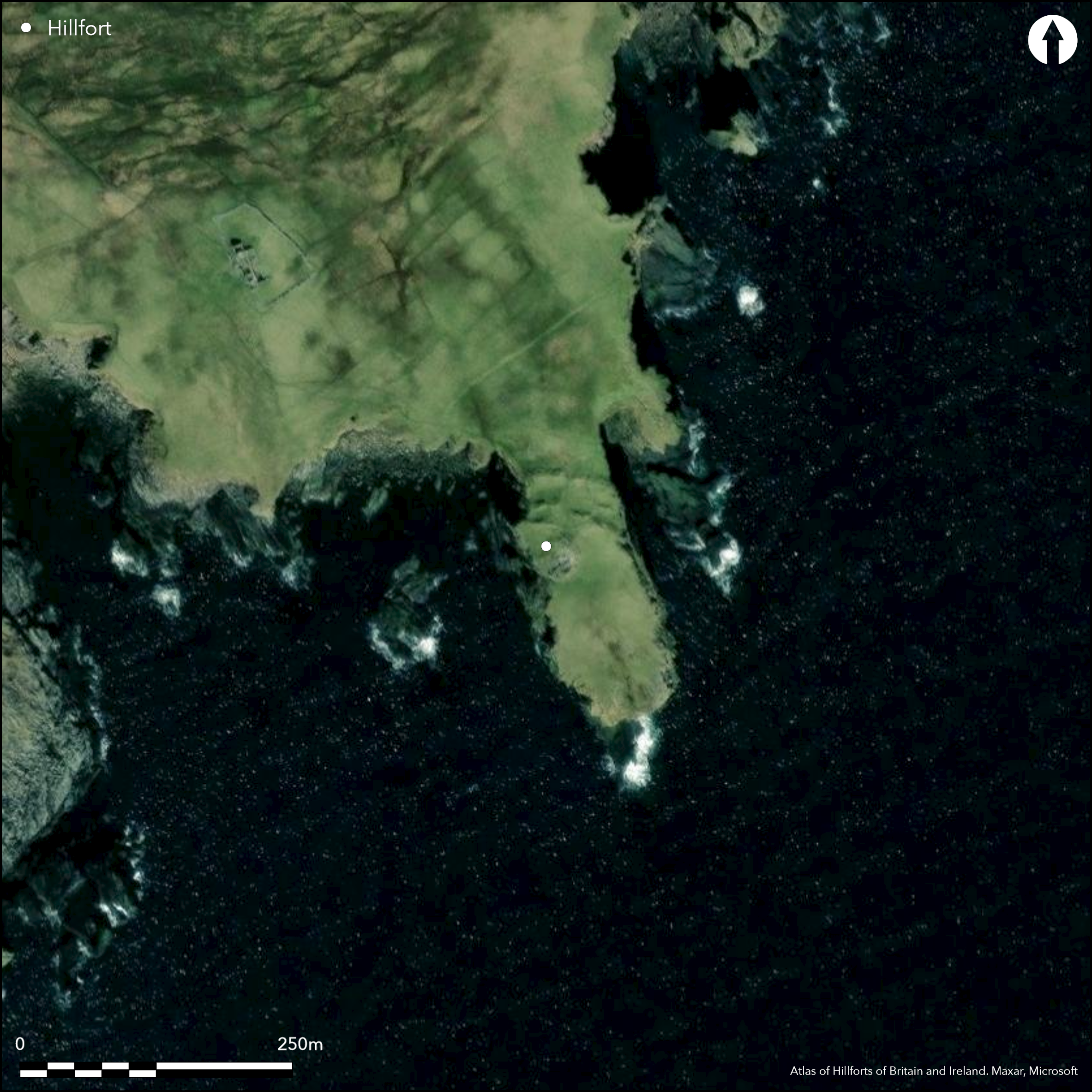
The Broch of Burland stands on a precipitous promontory some 30m above the sea and in addition to the broch three ramparts with external ditches cut across the neck to bar access from the NNW. The broch itself is choked with rubble, but nonetheless in places the outer wall-face stands 3m high, and at the entrance, which opens onto the present cliff-edge on the WNW and displays door-checks and a guard cell, evidence of a complex building history can be seen, with two skins of masonry added to the internal wall-face. The broch appears to stand to one side of the promontory immediately to the rear of the outer defences, but apparently dominates the entrance through the middle of the three outer ramparts. These are conventionally interpreted as outworks to the broch, but they have enclosed a much larger area, now measuring 85m from NNW to SSE by 45m transversely (0.34ha). How much has been lost to the sea down the W flank is unknown, but the curiously oblique course of these defences across the neck of the promontory, might be explained if they had once formed one side of a wider arc. The entrance through the middle of the ramparts on the NNW is complex, probably reflecting several separate periods of construction. The gap in the outermost, where there is no causeway across the broad external ditch, has simple opposed terminals, but the terminals to either side of the gaps in the middle and innermost rampart appear to have been staggered. In 1983 a trench was excavated across the eroding W ends of the outermost and middle ramparts (Carter et al 1995, 464-7), not extending to the then stable innermost, which in the sector W of the entrance is a faced wall 3m in thickness. Both the middle and outer ramparts were also found to be faced with stone, and the middle rampart not only overlay the upper fills of the ditches to either side, but there was also slight evidence that the outer overlay the ditch to its rear. While this does not contradict the interpretation of the outer ramparts as outworks, this longer building history is perhaps evidence that the broch has been inserted into an earlier promontory fort.
Citizen Science: ✗
Reliability of Data: Confirmed
Reliability of Interpretation: Confirmed
X: -133635 Y: 8423584 (EPSG: 3857)
Longitude: -1.2004591626112235 Latitude: 60.10693549894363 (EPSG:4326)
Country: Scotland
Current County or Unitary Authority: Shetland Islands
Historic County: Shetland
Current Parish/Community/Council/Townland: Lerwick
None
| Extant | ✓ |
| Cropmark | ✗ |
| Likely Destroyed | ✗ |
None
| Woodland | ✗ |
| Commercial Forestry Plantation | ✗ |
| Parkland | ✗ |
| Pasture (Grazing) | ✓ |
| Arable | ✗ |
| Scrub/Bracken | ✗ |
| Bare Outcrop | ✗ |
| Heather/Moorland | ✓ |
| Heath | ✗ |
| Built-up | ✗ |
| Coastal Grassland | ✗ |
| Other | ✗ |
None
| Contour Fort | ✗ |
| Partial Contour Fort | ✗ |
| Promontory Fort | ✓ |
| Hillslope Fort | ✗ |
| Level Terrain Fort | ✗ |
| Marsh Fort | ✗ |
| Multiple Enclosure Fort | ✗ |
| Hilltop | ✗ |
| Coastal Promontory | ✓ |
| Inland Promontory | ✗ |
| Valley Bottom | ✗ |
| Knoll/Hillock/Outcrop | ✗ |
| Ridge | ✗ |
| Cliff/Plateau-edge/Scarp | ✗ |
| Hillslope | ✗ |
| Lowland | ✗ |
| Spur | ✗ |
Dominant Topographic Feature: None
| North | ✗ |
| Northeast | ✗ |
| East | ✗ |
| Southeast | ✗ |
| South | ✗ |
| Southwest | ✗ |
| West | ✗ |
| Northwest | ✗ |
| Level | ✓ |
Altitude: 30.0m
N/A
Despite the excavation of a trench across the outer ramparts in 1983 (Carter et al 1995), no datable materials were recovered
Reliability: D - None
| Pre 1200BC | ✗ |
| 1200BC - 800BC | ✗ |
| 800BC - 400BC | ✗ |
| 400BC - AD50 | ✗ |
| AD50 - AD400 | ✗ |
| AD400 - AD 800 | ✗ |
| Post AD800 | ✗ |
| Unknown | ✓ |
| Pre Hillfort: | None |
| Post Hillfort: | Possibly the insertion of a broch |
None
| Earthwork Survey (1875): | Plan and sketch (RCAHMS DC25598 & DP149615; ) |
| 1st Identified Map Depiction (1878): | Annotated Brough of Burland on the 1st edition OS 6-inch map (Shetland 1881, sheet 56) |
| Other (1900): | OS 25-inch map (Zetland 1901, 56.12) |
| Earthwork Survey (1930): | Plan and description (RCAHMS 1946, iii, 70-2, no.1247, fig 574; RCAHMS SHD 3/1-4 & SC369953) |
| Other (1934): | Scheduled |
| Other (1963): | Visited by Euan MacKie (2002, 87-88; photographs held by RCAHMS) |
| Other (1968): | Resurveyed at 1:2500 by the OS |
| Other (1970): | Description by Raymond Lamb (1980, 82-3, plan redrawn from RCAHMS; photographs held by RCAHMS) |
| Other (1980): | Pottery found by Noel Fojut (1980, 28) |
| Excavation (1983): | Section cut by Peter Strong through the outer defences along the W cliff-edge (Carter et al 1995, 464-7) |
| Other (1987): | Description by Euan MacKie (2002, 87-88; photographs held by RCAHMS) |
| Other (2012): | Re-Scheduled |
| Other (2015): | Visit and photographs (SCAPE 12993) |
Featureless apart from the broch
None
| None | ✓ |
| Spring | ✗ |
| Stream | ✗ |
| Pool | ✗ |
| Flush | ✗ |
| Well | ✗ |
| Other | ✗ |
Broch
| No Known Features | ✗ |
| Round Stone Structures | ✗ |
| Rectangular Stone Structures | ✗ |
| Curvilinear Platforms | ✗ |
| Other Roundhouse Evidence | ✗ |
| Pits | ✗ |
| Quarry Hollows | ✗ |
| Other | ✓ |
Trench across the defences
| No Known Excavation | ✗ |
| Pits | ✗ |
| Postholes | ✗ |
| Roundhouses | ✗ |
| Rectangular Structures | ✗ |
| Roads/Tracks | ✗ |
| Quarry Hollows | ✗ |
| Other | ✓ |
| Nothing Found | ✗ |
None
| No Known Geophysics | ✓ |
| Pits | ✗ |
| Roundhouses | ✗ |
| Rectangular Structures | ✗ |
| Roads/Tracks | ✗ |
| Quarry Hollows | ✗ |
| Other | ✗ |
| Nothing Found | ✗ |
None
| No Known Finds | ✗ |
| Pottery | ✓ |
| Metal | ✗ |
| Metalworking | ✗ |
| Human Bones | ✗ |
| Animal Bones | ✗ |
| Lithics | ✗ |
| Environmental | ✗ |
| Other | ✗ |
Broch
| APs Not Checked | ✗ |
| None | ✗ |
| Roundhouses | ✗ |
| Rectangular Structures | ✗ |
| Pits | ✗ |
| Postholes | ✗ |
| Roads/Tracks | ✗ |
| Other | ✓ |
See main summary
| 1: | None |
| 2: | None |
Guard Chambers: ✗
Chevaux de Frise: ✗
| 1. Simple Gap (North west): | Central gap, but while the terminals of the outer rampart are directly opposed, those of the inner ones appear to have been staggered |
Three ramparts and ditches cutting off a precipitous promontory
| Area 1: | 0.34ha. |
| Total: | 0.34ha. |
Total Footprint Area: 0.49ha.
None
| ✗ | None |
| ✗ | None |
| NE Quadrant: | 0 |
| SE Quadrant: | 0 |
| SW Quadrant: | 0 |
| NW Quadrant: | 3 |
| Total: | 3 |
| Partial Univallate | ✗ |
| Univallate | ✗ |
| Partial Bivallate | ✗ |
| Bivallate | ✗ |
| Partial Multivallate | ✓ |
| Multivallate | ✗ |
| Unknown | ✗ |
| Partial Univallate | ✗ |
| Univallate | ✗ |
| Partial Bivallate | ✗ |
| Bivallate | ✗ |
| Partial Multivallate | ✗ |
| Multivallate | ✗ |
None
| None | ✗ |
| Earthen Bank | ✗ |
| Stone Wall | ✓ |
| Rubble | ✗ |
| Wall-walk | ✗ |
| Evidence of Timber | ✗ |
| Vitrification | ✗ |
| Other Burning | ✗ |
| Palisade | ✗ |
| Counter Scarp Bank | ✗ |
| Berm | ✗ |
| Unfinished | ✗ |
| Other | ✗ |
None
| None | ✗ |
| Earthen Bank | ✗ |
| Stone Wall | ✓ |
| Murus Duplex | ✗ |
| Timber-framed | ✗ |
| Timber-laced | ✗ |
| Vitrification | ✗ |
| Other Burning | ✗ |
| Palisade | ✗ |
| Counter Scarp Bank | ✗ |
| Berm | ✗ |
| Unfinished | ✗ |
| No Known Excavation | ✗ |
| Other | ✗ |
| ✗ | None |
| ✓ | None |
Number of Ditches: 3
| ✗ | None |
Carter, S P, McCullagh, R P J and MacSween, A (1995) 'The Iron Age in Shetland: excavations at five sites threatened by coastal erosion'. Proc Soc Antiq Scot 125 (1995), 429-82
Fojut, N (1980) 'Pottery'. Disc Exc Scot (1980), 28
Lamb, R G (1980) Iron Age promontory forts in the Northern Isles. Brit Archaeol Rep, British Ser 79. BAR: Oxford
MacKie, E W (2002) The roundhouses, brochs and wheelhouses of Atlantic Scotland c. 700BC - AD500: architecture and material culture Part 1 - The Orkney and Shetland Isles. BAR British Series 342: Oxford
RCAHMS (1946) The Royal Commission on the Ancient and Historical Monuments of Scotland. Twelfth report with an inventory of the ancient monuments of Orkney and Shetland, 3v. HMSO: Edinburgh
Atlas of Hillforts:
Wikidata:
This work is licensed under CC BY-SA 4.0

 and should be cited as:
Lock, Gary and Ralston, Ian. 2024. Atlas of Hillforts of Britain and Ireland. Available at: https://hillforts.arch.ox.ac.uk
Document Version 1.1