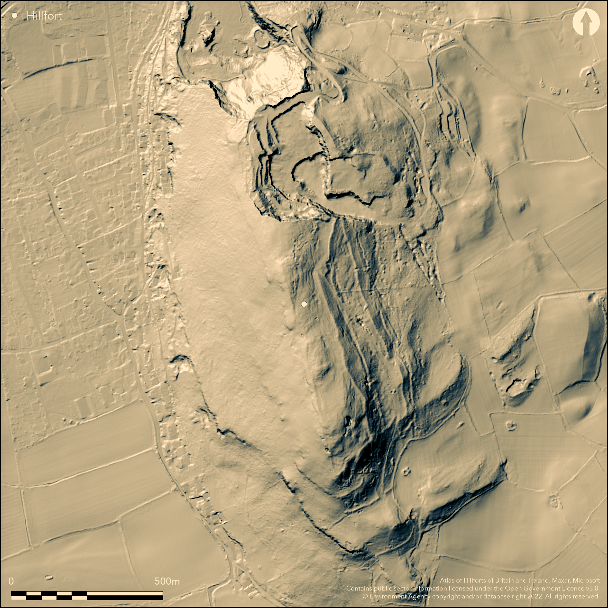
LiDAR 1m DTM Hillshade
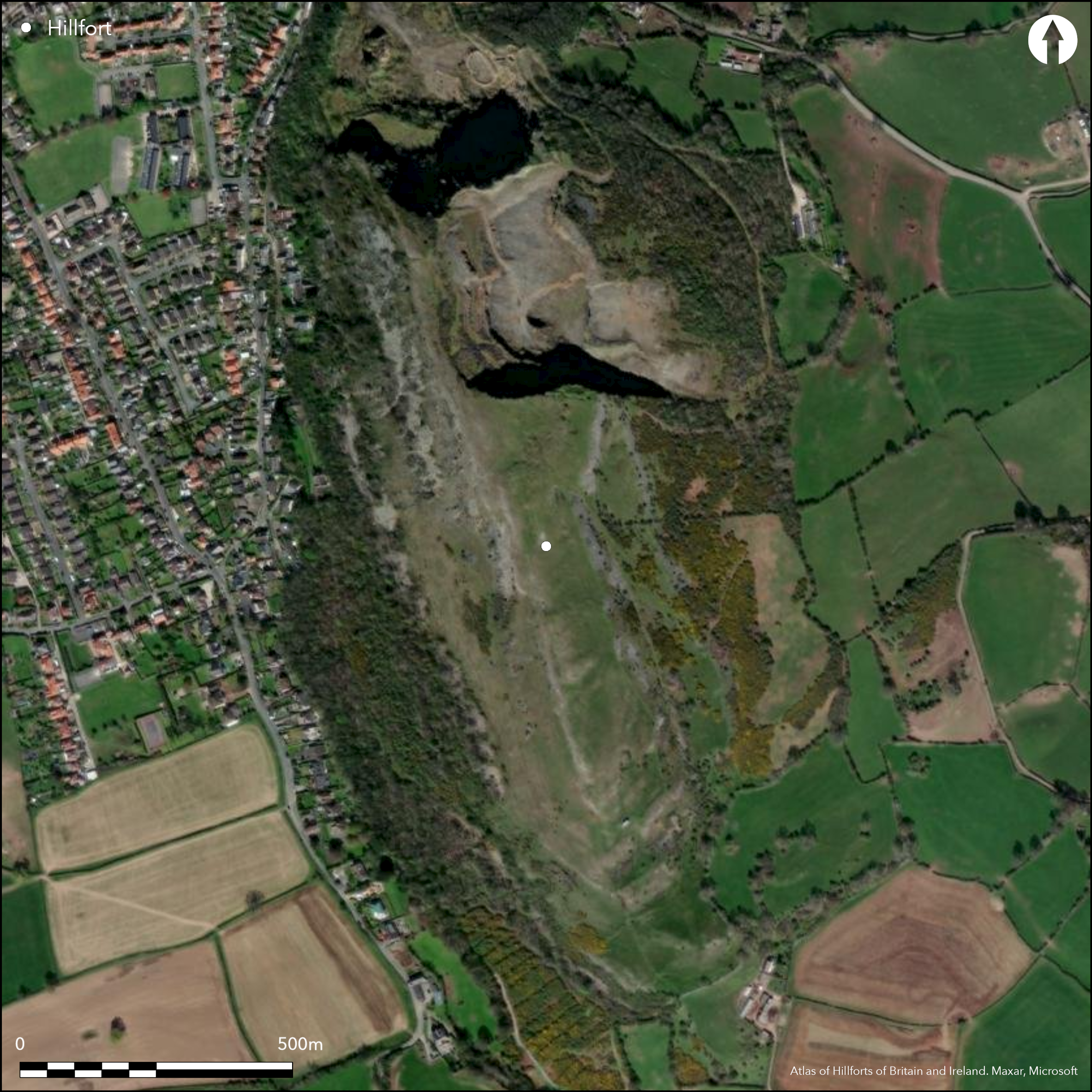
Satellite Imagery
LiDAR 1m DTM Hillshade
Satellite Imagery
Scroll left/right to view further images.
HER: Clwyd Powys 102057 (None)
NMR: SJ 07 NE 1 (95092)
SM: FL012
NGR: SJ06327845
X: 306320 Y: 378450 (OSGB36)
Complex, large and isolated contour hillfort located above the River Clwyd on prominent Carboniferous Limestone outcrop at N extremity of the Clwydian Range above coastal plain and sea at Dyserth. Very steep and precipitous surrounding slopes to S and W, less on E. N precipitous, now lost to quarrying. Measures c. 450m N-S by 200m with internal area c. 10.5ha. About one-third of site quarried away and rescue excavations in advance of quarrying 1954-80 (Brassil et al 1982). Site predominantly defined by denuded and tumbled stone walls or ramparts up to 4m-6m wide, of stone rubble between stone block revetments. Up to three lines visible, the inner composed of stone rubble, the outer of earth, with ditches and counterscarp, and these concentrated on the weaker S and E where slopes less. On W side, where slopes precipitous, only one rampart, and N part quarried away. To N, obliterated walls ran close together, but further S inner wall turns-in creating an outer enclosure some 70m-75m across. The 7.5ha inner or main enclosure is only 60m-90m wide at S end, where it encloses the summit ridge, but was up to 175m wide on the falling ground to N. Four possible entrances remain, complex with guard chambers. Possible that this outer circuit represents an original 10.5ha fort to which inner enclosure subsequently added. Site notable for hoard of metalwork found in making a road to a mine on summit in 1872, but many other finds. Rough upland grass and bare rock. On 1st Ed. OS map (1872).
Citizen Science: ✗
Reliability of Data: Confirmed
Reliability of Interpretation: Confirmed
X: -379265 Y: 7037694 (EPSG: 3857)
Longitude: -3.4069930180000005 Latitude: 53.29468750912519 (EPSG:4326)
Country: Wales
Current County or Unitary Authority: Denbighshire
Historic County: Flintshire
Current Parish/Community/Council/Townland: Dyserth
Tumbled walls and c. one-third of site quarried away.
| Extant | ✓ |
| Cropmark | ✗ |
| Likely Destroyed | ✓ |
Rough upland grass and bare rock. SSSI.
| Woodland | ✗ |
| Commercial Forestry Plantation | ✗ |
| Parkland | ✗ |
| Pasture (Grazing) | ✓ |
| Arable | ✗ |
| Scrub/Bracken | ✗ |
| Bare Outcrop | ✗ |
| Heather/Moorland | ✗ |
| Heath | ✗ |
| Built-up | ✗ |
| Coastal Grassland | ✗ |
| Other | ✗ |
Large and isolated contour hillfort located above the River Clwyd on prominent Carboniferous Limestone outcrop at N extremity of the Clwydian Range above coastal plain and sea at Dyserth. Very steep and precipitous surrounding slopes to S and W, less on E. N precipitous, now lost to quarrying.
| Contour Fort | ✓ |
| Partial Contour Fort | ✗ |
| Promontory Fort | ✗ |
| Hillslope Fort | ✗ |
| Level Terrain Fort | ✗ |
| Marsh Fort | ✗ |
| Multiple Enclosure Fort | ✗ |
| Hilltop | ✓ |
| Coastal Promontory | ✗ |
| Inland Promontory | ✗ |
| Valley Bottom | ✗ |
| Knoll/Hillock/Outcrop | ✗ |
| Ridge | ✗ |
| Cliff/Plateau-edge/Scarp | ✗ |
| Hillslope | ✗ |
| Lowland | ✗ |
| Spur | ✗ |
Dominant Topographic Feature: Hill top
| North | ✗ |
| Northeast | ✗ |
| East | ✗ |
| Southeast | ✗ |
| South | ✗ |
| Southwest | ✗ |
| West | ✗ |
| Northwest | ✗ |
| Level | ✓ |
Altitude: 265.0m
N/A
Metalwork found in 1872 (Smith 1928, 253-84) probably dates from the 1st century BC/AD. Few finds point to occupation in the 4th century BC and none earlier than 400 BC (Brassil et al 1982, 82). Limited C14 dating suggests that site may have been constructed at least a century earlier and calibrated to 6th and 5th centuries BC.
Reliability: B - Medium
| Pre 1200BC | ✗ |
| 1200BC - 800BC | ✗ |
| 800BC - 400BC | ✓ |
| 400BC - AD50 | ✓ |
| AD50 - AD400 | ✓ |
| AD400 - AD 800 | ✗ |
| Post AD800 | ✗ |
| Unknown | ✗ |
| Pre Hillfort: | None |
| Post Hillfort: | None |
| Artefactual: | None earlier than 400 BC. |
| C14: | Calibrated to 6th and 5th centuries BC. |
Rescue excavations in advance of quarrying 1954-80. Notably Brassil et al CPAT. On 1st Ed. OS map (1872).
| 1st Identified Map Depiction (1872): | OS map. |
| Other (1977): | Visit by Hillfort Study Group |
| Other (2012): | Visited by Hillfort Study Group |
| Excavation (None): | Rescue excavations in advance of quarrying. Notably Brassil et al. |
Once traces of perhaps at least 50 roundhouses within the two enclosures. Position of several post-built structures plotted from grass marks. Excavation revealed evidence of hut circles, largely confined to N half of W enclosure, with four-post huts in groups. Destruction clouded interpretation. Possible zoning of different types of structure, akin to Moel y Gaer, Rhosesmor (Atlas No. 1165). Notable for hoard of metalwork found in making a road to a mine on summit in 1872, including swords, plaques and shield-boss; former two lost, latter surviving in the Powsland Museum at Welshpool. Excavations found other metalwork of iron and bronze, notably fine bronze early La Tene bow brooch or fibula and openwork iron disc horse harness mount. Also items of antler, bone, stone, flint and chert.
Stream 0.5km outside fort.
| None | ✓ |
| Spring | ✗ |
| Stream | ✗ |
| Pool | ✗ |
| Flush | ✗ |
| Well | ✗ |
| Other | ✗ |
Once traces of perhaps at least 50 roundhouses within the two enclosures. Position of several post-built structures plotted from grass marks.
| No Known Features | ✗ |
| Round Stone Structures | ✓ |
| Rectangular Stone Structures | ✓ |
| Curvilinear Platforms | ✓ |
| Other Roundhouse Evidence | ✗ |
| Pits | ✗ |
| Quarry Hollows | ✗ |
| Other | ✓ |
Evidence of hut circles, largely confined to N half of W enclosure, with four-post huts in groups. Destruction clouded interpretation. Possible zoning of different types of structure, akin to Moel y Gaer, Rhosesmor (Atlas No. 1165).
| No Known Excavation | ✗ |
| Pits | ✗ |
| Postholes | ✗ |
| Roundhouses | ✓ |
| Rectangular Structures | ✓ |
| Roads/Tracks | ✗ |
| Quarry Hollows | ✗ |
| Other | ✓ |
| Nothing Found | ✗ |
None
| No Known Geophysics | ✓ |
| Pits | ✗ |
| Roundhouses | ✗ |
| Rectangular Structures | ✗ |
| Roads/Tracks | ✗ |
| Quarry Hollows | ✗ |
| Other | ✗ |
| Nothing Found | ✗ |
Notable for hoard of metalwork found in making a road to a mine on summit in 1872, including swords, plaques and shield-boss; former two lost, latter surviving in the Powysland Museum at Welshpool. Excavations found other metalwork of iron and bronze, notably fine bronze early La Tene bow brooch or fibula and openwork iron disc horse harness mount. Also items of worked antler, bone, stone, flint and chert.
| No Known Finds | ✗ |
| Pottery | ✗ |
| Metal | ✓ |
| Metalworking | ✗ |
| Human Bones | ✗ |
| Animal Bones | ✓ |
| Lithics | ✓ |
| Environmental | ✗ |
| Other | ✓ |
None
| APs Not Checked | ✓ |
| None | ✗ |
| Roundhouses | ✗ |
| Rectangular Structures | ✗ |
| Pits | ✗ |
| Postholes | ✗ |
| Roads/Tracks | ✗ |
| Other | ✗ |
Main entrance to inner enclosure opens onto outer enclosure. Two entrances in the short S side protected by complex outworks, one opening onto inner enclosure, the other onto the outer. There are also entrances in the N and E sides. Guard chambers.
| 6: | At least six points of entry, four now remain. |
| 2: | None |
Guard Chambers: ✓
Chevaux de Frise: ✗
| 1. Outworks (South east): | Complex. |
| 1. Recesses/Guard Chambers (South east): | None |
| 2. Outworks (South): | Complex |
| 2. Recesses/Guard Chambers (South): | None |
| 3. Simple Gap (North west): | None |
| 3. Recesses/Guard Chambers (North west): | None |
| 4. Simple Gap (East): | None |
| 4. Recesses/Guard Chambers (East): | None |
Up to three defensive lines, the inner of rubble, the outer of earth, these concentrated on the weaker S and E sides. Site predominantly defined by denuded and tumbled stone walls or ramparts up to 4m-6m wide, of stone rubble between stone block revetments, but up to three defensive lines visible, the inner of this stone rubble, the outer of earth, with ditches and counterscarp, and these concentrated on the weaker E where slopes less. On W side where slopes precipitous only one rampart. N part has been quarried away.
| Area 1: | 10.5ha. |
| Area 2: | 7.5ha. |
| Total: | 10.5ha. |
Total Footprint Area: Noneha.
None
| ✓ | Several periods of construction. Earlier outer circuit of 10.5ha with inner possibly added later. |
| ✗ | N lost to quarrying. Quadrants estimated. |
| NE Quadrant: | 3 |
| SE Quadrant: | 3 |
| SW Quadrant: | 1 |
| NW Quadrant: | 1 |
| Total: | 3 |
| Partial Univallate | ✓ |
| Univallate | ✗ |
| Partial Bivallate | ✗ |
| Bivallate | ✗ |
| Partial Multivallate | ✓ |
| Multivallate | ✗ |
| Unknown | ✗ |
| Partial Univallate | ✗ |
| Univallate | ✓ |
| Partial Bivallate | ✗ |
| Bivallate | ✗ |
| Partial Multivallate | ✗ |
| Multivallate | ✓ |
None
| None | ✗ |
| Earthen Bank | ✓ |
| Stone Wall | ✓ |
| Rubble | ✓ |
| Wall-walk | ✗ |
| Evidence of Timber | ✗ |
| Vitrification | ✗ |
| Other Burning | ✗ |
| Palisade | ✗ |
| Counter Scarp Bank | ✓ |
| Berm | ✗ |
| Unfinished | ✗ |
| Other | ✗ |
Walls of stone rubble between stone block revetments.
| None | ✗ |
| Earthen Bank | ✓ |
| Stone Wall | ✓ |
| Murus Duplex | ✗ |
| Timber-framed | ✗ |
| Timber-laced | ✗ |
| Vitrification | ✗ |
| Other Burning | ✗ |
| Palisade | ✗ |
| Counter Scarp Bank | ✗ |
| Berm | ✗ |
| Unfinished | ✗ |
| No Known Excavation | ✗ |
| Other | ✗ |
| ✗ | None |
| ✓ | None |
Number of Ditches: 3
| ✗ | None |
Brassil, K.S, Guilbert, G.C, Livens, R.G, Stead, W.H. and the late Bevan-Evans, M. 1982. Rescue excavations at Moel Hiraddug between 1960 and 1980, J Flintshire Hist Soc, 30,13-88.
Brown, I. 2004. Discovering a Welsh landscape. Archaeology in the Clwydian Range, Bollington: Windgather Press.
Burnham, H. 1995. A guide to ancient and historic Wales - Clwyd and Powys, London: HMSO, 193.
Davies, Canon Ellis 1949. Prehistoric and Roman remains of Flintshire, Cardiff: William Lewis.
Gale, F. 1991. The Iron Age, in eds Manley, J., Grenter, S. and Gale, F., The archaeology of Clwyd, Mold: Clwyd Archaeology Service, Clwyd County Council.
Hemp, W.J. 1928. A La Tene shield from Moel Hiraddug, Flintshire, Arch Camb, 83 (1928), 253-84.
Atlas of Hillforts:
Wikidata:
This work is licensed under CC BY-SA 4.0

 and should be cited as:
Lock, Gary and Ralston, Ian. 2024. Atlas of Hillforts of Britain and Ireland. Available at: https://hillforts.arch.ox.ac.uk
Document Version 1.1