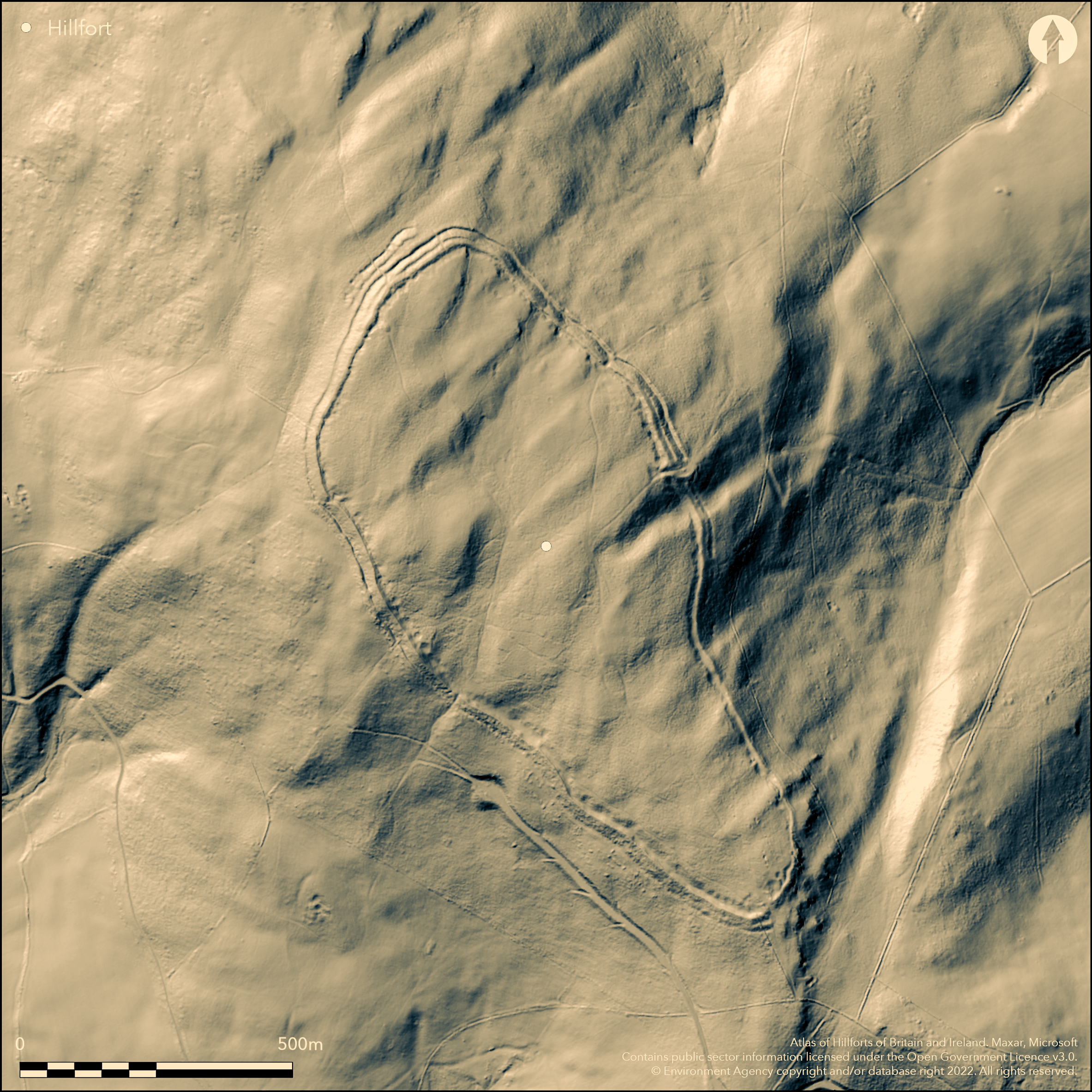
LiDAR 1m DTM Hillshade
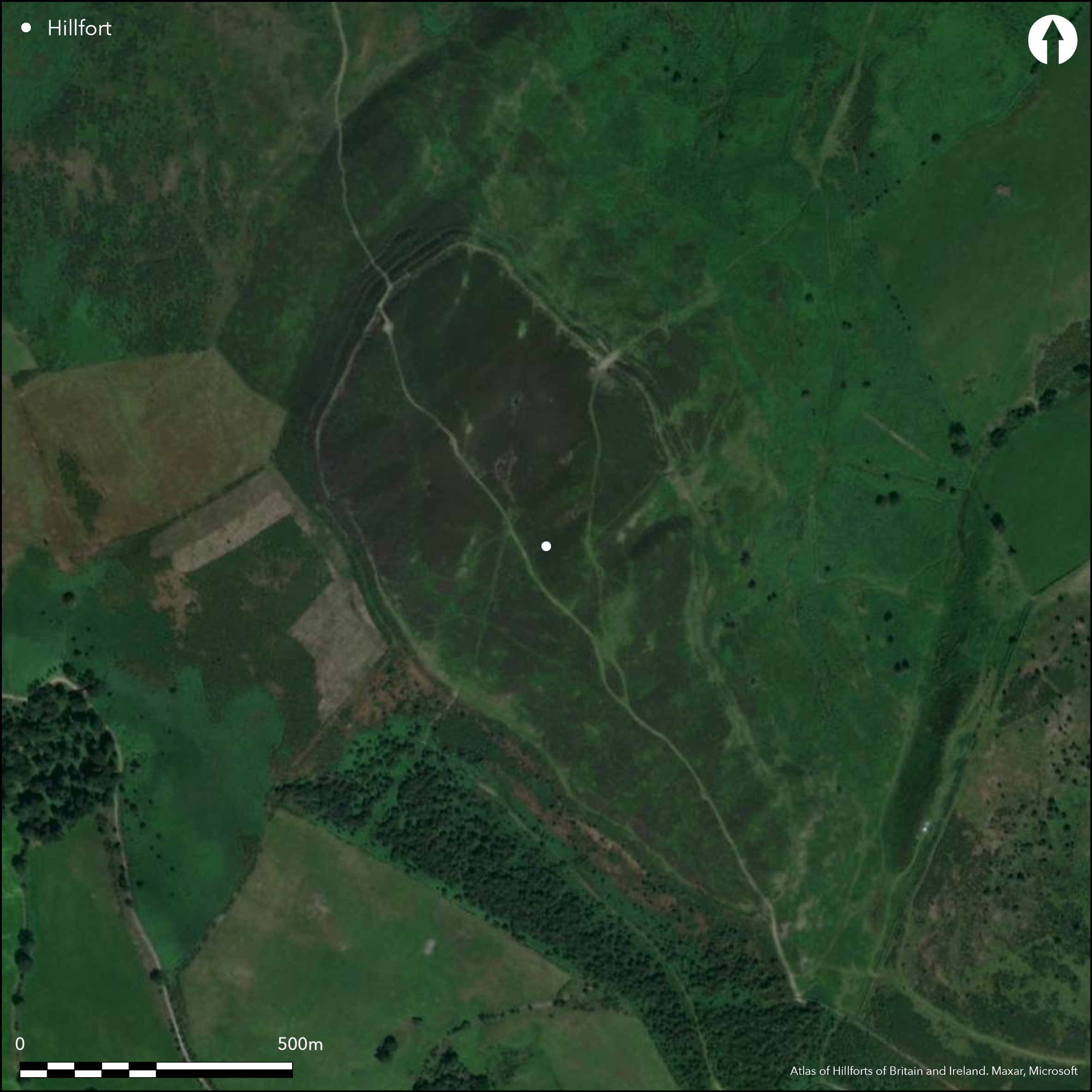
Satellite Imagery
LiDAR 1m DTM Hillshade
Satellite Imagery
Scroll left/right to view further images.
HER: Clwyd Powys 102273 (None)
NMR: SJ 16 NW (306898)
SM: FL009
NGR: SJ128676
X: 312888 Y: 367647 (OSGB36)
Very large and outstanding partial contour hillfort, one of the largest in Wales, located on a high spur of Ordovician rocks deep in the Clwydian Range near Llangwyfan and above the Vale of Clwyd to W and dominating one of the main passes through the upland. Surrounding slopes moderate to strong to N and S, very steep to E and W. Moel Arthur, Nannerch (Atlas No. 1156) 1.8 km away. Irregular shaped c. 794m SE-NW 134m-332m, with internal area c. 21ha. Fine use of topography, crags and rock in circuit and, at first glance, apparently simple in form, but more complicated. Single rampart following contours at S end, with prominent counterscarp, but at N quadrants ramparts cross the contours (situation similar to that at Moel Fenlli - Atlas No. 2954), at highest point of hill, with up to four banks and ditches at this most vulnerable point, and here located Bronze Age cairn. Fourth bank here separated by berm c. 6m wide, and ditch outside could be unfinished. To N ramparts largely stone. Inner quarry ditch around all circuit, rock-cut in places. S gate sited further downhill than might have been, flanked by inturned banks of unequal length, as at Castell Caer at Abergele (Atlas No. 1169). Possible guard chamber inside entrance. Eastwards, ground falls steeply away with single bank to meet inturned E entrance, reminiscent of those at Moel Arthur and Moel y Gaer, Bodfari (Atlas No 1217) (Hubbard 1986, 403), but with additional hornwork on S side and no guard chambers. Possible 33 roundhouse platforms in interior and further 49 platforms tucked close to ramparts. Hillfort constituent part of the Heather and Hillforts Landscape Partnership Scheme, funded by the Heritage Lottery fund of Denbighshire County Council 2006-2011, included geophysical and other surveys, interpretation and visitor management works. Excavation of Bronze Age cairn and reinstatement by CPAT (Grant et al 2011). Excavation by Rachel Pope and Richard Mason, University of Liverpool, 2012 on-going (in 2015). Rough upland grass and moorland grazing. On 1st Ed. OS map (1871).
Citizen Science: ✗
Reliability of Data: Confirmed
Reliability of Interpretation: Confirmed
X: -367969 Y: 7019842 (EPSG: 3857)
Longitude: -3.3055206332495612 Latitude: 53.19872644504622 (EPSG:4326)
Country: Wales; None
Current County or Unitary Authority: Denbighshire; Flintshire
Historic County: Flintshire; Denbighshire
Current Parish/Community/Council/Townland: Llandyrnog; Ysceifiog
Good condition. Part County Council owned. 'Heather and Hillforts' project included interpretation and visitor management works. Offa's Dyke Long Distance Path passes through the site.
| Extant | ✓ |
| Cropmark | ✗ |
| Likely Destroyed | ✗ |
Rough upland grass and moorland. SSSI.
| Woodland | ✗ |
| Commercial Forestry Plantation | ✗ |
| Parkland | ✗ |
| Pasture (Grazing) | ✓ |
| Arable | ✗ |
| Scrub/Bracken | ✗ |
| Bare Outcrop | ✗ |
| Heather/Moorland | ✓ |
| Heath | ✗ |
| Built-up | ✗ |
| Coastal Grassland | ✗ |
| Other | ✗ |
Fine, partial contour, hillfort located on high upland spur of Ordovician rocks of Clwydian Range above the Vale of Clwyd to W.
| Contour Fort | ✗ |
| Partial Contour Fort | ✓ |
| Promontory Fort | ✗ |
| Hillslope Fort | ✗ |
| Level Terrain Fort | ✗ |
| Marsh Fort | ✗ |
| Multiple Enclosure Fort | ✗ |
| Hilltop | ✓ |
| Coastal Promontory | ✗ |
| Inland Promontory | ✗ |
| Valley Bottom | ✗ |
| Knoll/Hillock/Outcrop | ✗ |
| Ridge | ✗ |
| Cliff/Plateau-edge/Scarp | ✗ |
| Hillslope | ✗ |
| Lowland | ✗ |
| Spur | ✗ |
Dominant Topographic Feature: Hill top
| North | ✗ |
| Northeast | ✗ |
| East | ✗ |
| Southeast | ✗ |
| South | ✓ |
| Southwest | ✗ |
| West | ✗ |
| Northwest | ✗ |
| Level | ✗ |
Altitude: 440.0m
Boundary Type: County
Occupation Iron Age through to Roman period, but conjecture, and Bronze Age origins cannot be discounted.
Reliability: D - None
| Pre 1200BC | ✗ |
| 1200BC - 800BC | ✗ |
| 800BC - 400BC | ✗ |
| 400BC - AD50 | ✗ |
| AD50 - AD400 | ✗ |
| AD400 - AD 800 | ✗ |
| Post AD800 | ✗ |
| Unknown | ✓ |
| Pre Hillfort: | Excavated Bronze Age cairn at highest point at N end of site. |
| Post Hillfort: | None |
| Morphology/Earthwork/Typology: | Conjecture. |
Recording of tumulus on site by S. Lewis 1842. On 1st Ed. OS map (1871). 2003 heather burn documented from the air RCAHMW. Hillfort constituent part of the Heather and Hillforts Landscape Partnership Scheme, funded by the Heritage Lottery fund of Denbighshire County Council 2006-2011, included geophysical and other surveys, interpretation and visitor management works. New ground survey was carried out in 2006 by CPAT. Excavation of Bronze Age cairn and reinstatement by CPAT 2009. Excavation by Rachel Pope and Richard Mason, University of Liverpool, 2012 on-going.
| Other (1849): | Recording of tumulus on site by S. Lewis in Topographical Dictionary. |
| 1st Identified Map Depiction (1871): | OS map. |
| Other (1977): | Visit by Hillfort Study Group |
| Other (2003): | Air survey RCAHMW. |
| Other (2006): | CPAT ground survey. |
| Excavation (2009): | Small excavation of the cairn by CPAT. |
| Other (2012): | Visited by Hillfort Study Group |
| Other (None): | Heather and Hillforts Landscape Partnership Scheme |
| Excavation (None): | R. Pope and R. Mason, University of Liverpool. |
| Geophysical Survey (None): | Heather and Hillforts project. |
As result of heather burns 1962 and 2003, hut emplacements recorded close to NE bank (Burnham 1995, 58) and recorded on site from air by RCAHMW. Possible 33 round house platforms in interior and further 49 platforms tucked close to ramparts. Fine inner quarry ditch around all circuit, rock-cut in places to S. Flint scraper and other flints recorded 1925 (Davies 1949, 273). No details of any finds from excavation in progress.
Cluster of round house platforms around a spring. Small pool located in saddle. Stream 0.3km outside fort.
| None | ✗ |
| Spring | ✓ |
| Stream | ✗ |
| Pool | ✓ |
| Flush | ✗ |
| Well | ✗ |
| Other | ✗ |
As result of heather burn 1962, hut emplacements recorded close to NE bank (Burnham 1995, 58). Possible 33 roundhouse platforms in interior and further 49 platforms tucked close to ramparts. Fine inner quarry ditch around all circuit, rock-cut in places to S.
| No Known Features | ✗ |
| Round Stone Structures | ✗ |
| Rectangular Stone Structures | ✗ |
| Curvilinear Platforms | ✓ |
| Other Roundhouse Evidence | ✗ |
| Pits | ✗ |
| Quarry Hollows | ✓ |
| Other | ✗ |
Excavation at present in progress - no details, but hut site investigated.
| No Known Excavation | ✗ |
| Pits | ✗ |
| Postholes | ✗ |
| Roundhouses | ✓ |
| Rectangular Structures | ✗ |
| Roads/Tracks | ✗ |
| Quarry Hollows | ✗ |
| Other | ✗ |
| Nothing Found | ✗ |
Found evidence of round houses and attached yards or 'gardens'.
| No Known Geophysics | ✗ |
| Pits | ✗ |
| Roundhouses | ✓ |
| Rectangular Structures | ✗ |
| Roads/Tracks | ✗ |
| Quarry Hollows | ✗ |
| Other | ✗ |
| Nothing Found | ✗ |
Flint scraper and other flints recorded 1925 (Davies 1949, 273). No details of any finds from excavation in progress.
| No Known Finds | ✗ |
| Pottery | ✗ |
| Metal | ✗ |
| Metalworking | ✗ |
| Human Bones | ✗ |
| Animal Bones | ✗ |
| Lithics | ✗ |
| Environmental | ✗ |
| Other | ✓ |
None
| APs Not Checked | ✓ |
| None | ✗ |
| Roundhouses | ✗ |
| Rectangular Structures | ✗ |
| Pits | ✗ |
| Postholes | ✗ |
| Roads/Tracks | ✗ |
| Other | ✗ |
S gate sited further downhill than might have been, flanked by inturned banks of unequal length, as at Castell Caer at Abergele. Possible guard chamber inside entrance. Eastwards, ground falls steeply away with single bank to meet inturned E entrance, reminiscent of those at Moel Arthur and Moel y Gaer, Bodfari (Hubbard 1986, 403), but with additional hornwork on S side and no guard chambers.
| 2: | None |
| 2: | None |
Guard Chambers: ✓
Chevaux de Frise: ✗
| 1. In-turned (South): | None |
| 1. Recesses/Guard Chambers (South): | None |
| 2. In-turned (East): | Additional hornwork on S side. |
| 2. Hornwork (East): | Additional hornwork on S side. |
Single rampart following contours at S end, with prominent counterscarp and inner quarry ditch, but as at Moel Fenlli (Atlas No. 2954) section of ramparts to N crosses contours at highest point of hill, with four banks and ditches at most vulnerable point, and here located Bronze Age cairn. Fourth bank here separated by berm c. 6m wide, and ditch outside could be unfinished. To N ramparts largely stone and to N quarry ditch rock-cut. Ramparts largely of stone using natural outcrops. Fine counterscarp visible. Fourth bank here separated by berm c. 6m wide at N end.
| Area 1: | 21.0ha. |
| Total: | 21.0ha. |
Total Footprint Area: 23.0ha.
None
| ✗ | Possible dimensions. |
| ✓ | Up to four ramparts at N end. |
| NE Quadrant: | 4 |
| SE Quadrant: | 1 |
| SW Quadrant: | 1 |
| NW Quadrant: | 4 |
| Total: | 4 |
| Partial Univallate | ✓ |
| Univallate | ✗ |
| Partial Bivallate | ✗ |
| Bivallate | ✗ |
| Partial Multivallate | ✓ |
| Multivallate | ✗ |
| Unknown | ✗ |
| Partial Univallate | ✗ |
| Univallate | ✗ |
| Partial Bivallate | ✗ |
| Bivallate | ✗ |
| Partial Multivallate | ✗ |
| Multivallate | ✗ |
Ramparts largely of stone at N end and stone/rubble using natural outcrops. Fine counterscarp visible. Fourth bank here separated by berm c. 6m wide at N end could be unfinished.
| None | ✗ |
| Earthen Bank | ✓ |
| Stone Wall | ✓ |
| Rubble | ✓ |
| Wall-walk | ✗ |
| Evidence of Timber | ✗ |
| Vitrification | ✗ |
| Other Burning | ✗ |
| Palisade | ✗ |
| Counter Scarp Bank | ✓ |
| Berm | ✓ |
| Unfinished | ✓ |
| Other | ✗ |
Excavation in progress, including section through rampart on E side.
| None | ✗ |
| Earthen Bank | ✓ |
| Stone Wall | ✓ |
| Murus Duplex | ✗ |
| Timber-framed | ✗ |
| Timber-laced | ✗ |
| Vitrification | ✗ |
| Other Burning | ✗ |
| Palisade | ✗ |
| Counter Scarp Bank | ✗ |
| Berm | ✗ |
| Unfinished | ✗ |
| No Known Excavation | ✗ |
| Other | ✓ |
| ✗ | None |
| ✓ | Up to four ditches at N end, one elsewhere with counterscarp. Outer ditch at N end possibly unfinished. |
Number of Ditches: 4
| ✗ | None |
Brown, I. 2004. Discovering a Welsh landscape. Archaeology in the Clwydian Range, Bollington: Windgather Press.
Brown, I. 2009. Beacons in the landscape. The hillforts of England and Wales, Oxford: Windgather Press/Oxbow Books.
Burnham, H. 1995. A guide to ancient and historic Wales - Clwyd and Powys, London: HMSO, 58-9.
Davies, Canon Ellis 1949. Prehistoric and Roman remains of Flintshire, Cardiff: William Lewis.
Driver,T. 2011. The Hillforts, In ed Mrowiec, H., Heather and Hillforts of the Clwydian Range and Llantysilio Mountains, Ruthin: Heather and Hillforts Partnership Board, Denbighshire County Council.
Grant, I. Jones, N.W. and Caseldine, A.E. 2011. Penycloddiau cairn, Flintshire: Archaeological excavations 2008-9. Archaeol Wales, 51, 45-9.
Hubbard, E. 1986. The buildings of Wales. Clwyd (Denbighshire and Flintshire), London: Penguin Books.
Lewis, S. 1849. Topographical Dictionary of Wales, London: S. Lewis.
Mason, R.G.S. and Pope, R.E . 2015. Excavations at Penycloddiau Hillfort Flintshire, North Wales: Interim Report. University of Liverpool internal report.
Atlas of Hillforts:
Wikidata:
This work is licensed under CC BY-SA 4.0

 and should be cited as:
Lock, Gary and Ralston, Ian. 2024. Atlas of Hillforts of Britain and Ireland. Available at: https://hillforts.arch.ox.ac.uk
Document Version 1.1