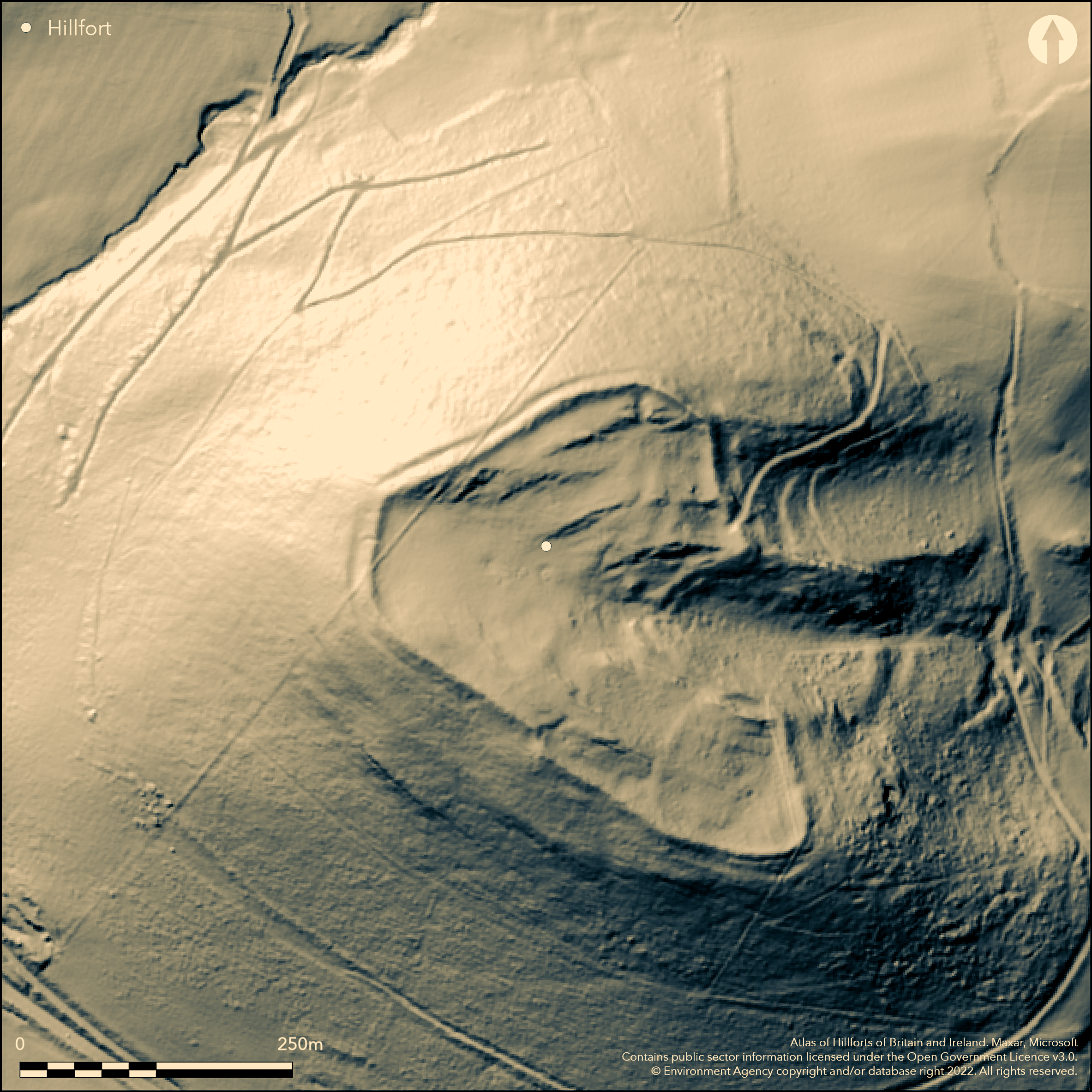
LiDAR 1m DTM Hillshade
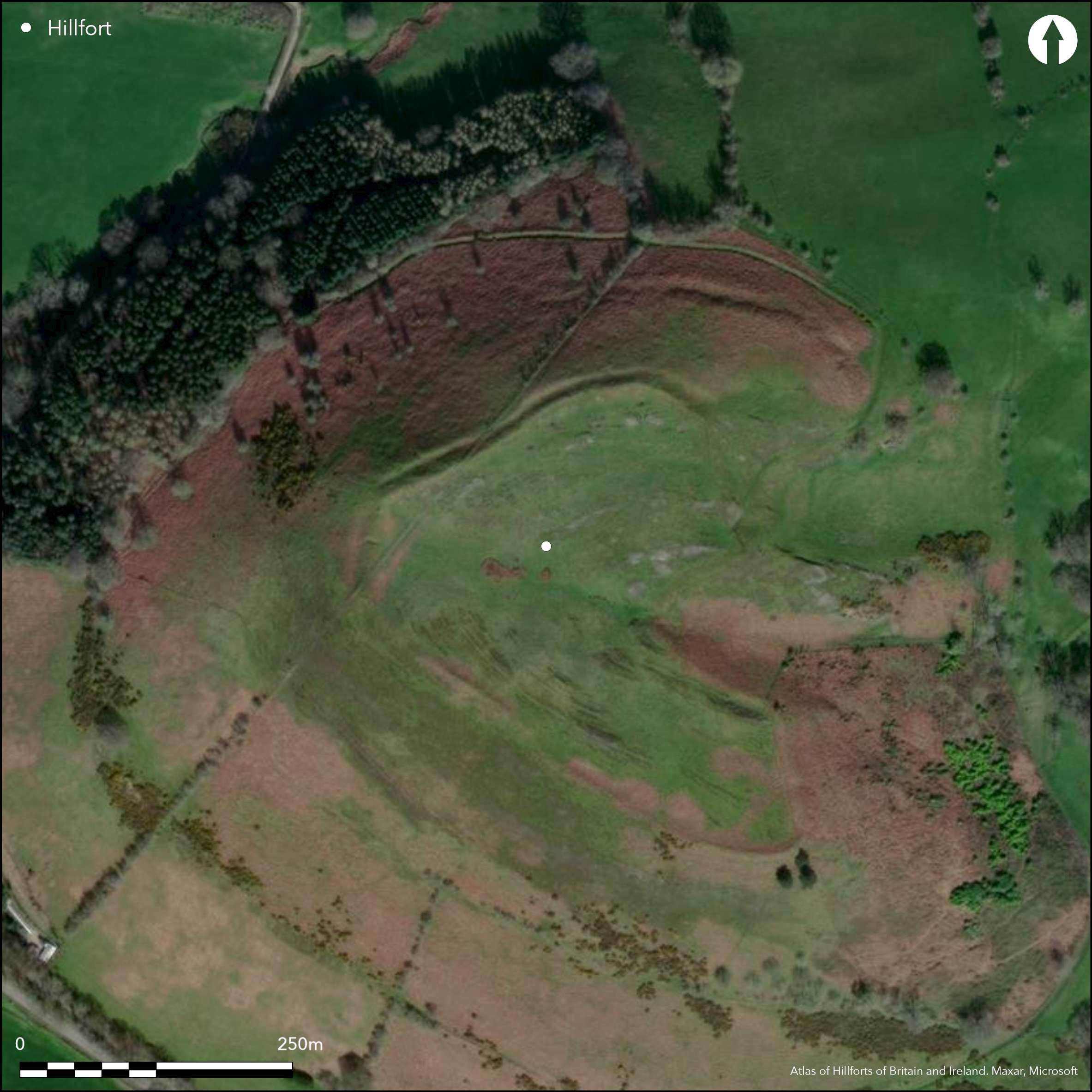
Satellite Imagery
LiDAR 1m DTM Hillshade
Satellite Imagery
Scroll left/right to view further images.
HER: Clwyd Powys 101065 (None)
NMR: SJ 12 SE 3 (306785)
SM: DE121
NGR: SJ1721324742
X: 317213 Y: 324742 (OSGB36)
Commanding contour hillfort located on prominent outcrop dominating the Afon Tanat valley near to the confluence of the Afon Tanat and Twrch. Very steep surrounding slopes, slightly less on E. Sub-oval in shape measuring 264m N-S by 204m, with inernal area 2.4ha. Defined by single surrounding rampart around circuit. Wide and substantial inturned entrance on E,narrowing to an entrance gap c. 8.0m wide taking advantage of a cleft in the hilltop. Excavations by CPAT/C.R. Musson in 1983 produced evidence of late Bronze Age occupation and metalworking using copper ore from Llanymynech Hill (Atlas No. 0071). Earliest fortifications C14 dated to late 9th to early 8th centuries BC and metallurgical analysis of debris from rear of rampart proved a metalworking floor which was C14 dated to 3rd century BC, with copper alloy casting, iron forging and possibly bronze production in a single workshop. Rampart of 10th to 9th centuries BC later enlarged in 4th or 3rd centuries BC. On 1st Ed. OS map (1875).
Citizen Science: ✗
Reliability of Data: Confirmed
Reliability of Interpretation: Confirmed
X: -359538 Y: 6948634 (EPSG: 3857)
Longitude: -3.2297831416394236 Latitude: 52.813820171834955 (EPSG:4326)
Country: Wales
Current County or Unitary Authority: Powys
Historic County: Denbighshire
Current Parish/Community/Council/Townland: Llangedwyn
Good condition under upland grazing. Upland road access.
| Extant | ✓ |
| Cropmark | ✗ |
| Likely Destroyed | ✗ |
Upland pasture. Upland road.
| Woodland | ✗ |
| Commercial Forestry Plantation | ✗ |
| Parkland | ✗ |
| Pasture (Grazing) | ✓ |
| Arable | ✗ |
| Scrub/Bracken | ✗ |
| Bare Outcrop | ✗ |
| Heather/Moorland | ✗ |
| Heath | ✗ |
| Built-up | ✗ |
| Coastal Grassland | ✗ |
| Other | ✓ |
Commanding contour hillfort located on prominent outcrop dominating the Afon Tanat valley near to the confluence of the Afon Tanat and Twrch. Very steep surrounding slopes, slightly less on E.
| Contour Fort | ✓ |
| Partial Contour Fort | ✗ |
| Promontory Fort | ✗ |
| Hillslope Fort | ✗ |
| Level Terrain Fort | ✗ |
| Marsh Fort | ✗ |
| Multiple Enclosure Fort | ✗ |
| Hilltop | ✓ |
| Coastal Promontory | ✗ |
| Inland Promontory | ✗ |
| Valley Bottom | ✗ |
| Knoll/Hillock/Outcrop | ✗ |
| Ridge | ✗ |
| Cliff/Plateau-edge/Scarp | ✗ |
| Hillslope | ✗ |
| Lowland | ✗ |
| Spur | ✗ |
Dominant Topographic Feature: Hill top
| North | ✗ |
| Northeast | ✗ |
| East | ✗ |
| Southeast | ✗ |
| South | ✗ |
| Southwest | ✗ |
| West | ✗ |
| Northwest | ✗ |
| Level | ✓ |
Altitude: 271.0m
N/A
Excavation 1983 produced 8th or 9th century date for the earliest occupation, persisting until 2nd century BC. Excavations by CPAT/C.R. Musson in 1983 produced evidence of late Bronze Age occupation and metalworking using copper ore from Llanymynech Hill (Atlas No 0071 ). Earliest fortifications C14 dated to late 9th to early 8th centuries BC and metallurgical analysis of debris from rear of rampart proved a metalworking floor which was C14 dated to 3rd century BC, with copper alloy casting, iron forging and possibly bronze production in a single workshop. Rampart of 10th to 9th centuries BC later enlarged in 4th or 3rd centuries BC.
Reliability: B - Medium
| Pre 1200BC | ✗ |
| 1200BC - 800BC | ✓ |
| 800BC - 400BC | ✓ |
| 400BC - AD50 | ✓ |
| AD50 - AD400 | ✗ |
| AD400 - AD 800 | ✗ |
| Post AD800 | ✗ |
| Unknown | ✗ |
| Pre Hillfort: | None |
| Post Hillfort: | None |
| C14: | 10th to 3rd centuries BC evidence. |
| Morphology/Earthwork/Typology: | Excavation evidence. |
| Other: | Metallurgical analysis. |
On 1st Ed. OS map (1875). Excavation 1983 by CPAT/C.R. Musson et al.
| 1st Identified Map Depiction (1875): | OS map. |
| Excavation (1983): | CPAT/C.R. Musson et al. |
Metallurgical analysis of debris from excavations from rear of rampart proved a metalworking floor which was C14 dated to 3rd century BC, with copper alloy casting, iron forging and possibly bronze production in a single workshop.
Small watercourse a little downslope and stream 0.2km outside fort.
| None | ✓ |
| Spring | ✗ |
| Stream | ✗ |
| Pool | ✗ |
| Flush | ✗ |
| Well | ✗ |
| Other | ✗ |
None
| No Known Features | ✓ |
| Round Stone Structures | ✗ |
| Rectangular Stone Structures | ✗ |
| Curvilinear Platforms | ✗ |
| Other Roundhouse Evidence | ✗ |
| Pits | ✗ |
| Quarry Hollows | ✗ |
| Other | ✗ |
Metallurgical analysis of debris from excavations from rear of rampart proved a metalworking floor which was C14 dated to 3rd century BC, with copper alloy casting, iron forging and possibly bronze production in a single workshop.
| No Known Excavation | ✗ |
| Pits | ✗ |
| Postholes | ✗ |
| Roundhouses | ✗ |
| Rectangular Structures | ✗ |
| Roads/Tracks | ✗ |
| Quarry Hollows | ✗ |
| Other | ✓ |
| Nothing Found | ✗ |
None
| No Known Geophysics | ✓ |
| Pits | ✗ |
| Roundhouses | ✗ |
| Rectangular Structures | ✗ |
| Roads/Tracks | ✗ |
| Quarry Hollows | ✗ |
| Other | ✗ |
| Nothing Found | ✗ |
Metallurgical analysis of debris from excavations from rear of rampart proved a metalworking floor which was C14 dated to 3rd century BC, with copper alloy casting, iron forging and possibly bronze production in a single workshop.
| No Known Finds | ✗ |
| Pottery | ✗ |
| Metal | ✓ |
| Metalworking | ✓ |
| Human Bones | ✗ |
| Animal Bones | ✗ |
| Lithics | ✗ |
| Environmental | ✗ |
| Other | ✓ |
None
| APs Not Checked | ✓ |
| None | ✗ |
| Roundhouses | ✗ |
| Rectangular Structures | ✗ |
| Pits | ✗ |
| Postholes | ✗ |
| Roads/Tracks | ✗ |
| Other | ✗ |
Wide and substantial inturned entrance on SE, narrowing to an entrance gap c. 8.0m wide taking advantage of a cleft in the hilltop.
| 1: | None |
| 2: | None |
Guard Chambers: ✗
Chevaux de Frise: ✗
| 1. In-turned (South east): | Takes advantage of a cleft in the hilltop. |
| 1. Other Forms (South east): | Takes advantage of a cleft in the hilltop. |
Defined by single surrounding rampart and ditch around circuit.
| Area 1: | 2.4ha. |
| Total: | 2.4ha. |
Total Footprint Area: Noneha.
None
| ✓ | Rampart of 10th to 9th centuries BC later enlarged in 4th or 3rd centuries BC. |
| ✓ | None |
| NE Quadrant: | 1 |
| SE Quadrant: | 1 |
| SW Quadrant: | 1 |
| NW Quadrant: | 1 |
| Total: | 1 |
| Partial Univallate | ✗ |
| Univallate | ✓ |
| Partial Bivallate | ✗ |
| Bivallate | ✗ |
| Partial Multivallate | ✗ |
| Multivallate | ✗ |
| Unknown | ✗ |
| Partial Univallate | ✗ |
| Univallate | ✗ |
| Partial Bivallate | ✗ |
| Bivallate | ✗ |
| Partial Multivallate | ✗ |
| Multivallate | ✗ |
None
| None | ✗ |
| Earthen Bank | ✓ |
| Stone Wall | ✗ |
| Rubble | ✗ |
| Wall-walk | ✗ |
| Evidence of Timber | ✗ |
| Vitrification | ✗ |
| Other Burning | ✗ |
| Palisade | ✗ |
| Counter Scarp Bank | ✗ |
| Berm | ✗ |
| Unfinished | ✗ |
| Other | ✗ |
Rampart of tenth to ninth centuries BC later enlarged in fourth or third centuries BC.
| None | ✗ |
| Earthen Bank | ✓ |
| Stone Wall | ✗ |
| Murus Duplex | ✗ |
| Timber-framed | ✗ |
| Timber-laced | ✗ |
| Vitrification | ✗ |
| Other Burning | ✗ |
| Palisade | ✗ |
| Counter Scarp Bank | ✗ |
| Berm | ✗ |
| Unfinished | ✗ |
| No Known Excavation | ✗ |
| Other | ✗ |
| ✗ | None |
| ✓ | None |
Number of Ditches: 1
| ✗ | None |
CPAT 1994. Llwyn Bryn-dinas, Plate inset, Windows on the past - a review of recent discoveries by CPAT, Clwyd Powys Archaeological Trust.
Houlder C. 1978. Wales: an archaeological guide. The prehistoric, Roman and early medieval field monuments,London: Faber and Faber.
Musson, C. 2012. Montgomeryshire hillforts and enclosures from the air, in Britnell, W.J. and Silvester, R.J. (eds) Reflections on the past. Essays in honour of Frances Lynch. Cambrian Archaeological Association, 351-368.
Musson, C.R., Britnell, W.J., Northover, J.P. and Salter, C.J. 1992. Excavations and metal-working at Llwyn Bryn-dinas hillfort, Llangedwyn, Clwyd, Proc Prehist Soc, 58, 265-83.
Atlas of Hillforts:
Wikidata:
This work is licensed under CC BY-SA 4.0

 and should be cited as:
Lock, Gary and Ralston, Ian. 2024. Atlas of Hillforts of Britain and Ireland. Available at: https://hillforts.arch.ox.ac.uk
Document Version 1.1