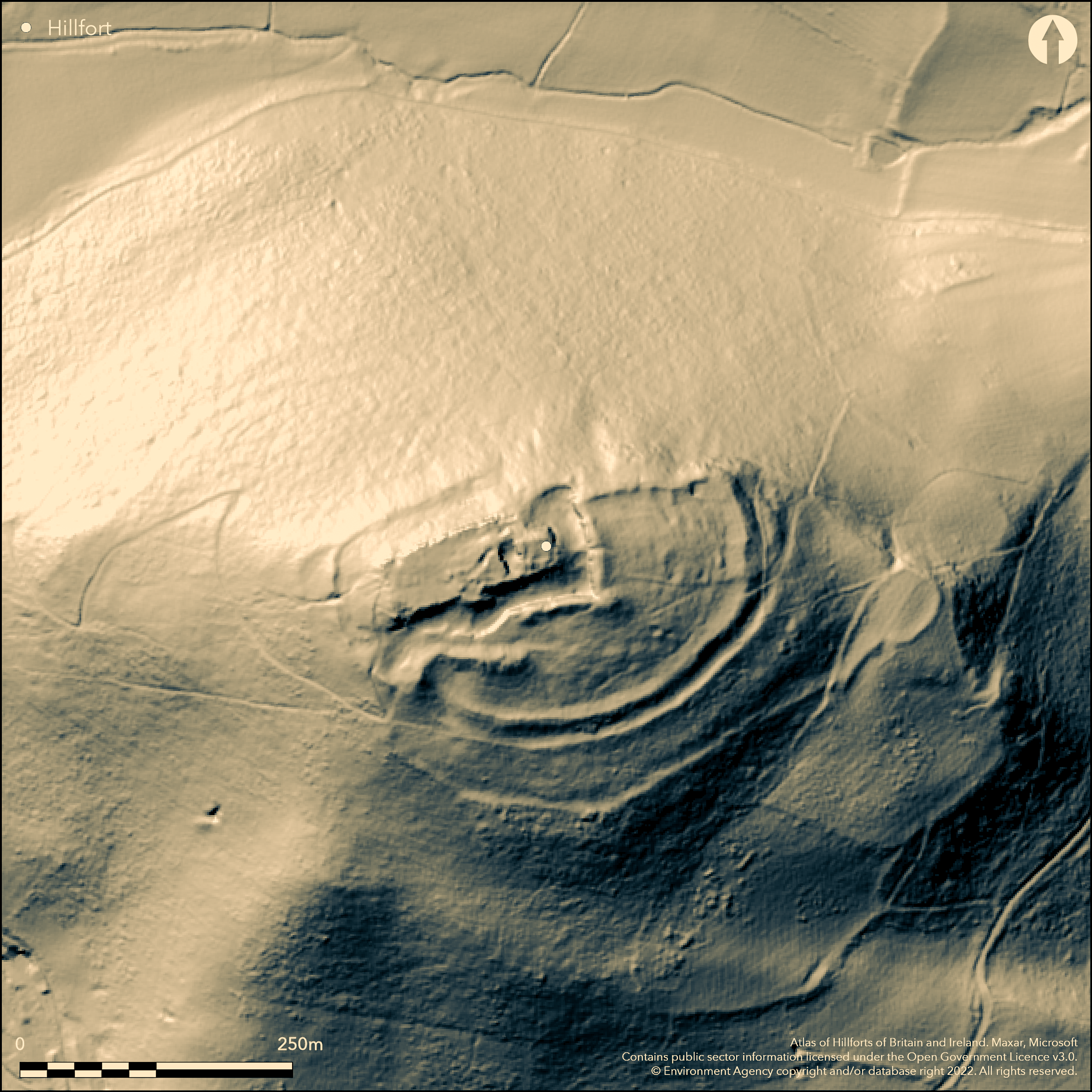
LiDAR 1m DTM Hillshade
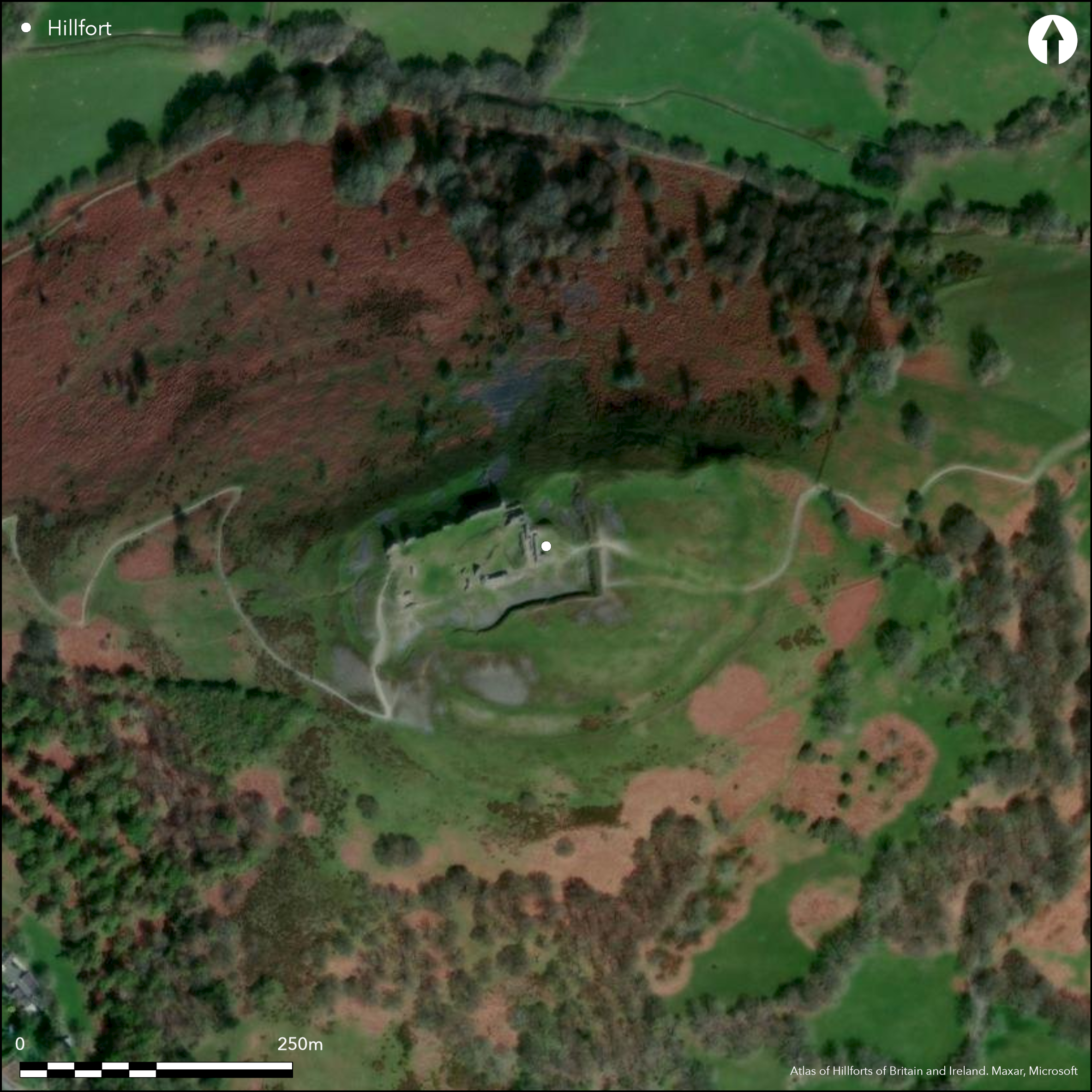
Satellite Imagery
LiDAR 1m DTM Hillshade
Satellite Imagery
Scroll left/right to view further images.
HER: Clwyd Powys 101173 (None)
NMR: SJ 24 SW 7 (93290)
SM: DE021
NGR: SJ 2224 4306
X: 322296 Y: 343075 (OSGB36)
Prominent, contour hillfort located in commanding position above Vale of Llangollen and River Dee at Llangollen where the valley meets the Horseshoe Pass from N and opposite to the Eglwseg rocks. Nearly precipitous slopes on N, very steep on S, and E, steep on W. Roughly D-shaped measuring c. 200m E-W by 120m, with internal area 1.7ha. Traces of bank and ditch survive in part, but hillfort much altered by medieval castle constructed on NW corner in 1260's by Lords of Powys Fadog. Internal quarry ditch. Possible hut sites visible in the interior, but disturbance/geology make interpretation difficult. Traces of slighter outer bank identified, running c. 20m-50m about the E and SW to sides of main enclosure. Visible as scarps, except on E with circular banked section c. 40m across. However, this could be part of the castle surrounds, No visible entrance. Deep rock-cut castle ditch surrounds the masonry ruins on E and S, with castle well in interior. Arched windows of great hall or chapel survive. Jones (2001) suggests that all the earthworks are medieval, but not proven. Under Denbighshire County Council ownership and management. Rough upland pasture and bare rock. On 1st Ed. OS map (1875). Minimal investigations, undated.
Citizen Science: ✗
Reliability of Data: Confirmed
Reliability of Interpretation: Confirmed
X: -351633 Y: 6979179 (EPSG: 3857)
Longitude: -3.1587698056668296 Latitude: 52.97934855875757 (EPSG:4326)
Country: Wales; None
Current County or Unitary Authority: Denbighshire
Historic County: Denbighshire
Current Parish/Community/Council/Townland: Llangollen urban; Llangollen rural
Site associated with medieval castle and only part remains. Under Denbighshire County Council ownership and management.
| Extant | ✓ |
| Cropmark | ✗ |
| Likely Destroyed | ✓ |
Rough upland pasture and bare rock. Medieval castle.
| Woodland | ✗ |
| Commercial Forestry Plantation | ✗ |
| Parkland | ✗ |
| Pasture (Grazing) | ✓ |
| Arable | ✗ |
| Scrub/Bracken | ✗ |
| Bare Outcrop | ✗ |
| Heather/Moorland | ✗ |
| Heath | ✗ |
| Built-up | ✓ |
| Coastal Grassland | ✗ |
| Other | ✓ |
Prominent, contour hillfort located in commanding position above Vale of Llangollen and River Dee at Llangollen where the valley meets the Horseshoe Pass from N and opposite to the Eglwseg rocks. Nearly precipitous slopes on N, very steep on S, and E, steep on W.
| Contour Fort | ✓ |
| Partial Contour Fort | ✗ |
| Promontory Fort | ✗ |
| Hillslope Fort | ✗ |
| Level Terrain Fort | ✗ |
| Marsh Fort | ✗ |
| Multiple Enclosure Fort | ✗ |
| Hilltop | ✓ |
| Coastal Promontory | ✗ |
| Inland Promontory | ✗ |
| Valley Bottom | ✗ |
| Knoll/Hillock/Outcrop | ✗ |
| Ridge | ✗ |
| Cliff/Plateau-edge/Scarp | ✗ |
| Hillslope | ✗ |
| Lowland | ✗ |
| Spur | ✗ |
Dominant Topographic Feature: Hill top
| North | ✗ |
| Northeast | ✗ |
| East | ✗ |
| Southeast | ✗ |
| South | ✗ |
| Southwest | ✗ |
| West | ✗ |
| Northwest | ✗ |
| Level | ✓ |
Altitude: 302.0m
Boundary Type: Parish/Townland
None.
Reliability: D - None
| Pre 1200BC | ✗ |
| 1200BC - 800BC | ✗ |
| 800BC - 400BC | ✗ |
| 400BC - AD50 | ✗ |
| AD50 - AD400 | ✗ |
| AD400 - AD 800 | ✗ |
| Post AD800 | ✗ |
| Unknown | ✓ |
| Pre Hillfort: | None |
| Post Hillfort: | Contains medieval castle ruins. Jones (2001) suggests that all the earthworks are medieval, but not proven. |
On 1st Ed. OS map (1875).
| Other (1875): | OS map. |
| Other (1982): | Visit by Hillfort Study Group |
| Other (2012): | Visited by Hillfort Study Group |
Possible hut sites visible in the interior, but disturbance/geology make interpretation difficult.
Castle well could indicate earlier supply.
| None | ✗ |
| Spring | ✗ |
| Stream | ✗ |
| Pool | ✗ |
| Flush | ✗ |
| Well | ✓ |
| Other | ✗ |
Possible hut sites in interior.
| No Known Features | ✗ |
| Round Stone Structures | ✗ |
| Rectangular Stone Structures | ✗ |
| Curvilinear Platforms | ✓ |
| Other Roundhouse Evidence | ✗ |
| Pits | ✗ |
| Quarry Hollows | ✗ |
| Other | ✗ |
None
| No Known Excavation | ✓ |
| Pits | ✗ |
| Postholes | ✗ |
| Roundhouses | ✗ |
| Rectangular Structures | ✗ |
| Roads/Tracks | ✗ |
| Quarry Hollows | ✗ |
| Other | ✗ |
| Nothing Found | ✗ |
None
| No Known Geophysics | ✓ |
| Pits | ✗ |
| Roundhouses | ✗ |
| Rectangular Structures | ✗ |
| Roads/Tracks | ✗ |
| Quarry Hollows | ✗ |
| Other | ✗ |
| Nothing Found | ✗ |
None
| No Known Finds | ✓ |
| Pottery | ✗ |
| Metal | ✗ |
| Metalworking | ✗ |
| Human Bones | ✗ |
| Animal Bones | ✗ |
| Lithics | ✗ |
| Environmental | ✗ |
| Other | ✗ |
None
| APs Not Checked | ✓ |
| None | ✗ |
| Roundhouses | ✗ |
| Rectangular Structures | ✗ |
| Pits | ✗ |
| Postholes | ✗ |
| Roads/Tracks | ✗ |
| Other | ✗ |
No visible entrance.
| 0: | None |
| 2: | None |
Guard Chambers: ✗
Chevaux de Frise: ✗
Traces of bank and ditch survive in part. Traces of slighter outer bank identified, running c. 20m-50m about the E and SW to sides of main enclosure.
| Area 1: | 1.7ha. |
| Total: | 1.7ha. |
Total Footprint Area: Noneha.
None
| ✗ | None |
| ✗ | Quadrants estimated and unclear. |
| NE Quadrant: | 1 |
| SE Quadrant: | 2 |
| SW Quadrant: | 2 |
| NW Quadrant: | 1 |
| Total: | 2 |
| Partial Univallate | ✓ |
| Univallate | ✗ |
| Partial Bivallate | ✓ |
| Bivallate | ✗ |
| Partial Multivallate | ✗ |
| Multivallate | ✗ |
| Unknown | ✗ |
| Partial Univallate | ✗ |
| Univallate | ✗ |
| Partial Bivallate | ✗ |
| Bivallate | ✗ |
| Partial Multivallate | ✗ |
| Multivallate | ✗ |
Probable stone or rubble wall.
| None | ✗ |
| Earthen Bank | ✗ |
| Stone Wall | ✓ |
| Rubble | ✓ |
| Wall-walk | ✗ |
| Evidence of Timber | ✗ |
| Vitrification | ✗ |
| Other Burning | ✗ |
| Palisade | ✗ |
| Counter Scarp Bank | ✗ |
| Berm | ✗ |
| Unfinished | ✗ |
| Other | ✗ |
None
| None | ✗ |
| Earthen Bank | ✗ |
| Stone Wall | ✗ |
| Murus Duplex | ✗ |
| Timber-framed | ✗ |
| Timber-laced | ✗ |
| Vitrification | ✗ |
| Other Burning | ✗ |
| Palisade | ✗ |
| Counter Scarp Bank | ✗ |
| Berm | ✗ |
| Unfinished | ✗ |
| No Known Excavation | ✓ |
| Other | ✗ |
| ✗ | None |
| ✓ | Traces of ditch survive. |
Number of Ditches: 1
| ✗ | None |
Brown, I. 2009. Beacons in the landscape. The hillforts of England and Wales, Oxford: Windgather Press/Oxbow Books.
Burnham, H. 1995. A guide to ancient and historic Wales - Clwyd and Powys, London: HMSO, 141-42.
Davies, Canon Ellis 1929. The prehistoric and Roman remains of Denbighshire, Cardiff: William Lewis, 252.
Forde-Johnston, J. 1964. Fieldwork on the hillforts of North Wales, Flintshire Historical Society Publications, 21, 1-20.
Jones, W.B. 2001. Medieval earthworks at Dinas Bran, Llangollen, Arch Camb, 147, 234-39.
Atlas of Hillforts:
Wikidata:
This work is licensed under CC BY-SA 4.0

 and should be cited as:
Lock, Gary and Ralston, Ian. 2024. Atlas of Hillforts of Britain and Ireland. Available at: https://hillforts.arch.ox.ac.uk
Document Version 1.1