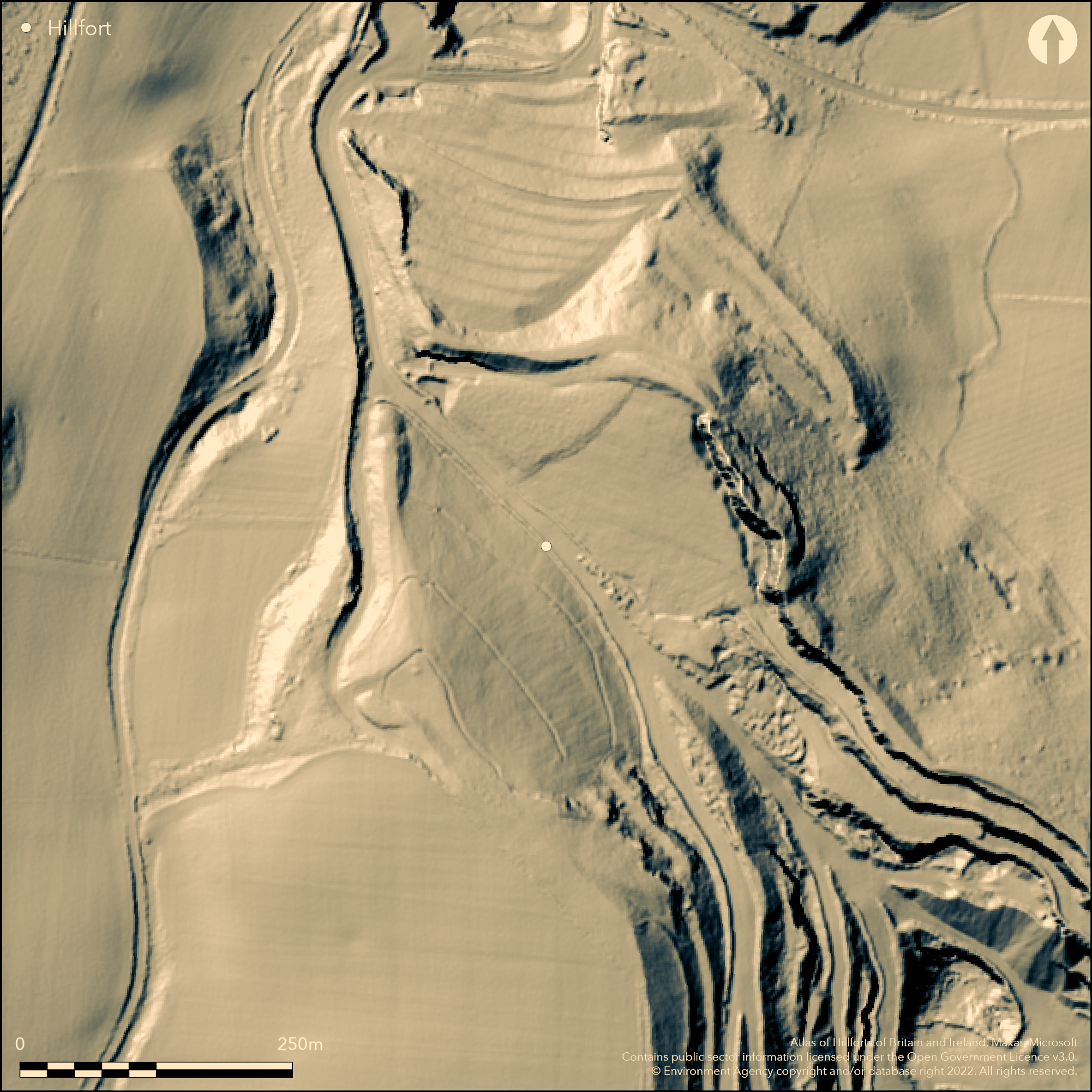
LiDAR 1m DTM Hillshade
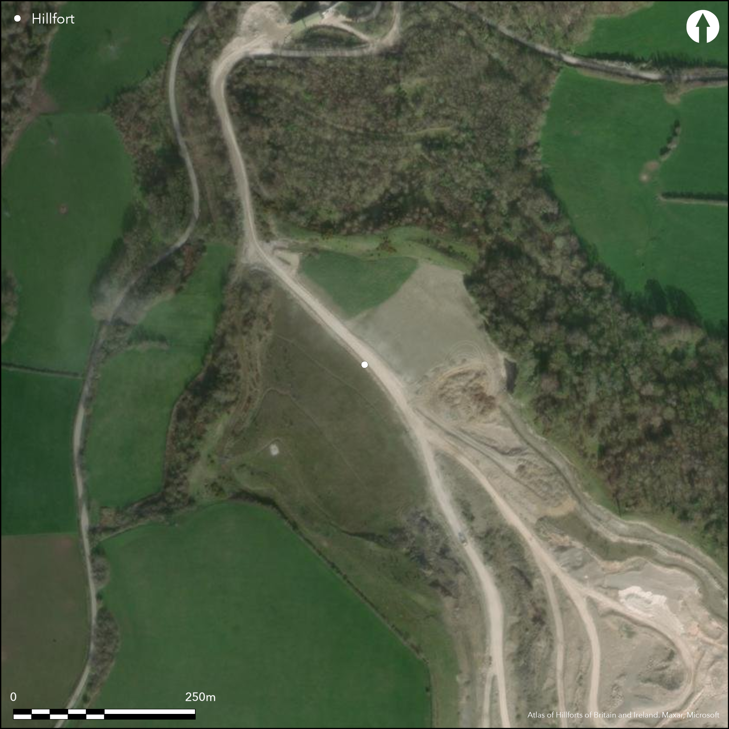
Satellite Imagery
LiDAR 1m DTM Hillshade
Satellite Imagery
Scroll left/right to view further images.
HER: Clwyd Powys 102003 (None)
NMR: SH 97 NE (406097)
SM: None
NGR: SH968757
X: 296800 Y: 375700 (OSGB36)
Former contour hillfort formerly located on limestone outcrop above coastal plain on North Wales coast and sea to E near Llandulas. Massive multi-period, excavated fort overlooking the coastal plain to the Afon Clwyd. Totally destroyed by St George Quarry. Excavations by Willoughby Gardner under auspices of Abergele Society 1912-22; then rescue excavations from 1956 to 1964, 1965-9 and 1977-8 for quarry extension 2009. Triangular area enclosed c. 2.4ha with limestone cliffs on two sides, with massive sloping-faced rampart, to over 13m in height, on S, with two smaller outer banks. Main entrance on SE modified several times. In 1978 seen as stone-faced passage over 10m long with guard chambers at inner end. Many hut floors found belonging to all phases of occupation. Important finds, including ox-head escutcheons, well described in excavation report of 1974. Eight C14 dates gave approximate late Bronze Age 9th to 8th century BC date for Period I suggested by Gardner and Savory (1964), with activity or reoccupation continuing through to the late Roman period and possibly beyond. This questioned by Guilbert (1980) as result of 17 more reliable C14 results, with beginnings later c. 8th to 5th century BC, 520 cal. BC to 400 cal. BC, and end c. 100 cal. BC to AD 100 and supported by Horn (Forthcoming). Many dateable finds. On 1st Ed. OS map (1872-84). 1961 1:2500 OS map show quarry just encroaching from N and hillfort now lost.
Citizen Science: ✗
Reliability of Data: Confirmed
Reliability of Interpretation: Confirmed
X: -395059 Y: 7032764 (EPSG: 3857)
Longitude: -3.548877615094813 Latitude: 53.268206998938325 (EPSG:4326)
Country: Wales
Current County or Unitary Authority: Conwy
Historic County: Denbighshire
Current Parish/Community/Council/Townland: Abergele
Progressively totally destroyed by quarrying.
| Extant | ✗ |
| Cropmark | ✗ |
| Likely Destroyed | ✓ |
Destroyed by quarry.
| Woodland | ✗ |
| Commercial Forestry Plantation | ✗ |
| Parkland | ✗ |
| Pasture (Grazing) | ✗ |
| Arable | ✗ |
| Scrub/Bracken | ✗ |
| Bare Outcrop | ✗ |
| Heather/Moorland | ✗ |
| Heath | ✗ |
| Built-up | ✗ |
| Coastal Grassland | ✗ |
| Other | ✓ |
Destroyed contour hillfort lformerly located on limestone outcrop above coastal plain and sea to E.
| Contour Fort | ✓ |
| Partial Contour Fort | ✗ |
| Promontory Fort | ✗ |
| Hillslope Fort | ✗ |
| Level Terrain Fort | ✗ |
| Marsh Fort | ✗ |
| Multiple Enclosure Fort | ✗ |
| Hilltop | ✗ |
| Coastal Promontory | ✗ |
| Inland Promontory | ✓ |
| Valley Bottom | ✗ |
| Knoll/Hillock/Outcrop | ✓ |
| Ridge | ✗ |
| Cliff/Plateau-edge/Scarp | ✗ |
| Hillslope | ✗ |
| Lowland | ✗ |
| Spur | ✗ |
Dominant Topographic Feature: Former limestone outcrop promontory.
| North | ✗ |
| Northeast | ✗ |
| East | ✗ |
| Southeast | ✗ |
| South | ✗ |
| Southwest | ✗ |
| West | ✗ |
| Northwest | ✗ |
| Level | ✓ |
Altitude: 160.0m
N/A
Eight C14 dates gave approximate late Bronze Age 9th to 8th century BC date for Period I suggested by Gardner and Savory (1964), with activity or reoccupation continuing through to the late Roman period and beyond. This early date questioned by Guilbert (1980) as result of 17 more reliable C14 results, with beginnings later c. 8th to 5th century BC, 520 cal. BC to 400 cal. BC, and end c. 100 cal. BC to AD 100 and supported by Horn (Forthcoming). Possible reoccupation from 2nd century AD after period of disuse, through to late Roman period and beyond. Several pre-rampart palisades dated to c. middle of 1st century BC. 2nd century AD trumpet brooch and Roman light spear and ballista bolt and Roman coin found.
Reliability: A - High
| Pre 1200BC | ✗ |
| 1200BC - 800BC | ✗ |
| 800BC - 400BC | ✓ |
| 400BC - AD50 | ✓ |
| AD50 - AD400 | ✓ |
| AD400 - AD 800 | ✗ |
| Post AD800 | ✗ |
| Unknown | ✗ |
| Pre Hillfort: | None |
| Post Hillfort: | None |
| Artefactual: | Many artefacts recovered, including second century AD trumpet brooch and Roman light spear, ballista bolt and Roman coin. |
| C14: | Period I date. |
| Morphology/Earthwork/Typology: | Several pre-rampart palisades dated to c. middle of first century BC. |
On 1st Ed. OS map (1872-84). Excavations by Willoughby Gardner 1912-22. Later in advance of quarrying from 1956 to 1964, 1965-9 and 1977-8. Excavations by Northern Archaeological Associates on St George Quarry extension 2009.
| Other (1977): | Visit by Hillfort Study Group |
| Excavation (2009): | In advance quarrying. |
| 1st Identified Map Depiction (None): | OS map, |
| Excavation (None): | Willoughby Gardner |
| Excavation (None): | In advance of quarrying. |
Many hut platforms and hut floors found belonging to all phases of occupation. Many important finds, including ox-head escutcheons, iron buckles, iron and bronze pins, bronze wand, trumpet brooch, iron and antler tools well described in excavation report of 1974. Inhumation evidence. Mould pieces. Roman coin.
Stream 1.3km outside fort.
| None | ✓ |
| Spring | ✗ |
| Stream | ✗ |
| Pool | ✗ |
| Flush | ✗ |
| Well | ✗ |
| Other | ✗ |
Site destroyed.
| No Known Features | ✓ |
| Round Stone Structures | ✗ |
| Rectangular Stone Structures | ✗ |
| Curvilinear Platforms | ✗ |
| Other Roundhouse Evidence | ✗ |
| Pits | ✗ |
| Quarry Hollows | ✗ |
| Other | ✗ |
Many hut platforms and hut floors found belonging to all phases of occupation, including large structure.
| No Known Excavation | ✗ |
| Pits | ✗ |
| Postholes | ✓ |
| Roundhouses | ✓ |
| Rectangular Structures | ✗ |
| Roads/Tracks | ✗ |
| Quarry Hollows | ✗ |
| Other | ✓ |
| Nothing Found | ✗ |
None
| No Known Geophysics | ✓ |
| Pits | ✗ |
| Roundhouses | ✗ |
| Rectangular Structures | ✗ |
| Roads/Tracks | ✗ |
| Quarry Hollows | ✗ |
| Other | ✗ |
| Nothing Found | ✗ |
Many dateable and important finds including ox-head escutcheons, iron buckles, iron and bronze pins, bronze wand, trumpet brooch, iron and antler tools well described in excavation report of 1974. Inhumation evidence. Mould pieces. Roman coin.
| No Known Finds | ✗ |
| Pottery | ✓ |
| Metal | ✓ |
| Metalworking | ✓ |
| Human Bones | ✓ |
| Animal Bones | ✗ |
| Lithics | ✓ |
| Environmental | ✗ |
| Other | ✓ |
None
| APs Not Checked | ✓ |
| None | ✗ |
| Roundhouses | ✗ |
| Rectangular Structures | ✗ |
| Pits | ✗ |
| Postholes | ✗ |
| Roads/Tracks | ✗ |
| Other | ✗ |
Main entrance on SE modified several times. In 1978 seen as stone-faced passage over 10m long with guard chambers at inner end.
| 1: | None |
| 2: | None |
Guard Chambers: ✓
Chevaux de Frise: ✗
| 1. Passage-way/Corridor (South east): | None |
| 1. Recesses/Guard Chambers (South east): | None |
Triangular area enclosed c. 2.4ha with limestone cliffs providing defence on two sides, with massive sloping-faced rampart, to over 13m in height, on S, with two smaller outer banks. Excavation showed stone-faced rampart with timber strengthening. Palisades around site in early phase. Evidence of burnt timber within ramparts of Period II.
| Area 1: | 2.4ha. |
| Total: | 2.4ha. |
Total Footprint Area: Noneha.
None
| ✓ | Willoughby Gardner identified five phases of construction and occupation. |
| ✗ | Site destroyed. |
| NE Quadrant: | 1 |
| SE Quadrant: | 3 |
| SW Quadrant: | 3 |
| NW Quadrant: | 0 |
| Total: | 3 |
| Partial Univallate | ✓ |
| Univallate | ✗ |
| Partial Bivallate | ✗ |
| Bivallate | ✗ |
| Partial Multivallate | ✓ |
| Multivallate | ✗ |
| Unknown | ✗ |
| Partial Univallate | ✗ |
| Univallate | ✓ |
| Partial Bivallate | ✗ |
| Bivallate | ✗ |
| Partial Multivallate | ✗ |
| Multivallate | ✗ |
Site destroyed.
| None | ✓ |
| Earthen Bank | ✗ |
| Stone Wall | ✗ |
| Rubble | ✗ |
| Wall-walk | ✗ |
| Evidence of Timber | ✗ |
| Vitrification | ✗ |
| Other Burning | ✗ |
| Palisade | ✗ |
| Counter Scarp Bank | ✗ |
| Berm | ✗ |
| Unfinished | ✗ |
| Other | ✗ |
Excavation showed stone-faced rampart with timber strengthening. Palisades around site in early phase. Evidence of burnt timber within ramparts of Period II.
| None | ✗ |
| Earthen Bank | ✓ |
| Stone Wall | ✓ |
| Murus Duplex | ✗ |
| Timber-framed | ✗ |
| Timber-laced | ✓ |
| Vitrification | ✗ |
| Other Burning | ✓ |
| Palisade | ✓ |
| Counter Scarp Bank | ✗ |
| Berm | ✗ |
| Unfinished | ✗ |
| No Known Excavation | ✗ |
| Other | ✗ |
| ✗ | None |
| ✓ | Outside ditch. |
Number of Ditches: 1
| ✗ | None |
Brown, I. 2009. Beacons in the landscape. The hillforts of England and Wales, Oxford: Windgather Press/Oxbow Books.
Gale, F. 1991. The Iron Age, in eds Manley, J., Grenter, S. and Gale, F., The archaeology of Clwyd, Mold: Clwyd Archaeology Service, Clwyd County Council.
Gardner, W. and Savory, H.N. 1964. Dinorben: a hillfort occupied in the Early Iron Age and Roman times, Cardiff: National Museum of Wales.
Guilbert, G.C. 1980. Dinorben C14 dates, Current Arch, 6, 182-88.
Horn, J. Forthcoming. The dating of hillforts in Britain and Ireland. Unpublished PhD thesis, University of Edinburgh.
Houlder, C. 1973. Wales: an archaeological guide, the prehistoric, Roman and early medieval field monuments,London and Boston: Faber, 64.
Savory, H.N. 1971. Excavations at Dinorben , 1965-9, Cardiff: National Museum of Wales.
Wood, P. 2009. St George Quarry, Dinorben, near Abergele, Conwy (SH 9695 7515), Arch in Wales, 49 (2009), 58-60.
Atlas of Hillforts:
Wikidata:
This work is licensed under CC BY-SA 4.0

 and should be cited as:
Lock, Gary and Ralston, Ian. 2024. Atlas of Hillforts of Britain and Ireland. Available at: https://hillforts.arch.ox.ac.uk
Document Version 1.1