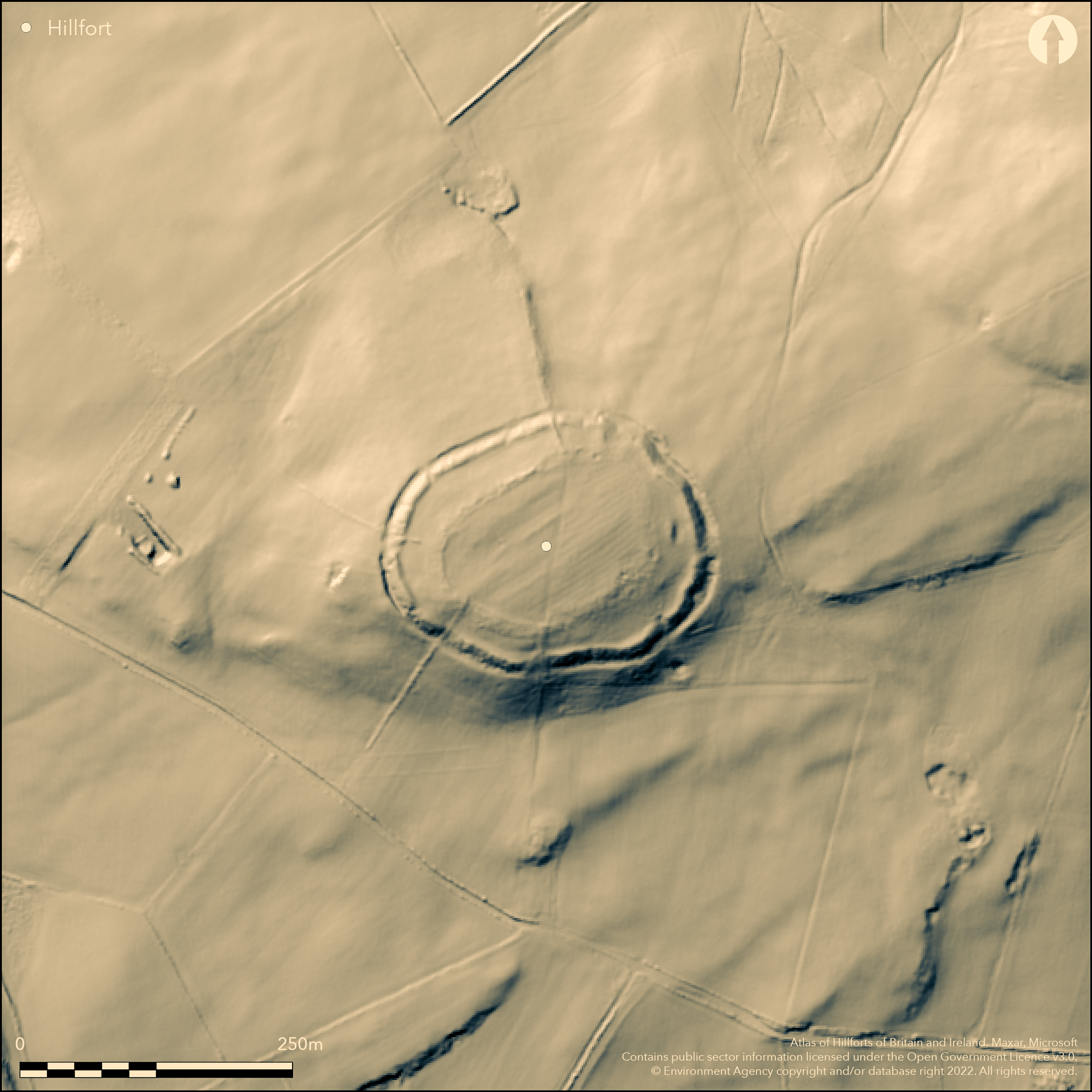
LiDAR 1m DTM Hillshade
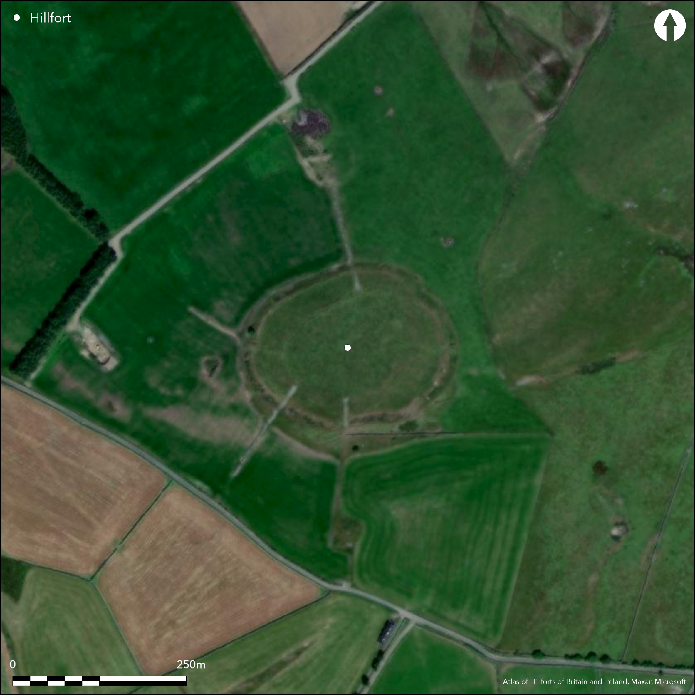
Satellite Imagery
LiDAR 1m DTM Hillshade
Satellite Imagery
Scroll left/right to view further images.
HER: Clwyd Powys 100690 (None)
NMR: SH 94 NE (303453)
SM: DE011
NGR: SH96824792
X: 296820 Y: 347920 (OSGB36)
Partial contour hillfort located in a commanding position on an isolated mountain spur overlooking the Cerrigydrudion valley basin and above the confluence of the Afon Ceirw, Nant y Felin and Nant y Odyn near Llanfihangel Glyn Myfyr. Moderate to strong surrounding slopes. Round in form measuring c. 166m E-W by 130m, with internal area 1.7ha. Excavations by Livens and Smith (1991) showed an original ditchless bank, followed in a second period by larger and massive bank with a rock-cut ditch. Bank of simple dump construction, still rises to c. 6m above base of ditch. No timber work or dating evidence found. Damaged and widened entrance to E, facing along the saddle connecting spur to main massif of Y Drum, although the excavations found no evidence for gate. Slight remains of a concentric inner circuit with cultivation ridges visible, c. 122 E-W by 89m, with area 0.88ha, which may be comparatively recent agricultural feature or rabbit warren. Shows on 1;2500 OS map of 1875 and unproven. Improved pasture interior, scrub on banks. Fair condition with good, massive, ramparts. On 1st Ed. OS map (1875). Undated.
Citizen Science: ✗
Reliability of Data: Confirmed
Reliability of Interpretation: Confirmed
X: -394029 Y: 6986436 (EPSG: 3857)
Longitude: -3.5396232411063937 Latitude: 53.018583545080325 (EPSG:4326)
Country: Wales
Current County or Unitary Authority: Conwy
Historic County: Denbighshire
Current Parish/Community/Council/Townland: Llanfihangel Glyn Myfyr
Fair condition with good, massive, ramparts. Entrance damaged and widened.
| Extant | ✓ |
| Cropmark | ✗ |
| Likely Destroyed | ✗ |
Improved pasture interior, scrub on banks.
| Woodland | ✗ |
| Commercial Forestry Plantation | ✗ |
| Parkland | ✗ |
| Pasture (Grazing) | ✓ |
| Arable | ✗ |
| Scrub/Bracken | ✗ |
| Bare Outcrop | ✗ |
| Heather/Moorland | ✗ |
| Heath | ✗ |
| Built-up | ✗ |
| Coastal Grassland | ✗ |
| Other | ✗ |
Partial contour hillfort located in a commanding position on an isolated mountain spur overlooking the Cerrigydrudion valley basin and above the confluence of the Afon Ceirw, Nant y Felin and Nant y Odyn. Moderate to strong surrounding slopes.
| Contour Fort | ✗ |
| Partial Contour Fort | ✓ |
| Promontory Fort | ✗ |
| Hillslope Fort | ✗ |
| Level Terrain Fort | ✗ |
| Marsh Fort | ✗ |
| Multiple Enclosure Fort | ✗ |
| Hilltop | ✗ |
| Coastal Promontory | ✗ |
| Inland Promontory | ✗ |
| Valley Bottom | ✗ |
| Knoll/Hillock/Outcrop | ✗ |
| Ridge | ✗ |
| Cliff/Plateau-edge/Scarp | ✗ |
| Hillslope | ✗ |
| Lowland | ✗ |
| Spur | ✓ |
Dominant Topographic Feature: Spur
| North | ✗ |
| Northeast | ✗ |
| East | ✗ |
| Southeast | ✗ |
| South | ✗ |
| Southwest | ✗ |
| West | ✗ |
| Northwest | ✗ |
| Level | ✓ |
Altitude: 370.0m
N/A
No dating evidence from excavations.
Reliability: D - None
| Pre 1200BC | ✗ |
| 1200BC - 800BC | ✗ |
| 800BC - 400BC | ✗ |
| 400BC - AD50 | ✗ |
| AD50 - AD400 | ✗ |
| AD400 - AD 800 | ✗ |
| Post AD800 | ✗ |
| Unknown | ✓ |
| Pre Hillfort: | None |
| Post Hillfort: | Slight remains of a concentric inner circuit, c. 122 E-W by 89m, with area 0.88ha which may be comparatively recent agricultural feature or rabbit warren, but unproven. |
On 1st Ed. OS map (1875). Part excavated by R.G. Livens and J.A. Smith 1963 and 1964.
| 1st Identified Map Depiction (1875): | OS map. |
| Excavation (None): | R.G. Livens and J.A. Smith. |
Excavation did not show any structures apart from nature of rampart. Slight remains of a concentric inner circuit with cultivation ridges visible, especially from the air, c. 122 E-W by 89m, with area 0.88ha which may be comparatively recent agricultural feature or rabbit warren, but unproven.
None
| None | ✓ |
| Spring | ✗ |
| Stream | ✗ |
| Pool | ✗ |
| Flush | ✗ |
| Well | ✗ |
| Other | ✗ |
Slight remains of a concentric inner circuit with cultivation ridges visible, c. 122 E-W by 89m, with area 0.88ha which may be comparatively recent agricultural feature or rabbit warren, but unproven.
| No Known Features | ✗ |
| Round Stone Structures | ✗ |
| Rectangular Stone Structures | ✗ |
| Curvilinear Platforms | ✗ |
| Other Roundhouse Evidence | ✗ |
| Pits | ✗ |
| Quarry Hollows | ✗ |
| Other | ✓ |
Excavation did not show any structures apart from nature of rampart nor evidence of gate.
| No Known Excavation | ✗ |
| Pits | ✗ |
| Postholes | ✗ |
| Roundhouses | ✗ |
| Rectangular Structures | ✗ |
| Roads/Tracks | ✗ |
| Quarry Hollows | ✗ |
| Other | ✗ |
| Nothing Found | ✓ |
None
| No Known Geophysics | ✓ |
| Pits | ✗ |
| Roundhouses | ✗ |
| Rectangular Structures | ✗ |
| Roads/Tracks | ✗ |
| Quarry Hollows | ✗ |
| Other | ✗ |
| Nothing Found | ✗ |
None
| No Known Finds | ✓ |
| Pottery | ✗ |
| Metal | ✗ |
| Metalworking | ✗ |
| Human Bones | ✗ |
| Animal Bones | ✗ |
| Lithics | ✗ |
| Environmental | ✗ |
| Other | ✗ |
Slight remains of a concentric inner circuit with cultivation ridges visible from air.
| APs Not Checked | ✗ |
| None | ✗ |
| Roundhouses | ✗ |
| Rectangular Structures | ✗ |
| Pits | ✗ |
| Postholes | ✗ |
| Roads/Tracks | ✗ |
| Other | ✓ |
Entrance to E, facing along the saddle connecting spur to main massif of Y Drum. Modern damage and widening to entrance.
| 1: | None |
| 2: | Damaged. |
Guard Chambers: ✗
Chevaux de Frise: ✗
| 1. Simple Gap (East): | None |
Original ditchless bank, followed in a second period by larger and massive bank with a rock-cut ditch. Bank of simple dump construction, still rises to c. 6m above base of ditch. No timber work or dating evidence found.
| Area 1: | 1.7ha. |
| Total: | 1.7ha. |
Total Footprint Area: Noneha.
None
| ✓ | Two phases to site. |
| ✓ | None |
| NE Quadrant: | 1 |
| SE Quadrant: | 1 |
| SW Quadrant: | 1 |
| NW Quadrant: | 1 |
| Total: | 1 |
| Partial Univallate | ✗ |
| Univallate | ✓ |
| Partial Bivallate | ✗ |
| Bivallate | ✗ |
| Partial Multivallate | ✗ |
| Multivallate | ✗ |
| Unknown | ✗ |
| Partial Univallate | ✗ |
| Univallate | ✗ |
| Partial Bivallate | ✗ |
| Bivallate | ✗ |
| Partial Multivallate | ✗ |
| Multivallate | ✗ |
None
| None | ✗ |
| Earthen Bank | ✓ |
| Stone Wall | ✗ |
| Rubble | ✗ |
| Wall-walk | ✗ |
| Evidence of Timber | ✗ |
| Vitrification | ✗ |
| Other Burning | ✗ |
| Palisade | ✗ |
| Counter Scarp Bank | ✗ |
| Berm | ✗ |
| Unfinished | ✗ |
| Other | ✗ |
Excavations 1963 and 1964 showed an original ditchless bank, followed in a second period by larger bank with a rock-cut ditch. Simple dump construction. No timber work or dating evidence found.
| None | ✗ |
| Earthen Bank | ✓ |
| Stone Wall | ✗ |
| Murus Duplex | ✗ |
| Timber-framed | ✗ |
| Timber-laced | ✗ |
| Vitrification | ✗ |
| Other Burning | ✗ |
| Palisade | ✗ |
| Counter Scarp Bank | ✗ |
| Berm | ✗ |
| Unfinished | ✗ |
| No Known Excavation | ✗ |
| Other | ✗ |
| ✗ | None |
| ✓ | Rock-cut ditch in second phase. |
Number of Ditches: 1
| ✗ | None |
Davies, Canon Ellis 1929. The prehistoric and Roman remains of Denbighshire, Cardiff: William Lewis, 234.
Houlder, C. 1973. Wales: an archaeological guide, the prehistoric, Roman and early medieval field monuments,London and Boston: Faber, 86.
Livens, R.G. and Smith, J.A. 1991. Excavations at Caer Caradog, Llanfihangel Glyn Myfyr, Clwyd, 1963-4, Arch Camb, 140, 77-101
Atlas of Hillforts:
Wikidata:
This work is licensed under CC BY-SA 4.0

 and should be cited as:
Lock, Gary and Ralston, Ian. 2024. Atlas of Hillforts of Britain and Ireland. Available at: https://hillforts.arch.ox.ac.uk
Document Version 1.1