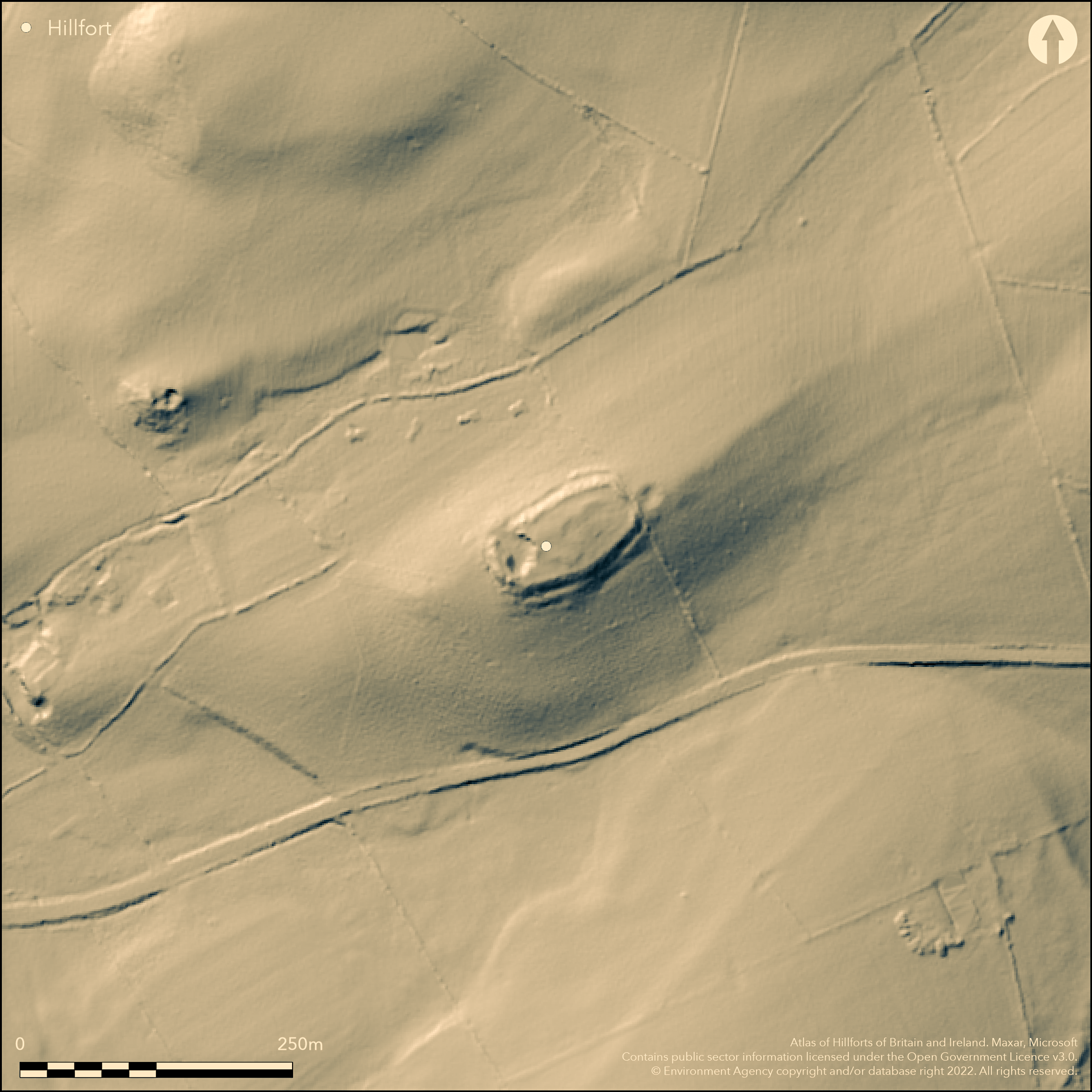
LiDAR 1m DTM Hillshade
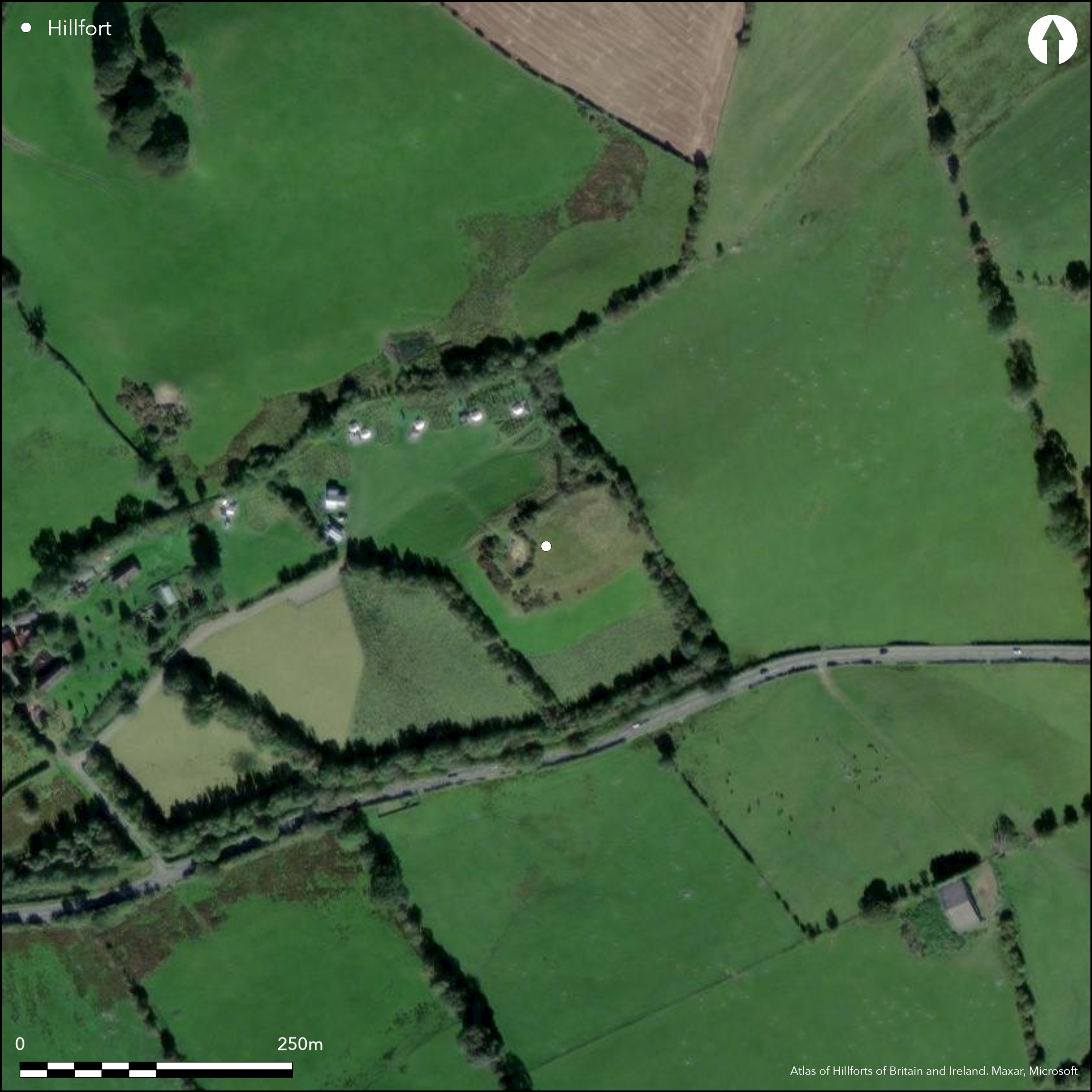
Satellite Imagery
LiDAR 1m DTM Hillshade
Satellite Imagery
Scroll left/right to view further images.
HER: Clwyd Powys 100792 (None)
NMR: SJ 04 NE (306594)
SM: None
NGR: SJ0961045670
X: 309610 Y: 345670 (OSGB36)
Small, univallate, contour hillfort located on glacial knoll just before the Afon Morwynion enters the River Dee at Corwen. Moderate slopes to N and E, moderate to strong to S and W. Oblong in shape, but cut into by local disused quarry on NW, measuring c. 77m by 34m, with internal area 0.28ha. Said by Bowen and Gresham (1967, 139) to be a miniature version of Caer Euni (Atlas No. 1734), visible to the SW. Single low scarp and ditch surrounds the site, formed mostly by cutting back into the natural slope. Slight counterscarp. There is a slight berm visible and it is possible that there was a stone or rubble wall around the interior at the top of the scarp. Simple entrance at NE end facing along the ridge, with possibly hint of inturns in past. Complete topographical and geophysical surveys by Engineering Archaeological Services and Oxford University 2010 and excavations by Bangor University and Oxford University in interior, entrance and rampart section 2011-2013. Geophysical surveys and excavation revealed roundhouses in interior with postholes and hearth. Excavation across scarp and ditch found ditch filled with rubble and boulders from wall, suggesting possible slighting of ramparts around circuit. Two degraded sherds of possible late Bronze Age pottery found, with traces of burnt, possible animal, bone and burnt stone from postholes/cooking pits (?). On 1st Ed. OS map (1874).
Citizen Science: ✗
Reliability of Data: Confirmed
Reliability of Interpretation: Confirmed
X: -372741 Y: 6983123 (EPSG: 3857)
Longitude: -3.3483865210289276 Latitude: 53.00067815880989 (EPSG:4326)
Country: Wales
Current County or Unitary Authority: Denbighshire
Historic County: Merioneth
Current Parish/Community/Council/Townland: Corwen
Good condition. Former quarry cuts rampart on NW.Entrance on NE cleared of gorse 2011.
| Extant | ✓ |
| Cropmark | ✗ |
| Likely Destroyed | ✗ |
Good upland pasture. Hedge/tree line abuts site on NE. Quarry.
| Woodland | ✗ |
| Commercial Forestry Plantation | ✗ |
| Parkland | ✗ |
| Pasture (Grazing) | ✓ |
| Arable | ✗ |
| Scrub/Bracken | ✗ |
| Bare Outcrop | ✗ |
| Heather/Moorland | ✗ |
| Heath | ✗ |
| Built-up | ✗ |
| Coastal Grassland | ✗ |
| Other | ✓ |
Small, contour hillfort located on glacial knoll just before the Afon Morwynion enters the River Dee at Corwen. Moderate slopes to N and E, moderate to strong to S and W.
| Contour Fort | ✓ |
| Partial Contour Fort | ✗ |
| Promontory Fort | ✗ |
| Hillslope Fort | ✗ |
| Level Terrain Fort | ✗ |
| Marsh Fort | ✗ |
| Multiple Enclosure Fort | ✗ |
| Hilltop | ✗ |
| Coastal Promontory | ✗ |
| Inland Promontory | ✗ |
| Valley Bottom | ✗ |
| Knoll/Hillock/Outcrop | ✓ |
| Ridge | ✗ |
| Cliff/Plateau-edge/Scarp | ✗ |
| Hillslope | ✗ |
| Lowland | ✗ |
| Spur | ✗ |
Dominant Topographic Feature: Glacial outcrop
| North | ✗ |
| Northeast | ✗ |
| East | ✗ |
| Southeast | ✗ |
| South | ✗ |
| Southwest | ✗ |
| West | ✗ |
| Northwest | ✗ |
| Level | ✓ |
Altitude: 230.0m
N/A
Two degraded sherds of late Bronze Age pottery found suggest early origins.
Reliability: B - Medium
| Pre 1200BC | ✗ |
| 1200BC - 800BC | ✗ |
| 800BC - 400BC | ✓ |
| 400BC - AD50 | ✗ |
| AD50 - AD400 | ✗ |
| AD400 - AD 800 | ✗ |
| Post AD800 | ✗ |
| Unknown | ✗ |
| Pre Hillfort: | None |
| Post Hillfort: | None |
| Artefactual: | Two degraded sherds of late Bronze Age pottery. |
On 1st Ed. OS map (1874). Complete topographical and geophysical surveys by I. P Brooks of Engineering Archaeological Services and I. Brown of Oxford University 2010, and excavations by R. Karl of Bangor University assisted by I. Brown of Oxford University in interior, entrance and rampart section 2011-2013.
| 1st Identified Map Depiction (1874): | OS map. |
| Earthwork Survey (2010): | Complete topographical survey by Engineering Archaeological Services and Oxford University. |
| Geophysical Survey (2010): | Complete magnetometer survey by Engineering Archaeological Services and Oxford University. |
| Other (2012): | Visited by Hillfort Study Group |
| Excavation (None): | R. Karl of Bangor University assisted by I. Brown of Oxford University. |
Geophysics confirmed surface evidence of roundhouses, with possible hearth and several possible pits and possible boundary lines. Roundhouses excavated with prominent drip gullies and hearth. Postholes prominent. Two degraded sherds of late Bronze Age pottery found.
None
| None | ✓ |
| Spring | ✗ |
| Stream | ✗ |
| Pool | ✗ |
| Flush | ✗ |
| Well | ✗ |
| Other | ✗ |
Hut platforms in evidence.
| No Known Features | ✗ |
| Round Stone Structures | ✗ |
| Rectangular Stone Structures | ✗ |
| Curvilinear Platforms | ✓ |
| Other Roundhouse Evidence | ✗ |
| Pits | ✗ |
| Quarry Hollows | ✗ |
| Other | ✗ |
Roundhouses excavated with prominent drip gullies and hearth. Postholes prominent, two stone-lined and pit-like, with burnt stone and traces of bone - cooking pits/ hearths possibility?
| No Known Excavation | ✗ |
| Pits | ✓ |
| Postholes | ✓ |
| Roundhouses | ✓ |
| Rectangular Structures | ✗ |
| Roads/Tracks | ✗ |
| Quarry Hollows | ✗ |
| Other | ✓ |
| Nothing Found | ✗ |
Confirmed surface evidence of roundhouses, with possible hearth, several possible pits and possible boundary lines.
| No Known Geophysics | ✗ |
| Pits | ✓ |
| Roundhouses | ✓ |
| Rectangular Structures | ✗ |
| Roads/Tracks | ✗ |
| Quarry Hollows | ✗ |
| Other | ✓ |
| Nothing Found | ✗ |
Two degraded sherds of possible late Bronze Age pottery found. Traces of burnt animal (?) bone, burnt stone and charcoal from postholes/pits (?). Fragment of burnt slag suggests possible metalworking.
| No Known Finds | ✗ |
| Pottery | ✓ |
| Metal | ✗ |
| Metalworking | ✓ |
| Human Bones | ✗ |
| Animal Bones | ✓ |
| Lithics | ✓ |
| Environmental | ✗ |
| Other | ✗ |
Winter aerial photographs taken by RCAHMW 2007 suggested two to three discrete house platforms surviving in central and E parts of hillfort.
| APs Not Checked | ✗ |
| None | ✗ |
| Roundhouses | ✓ |
| Rectangular Structures | ✗ |
| Pits | ✗ |
| Postholes | ✗ |
| Roads/Tracks | ✗ |
| Other | ✗ |
Simple NE entrance now, possible hint of inturns in past.
| 1: | Probably degraded and used as modern access in past. |
| 2: | None |
Guard Chambers: ✗
Chevaux de Frise: ✗
| 1. Simple Gap (North east): | Possible hint of inturns in past. |
| 1. In-turned (North east): | Degraded, but possible hint of inturns in past. |
Single low scarp and ditch surrounds the site, formed mostly by cutting back into the natural slope. There is a slight berm visible and it is possible that there was a stone or rubble wall around the interior at the top of the scarp. Appears slighted as rubble fills ditch. Scarp shows hint of rubble on surface. Slight berm and slight counterscarp in places.
| Area 1: | 0.28ha. |
| Total: | 0.28ha. |
Total Footprint Area: Noneha.
None
| ✗ | None |
| ✗ | Gap on NW where quarry cuts into site. |
| NE Quadrant: | 1 |
| SE Quadrant: | 1 |
| SW Quadrant: | 1 |
| NW Quadrant: | 1 |
| Total: | 1 |
| Partial Univallate | ✗ |
| Univallate | ✓ |
| Partial Bivallate | ✗ |
| Bivallate | ✗ |
| Partial Multivallate | ✗ |
| Multivallate | ✗ |
| Unknown | ✗ |
| Partial Univallate | ✗ |
| Univallate | ✗ |
| Partial Bivallate | ✗ |
| Bivallate | ✗ |
| Partial Multivallate | ✗ |
| Multivallate | ✗ |
Scarp shows hint of rubble on surface. Slight berm and slight counterscarp in places.
| None | ✗ |
| Earthen Bank | ✓ |
| Stone Wall | ✗ |
| Rubble | ✓ |
| Wall-walk | ✗ |
| Evidence of Timber | ✗ |
| Vitrification | ✗ |
| Other Burning | ✗ |
| Palisade | ✗ |
| Counter Scarp Bank | ✓ |
| Berm | ✓ |
| Unfinished | ✗ |
| Other | ✗ |
Excavation across scarp and ditch found ditch filled with rubble and boulders from wall, suggesting possible slighting of ramparts around circuit.
| None | ✗ |
| Earthen Bank | ✓ |
| Stone Wall | ✓ |
| Murus Duplex | ✗ |
| Timber-framed | ✗ |
| Timber-laced | ✗ |
| Vitrification | ✗ |
| Other Burning | ✗ |
| Palisade | ✗ |
| Counter Scarp Bank | ✗ |
| Berm | ✗ |
| Unfinished | ✗ |
| No Known Excavation | ✗ |
| Other | ✓ |
| ✗ | None |
| ✓ | Filled with rubble. |
Number of Ditches: 1
| ✗ | None |
Bowen, E.G. and Gresham, C.A. 1967. History of Merioneth 1, Dolgellau, 139-40.
Brooks, I.P., Engineering Archaeological Sevices 2010. Moel Fodig geophysical survey, EAS Survey Report 2010/14.
Brooks, I.P., Engineering Archaeological Sevices 2010. Survey report: Moel Fodig, EAS Survey Report 2010/19.
Brown, I. and Karl, R. 2010. Caer Drewyn and its Environs-survey and desktop analyses, 2009-2010 Preliminary Report, Bangor Studies in Archaeology, Report No. 3, Bangor: Bangor University School of History, Welsh History and Archaeology.
Karl, R. and Brown, I. 2011. Caer Drewyn and its Environs. Site survey and analyses 2010-2011. Excavations at Moel Fodig Hillfort, August 2011. Interim Report, Bangor Studies in Archaeology, Report No. 5, Bangor: Bangor University School of History, Welsh History and Archaeology.
Morton Williams, S., Moller, K., Brown, I. and Karl, R. 2012. Hillforts of North Wales: Moel Fodig excavations, 2011-2012, Bangor Studies in Archaeology, Report No. 7, Bangor: Bangor University School of History, Welsh History and Archaeology.
Atlas of Hillforts:
Wikidata:
This work is licensed under CC BY-SA 4.0

 and should be cited as:
Lock, Gary and Ralston, Ian. 2024. Atlas of Hillforts of Britain and Ireland. Available at: https://hillforts.arch.ox.ac.uk
Document Version 1.1