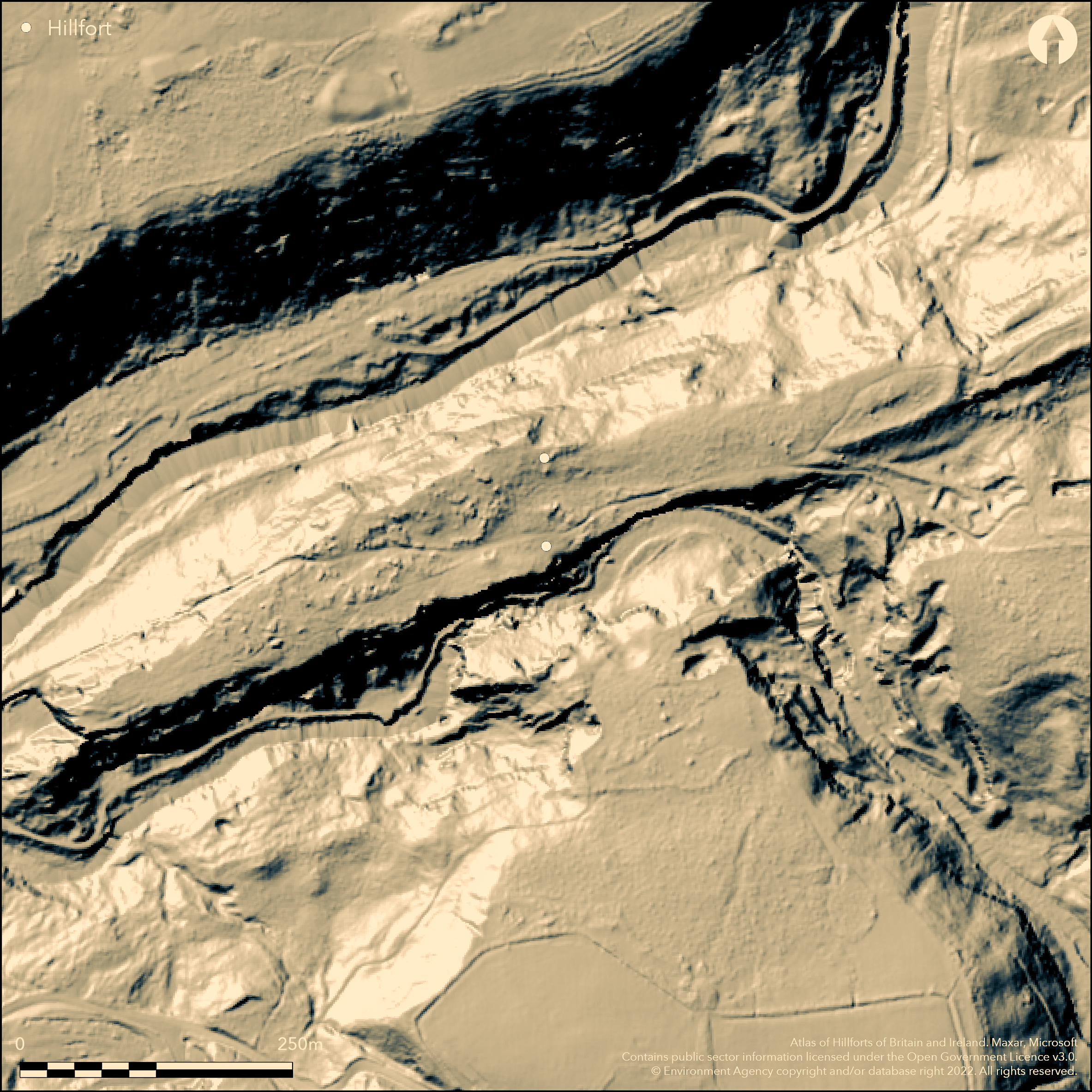
LiDAR 1m DTM Hillshade
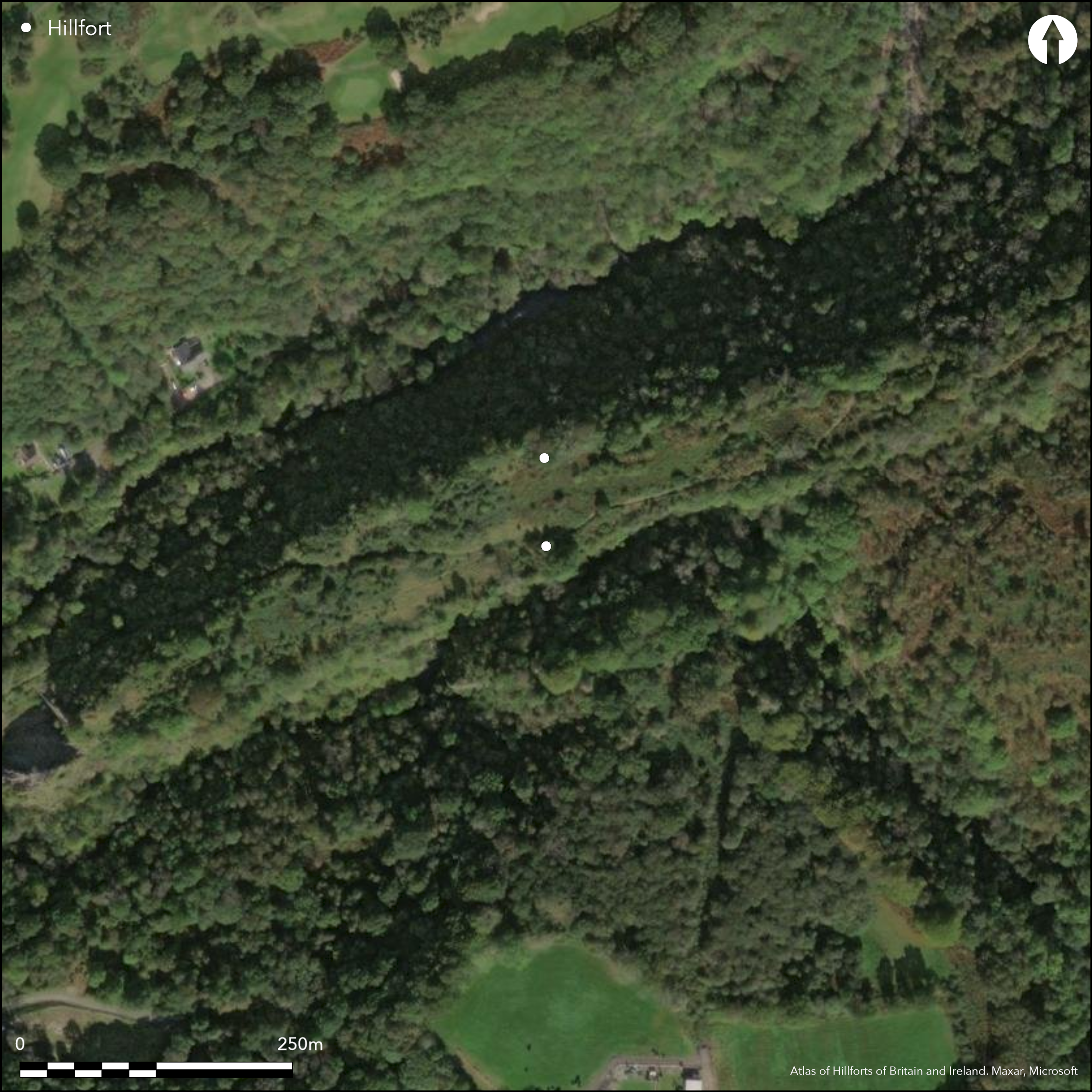
Satellite Imagery
LiDAR 1m DTM Hillshade
Satellite Imagery
Scroll left/right to view further images.
HER: Clwyd Powys 39154 (None)
NMR: SN 90 NW (301695)
SM: None
NGR: SN91500805
X: 291500 Y: 208050 (OSGB36)
Inland promontory fort protected by sheer cliffs and two defensive lines and located on a long sinuous limestone ridge directly above the steep gorge of the Afon Mellte to N and Sychryd to S, at the confluence of both rivers to form the River Neath flowing to SW at Ystradfellte. Site naturally protected by sheer cliffs. Badly affected by silica quarrying, and the original W end and parts of the N ridge have been lost. Two banks cut off the neck of the ridge on steep slopes and crags from the W. Inner bank of limestone rubble runs NNE-WSW, to 2.5m high, with dilapidated field-wall on top. Possible attempt at ditch and possible quarry ditch. Area protected would have been c. 542m long by 77m max. with area c. 2.52ha. Outer bank badly eroded, but rises from 0.5m high to c. 3m externally to E. Mining cut occupies possible site of ditch. Area defended by outer line c. 103m long and 16m long max. with area 0.15ha. Track from Penderyn passes through oblique gap near W end of inner bank and site of possible entrance, with additional narrow gaps between ends of ramparts and N slopes possible sites of gates. No interior remains apart from recent activity. Possible annexe of 0.6ha, but not proven. Scrub, rough grass and bare rock. Wooded surrounds. Minimal investigations, undated.
Citizen Science: ✗
Reliability of Data: Confirmed
Reliability of Interpretation: Confirmed
X: -397805 Y: 6756945 (EPSG: 3857)
Longitude: -3.57354360557348 Latitude: 51.760547940188715 (EPSG:4326)
Country: Wales
Current County or Unitary Authority: Powys
Historic County: Brecknockshire
Current Parish/Community/Council/Townland: Ystradfellte
Badly affected by silica quarrying, and the original W end and parts of the N ridge have been lost. Tramway destroyed rampart end at S end of ridge.
| Extant | ✓ |
| Cropmark | ✗ |
| Likely Destroyed | ✓ |
Scrub, rough grass and bare rock. Wooded surrounds. Quarrying and tramway.
| Woodland | ✗ |
| Commercial Forestry Plantation | ✗ |
| Parkland | ✗ |
| Pasture (Grazing) | ✓ |
| Arable | ✗ |
| Scrub/Bracken | ✓ |
| Bare Outcrop | ✗ |
| Heather/Moorland | ✗ |
| Heath | ✗ |
| Built-up | ✗ |
| Coastal Grassland | ✗ |
| Other | ✓ |
Inland promontory fort protected by sheer cliffs and two defensive lines and located on a long sinuous limestone ridge directly above the steep gorge of the Afon Mellte to N and Sychryd to S, at the confluence of both rivers to form the River Neath flowing to SW. Site naturally protected by sheer cliffs.
| Contour Fort | ✗ |
| Partial Contour Fort | ✗ |
| Promontory Fort | ✓ |
| Hillslope Fort | ✗ |
| Level Terrain Fort | ✗ |
| Marsh Fort | ✗ |
| Multiple Enclosure Fort | ✗ |
| Hilltop | ✗ |
| Coastal Promontory | ✗ |
| Inland Promontory | ✓ |
| Valley Bottom | ✗ |
| Knoll/Hillock/Outcrop | ✗ |
| Ridge | ✓ |
| Cliff/Plateau-edge/Scarp | ✗ |
| Hillslope | ✗ |
| Lowland | ✗ |
| Spur | ✗ |
Dominant Topographic Feature: Ridge
| North | ✗ |
| Northeast | ✗ |
| East | ✗ |
| Southeast | ✗ |
| South | ✗ |
| Southwest | ✓ |
| West | ✗ |
| Northwest | ✗ |
| Level | ✗ |
Altitude: 150.0m
N/A
None.
Reliability: D - None
| Pre 1200BC | ✗ |
| 1200BC - 800BC | ✗ |
| 800BC - 400BC | ✗ |
| 400BC - AD50 | ✗ |
| AD50 - AD400 | ✗ |
| AD400 - AD 800 | ✗ |
| Post AD800 | ✗ |
| Unknown | ✓ |
| Pre Hillfort: | None |
| Post Hillfort: | None |
RCAHMW investigation 1978.
| Other (1978): | RCAHMW investigation. |
None.
None
| None | ✓ |
| Spring | ✗ |
| Stream | ✗ |
| Pool | ✗ |
| Flush | ✗ |
| Well | ✗ |
| Other | ✗ |
Possible quarry ditch.
| No Known Features | ✗ |
| Round Stone Structures | ✗ |
| Rectangular Stone Structures | ✗ |
| Curvilinear Platforms | ✗ |
| Other Roundhouse Evidence | ✗ |
| Pits | ✗ |
| Quarry Hollows | ✓ |
| Other | ✗ |
None
| No Known Excavation | ✓ |
| Pits | ✗ |
| Postholes | ✗ |
| Roundhouses | ✗ |
| Rectangular Structures | ✗ |
| Roads/Tracks | ✗ |
| Quarry Hollows | ✗ |
| Other | ✗ |
| Nothing Found | ✗ |
None
| No Known Geophysics | ✓ |
| Pits | ✗ |
| Roundhouses | ✗ |
| Rectangular Structures | ✗ |
| Roads/Tracks | ✗ |
| Quarry Hollows | ✗ |
| Other | ✗ |
| Nothing Found | ✗ |
None
| No Known Finds | ✓ |
| Pottery | ✗ |
| Metal | ✗ |
| Metalworking | ✗ |
| Human Bones | ✗ |
| Animal Bones | ✗ |
| Lithics | ✗ |
| Environmental | ✗ |
| Other | ✗ |
None
| APs Not Checked | ✓ |
| None | ✗ |
| Roundhouses | ✗ |
| Rectangular Structures | ✗ |
| Pits | ✗ |
| Postholes | ✗ |
| Roads/Tracks | ✗ |
| Other | ✗ |
Track from Penderyn passes through oblique gap near W end of inner bank and site of possible entrance, with additional narrow gaps between ends of ramparts and N slopes possible sites of gates.
| 1: | None |
| 2: | Additional narrow gaps between ends of ramparts and N slopes possible sites of other gates, but no details. |
Guard Chambers: ✗
Chevaux de Frise: ✗
| 1. Oblique (South west): | Oblique breach in inner rampart. |
Two banks cut off the neck of the ridge on steep slopes and crags from the W. Inner bank of limestone rubble runs NNE-WSW, to 2.5m high, with dilapidated field-wall on top. Possible attempt at ditch and possible quarry ditch. Outer bank badly eroded, but rises from 0.5m high to c. 3m externally to E. Mining cut occupies possible site of ditch.
| Area 1: | 2.52ha. |
| Area 2: | 0.15ha. |
| Total: | 2.52ha. |
Total Footprint Area: Noneha.
None
| ✗ | Area protected would have been c. 542m long by 77m max. with area c. 2.52ha. Area defended by outer line c. 103m long and 16m long max. with area 0.15ha. |
| ✗ | None |
| NE Quadrant: | 2 |
| SE Quadrant: | 0 |
| SW Quadrant: | 2 |
| NW Quadrant: | 2 |
| Total: | 2 |
| Partial Univallate | ✗ |
| Univallate | ✗ |
| Partial Bivallate | ✓ |
| Bivallate | ✗ |
| Partial Multivallate | ✗ |
| Multivallate | ✗ |
| Unknown | ✗ |
| Partial Univallate | ✗ |
| Univallate | ✗ |
| Partial Bivallate | ✗ |
| Bivallate | ✗ |
| Partial Multivallate | ✗ |
| Multivallate | ✗ |
Limestone rubble banks.
| None | ✗ |
| Earthen Bank | ✗ |
| Stone Wall | ✗ |
| Rubble | ✓ |
| Wall-walk | ✗ |
| Evidence of Timber | ✗ |
| Vitrification | ✗ |
| Other Burning | ✗ |
| Palisade | ✗ |
| Counter Scarp Bank | ✗ |
| Berm | ✗ |
| Unfinished | ✗ |
| Other | ✗ |
None
| None | ✗ |
| Earthen Bank | ✗ |
| Stone Wall | ✗ |
| Murus Duplex | ✗ |
| Timber-framed | ✗ |
| Timber-laced | ✗ |
| Vitrification | ✗ |
| Other Burning | ✗ |
| Palisade | ✗ |
| Counter Scarp Bank | ✗ |
| Berm | ✗ |
| Unfinished | ✗ |
| No Known Excavation | ✓ |
| Other | ✗ |
| ✗ | None |
| ✓ | One or two ditches - estimated as damaged. Possible attempt at ditch to inner bank. Also mining cut occupies possible site of ditch. |
Number of Ditches: 2
| ✓ | Possible annexe of 0.6ha, but not proven. |
RCAHMW 1986. An inventory of the ancient monuments in Brecknock (Brycheiniog). The Prehistoric and Roman monuments, Vol 1, Part 2, Hill-forts and Roman remains, HF 4, London: HMSO.
Atlas of Hillforts:
Wikidata:
This work is licensed under CC BY-SA 4.0

 and should be cited as:
Lock, Gary and Ralston, Ian. 2024. Atlas of Hillforts of Britain and Ireland. Available at: https://hillforts.arch.ox.ac.uk
Document Version 1.1