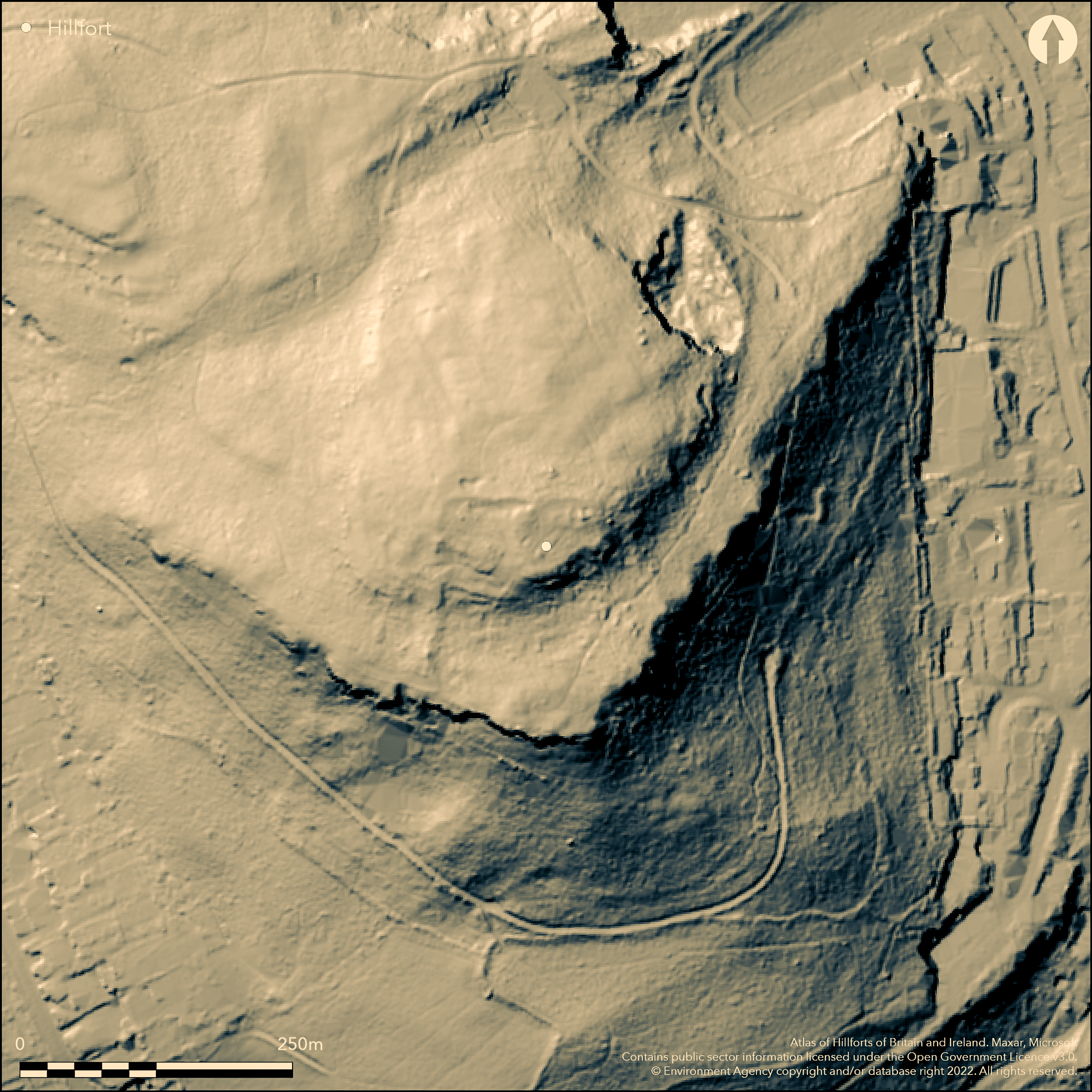
LiDAR 1m DTM Hillshade
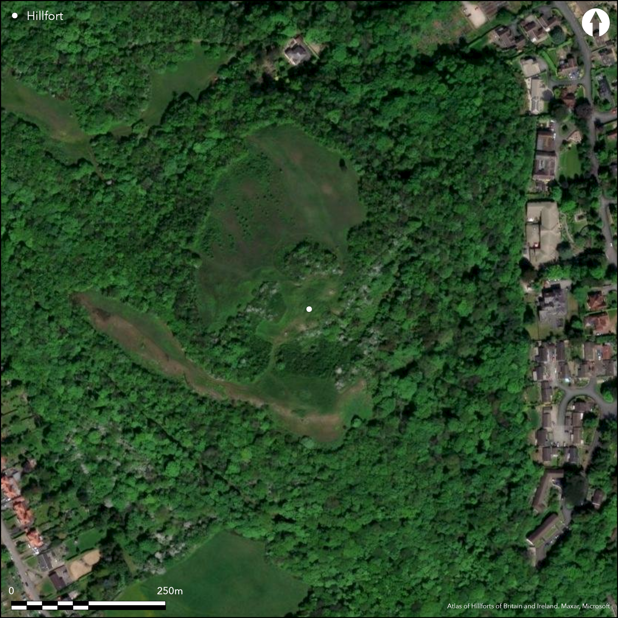
Satellite Imagery
LiDAR 1m DTM Hillshade
Satellite Imagery
Scroll left/right to view further images.
HER: Clwyd Powys 35897 (None)
NMR: SH 87 NW (93326)
SM: DE071
NGR: SH83207983
X: 283200 Y: 379830 (OSGB36)
Prominent, partial contour fort located in commanding position above the coastal plain and sea at Rhos-on-Sea at W end of Colwyn Bay. Steep slopes on N and W, very steep elsewhere. Whole fort occupies two summits with intervening hollow. Roughly circular in shape measures c. 120m square, with internal area c. 0.6ha. Defined by low stony bank to 1.2m in height on N and 1.3m on W, none elsewhere. Excavations by Gwynedd Archaeological Trust 1997 found evidence of the former wall to be massive and of quarried limestone, c. 3m high and fronted by 3.5m of rubble. Quarry hollows to interior on N and to exterior on NW apex. Possible entrance gap to N end of W bank. To NE of site traces of walling linking E end of N bank with steep rocky slopes on SE. Built inside NE corner traces of small pear-shaped enclosure measuring 40m NE-SW by 30m, with internal area c. 0.12ha. This is defined by low banks to 0.4m high, natural outcrop on SE and traces of walling at ground level on E. Inside this enclosure, adjacent to trig point, are possible building foundations to 0.6m high. There was no dating evidence from the excavations, but its pre-Norman layout led David Longley of GAT to connect it with the early-6th century king of Rhos, Cynlas the Red, on the basis of the "Bear Den" (Latin: receptaculi ursi) mentioned in Gildas's passage on him and the surviving local name of the area as Dinerth (Old Welsh: Din Eirth, "Fort Bear"). The site may then be Dark Age, but maybe with indeterminate earlier connotations. Pillow mounds (rabbit warrens) can also be seen. Much blackthorn and scrub. Degraded banks. On 1st Ed. OS map (1875).
Citizen Science: ✗
Reliability of Data: Confirmed
Reliability of Interpretation: Confirmed
X: -417918 Y: 7039148 (EPSG: 3857)
Longitude: -3.75422102204992 Latitude: 53.302491421196464 (EPSG:4326)
Country: Wales
Current County or Unitary Authority: Conwy
Historic County: Denbighshire
Current Parish/Community/Council/Townland: Rhos-on-Sea
Degraded banks.
| Extant | ✓ |
| Cropmark | ✗ |
| Likely Destroyed | ✗ |
Rough grass with much blackthorn and scrub. Surrounded by Rhos-on-Sea and A55 Expressway.
| Woodland | ✗ |
| Commercial Forestry Plantation | ✗ |
| Parkland | ✗ |
| Pasture (Grazing) | ✓ |
| Arable | ✗ |
| Scrub/Bracken | ✓ |
| Bare Outcrop | ✗ |
| Heather/Moorland | ✗ |
| Heath | ✗ |
| Built-up | ✗ |
| Coastal Grassland | ✗ |
| Other | ✗ |
Prominent partial contour fort located above the coastal plain and sea at W end of Colwyn Bay. Whole fort occupies two summits with intervening hollow. Steep slopes on N and W, very steep elsewhere.
| Contour Fort | ✗ |
| Partial Contour Fort | ✓ |
| Promontory Fort | ✗ |
| Hillslope Fort | ✗ |
| Level Terrain Fort | ✗ |
| Marsh Fort | ✗ |
| Multiple Enclosure Fort | ✗ |
| Hilltop | ✓ |
| Coastal Promontory | ✗ |
| Inland Promontory | ✗ |
| Valley Bottom | ✗ |
| Knoll/Hillock/Outcrop | ✗ |
| Ridge | ✗ |
| Cliff/Plateau-edge/Scarp | ✗ |
| Hillslope | ✗ |
| Lowland | ✗ |
| Spur | ✗ |
Dominant Topographic Feature: Rocky outcrop.
| North | ✗ |
| Northeast | ✗ |
| East | ✗ |
| Southeast | ✗ |
| South | ✗ |
| Southwest | ✗ |
| West | ✗ |
| Northwest | ✗ |
| Level | ✓ |
Altitude: 131.0m
N/A
There was no dating evidence from the excavations, but its pre-Norman layout led David Longley of GAT to connect it with the early-6th century king of Rhos, Cynlas the Red, on the basis of the "Bear Den" (Latin: receptaculi ursi) mentioned in Gildas's passage on him and the surviving local name of the area as Dinerth (Old Welsh: Din Eirth, "Fort Bear"). The site may then be Dark Age, but maybe with indeterminate earlier connotations.
Reliability: C - Low
| Pre 1200BC | ✗ |
| 1200BC - 800BC | ✗ |
| 800BC - 400BC | ✗ |
| 400BC - AD50 | ✗ |
| AD50 - AD400 | ✗ |
| AD400 - AD 800 | ✓ |
| Post AD800 | ✗ |
| Unknown | ✗ |
| Pre Hillfort: | None |
| Post Hillfort: | None |
| Morphology/Earthwork/Typology: | Pre-Norman layout. |
On 1st Ed. OS map (1875). Excavation by Gwynedd Archaeological Trust 1997.
| 1st Identified Map Depiction (1875): | OS map. |
| Other (1992): | Visited by Hillfort Study Group |
| Excavation (1997): | Gwynedd Archeological Trust. |
Quarry hollows to interior on N and to exterior on NW apex. Inside smaller enclosure, adjacent to trig point, are possible building foundations to 0.6m high. Pillow mounds (rabbit warrens) can also be seen.
Steam 0.6km outside fort.
| None | ✓ |
| Spring | ✗ |
| Stream | ✗ |
| Pool | ✗ |
| Flush | ✗ |
| Well | ✗ |
| Other | ✗ |
Quarry hollows to interior on N and to exterior on NW apex. Inside smaller enclosure, adjacent to trig point, are possible building foundations to 0.6m high. Pillow mounds (rabbit warrens) can also be seen.
| No Known Features | ✗ |
| Round Stone Structures | ✗ |
| Rectangular Stone Structures | ✗ |
| Curvilinear Platforms | ✗ |
| Other Roundhouse Evidence | ✗ |
| Pits | ✗ |
| Quarry Hollows | ✓ |
| Other | ✓ |
No details.
| No Known Excavation | ✗ |
| Pits | ✗ |
| Postholes | ✗ |
| Roundhouses | ✗ |
| Rectangular Structures | ✗ |
| Roads/Tracks | ✗ |
| Quarry Hollows | ✗ |
| Other | ✓ |
| Nothing Found | ✗ |
None
| No Known Geophysics | ✓ |
| Pits | ✗ |
| Roundhouses | ✗ |
| Rectangular Structures | ✗ |
| Roads/Tracks | ✗ |
| Quarry Hollows | ✗ |
| Other | ✗ |
| Nothing Found | ✗ |
None
| No Known Finds | ✓ |
| Pottery | ✗ |
| Metal | ✗ |
| Metalworking | ✗ |
| Human Bones | ✗ |
| Animal Bones | ✗ |
| Lithics | ✗ |
| Environmental | ✗ |
| Other | ✗ |
None
| APs Not Checked | ✓ |
| None | ✗ |
| Roundhouses | ✗ |
| Rectangular Structures | ✗ |
| Pits | ✗ |
| Postholes | ✗ |
| Roads/Tracks | ✗ |
| Other | ✗ |
Possible entrance gap to N end of W bank.
| 1: | None |
| 2: | None |
Guard Chambers: ✗
Chevaux de Frise: ✗
| 1. Simple Gap (West): | None |
Defined by low stony bank to 1.2m in height on N and 1.3m on W. Quarry hollows to interior on N and to exterior on NW apex. To NE of site traces of walling linking E end of N bank with steep rocky slopes on SE. Built inside NE corner traces of small pear-shaped enclosure measuring 40m NE-SW by 30m, with internal area c. 0.12ha. This is defined by low banks to 0.4m high, natural outcrop on SE and traces of walling at ground level on E.
| Area 1: | 0.6ha. |
| Total: | 0.6ha. |
Total Footprint Area: Noneha.
None
| ✗ | Approximate area. |
| ✗ | Defined by low stony bank to 1.2m in height on N and 1.3m on W. No defences elsewhere. |
| NE Quadrant: | 1 |
| SE Quadrant: | 0 |
| SW Quadrant: | 0 |
| NW Quadrant: | 1 |
| Total: | 1 |
| Partial Univallate | ✓ |
| Univallate | ✗ |
| Partial Bivallate | ✗ |
| Bivallate | ✗ |
| Partial Multivallate | ✗ |
| Multivallate | ✗ |
| Unknown | ✗ |
| Partial Univallate | ✗ |
| Univallate | ✗ |
| Partial Bivallate | ✗ |
| Bivallate | ✗ |
| Partial Multivallate | ✗ |
| Multivallate | ✗ |
Probable stone-walled site.
| None | ✗ |
| Earthen Bank | ✗ |
| Stone Wall | ✓ |
| Rubble | ✗ |
| Wall-walk | ✗ |
| Evidence of Timber | ✗ |
| Vitrification | ✗ |
| Other Burning | ✗ |
| Palisade | ✗ |
| Counter Scarp Bank | ✗ |
| Berm | ✗ |
| Unfinished | ✗ |
| Other | ✗ |
No details.
| None | ✗ |
| Earthen Bank | ✗ |
| Stone Wall | ✗ |
| Murus Duplex | ✗ |
| Timber-framed | ✗ |
| Timber-laced | ✗ |
| Vitrification | ✗ |
| Other Burning | ✗ |
| Palisade | ✗ |
| Counter Scarp Bank | ✗ |
| Berm | ✗ |
| Unfinished | ✗ |
| No Known Excavation | ✗ |
| Other | ✓ |
| ✗ | None |
| ✗ | None |
Number of Ditches: 0
| ✗ | None |
Burnham, H. 1995. A guide to ancient and historic Wales - Clwyd and Powys, London: HMSO, 53-4.
Davies, Canon Ellis 1929. The prehistoric and Roman remains of Denbighshire, Cardiff: William Lewis, 194.
Longley, D. 1997. Welsh fort identified as citadel of Dark Age king, British Archaeol, 29, Council for British Archaeology.
Reid, I. 2009. Rhos-on-Sea Heritage Trail, BBC.
Atlas of Hillforts:
Wikidata:
This work is licensed under CC BY-SA 4.0

 and should be cited as:
Lock, Gary and Ralston, Ian. 2024. Atlas of Hillforts of Britain and Ireland. Available at: https://hillforts.arch.ox.ac.uk
Document Version 1.1