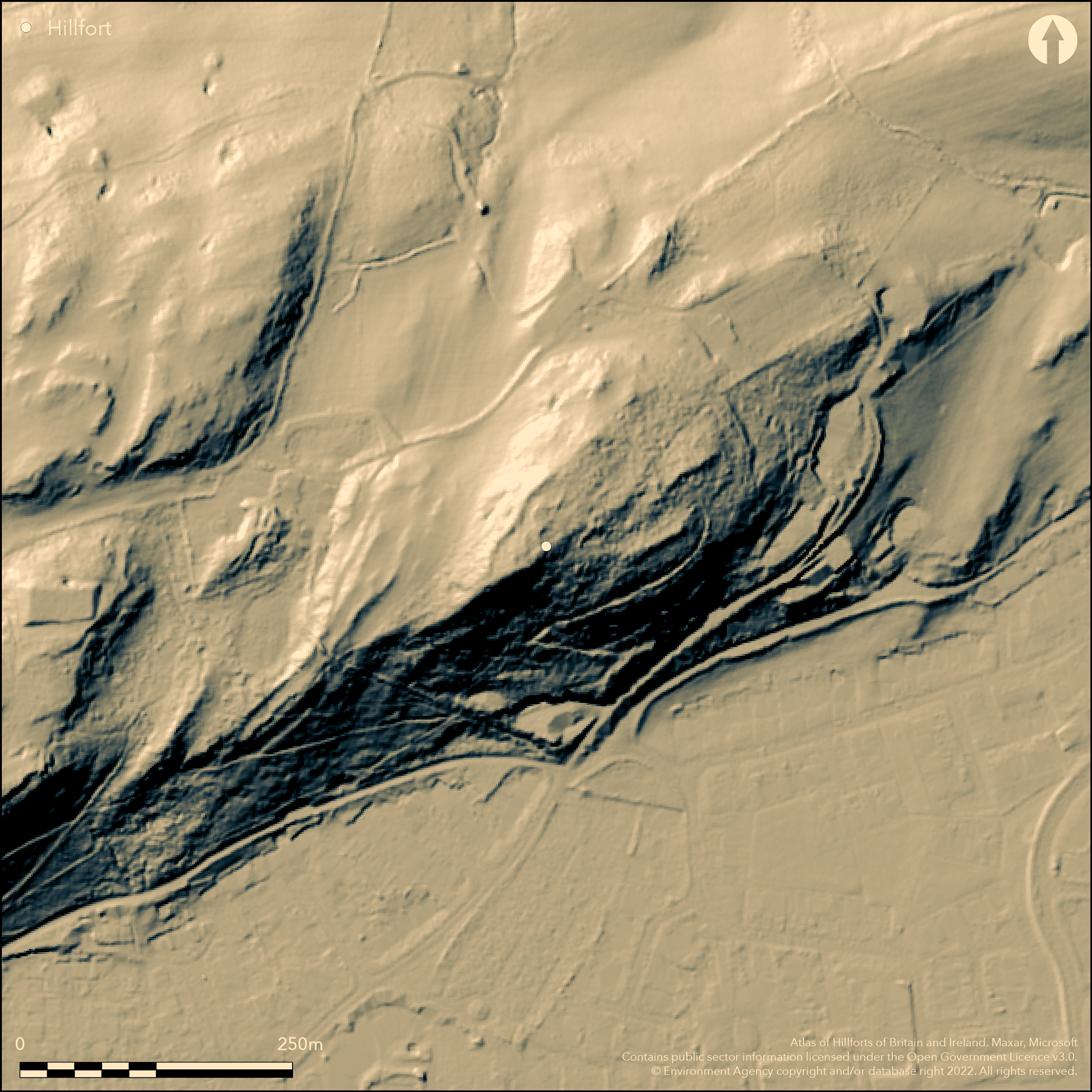
LiDAR 1m DTM Hillshade
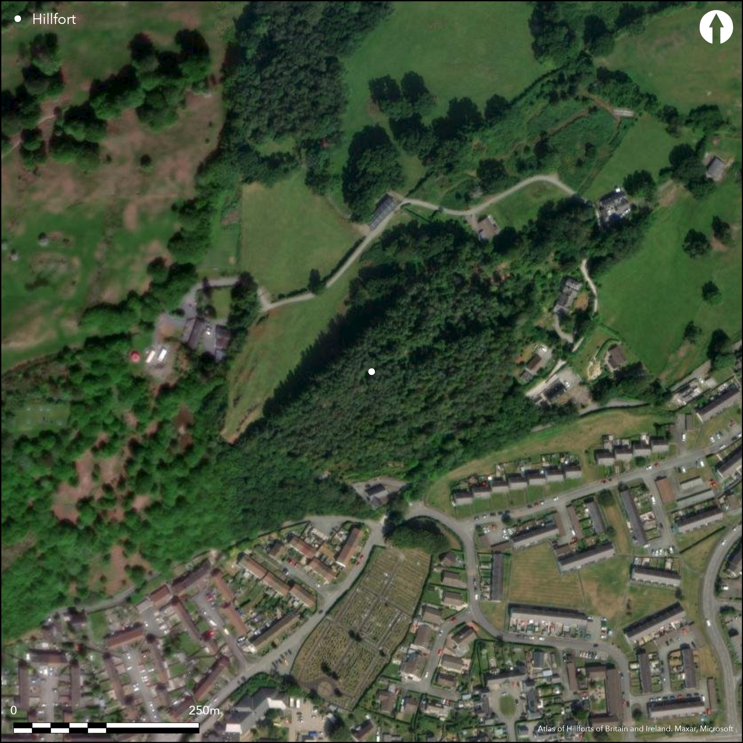
Satellite Imagery
LiDAR 1m DTM Hillshade
Satellite Imagery
Scroll left/right to view further images.
HER: Clwyd Powys 711 (None)
NMR: SH 70 SE (303102)
SM: None
NGR: SH75190124
X: 275190 Y: 301240 (OSGB36)
Isolated, small and univallate contour hillfort, strategically located on Gallt y Gog summit overlooking the Afon Dyfi at its confluence with the Afon Dulas at Machynlleth. Moderate to strong surrounding slopes. Internal area 0.4ha. Defined by partial embanked natural rock ridge becoming steep scarp bank 9m wide and 3m high externally, on SE, curving NW then NE parallel with modern fence. Gap of c. 18m at NE end. On NE scarp 2m high and 10m wide meeting end of rock ridge, probable stone-wall or rubble construction, no ditches. Interior uneven at SW end, with much rock on surface, levelling off to NE. No interior structures. WWII lookout post at SW end. Mature conifer plantation makes interpretation difficult with tree and animal damage. Minimal investigations, undated.
Citizen Science: ✗
Reliability of Data: Confirmed
Reliability of Interpretation: Confirmed
X: -427920 Y: 6908351 (EPSG: 3857)
Longitude: -3.8440691630064285 Latitude: 52.59455655726459 (EPSG:4326)
Country: Wales
Current County or Unitary Authority: Powys
Historic County: Montgomeryshire
Current Parish/Community/Council/Townland: Machynlleth
Tree and animal damage, but generally well-preserved.
| Extant | ✓ |
| Cropmark | ✗ |
| Likely Destroyed | ✗ |
Mature conifer plantation hampers interpretation. WWII lookout post at SW.
| Woodland | ✗ |
| Commercial Forestry Plantation | ✓ |
| Parkland | ✗ |
| Pasture (Grazing) | ✗ |
| Arable | ✗ |
| Scrub/Bracken | ✗ |
| Bare Outcrop | ✗ |
| Heather/Moorland | ✗ |
| Heath | ✗ |
| Built-up | ✗ |
| Coastal Grassland | ✗ |
| Other | ✓ |
Isolated, small and univallate contour hillfort strategically located on Gallt y Gog summit overlooking the Afon Dyfi at its confluence with the Afon Dulas at Machynlleth. Moderate to strong surrounding slopes.
| Contour Fort | ✓ |
| Partial Contour Fort | ✗ |
| Promontory Fort | ✗ |
| Hillslope Fort | ✗ |
| Level Terrain Fort | ✗ |
| Marsh Fort | ✗ |
| Multiple Enclosure Fort | ✗ |
| Hilltop | ✓ |
| Coastal Promontory | ✗ |
| Inland Promontory | ✗ |
| Valley Bottom | ✗ |
| Knoll/Hillock/Outcrop | ✗ |
| Ridge | ✗ |
| Cliff/Plateau-edge/Scarp | ✗ |
| Hillslope | ✗ |
| Lowland | ✗ |
| Spur | ✗ |
Dominant Topographic Feature: Hill top
| North | ✗ |
| Northeast | ✗ |
| East | ✗ |
| Southeast | ✗ |
| South | ✗ |
| Southwest | ✗ |
| West | ✗ |
| Northwest | ✗ |
| Level | ✓ |
Altitude: 85.0m
N/A
None.
Reliability: D - None
| Pre 1200BC | ✗ |
| 1200BC - 800BC | ✗ |
| 800BC - 400BC | ✗ |
| 400BC - AD50 | ✗ |
| AD50 - AD400 | ✗ |
| AD400 - AD 800 | ✗ |
| Post AD800 | ✗ |
| Unknown | ✓ |
| Pre Hillfort: | None |
| Post Hillfort: | None |
CPAT Montgomeryshire Small enclosures project 1990-97. CPAT defended enclosures in Montgomeryshire survey 2007-2008.
| Other (None): | CPAT Montgomeryshire Small enclosures project. |
| Other (None): | CPAT defended enclosures project. |
No interior features visible.
Afon Dyfi 0.5km outside fort.
| None | ✓ |
| Spring | ✗ |
| Stream | ✗ |
| Pool | ✗ |
| Flush | ✗ |
| Well | ✗ |
| Other | ✗ |
None
| No Known Features | ✓ |
| Round Stone Structures | ✗ |
| Rectangular Stone Structures | ✗ |
| Curvilinear Platforms | ✗ |
| Other Roundhouse Evidence | ✗ |
| Pits | ✗ |
| Quarry Hollows | ✗ |
| Other | ✗ |
None
| No Known Excavation | ✓ |
| Pits | ✗ |
| Postholes | ✗ |
| Roundhouses | ✗ |
| Rectangular Structures | ✗ |
| Roads/Tracks | ✗ |
| Quarry Hollows | ✗ |
| Other | ✗ |
| Nothing Found | ✗ |
None
| No Known Geophysics | ✓ |
| Pits | ✗ |
| Roundhouses | ✗ |
| Rectangular Structures | ✗ |
| Roads/Tracks | ✗ |
| Quarry Hollows | ✗ |
| Other | ✗ |
| Nothing Found | ✗ |
None
| No Known Finds | ✓ |
| Pottery | ✗ |
| Metal | ✗ |
| Metalworking | ✗ |
| Human Bones | ✗ |
| Animal Bones | ✗ |
| Lithics | ✗ |
| Environmental | ✗ |
| Other | ✗ |
None
| APs Not Checked | ✓ |
| None | ✗ |
| Roundhouses | ✗ |
| Rectangular Structures | ✗ |
| Pits | ✗ |
| Postholes | ✗ |
| Roads/Tracks | ✗ |
| Other | ✗ |
None defined.
| 0: | None |
| 2: | None |
Guard Chambers: ✗
Chevaux de Frise: ✗
Defined by partial embanked natural rock ridge becoming steep scarp bank 9m wide and 3m high externally, on SE, curving NW then NE parallel with modern fence. Gap of c. 18m at NE end. On NE scarp 2m high and 10m wide meeting end of rock ridge, probable stone-wall or rubble construction, no ditches.
| Area 1: | 0.4ha. |
| Total: | 0.4ha. |
Total Footprint Area: Noneha.
None
| ✗ | None |
| ✗ | Gap of c. 18m at NE end. |
| NE Quadrant: | 1 |
| SE Quadrant: | 1 |
| SW Quadrant: | 1 |
| NW Quadrant: | 1 |
| Total: | 1 |
| Partial Univallate | ✗ |
| Univallate | ✓ |
| Partial Bivallate | ✗ |
| Bivallate | ✗ |
| Partial Multivallate | ✗ |
| Multivallate | ✗ |
| Unknown | ✗ |
| Partial Univallate | ✗ |
| Univallate | ✗ |
| Partial Bivallate | ✗ |
| Bivallate | ✗ |
| Partial Multivallate | ✗ |
| Multivallate | ✗ |
Probable stone-wall or rubble construction.
| None | ✗ |
| Earthen Bank | ✗ |
| Stone Wall | ✓ |
| Rubble | ✓ |
| Wall-walk | ✗ |
| Evidence of Timber | ✗ |
| Vitrification | ✗ |
| Other Burning | ✗ |
| Palisade | ✗ |
| Counter Scarp Bank | ✗ |
| Berm | ✗ |
| Unfinished | ✗ |
| Other | ✗ |
None
| None | ✗ |
| Earthen Bank | ✗ |
| Stone Wall | ✗ |
| Murus Duplex | ✗ |
| Timber-framed | ✗ |
| Timber-laced | ✗ |
| Vitrification | ✗ |
| Other Burning | ✗ |
| Palisade | ✗ |
| Counter Scarp Bank | ✗ |
| Berm | ✗ |
| Unfinished | ✗ |
| No Known Excavation | ✓ |
| Other | ✗ |
| ✗ | None |
| ✗ | None defined. |
Number of Ditches: 0
| ✗ | None |
Hankinson, R. 2008. Defended enclosures in Montgomeryshire. A further study. Project Report. CPAT Report No 918, Welshpool: Clwyd-Powys Archaeological Trust.
Royal Commission on the Ancient and Historical Monuments and Constructions in Wales and Monmouthshire, 1911. An Inventory of the Ancient Monuments in Wales and Monmouthshire, I, County of Montgomery, No. 745, London: HMSO.
Silvester, R.J. and Britnell, W.J. 1993. Montgomeryshire small enclosures project. Summary Report 1993, CPAT Report No 80, Welshpool, Clwyd-Powys Archaeological Trust.
Atlas of Hillforts:
Wikidata:
This work is licensed under CC BY-SA 4.0

 and should be cited as:
Lock, Gary and Ralston, Ian. 2024. Atlas of Hillforts of Britain and Ireland. Available at: https://hillforts.arch.ox.ac.uk
Document Version 1.1