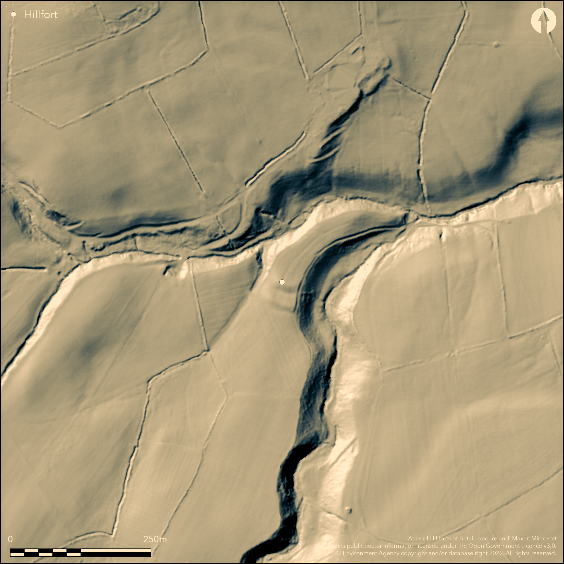
LiDAR 1m DTM Hillshade
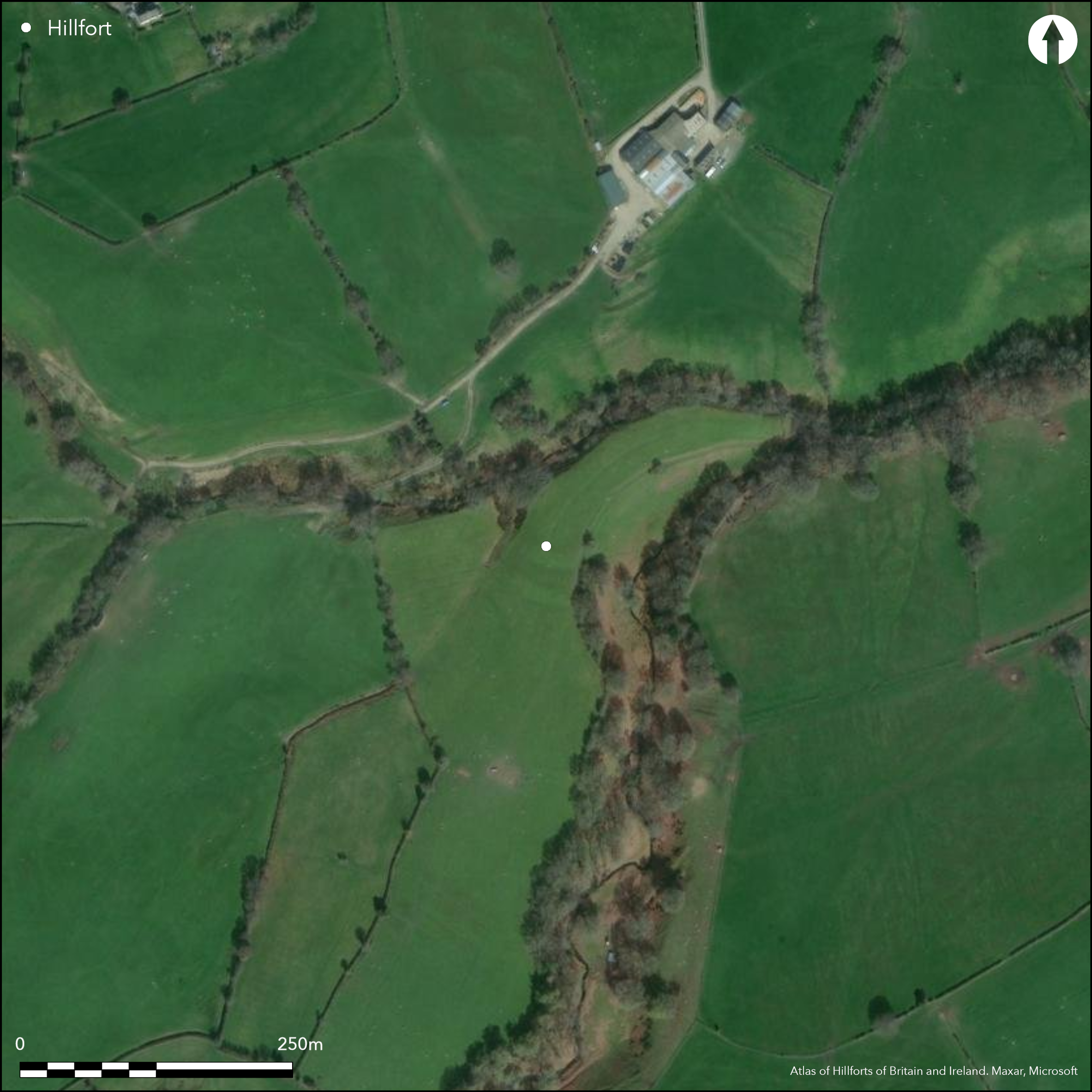
Satellite Imagery
LiDAR 1m DTM Hillshade
Satellite Imagery
Scroll left/right to view further images.
HER: Clwyd Powys 769 (None)
NMR: SO 09 NE (305907)
SM: None
NGR: SO05819985
X: 305810 Y: 299850 (OSGB36)
Multivallate, inland promontory fort located on a NE-facing spur above stream confluences flowing into River Rhiw to NE at Dwyriw. Surrounding slopes moderate. Occupies secluded position with limited surrounding views. No area defined. Twin parallel ramparts with outer ditches cut off the spur on SW side, extending 40m from edge of steep slopes at E end to within 15m of a rivulet (fomerly marshy ground?) at W end. Ramparts are 10m to 12.0m wide, 0.9m high and ditches, 8m wide and 0.2m to 0.3m deep. Estimated enclosed area 0.37ha. No other ramparts and as slopes not very steep, fort probably relied on areas of marsh around the streams. Additional information from field notes of Toby Driver, RCAHMW, 2007 as follows: Twin ramparts well-preserved; both flanked by outer ditches on S sides. Both ramparts are also higher and steeper on their forward-facing, S, sides. Modern track along E terminals of ramparts gives access for vehicles down to the river confluence and truncates the original ends of the ramparts. No features visible in interior and, save for a diagonal set of land drains crossing the field to S. Pasture within and outside site largely featureless. Potsherd collected from a molehill in between the two ramparts on E side of the interspace with coarse black surface, a pale white fabric with large red inclusions. Under pasture and well-preserved though banks spread. Minimal investigations, undated.
Citizen Science: ✗
Reliability of Data: Confirmed
Reliability of Interpretation: Confirmed
X: -377572 Y: 6907194 (EPSG: 3857)
Longitude: -3.391785339740474 Latitude: 52.58823908191333 (EPSG:4326)
Country: Wales
Current County or Unitary Authority: Powys
Historic County: Montgomeryshire
Current Parish/Community/Council/Townland: Dwyriw
Banks ploughed and spread.
| Extant | ✓ |
| Cropmark | ✗ |
| Likely Destroyed | ✗ |
Improved pasture.
| Woodland | ✗ |
| Commercial Forestry Plantation | ✗ |
| Parkland | ✗ |
| Pasture (Grazing) | ✓ |
| Arable | ✗ |
| Scrub/Bracken | ✗ |
| Bare Outcrop | ✗ |
| Heather/Moorland | ✗ |
| Heath | ✗ |
| Built-up | ✗ |
| Coastal Grassland | ✗ |
| Other | ✗ |
Multivallate inland promontory fort located on a NE-facing spur above stream confluences flowing into River Rhiw to NE. Surrounding slopes moderate.
| Contour Fort | ✗ |
| Partial Contour Fort | ✗ |
| Promontory Fort | ✓ |
| Hillslope Fort | ✗ |
| Level Terrain Fort | ✗ |
| Marsh Fort | ✗ |
| Multiple Enclosure Fort | ✗ |
| Hilltop | ✗ |
| Coastal Promontory | ✗ |
| Inland Promontory | ✓ |
| Valley Bottom | ✗ |
| Knoll/Hillock/Outcrop | ✗ |
| Ridge | ✗ |
| Cliff/Plateau-edge/Scarp | ✗ |
| Hillslope | ✗ |
| Lowland | ✗ |
| Spur | ✗ |
Dominant Topographic Feature: Spur
| North | ✗ |
| Northeast | ✓ |
| East | ✗ |
| Southeast | ✗ |
| South | ✗ |
| Southwest | ✗ |
| West | ✗ |
| Northwest | ✗ |
| Level | ✗ |
Altitude: 250.0m
N/A
None.
Reliability: D - None
| Pre 1200BC | ✗ |
| 1200BC - 800BC | ✗ |
| 800BC - 400BC | ✗ |
| 400BC - AD50 | ✗ |
| AD50 - AD400 | ✗ |
| AD400 - AD 800 | ✗ |
| Post AD800 | ✗ |
| Unknown | ✓ |
| Pre Hillfort: | None |
| Post Hillfort: | None |
CPAT Montgomeryshire Small enclosures project 1990-97. RCAHMW investigation 2007.
| Other (2007): | RCAHMW investigation. |
| Other (None): | CPAT Montgomeryshire Small enclosures project. |
Potsherd collected from a molehill in between the two ramparts on E side of the interspace, with coarse black surface, a pale white fabric with large red inclusions.
Marshy ground nearby.
| None | ✓ |
| Spring | ✗ |
| Stream | ✗ |
| Pool | ✗ |
| Flush | ✗ |
| Well | ✗ |
| Other | ✗ |
None
| No Known Features | ✓ |
| Round Stone Structures | ✗ |
| Rectangular Stone Structures | ✗ |
| Curvilinear Platforms | ✗ |
| Other Roundhouse Evidence | ✗ |
| Pits | ✗ |
| Quarry Hollows | ✗ |
| Other | ✗ |
None
| No Known Excavation | ✓ |
| Pits | ✗ |
| Postholes | ✗ |
| Roundhouses | ✗ |
| Rectangular Structures | ✗ |
| Roads/Tracks | ✗ |
| Quarry Hollows | ✗ |
| Other | ✗ |
| Nothing Found | ✗ |
None
| No Known Geophysics | ✓ |
| Pits | ✗ |
| Roundhouses | ✗ |
| Rectangular Structures | ✗ |
| Roads/Tracks | ✗ |
| Quarry Hollows | ✗ |
| Other | ✗ |
| Nothing Found | ✗ |
Potsherd collected from a molehill in between the two ramparts on E side of the interspace, with coarse black surface, a pale white fabric with large red inclusions.
| No Known Finds | ✗ |
| Pottery | ✓ |
| Metal | ✗ |
| Metalworking | ✗ |
| Human Bones | ✗ |
| Animal Bones | ✗ |
| Lithics | ✗ |
| Environmental | ✗ |
| Other | ✗ |
None
| APs Not Checked | ✓ |
| None | ✗ |
| Roundhouses | ✗ |
| Rectangular Structures | ✗ |
| Pits | ✗ |
| Postholes | ✗ |
| Roads/Tracks | ✗ |
| Other | ✗ |
Original entrance probably at one end or other of the ramparts on the SW side - not defined.
| 2: | None |
| 2: | Original entrance probably at one end or other of the ramparts on the SW side - not defined. |
Guard Chambers: ✗
Chevaux de Frise: ✗
| 1. Simple Gap (South west): | Type estimated. |
Twin parallel ramparts with outer ditches cut off the spur on SW side, extending 40m from edge of steep slopes at E end to within 15m of a rivulet (fomerly marshy ground?) at W end. Ramparts are 10mto 12.0m wide, 0.9m high and ditches, 8m wide and 0.2m to 0.3m deep. No other defences and as slopes not very steep, fort probably relied on areas of marsh around the streams.
| Area 1: | 0.37ha. |
| Total: | 0.37ha. |
Total Footprint Area: Noneha.
None
| ✗ | Area estimated |
| ✗ | None |
| NE Quadrant: | 0 |
| SE Quadrant: | 0 |
| SW Quadrant: | 2 |
| NW Quadrant: | 0 |
| Total: | 2 |
| Partial Univallate | ✗ |
| Univallate | ✗ |
| Partial Bivallate | ✓ |
| Bivallate | ✗ |
| Partial Multivallate | ✗ |
| Multivallate | ✗ |
| Unknown | ✗ |
| Partial Univallate | ✗ |
| Univallate | ✗ |
| Partial Bivallate | ✗ |
| Bivallate | ✗ |
| Partial Multivallate | ✗ |
| Multivallate | ✗ |
None
| None | ✗ |
| Earthen Bank | ✓ |
| Stone Wall | ✗ |
| Rubble | ✗ |
| Wall-walk | ✗ |
| Evidence of Timber | ✗ |
| Vitrification | ✗ |
| Other Burning | ✗ |
| Palisade | ✗ |
| Counter Scarp Bank | ✗ |
| Berm | ✗ |
| Unfinished | ✗ |
| Other | ✗ |
None
| None | ✗ |
| Earthen Bank | ✗ |
| Stone Wall | ✗ |
| Murus Duplex | ✗ |
| Timber-framed | ✗ |
| Timber-laced | ✗ |
| Vitrification | ✗ |
| Other Burning | ✗ |
| Palisade | ✗ |
| Counter Scarp Bank | ✗ |
| Berm | ✗ |
| Unfinished | ✗ |
| No Known Excavation | ✓ |
| Other | ✗ |
| ✗ | None |
| ✓ | None |
Number of Ditches: 2
| ✗ | None |
Silvester, R.J. and Britnell, W.J. 1993. Montgomeryshire small enclosures project. Summary Report 1993, CPAT Report No 80, Welshpool, Clwyd-Powys Archaeological Trust.
Atlas of Hillforts:
Wikidata:
This work is licensed under CC BY-SA 4.0

 and should be cited as:
Lock, Gary and Ralston, Ian. 2024. Atlas of Hillforts of Britain and Ireland. Available at: https://hillforts.arch.ox.ac.uk
Document Version 1.1