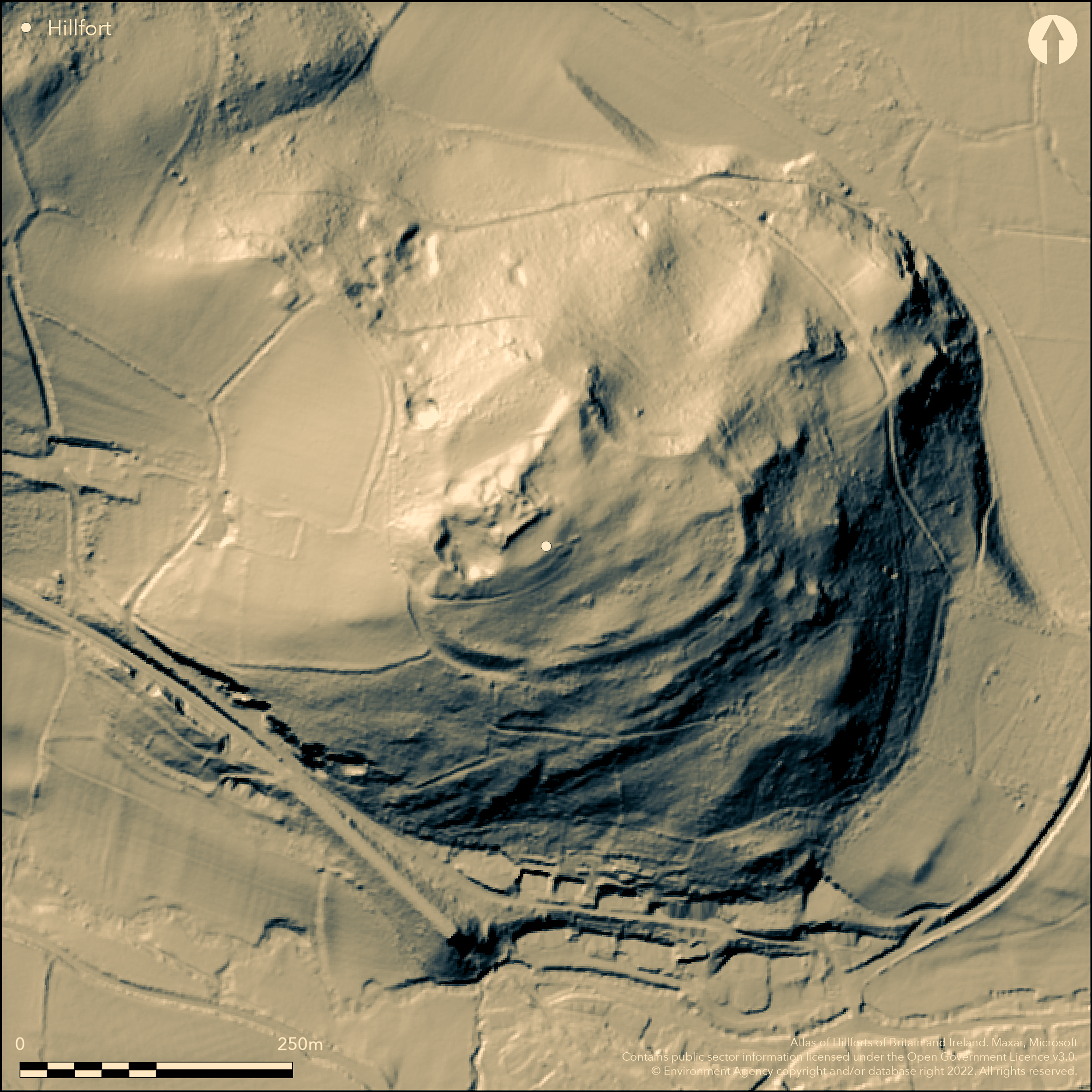
LiDAR 1m DTM Hillshade
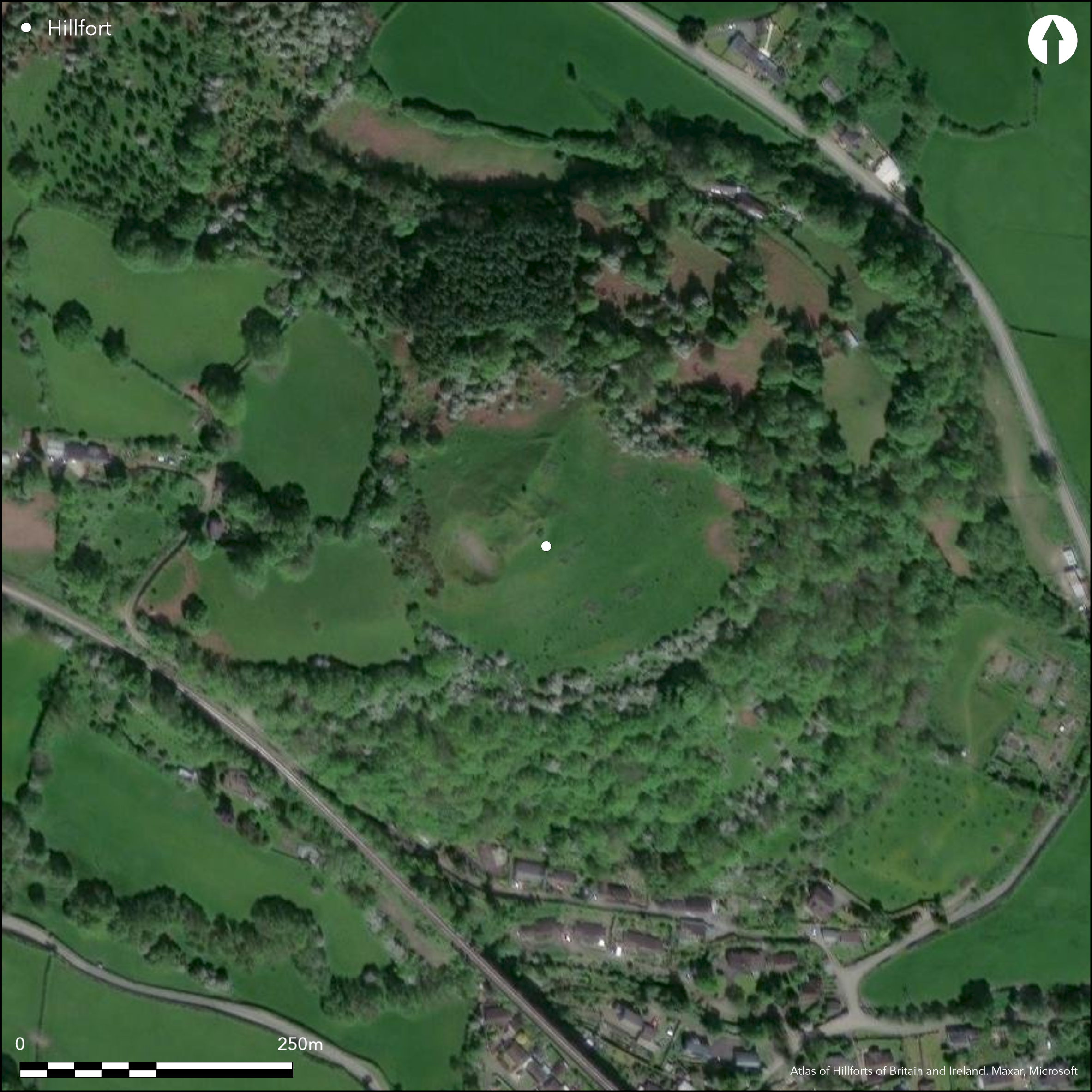
Satellite Imagery
LiDAR 1m DTM Hillshade
Satellite Imagery
Scroll left/right to view further images.
HER: Clwyd Powys 50002 (None)
NMR: SO 27 SW (306398)
SM: RD085(POW)
NGR: SO 24983 74531
X: 324983 Y: 274531 (OSGB36)
Possible contour hillfort, with medieval castle in interior, located on a prominent spur summit of Castle Hill at junction of two streams (Ffrwdwen Brook and King's Brook) flowing directly into the River Teme immediately to E at Beguildy. Very steep surrounding slopes, less on ridge to NW. Measures c. 183m by 124m, with internal area 2.24ha. Castle area sub-rectangular in plan, c. 23m by 40m, but truncated by quarrying to SW. Unclear whether medieval castle site has origins as prehistoric enclosure. Little, if any, substantive evidence and extensive quarrying and disturbance makes interpretation very difficult. Badly damaged and much quarried motte to the castle occupies W part of large, irregular enclosure. The bailey extends downwards from NW-SE and defences on S and E sides defined by a scarp. Along some sections terrace at base of slope. Possible ditch on short length of E, but not proven. At N apex defences swing back as bank to the motte, undoubtedly medieval in origin. Also at apex land drops to another shelf and natural scarp continues, but whether this has been modified, or forms part of a larger enclosure, also unclear, as is another bank at SW end of shelf which continues up the side of the motte. E of motte, platform or embanked area, possibly for building, with revetment wall, possibly continuing SW of the motte. Whether this pre-dates the motte is unclear. Entrance to bailey immediately to S of motte on W, giving easiest access to the castle. Its origin unclear, but possible enclosure entrance. The castle mentioned in 1248 and 1262. On 1st Ed. OS map (1889).
Citizen Science: ✗
Reliability of Data: Unconfirmed
Reliability of Interpretation: Unconfirmed
X: -345439 Y: 6866147 (EPSG: 3857)
Longitude: -3.103130287772315 Latitude: 52.363647391988856 (EPSG:4326)
Country: Wales
Current County or Unitary Authority: Powys
Historic County: Radnorshire
Current Parish/Community/Council/Townland: Beguildy
Very badly damaged and quarried. In care of Knucklas Castle Community Land Project. Medieval castle in interior.
| Extant | ✓ |
| Cropmark | ✗ |
| Likely Destroyed | ✓ |
Grassy interior with dotted trees. Wooded surrounding slopes. Medieval castle.
| Woodland | ✓ |
| Commercial Forestry Plantation | ✗ |
| Parkland | ✗ |
| Pasture (Grazing) | ✓ |
| Arable | ✗ |
| Scrub/Bracken | ✗ |
| Bare Outcrop | ✗ |
| Heather/Moorland | ✗ |
| Heath | ✗ |
| Built-up | ✓ |
| Coastal Grassland | ✗ |
| Other | ✓ |
Possible contour hillfort, with medieval castle in interior, located on a prominent spur summit of Castle Hill at junction of two streams (Ffrwdwen Brook and King's Brook) flowing directly into the River Teme immediately to E. Very steep surrounding slopes, less on ridge to NW.
| Contour Fort | ✓ |
| Partial Contour Fort | ✗ |
| Promontory Fort | ✗ |
| Hillslope Fort | ✗ |
| Level Terrain Fort | ✗ |
| Marsh Fort | ✗ |
| Multiple Enclosure Fort | ✗ |
| Hilltop | ✗ |
| Coastal Promontory | ✗ |
| Inland Promontory | ✗ |
| Valley Bottom | ✗ |
| Knoll/Hillock/Outcrop | ✗ |
| Ridge | ✗ |
| Cliff/Plateau-edge/Scarp | ✗ |
| Hillslope | ✗ |
| Lowland | ✗ |
| Spur | ✓ |
Dominant Topographic Feature: Spur summit
| North | ✗ |
| Northeast | ✗ |
| East | ✗ |
| Southeast | ✗ |
| South | ✗ |
| Southwest | ✗ |
| West | ✗ |
| Northwest | ✗ |
| Level | ✓ |
Altitude: 274.0m
N/A
None.
Reliability: D - None
| Pre 1200BC | ✗ |
| 1200BC - 800BC | ✗ |
| 800BC - 400BC | ✗ |
| 400BC - AD50 | ✗ |
| AD50 - AD400 | ✗ |
| AD400 - AD 800 | ✗ |
| Post AD800 | ✗ |
| Unknown | ✓ |
| Pre Hillfort: | None |
| Post Hillfort: | Medieval castle mentioned in 1248 and 1262. |
On 1st Ed. OS map (1889). CPAT defended enclosures survey 2006.
| 1st Identified Map Depiction (1889): | OS map. |
| Other (2006): | CPAT defended enclosures survey. |
None.
None
| None | ✓ |
| Spring | ✗ |
| Stream | ✗ |
| Pool | ✗ |
| Flush | ✗ |
| Well | ✗ |
| Other | ✗ |
None
| No Known Features | ✓ |
| Round Stone Structures | ✗ |
| Rectangular Stone Structures | ✗ |
| Curvilinear Platforms | ✗ |
| Other Roundhouse Evidence | ✗ |
| Pits | ✗ |
| Quarry Hollows | ✗ |
| Other | ✗ |
None
| No Known Excavation | ✓ |
| Pits | ✗ |
| Postholes | ✗ |
| Roundhouses | ✗ |
| Rectangular Structures | ✗ |
| Roads/Tracks | ✗ |
| Quarry Hollows | ✗ |
| Other | ✗ |
| Nothing Found | ✗ |
None
| No Known Geophysics | ✓ |
| Pits | ✗ |
| Roundhouses | ✗ |
| Rectangular Structures | ✗ |
| Roads/Tracks | ✗ |
| Quarry Hollows | ✗ |
| Other | ✗ |
| Nothing Found | ✗ |
None
| No Known Finds | ✓ |
| Pottery | ✗ |
| Metal | ✗ |
| Metalworking | ✗ |
| Human Bones | ✗ |
| Animal Bones | ✗ |
| Lithics | ✗ |
| Environmental | ✗ |
| Other | ✗ |
None
| APs Not Checked | ✓ |
| None | ✗ |
| Roundhouses | ✗ |
| Rectangular Structures | ✗ |
| Pits | ✗ |
| Postholes | ✗ |
| Roads/Tracks | ✗ |
| Other | ✗ |
Entrance to bailey immediately to S of motte on W, giving easiest access to the castle. Its origin unclear, but possible entrance to enclosure.
| 1: | None |
| 2: | None |
Guard Chambers: ✗
Chevaux de Frise: ✗
| 1. Simple Gap (West): | Possible entrance only and not proven. |
Badly damaged and much quarried motte to the castle occupies W part of large, irregular enclosure. The bailey extends downwards from NW-SE and defences on S and E sides defined by a scarp. Along some sections terrace at base of slope. Possible ditch on short length of E, but not proven. At N apex defences swing back as bank to the motte, undoubtedly medieval in origin. Also at apex land drops to another shelf and natural scarp continues, but whether this has been modified, of forms part of a larger enclosure also unclear, as is another bank at SW end of shelf which continues up the side of the motte.
| Area 1: | 2.24ha. |
| Total: | 2.24ha. |
Total Footprint Area: Noneha.
None
| ✗ | None |
| ✗ | Quadrants cannot be determind with any accuracy. |
| NE Quadrant: | None |
| SE Quadrant: | None |
| SW Quadrant: | None |
| NW Quadrant: | None |
| Total: | None |
| Partial Univallate | ✗ |
| Univallate | ✗ |
| Partial Bivallate | ✗ |
| Bivallate | ✗ |
| Partial Multivallate | ✗ |
| Multivallate | ✗ |
| Unknown | ✓ |
| Partial Univallate | ✗ |
| Univallate | ✗ |
| Partial Bivallate | ✗ |
| Bivallate | ✗ |
| Partial Multivallate | ✗ |
| Multivallate | ✗ |
Possible evidence of revetment.
| None | ✗ |
| Earthen Bank | ✗ |
| Stone Wall | ✓ |
| Rubble | ✗ |
| Wall-walk | ✗ |
| Evidence of Timber | ✗ |
| Vitrification | ✗ |
| Other Burning | ✗ |
| Palisade | ✗ |
| Counter Scarp Bank | ✗ |
| Berm | ✗ |
| Unfinished | ✗ |
| Other | ✗ |
None
| None | ✗ |
| Earthen Bank | ✗ |
| Stone Wall | ✗ |
| Murus Duplex | ✗ |
| Timber-framed | ✗ |
| Timber-laced | ✗ |
| Vitrification | ✗ |
| Other Burning | ✗ |
| Palisade | ✗ |
| Counter Scarp Bank | ✗ |
| Berm | ✗ |
| Unfinished | ✗ |
| No Known Excavation | ✓ |
| Other | ✗ |
| ✗ | None |
| ✓ | Possible hint of a ditch on E. |
Number of Ditches: 1
| ✗ | None |
Silvester, R.J. and Hankinson, R. 2006. Defended enclosures in Radnorshire. Project report, CPAT Report 781, Welshpool: CPAT.
Atlas of Hillforts:
Wikidata:
This work is licensed under CC BY-SA 4.0

 and should be cited as:
Lock, Gary and Ralston, Ian. 2024. Atlas of Hillforts of Britain and Ireland. Available at: https://hillforts.arch.ox.ac.uk
Document Version 1.1