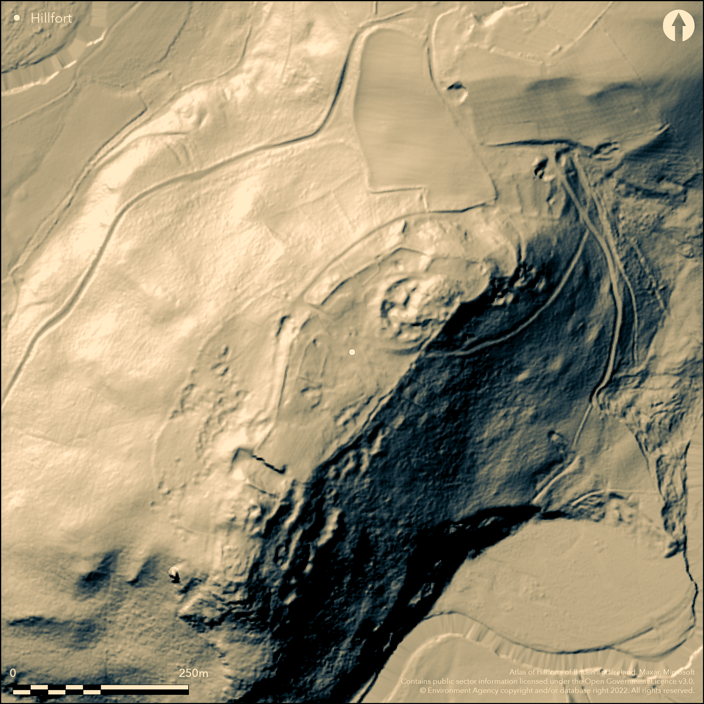
LiDAR 1m DTM Hillshade
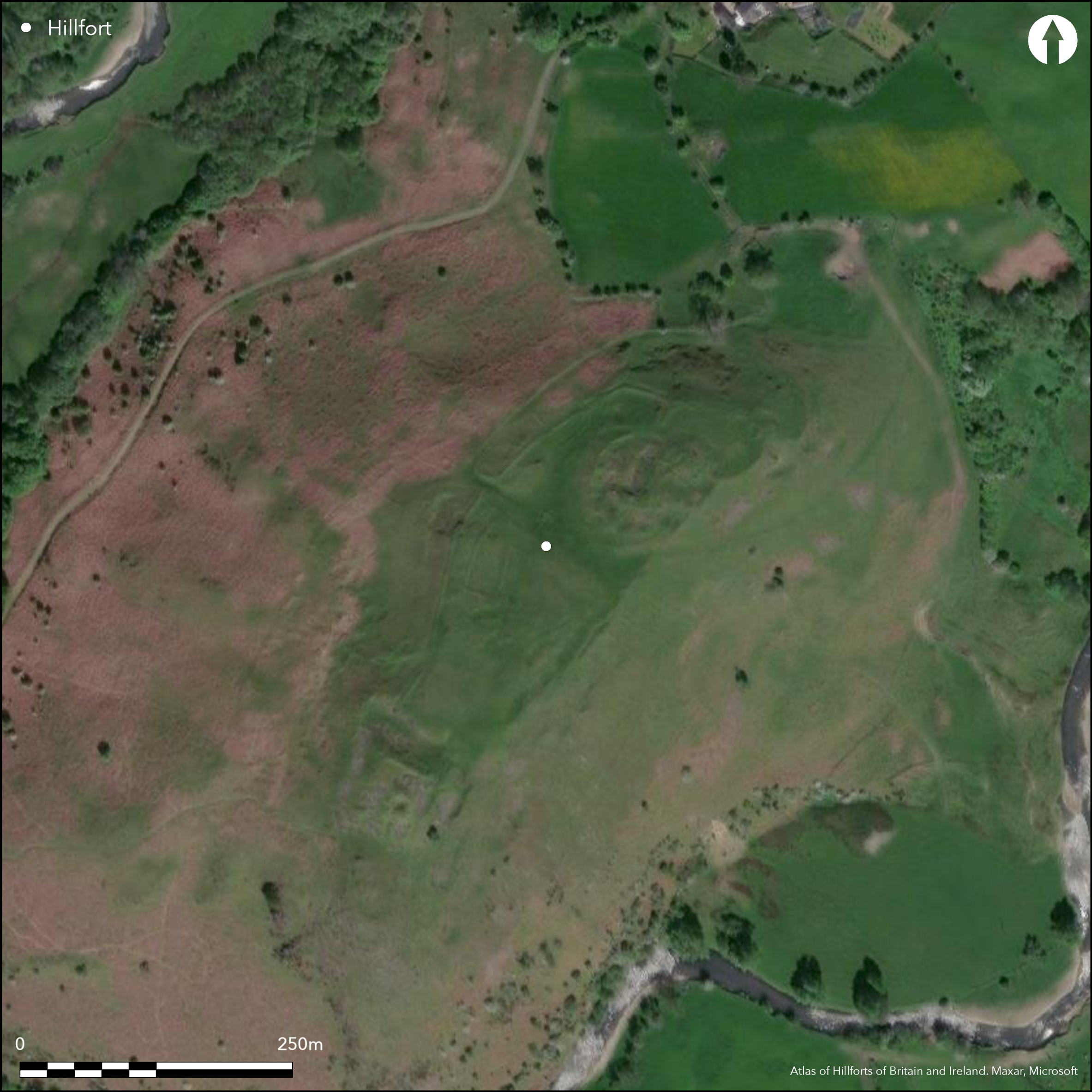
Satellite Imagery
LiDAR 1m DTM Hillshade
Satellite Imagery
Scroll left/right to view further images.
HER: Clwyd Powys 50039 (None)
NMR: SO 06 SE (96530)
SM: RD008(POW)
NGR: SO 08930 61480
X: 308930 Y: 261480 (OSGB36)
Complex series of earthworks on Castle Bank, Cefnllys, set upon a ridge in a loop of the River Irfon. Amongst the later earthwork castles, medieval town and associated features on site are remains of a contour hillfort. Very strategic and defensive position. Steep surrounding slopes up to the crest of the ridge, less to NE. Measures c. 356m by 102m, with internal area 1.6ha. Stony bank, with no visible ditch, follows the contours of the hill. Entrance on long NW side, with possible guard chamber. Possible annexe on NW side, much damaged by quarrying and possible hut sites on far SW not proved. Motte and bailey castle to NE thought to have been destroyed in 1262 and replaced by one at the SE tip of the site, commenced in 1267. Other rectilinear banks and enclosures, some overlying elements of the defensive complex, probably more recent farmstead. Rough upland grazing. On 1st Ed. OS map (1889).
Citizen Science: ✗
Reliability of Data: Confirmed
Reliability of Interpretation: Confirmed
X: -371282 Y: 6844348 (EPSG: 3857)
Longitude: -3.3352859373879995 Latitude: 52.24391018982555 (EPSG:4326)
Country: Wales
Current County or Unitary Authority: Powys
Historic County: Radnorshire
Current Parish/Community/Council/Townland: Penybont
Much damaged by quarrying and later medieval castles.
| Extant | ✓ |
| Cropmark | ✗ |
| Likely Destroyed | ✓ |
Rough upland grazings and moorland. Motte and bailey castle. Quarrying.
| Woodland | ✗ |
| Commercial Forestry Plantation | ✗ |
| Parkland | ✗ |
| Pasture (Grazing) | ✓ |
| Arable | ✗ |
| Scrub/Bracken | ✗ |
| Bare Outcrop | ✗ |
| Heather/Moorland | ✓ |
| Heath | ✗ |
| Built-up | ✗ |
| Coastal Grassland | ✗ |
| Other | ✓ |
Complex series of earthworks on Castle Bank, Cefnllys set upon a ridge in a loop of the River Irfon. Amongst the later earthwork castles and associated features are remains of a contour hillfort. Very strategic and defensive position. Steep surrounding slopes up to the crest of the ridge, less to NE.
| Contour Fort | ✓ |
| Partial Contour Fort | ✗ |
| Promontory Fort | ✗ |
| Hillslope Fort | ✗ |
| Level Terrain Fort | ✗ |
| Marsh Fort | ✗ |
| Multiple Enclosure Fort | ✗ |
| Hilltop | ✗ |
| Coastal Promontory | ✗ |
| Inland Promontory | ✗ |
| Valley Bottom | ✗ |
| Knoll/Hillock/Outcrop | ✗ |
| Ridge | ✓ |
| Cliff/Plateau-edge/Scarp | ✗ |
| Hillslope | ✗ |
| Lowland | ✗ |
| Spur | ✗ |
Dominant Topographic Feature: Ridge
| North | ✗ |
| Northeast | ✗ |
| East | ✗ |
| Southeast | ✗ |
| South | ✗ |
| Southwest | ✗ |
| West | ✗ |
| Northwest | ✗ |
| Level | ✓ |
Altitude: 305.0m
N/A
None.
Reliability: D - None
| Pre 1200BC | ✗ |
| 1200BC - 800BC | ✗ |
| 800BC - 400BC | ✗ |
| 400BC - AD50 | ✗ |
| AD50 - AD400 | ✗ |
| AD400 - AD 800 | ✗ |
| Post AD800 | ✗ |
| Unknown | ✓ |
| Pre Hillfort: | None |
| Post Hillfort: | Castles and medieval town on site. Motte and bailey castle to NE thought to have been destroyed in 1262 and replaced by one at the SE tip of the site, commenced in 1267. Other rectilinear banks and enclosures, some overlying elements of the defensive complex, probably more recent farmstead. |
On 1st Ed. OS map (1889). CPAT defended enclosures survey 2006.
| 1st Identified Map Depiction (1889): | OS map. |
| Other (2006): | CPAT defended enclosures survey. |
Possible hut sites on far SW not proved.
None
| None | ✓ |
| Spring | ✗ |
| Stream | ✗ |
| Pool | ✗ |
| Flush | ✗ |
| Well | ✗ |
| Other | ✗ |
Possible hut sites on far SW not proved.
| No Known Features | ✗ |
| Round Stone Structures | ✗ |
| Rectangular Stone Structures | ✗ |
| Curvilinear Platforms | ✗ |
| Other Roundhouse Evidence | ✓ |
| Pits | ✗ |
| Quarry Hollows | ✗ |
| Other | ✗ |
None
| No Known Excavation | ✓ |
| Pits | ✗ |
| Postholes | ✗ |
| Roundhouses | ✗ |
| Rectangular Structures | ✗ |
| Roads/Tracks | ✗ |
| Quarry Hollows | ✗ |
| Other | ✗ |
| Nothing Found | ✗ |
None
| No Known Geophysics | ✓ |
| Pits | ✗ |
| Roundhouses | ✗ |
| Rectangular Structures | ✗ |
| Roads/Tracks | ✗ |
| Quarry Hollows | ✗ |
| Other | ✗ |
| Nothing Found | ✗ |
None
| No Known Finds | ✓ |
| Pottery | ✗ |
| Metal | ✗ |
| Metalworking | ✗ |
| Human Bones | ✗ |
| Animal Bones | ✗ |
| Lithics | ✗ |
| Environmental | ✗ |
| Other | ✗ |
None
| APs Not Checked | ✓ |
| None | ✗ |
| Roundhouses | ✗ |
| Rectangular Structures | ✗ |
| Pits | ✗ |
| Postholes | ✗ |
| Roads/Tracks | ✗ |
| Other | ✗ |
Entrance on long NW side, with possible guard chamber. It is possible that there is more than one original entrance, but not defined.
| 8: | Many gaps. |
| 2: | It is possible that there is more than one original entrance, but not defined. |
Guard Chambers: ✓
Chevaux de Frise: ✗
| 1. Simple Gap (North west): | None |
| 1. Recesses/Guard Chambers (North west): | None |
Stony bank, with no visible ditch, follows the contours of the hill.
| Area 1: | 1.6ha. |
| Total: | 1.6ha. |
Total Footprint Area: Noneha.
None
| ✗ | None |
| ✓ | None |
| NE Quadrant: | 1 |
| SE Quadrant: | 1 |
| SW Quadrant: | 1 |
| NW Quadrant: | 1 |
| Total: | 1 |
| Partial Univallate | ✗ |
| Univallate | ✓ |
| Partial Bivallate | ✗ |
| Bivallate | ✗ |
| Partial Multivallate | ✗ |
| Multivallate | ✗ |
| Unknown | ✗ |
| Partial Univallate | ✗ |
| Univallate | ✗ |
| Partial Bivallate | ✗ |
| Bivallate | ✗ |
| Partial Multivallate | ✗ |
| Multivallate | ✗ |
Stony bank.
| None | ✗ |
| Earthen Bank | ✓ |
| Stone Wall | ✗ |
| Rubble | ✓ |
| Wall-walk | ✗ |
| Evidence of Timber | ✗ |
| Vitrification | ✗ |
| Other Burning | ✗ |
| Palisade | ✗ |
| Counter Scarp Bank | ✗ |
| Berm | ✗ |
| Unfinished | ✗ |
| Other | ✗ |
None
| None | ✗ |
| Earthen Bank | ✗ |
| Stone Wall | ✗ |
| Murus Duplex | ✗ |
| Timber-framed | ✗ |
| Timber-laced | ✗ |
| Vitrification | ✗ |
| Other Burning | ✗ |
| Palisade | ✗ |
| Counter Scarp Bank | ✗ |
| Berm | ✗ |
| Unfinished | ✗ |
| No Known Excavation | ✓ |
| Other | ✗ |
| ✗ | None |
| ✗ | No ditch visible. |
Number of Ditches: 0
| ✓ | Possible annexe on NW side, much damaged by quarrying. Not proven. |
Silvester, R.J. and Hankinson, R. 2006. Defended enclosures in Radnorshire. Project report, CPAT Report 781, Welshpool: CPAT,
Atlas of Hillforts:
Wikidata:
This work is licensed under CC BY-SA 4.0

 and should be cited as:
Lock, Gary and Ralston, Ian. 2024. Atlas of Hillforts of Britain and Ireland. Available at: https://hillforts.arch.ox.ac.uk
Document Version 1.1